
The Northern Lakes Tour, 7 Days
Arusha, Tanzania
7 days
$3,540 / person

A half-day ride from Arusha around the southern foot of Mount Meru: out along the Moshi road, up the Momella Road to the gate of Arusha National Park, and home on the bypass with the mountain over your shoulder.
Mount Meru fills the sky north of Arusha, and this ride circles its southern foot. It follows the main road east past Lake Duluti, a small crater lake ringed by forest, to Usa River, then turns up the Momella Road through farms and villages to Ngongongare Gate, the southern entrance to Arusha National Park. Motorcycles are not allowed into Tanzania's national parks, so the gate is the turning point. The way home avoids the city traffic on the Arusha Bypass, which swings through open farmland south of town with the mountain to the north.
The roads are paved almost the whole way; the exceptions are the last few hundred metres of gravel up to the gate and the rough lane down to Lake Duluti. The gradients are gentle, and the Momella Road and the stretch of the Moshi road back to the bypass turn are ridden in both directions. What makes it more than an easy ride is the traffic: the Arusha–Moshi road is one of the busiest in northern Tanzania, crowded with trucks, buses, dala-dalas (minibuses) and boda-bodas (motorbike taxis). It suits riders who are new to East Africa and want a short, manageable first day before going further.
Start
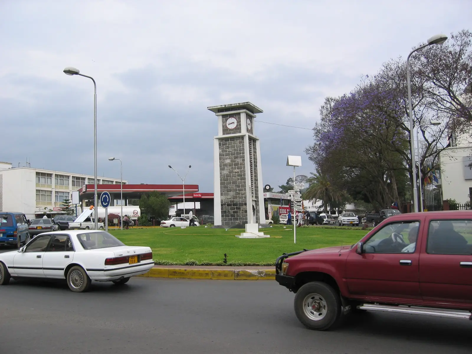
The clock tower on its roundabout in the centre of Arusha is the town's best-known landmark and the easiest place to meet. Arusha likes to say it stands halfway between Cairo and Cape Town. Set off early: the main road east is quieter before the morning rush, and Meru is more often clear of cloud early in the day.
Tip: There are fuel stations within the first few kilometres along the T2, so you can leave town and fill up on the way.
The roadkm 0–12
Nyerere Avenue and King Simeon Avenue take you out to the T2, the main road to Moshi. The road reaches the ride's highest point, about 1,450 metres, in the eastern suburbs and then runs gently downhill to Tengeru. Dala-dalas stop without warning and boda-bodas pass on both sides; keep left and leave room.
SightDetour
Allow 1–2 hoursAbout 1 km each way on a rough unpaved lane
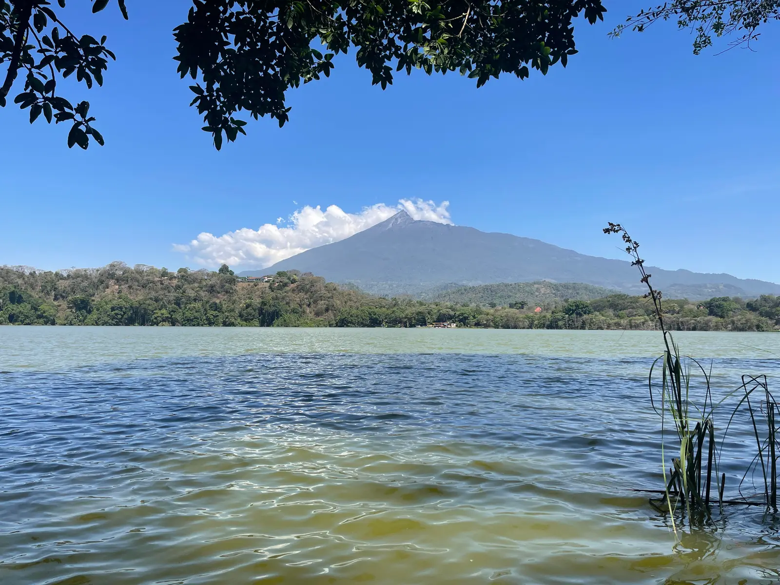
A small crater lake at Tengeru, hidden from the main road by the forest that surrounds it. A footpath runs round the water through the trees, and on a clear day Meru stands over the far shore. It is a quiet place to stretch your legs after the traffic of the Moshi road.
Tip: The lane from the T2 is gravel and dirt with ruts, and slippery after rain; take it slowly. An entry fee is charged for the forest reserve.
The roadkm 12–21.2
The T2 runs east past the turn for Lake Duluti at Tengeru, then through Makumira to Usa River. Trucks and buses run fast between the villages, and speed humps slow everything down inside them. Fill up here: there is no fuel on the Momella Road.
Food
Allow 30 min
A busy roadside town on the Arusha–Moshi road, where the Momella Road turns north towards the mountain. Simple restaurants and stalls line the main road, so it is the natural place for a drink or an early lunch, on the way out or on the way back.
Tip: The turn for the Momella Road is easy to miss in the traffic; it is on the left as you ride east, just past the centre of town.
The roadkm 21.2–28.5
The Momella Road leaves the main road at Usa River and climbs gently, about 230 metres in 7 km, through farms and villages to Ngongongare Gate. Traffic is light but local: pedestrians, cattle, bicycles and boda-bodas. The tarmac stops just short of the gate.
Sight
Allow 10 min
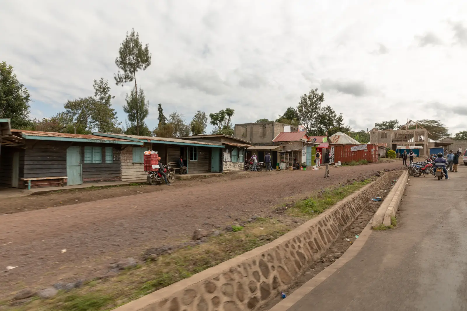
The Momella Road climbs steadily through farms and the scattered village of Ngongongare, with kiosks and small shops at the roadside and Meru filling the view ahead. It is the last place to buy a drink before the gate.
Tip: Expect children, livestock and boda-bodas on the road through the village, and slow right down.
Viewpoint
Allow 15 min
The southern entrance to Arusha National Park, at about 1,390 metres and the turning point of the ride. Beyond the barrier the road continues as gravel through the park towards the Momella lakes, but motorcycles are not allowed inside Tanzania's national parks, so this is as far as you go on two wheels. Stop outside the gate, look up at the forested slopes of the mountain, and turn round.
Tip: The tarmac ends a few hundred metres before the gate; the last stretch is loose gravel. Don't ride past the barrier.
The roadkm 28.5–40.9
Ride back down the Momella Road and turn right onto the T2 in Usa River. Shortly before Makumira, turn left off the T2 onto the link road south to the bypass.
The roadkm 40.9–76.4
A short stretch of the Old Moshi Road leads to the Arusha Bypass, which swings west through open farmland south of the city, dropping to about 1,125 metres before climbing back towards Arusha with Meru to the north. Traffic is lighter than in town but includes heavy trucks running fast. Slow down for the two small river bridges on the Old Moshi Road link, which may be rough. There is one fuel station along the bypass, at km 61.
The roadkm 76.4–82.8
The bypass meets the T5 near Arusha Airport. Follow it east into town, then Sokoine Avenue to the Clock Tower. Expect slow, crowded traffic from late afternoon.
Finish
The bypass joins the T5 near Arusha Airport, and Sokoine Avenue brings you back through the centre of town to the Clock Tower, where the ride began.
Bring your home licence with a motorcycle category and an International Driving Permit that covers motorcycles; that is generally what foreign riders need, but check the current rules before you ride. Carry your documents and the bike's papers, and make sure your travel insurance covers motorcycling.
A 125–250 cc motorcycle is ideal. The ride is short and the gradients gentle, and the only unpaved sections are the last stretch to the park gate and the optional lane to Lake Duluti, both short and manageable on a road bike ridden slowly.
There are plenty of stations on the T2 between Arusha and Usa River, and you pass the same ones again on the way back. There is none on the Momella Road and only one on the bypass, so fill up on the T2 before you turn off for the gate.
The long rains fall roughly from March to May and the short rains in November and December, when the gravel and dirt sections turn slippery and Meru disappears into cloud. June to October and January to February are drier. Ride in the morning: the mountain is most often clear early in the day.
Tanzania drives on the left. Helmets are compulsory for rider and passenger. Boda-bodas, dala-dalas and trucks make the main roads demanding, and speed humps mark most villages. Police checkpoints are common; stop when waved in and have your documents ready. Avoid riding after dark, when unlit vehicles, pedestrians and livestock share the road.
Motorcycles are not allowed into Tanzania's national parks, so do not ride past Ngongongare Gate, even though the road continues. If you want to see the park, come back another day in a vehicle with a guide.
These operators run guided tours from Arusha, listed alphabetically. Contact any of them through Moto Mass.