Manang Motorbike Tour, 8 Days
Kathmandu, Nepal
8 days
Contact for price

Kathmandu's classic day ride: the great stupa at Boudha, the hilltop temple of Changunarayan, a climb to Nagarkot for the Himalaya, and home along the Araniko Highway past Dhulikhel.
Ask a Kathmandu rider where to go for a day and Nagarkot comes up first. It sits on the eastern rim of the valley, and from the top of the ridge, at a little over 2,100 metres, the snow peaks of the Langtang range fill the northern horizon on a clear morning. This loop gets there the long way round: out past Boudhanath, up to the ancient temple of Changunarayan, through the edge of medieval Bhaktapur, then up the winding road to Nagarkot. It drops off the far side of the ridge to Nala and Banepa and comes home along the Araniko Highway, with a short run out to the hill town of Dhulikhel if you have the time.
At about 80 km it is a short day on the map, but valley traffic, three world-class heritage sites and the mountain views will fill it. Most of the road is paved. The exception is the descent from Nagarkot to Nala: about four kilometres are mapped as gravel, and it is steep. A rented 150–250 cc motorcycle handles it comfortably; on a small scooter, take it slowly or ride back down the way you came. The city sections are busy and dusty, so this suits riders who are already at ease in Kathmandu traffic.
Longest stretch without a fuel station: about 43 km, between km 11 and km 54.
Start
The former royal palace, turned into a museum after the monarchy was abolished in 2008, closes the north end of Durbar Marg. It is a few minutes from Thamel, where most visiting riders stay, and an easy place to meet. Leave early: the streets are quieter before 8 am and the mountains are most often clear in the first half of the day.
Tip: There are fuel stations along the first 11 km, then none until Banepa; fill the tank before you leave the city.
The roadkm 0–10
Pashupati Road takes you east to the Ring Road at Gaushala, a short way from Pashupatinath, then north to Chabahil, where the F26 runs out through Boudha and Jorpati. Traffic is dense and unpredictable: buses stop anywhere, motorcycles filter on both sides and pedestrians step out without looking. Keep left and keep your speed down.
Sight
Allow 30–45 min
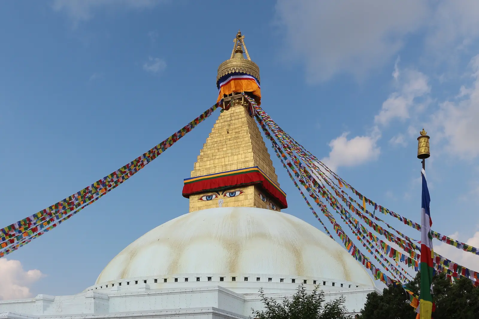
One of the largest stupas in the world and the heart of Tibetan Buddhist Kathmandu, part of the Kathmandu Valley World Heritage Site. Painted eyes look out from the gilded tower, and pilgrims walk clockwise around the white dome beneath strings of prayer flags. Monasteries crowd the lanes around it; early in the morning the square belongs to people walking their circuits.
Tip: The square is closed to traffic and foreign visitors pay a fee at the gate. Park on the main road and walk in, and go round clockwise with everyone else.
The roadkm 10–23
The F92, Upanishad Path and F93 cross the Manohara river and climb gently through villages and farmland to the Changunarayan ridge, then the F94 drops south to Bhaktapur. The roads are narrow in places, with local buses, tractors and people walking in the road; ride it slowly and enjoy the change from the city.
Sight
Allow 45 min
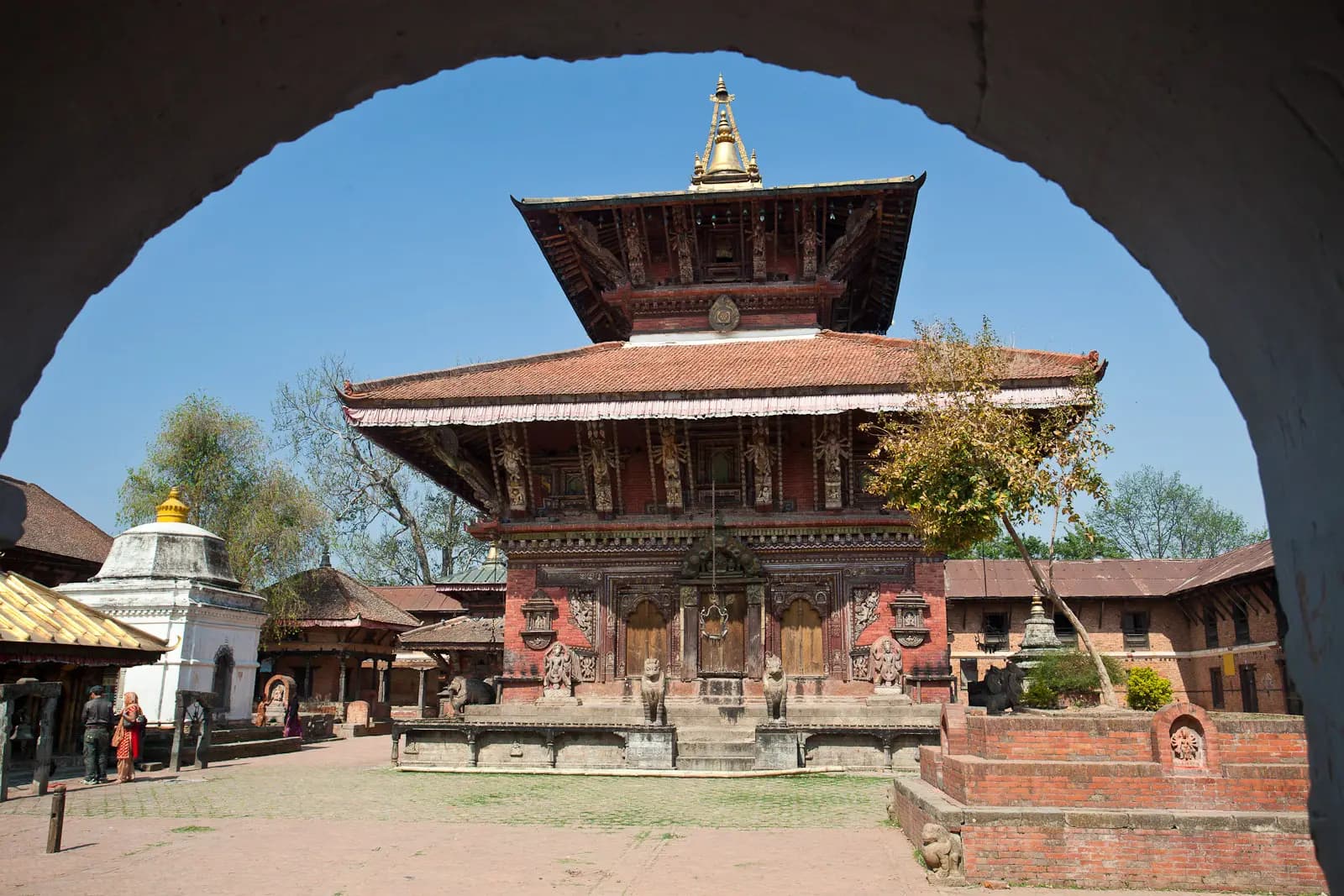
A two-tiered pagoda temple to Vishnu on a ridge above the Manohara river, regarded as the oldest temple in the Kathmandu Valley and part of its World Heritage Site. The courtyard is full of stone and metal sculpture, and a pillar inscription here, from the 5th century, is the oldest dated inscription found in Nepal. The road passes below the village and the quiet ridge-top village feels a world away from the city.
Tip: Leave the bike at the bottom of the village and walk up the lane to the temple. Foreign visitors pay an entry fee.
Sight
Allow 1–2 hours

The road down from Changunarayan meets the Nagarkot road on the edge of Bhaktapur, the best preserved of the valley's three old royal cities. Brick lanes lead to Durbar Square, with its royal palace and temples, and on to Taumadhi Square and the five-tiered Nyatapola, the tallest pagoda in Nepal. It is also the place to try juju dhau, Bhaktapur's famous sweet curd, served in clay bowls.
Tip: The old centre is closed to traffic and foreign visitors pay an entry fee; park on the edge and walk in. If you want time for Bhaktapur and the mountains, see Bhaktapur on the way home instead, from the Araniko Highway.
The roadkm 23–39.3
From the edge of Bhaktapur the F28 climbs about 550 metres to Nagarkot village, gently at first through terraced farmland, then in a long series of bends through pine forest. Local buses and tourist jeeps use it all day; expect them on your side of the road in the corners and use the horn on blind bends, as local riders do.
The roadkm 39.3–50.2
The F98 follows the ridge south from the village to the view tower at the high point of the ride, then turns west and down. Below about km 46 the road is mapped as gravel and drops steeply, averaging around 13% over a kilometre in places, through farms to Nala. Stand on the pegs, keep to a low gear and take care after rain. If the surface looks beyond you or your bike, turn round and ride back down the way you came up.
Viewpoint
Allow 30 min

The road climbs through Nagarkot village and on along the ridge to the top of the ride, about 2,150 metres, where an observation tower stands beside the road. On a clear day the Himalaya runs along the northern skyline, with the Langtang range to the north, and the whole Kathmandu Valley lies spread out to the west. The village below has plenty of terraces with the same view if you want to sit down with tea.
Tip: The peaks are clearest early in the day; cloud usually builds by late morning. It is noticeably colder up here than in the city, so bring a warm layer.
The roadkm 50.2–74.2
The F97 runs through Nala to Banepa, where you join the Araniko Highway (NH34); Dhulikhel is a short way east. Heading west, the highway climbs over the low pass at Sanga, where the giant Kailashnath Mahadev statue of Shiva watches from the hill to the north, then runs down past Bhaktapur and Thimi to the Ring Road at Koteshwor. It is fast, with trucks, buses and dust: ride defensively and watch for vehicles pulling out of side roads.
FoodDetour
Allow 1 hour with lunchAbout 4½ km each way along the Araniko Highway from Banepa
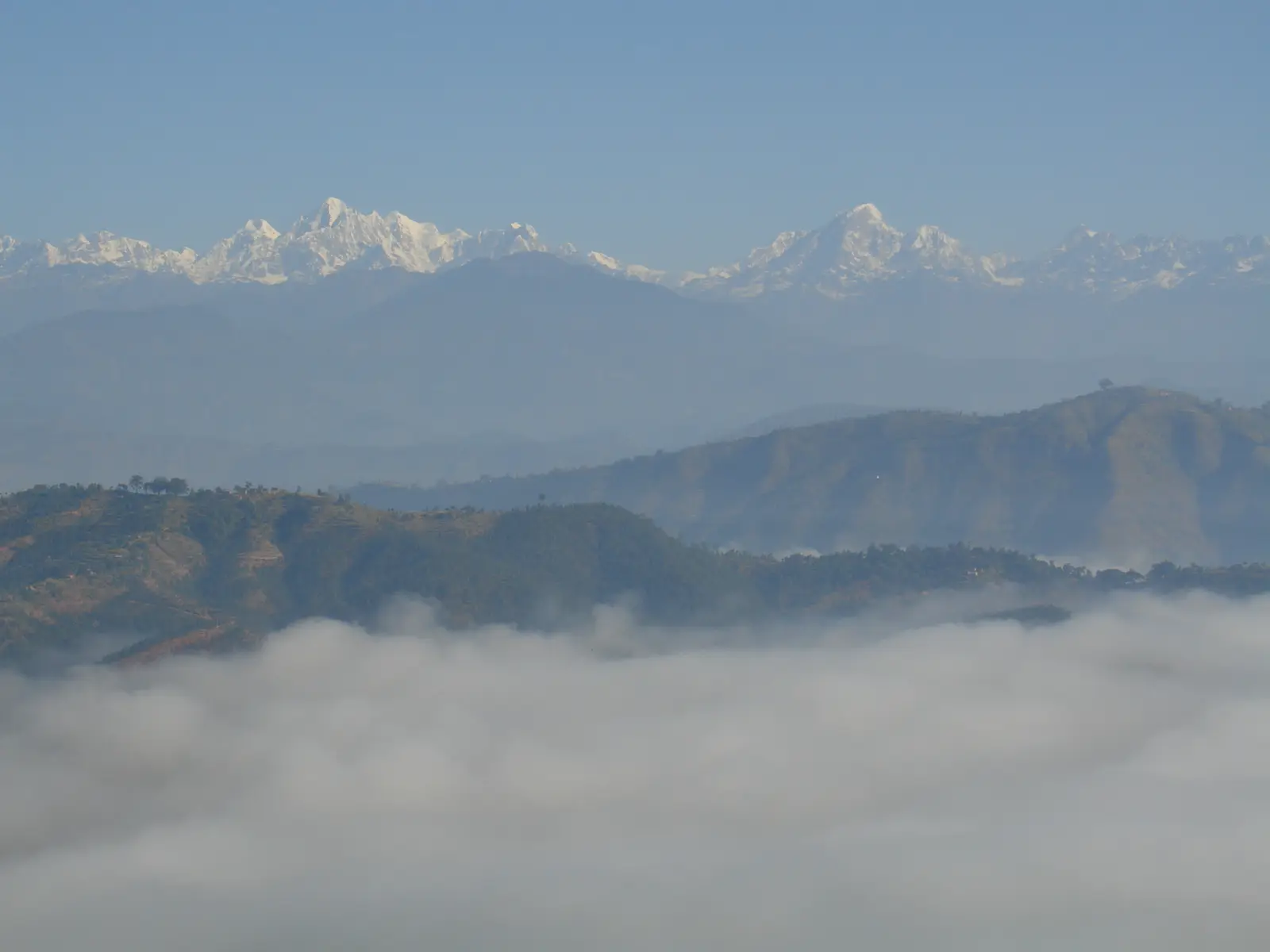
An old Newar hill town on the Araniko Highway with a wide Himalayan view of its own, looking north across terraced hills. Its old bazaar sits just off the highway, and simple restaurants line the road. It is the natural lunch stop: at Banepa the loop turns west for home, so carry on east to Dhulikhel and ride back.
Tip: The Araniko Highway carries heavy trucks and buses through Banepa and Dhulikhel; take your time pulling in and out.
The roadkm 74.2–80.2
From Koteshwor the highway becomes a city avenue through Baneshwor to the Maitighar Mandala roundabout, then the route turns north to Rani Pokhari. Late-afternoon traffic is heavy; allow extra time.
Finish
The loop ends at the Ghantaghar clock tower beside Rani Pokhari, the walled pond with a white temple on an island at its centre, built by a Malla king in the 17th century. Durbar Marg, where you started, is a few hundred metres north, and Thamel a short ride north-west.
To ride legally in Nepal you need a Nepali licence, or your home licence with an International Driving Permit that covers motorcycles. Check the current rules before you ride. Traffic police work the main junctions in Kathmandu, and most travel insurance will not pay out if you ride without the right licence.
A 150–250 cc motorcycle is the right tool: it climbs to Nagarkot easily and copes with the gravel descent to Nala. A 125 cc scooter will reach Nagarkot, but if you are on one, consider returning to Bhaktapur the way you came rather than taking the gravel. Check the brakes before you leave.
There are plenty of stations in the first 11 km, around Chabahil, Boudha and Jorpati, then none on the loop until Banepa, more than 40 km later and with the whole climb in between. Leave the city with a full tank.
October and November, just after the monsoon, bring the clearest mountain views; February to April is good too, though haze builds as spring goes on. December and January are often clear but cold, with fog lying in the valley in the early morning. From June to September the monsoon hides the mountains and makes the hill roads muddy and slippery, with landslides possible on the slopes.
Nepal drives on the left. Helmets are compulsory for rider and passenger. Kathmandu traffic is heavy and the valley is dusty: a full-face helmet or a mask makes the city sections much more pleasant. Ride out early, both for the traffic and for the mountains, and aim to be off the Araniko Highway before the evening rush.
These operators run guided tours from Kathmandu, listed alphabetically. Contact any of them through Moto Mass.