

Kilimanjaro Masai Trail to the Indian Ocean, 8 Days
Nairobi, Kenya
8 days
$3,175 / person

Nairobi's classic day out: over the highlands, down the old wartime road into the Great Rift Valley, across the valley floor to Naivasha and back over the top at more than 2,700 metres. Tarmac all the way.
Forty kilometres from the centre of Nairobi the highlands simply stop, and the floor of the Great Rift Valley opens up some 300 metres below, with the volcano of Mount Longonot standing in the middle of it. This loop takes the old road down the escarpment, built by Italian prisoners of war during the Second World War, past the small chapel they left at the bottom. It then crosses the valley floor to Naivasha and climbs home on the main Nairobi–Nakuru highway, which tops out at more than 2,700 metres before dropping back towards the city.
It is a loop, but the first and last 30 km or so, between Nairobi and the Rironi junction near Limuru, are the same road ridden in both directions. Every kilometre is paved, and the gradients are gentle by mountain standards. What makes it a moderate ride rather than an easy one is the traffic: these are Kenya's main freight routes to the west, busy with heavy trucks and matatus (minibuses), and the ride suits riders who are confident on fast, crowded two-lane roads.
Start

The national museum on Museum Hill, just north of the city centre, is an easy landmark to meet at and sits right by the start of Waiyaki Way, the road out to the west. Leave early: an hour after sunrise the city traffic is still manageable, and the morning light over the valley is the best of the day.
Tip: There are fuel stations every kilometre or so along Waiyaki Way through Westlands, so you can leave with whatever is in the tank and fill up on the way out.
The roadkm 0–31
Waiyaki Way (A8) carries you west through Westlands and the suburbs beyond, climbing steadily from about 1,660 metres to nearly 2,300 metres by the Rironi junction near Limuru. Matatus stop and pull out without warning, and boda bodas (motorcycle taxis) filter on both sides. At the Rironi junction, take the A8 South, the old road to Mai Mahiu and Naivasha.
The roadkm 31–51
The road runs across farmland to the edge of the highlands, where the viewpoints sit at around km 40, then drops about 350 metres to the valley floor at Mai Mahiu. The corners are well-sighted and the gradients moderate, but heavy trucks crawl down in low gear and overtaking traffic comes towards you on your side of the road. Leave plenty of space, and stay well left on the bends.
Viewpoint
Allow 20–30 min
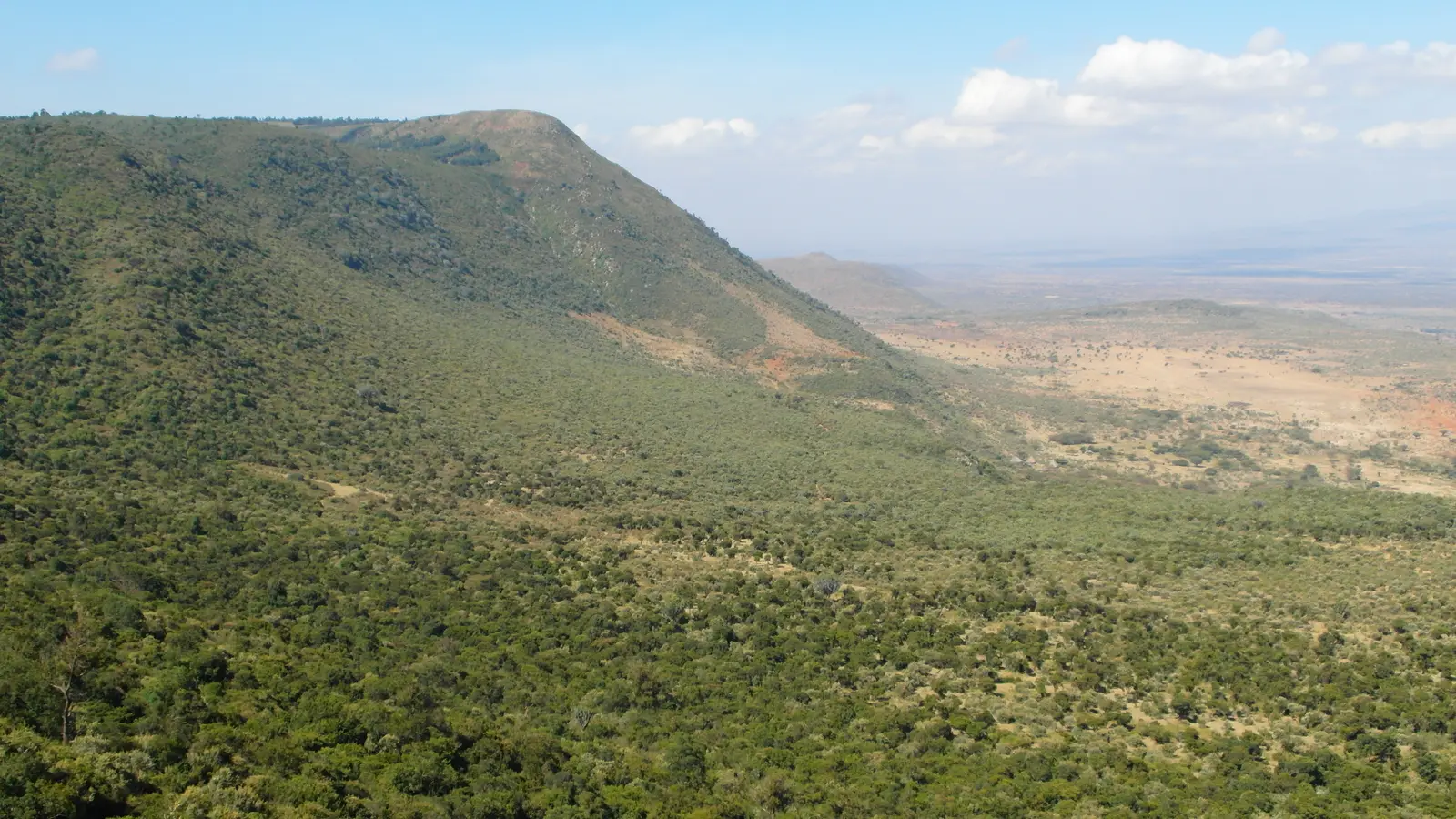
A string of roadside viewpoints sits on the lip of the escarpment, about 2,150 metres up, where the road begins its descent. Below you the valley floor runs away to the horizon, with the cone of Mount Longonot to the north-west and Mount Suswa to the south-west. Curio stalls line the pull-offs and traders will want to show you their wares.
Tip: This is a busy truck road: pull completely off the carriageway, and look well behind before you rejoin it.
Sight
Allow 15 min

At the foot of the escarpment, right beside the road, stands a tiny stone chapel built in 1942 by the Italian prisoners of war who built this road down the escarpment. It is barely bigger than a garden shed, with a tiled roof and a Latin inscription over the door, and it is a moving reminder of who carved the corners you have just ridden.
Tip: It is still a place of worship, so keep your visit quiet and leave the bike well off the road.
The roadkm 51–90
From Mai Mahiu the A8 South heads north-west across the floor of the Rift Valley, with Mount Longonot on your left for much of the way. The straights invite speed, and so they attract risky overtakes from cars and trucks alike; hold a steady pace and watch your mirrors. Livestock and pedestrians cross on the open stretches. Town roads take you through the centre of Naivasha.
Food
Allow 1 hour with lunch
The market town at the turning point of the loop, on the north-east side of Lake Naivasha. Simple restaurants and fuel stations line the main roads, and it is the natural place for lunch and a full tank before the climb home. The lake itself lies south of the town, along Moi South Lake Road, if you have time for a longer day.
Tip: Fill up here before the climb home; there are stations on the highway too, but none at the viewpoints.
The roadkm 90–127
The A8, the main Nairobi–Nakuru highway, climbs out of the valley from about 1,970 metres to the ride's high point of a little over 2,700 metres near km 110, then runs along the high ground and drops to Kimende. Fully loaded trucks climb slowly, and the queues behind them produce impatient overtaking. Cloud and mist can sit on the high section, and it is noticeably colder than Nairobi.
Viewpoint
Allow 10 min
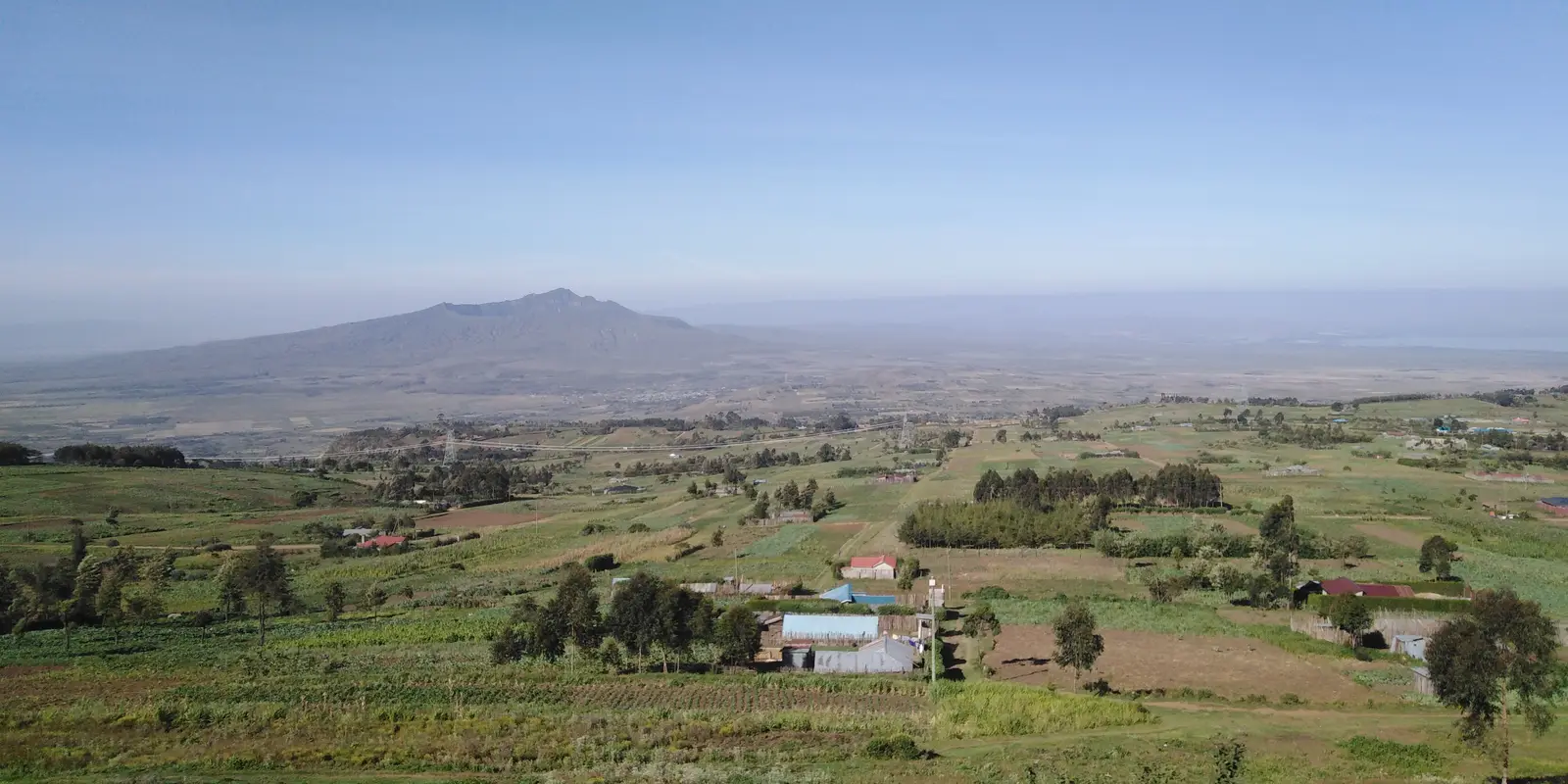
Near the top of the long climb out of Naivasha, at the highest point of the ride a little over 2,700 metres, a viewpoint looks out from the rim of the escarpment over farmland to the floor of the valley. Mount Longonot stands over the plain you crossed in the morning.
Tip: Only stop where you can get fully off the carriageway: trucks come over the top fast and close to the edge of the road.
The roadkm 127–175
Just past Kimende the highway runs along the rim of the escarpment with a last couple of views back over the valley, then passes Limuru and rejoins the morning's road at the Rironi junction. From there it is the same A8 back into Nairobi, where traffic builds from late afternoon.
Finish
The last stretch retraces the morning's road from the Rironi junction back along Waiyaki Way to Museum Hill. Westlands, the last few kilometres before the finish, has plenty of places to eat if you want to end the day over a meal.
You need a licence that covers motorcycles. Visitors generally ride on their home licence together with an International Driving Permit that includes motorcycles; check the current rules before you ride. Traffic police checks are common on these highways, so carry your licence and the bike's papers, and make sure your insurance covers you on a motorcycle.
This is a day of fast main roads, long climbs at altitude and heavy traffic, so a 150–250 cc motorcycle is far more comfortable than a small scooter, and gives you the speed to stay out of the way of trucks. Check the brakes and tyres before you leave.
Fuel is easy: there are stations all along Waiyaki Way, at Mai Mahiu, along the valley floor, in Naivasha and on the highway home. Even so, fill up in Naivasha before the long climb back over the top.
The dry months, January to February and June to September, are the best. The long rains fall roughly from March to May and the short rains from October to December, when the escarpment roads turn slippery and cloud can hide the views. June to August is dry but often grey and cool, and the high section of the highway can be cold at any time of year.
Kenya drives on the left, and helmets are compulsory for rider and passenger. Heavy trucks on both escarpment roads and matatus that stop anywhere are the main hazards; give both plenty of room and never sit in a truck's blind spot. Ride in daylight, start early, and plan to be back in Nairobi well before dark.
The ride spends most of its time above 2,000 metres and tops out a little over 2,700. Even on a warm day in Nairobi it can be cold and damp on the high ground, so bring a warm layer and waterproofs.
These operators run guided tours from Nairobi, listed alphabetically. Contact any of them through Moto Mass.