Andalusia – Motorcycle Touring at Its Best
Andalusia, Spain
10 days
€5,390 / person

Ronda's classic mountain loop: over the Sierra de Grazalema to a pass close to 1,200 metres, down a ladder of hairpins to the castle village of Zahara, and home through the cave houses of Setenil. Tarmac all the way.
Ronda sits on a cliff at the edge of some of the best motorcycling country in Spain, and this is the loop that shows you most of it in a day. You ride west on the A-374 and A-372 into the Sierra de Grazalema Natural Park, stop for coffee in the white village of Grazalema, then climb the CA-9104 to the Puerto de las Palomas, the highest point of the ride. The descent on the far side is the reason riders come: a long run of hairpins dropping more than 650 metres to Zahara de la Sierra, its castle tower perched above a turquoise reservoir. The way home crosses quieter farm roads through El Gastor and Setenil de las Bodegas, where houses are built straight into the rock, before returning to Ronda through Arriate.
The whole loop is paved, and a rented 125–300 cc bike will manage it, but the pass road is narrow, steep and full of tight corners, so it suits riders who are comfortable on mountain roads. The main roads out of Ronda are wide and flowing; after Zahara the roads get smaller, slower and emptier. Expect plenty of other motorcyclists at weekends, cyclists on the climbs and livestock on the road in the natural park.
Longest stretch without a fuel station: about 56 km, between km 32 and km 88.
Start
Allow 30 min
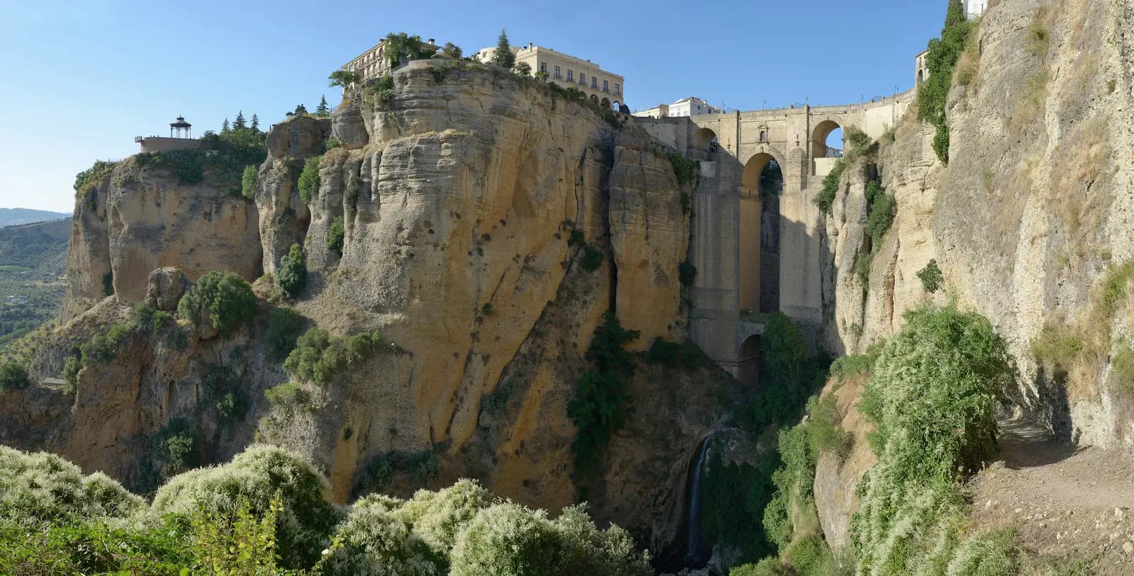
The square at the north end of the Puente Nuevo, the 18th-century bridge that spans the gorge of El Tajo and joins the old town to the newer one. Walk onto the bridge before you leave: the drop to the Guadalevín river below is the image of Ronda everyone knows. Start early in summer, while the air is still cool.
Tip: There is a fuel station on the way out of town at km 1.4; fill up there, as the next one on the route is in Grazalema.
The roadkm 0–15.8
A short run through town brings you onto the A-374, which drops off the Ronda plateau and heads west through open farmland and oak woods. The road is wide with fast, flowing bends; it is also a main road into the Sierra de Cádiz, so expect some trucks and traffic.
The roadkm 15.8–34.3
The A-372 winds through cork oak country, over the Puerto de Montejaque and into the limestone of the natural park, crossing the Puerto de los Alamillos at about 820 metres before Grazalema appears on its hillside. It is a fine riding road, with good tarmac and a rhythm of medium-speed corners; slow down for the village itself, where the road passes right through the centre.
Coffee
Allow 45 min
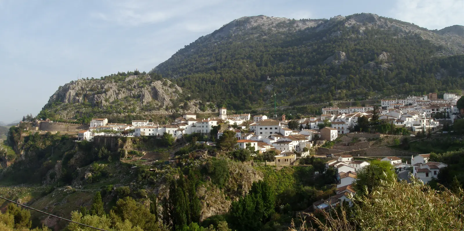
A white village of steep streets and tiled roofs at about 830 metres, tucked under the limestone wall of the Peñón Grande. The road runs right past the Plaza de España, the small square at its centre, with cafés and bars around it. Grazalema is famous as one of the rainiest places in Spain, which is why the hills around it are so green.
Tip: This is the last fuel on the route for over 50 km, until Setenil; top up at the station as you come into the village.
The roadkm 34.3–48.6
The highlight. The CA-9104 leaves the A-372 just past Grazalema and climbs hard to the Puerto de las Palomas at close to 1,200 metres, then drops more than 650 metres to Zahara through a long sequence of hairpins. The road is narrow, the corners are tight and often blind, and the rock walls and drops leave little room for error. Watch for gravel washed onto the road, cyclists grinding up, goats and cattle, and cars coming up the middle of the hairpins.
Viewpoint
Allow 15 min
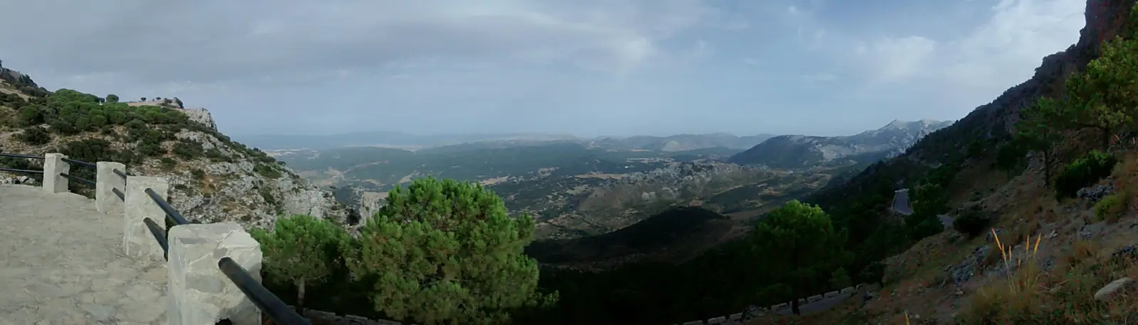
The viewpoint at the Puerto de las Palomas, the top of the loop at close to 1,200 metres, reached after a short, steep climb out of Grazalema. A paved terrace with stone railings looks out over the limestone peaks of the natural park, and as the road starts down the far side the Zahara reservoir comes into view below.
Tip: It is often windy and several degrees colder up here than in Ronda; put a layer on before the descent.
Food
Allow 1–1½ hours with lunch
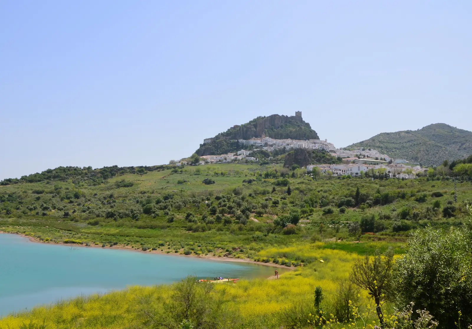
The bottom of the hairpins and the natural lunch stop. Zahara's white houses climb a rocky crag topped by the tower of a medieval castle, with the turquoise water of the Zahara-El Gastor reservoir spread out below. Simple restaurants and bars cluster in the village centre near the church of Santa María de la Mesa, and there are viewpoints over the lake at the edge of the village.
Tip: A footpath climbs from the village to the castle tower for the widest view of the reservoir; it is steep, so leave time for it if you want to go up.
The roadkm 48.6–68.9
From Zahara the road drops to the valley floor, the lowest point of the loop at under 300 metres, and follows the A-2300 north before a short run on the busier A-384 and A-374. The CA-9109 and CA-9110 then climb back into the hills, a quieter, narrower road through olive groves, to the white village of El Gastor at about 600 metres.
The roadkm 68.9–87.3
The CA-9113 and CA-9122 wind east through olive groves and farmland with little traffic. These are minor roads: narrower than the main roads, with bends that tighten without warning and farm vehicles on them. Take it gently and enjoy the emptiness before dropping into the gorge at Setenil.
Sight
Allow 45 min
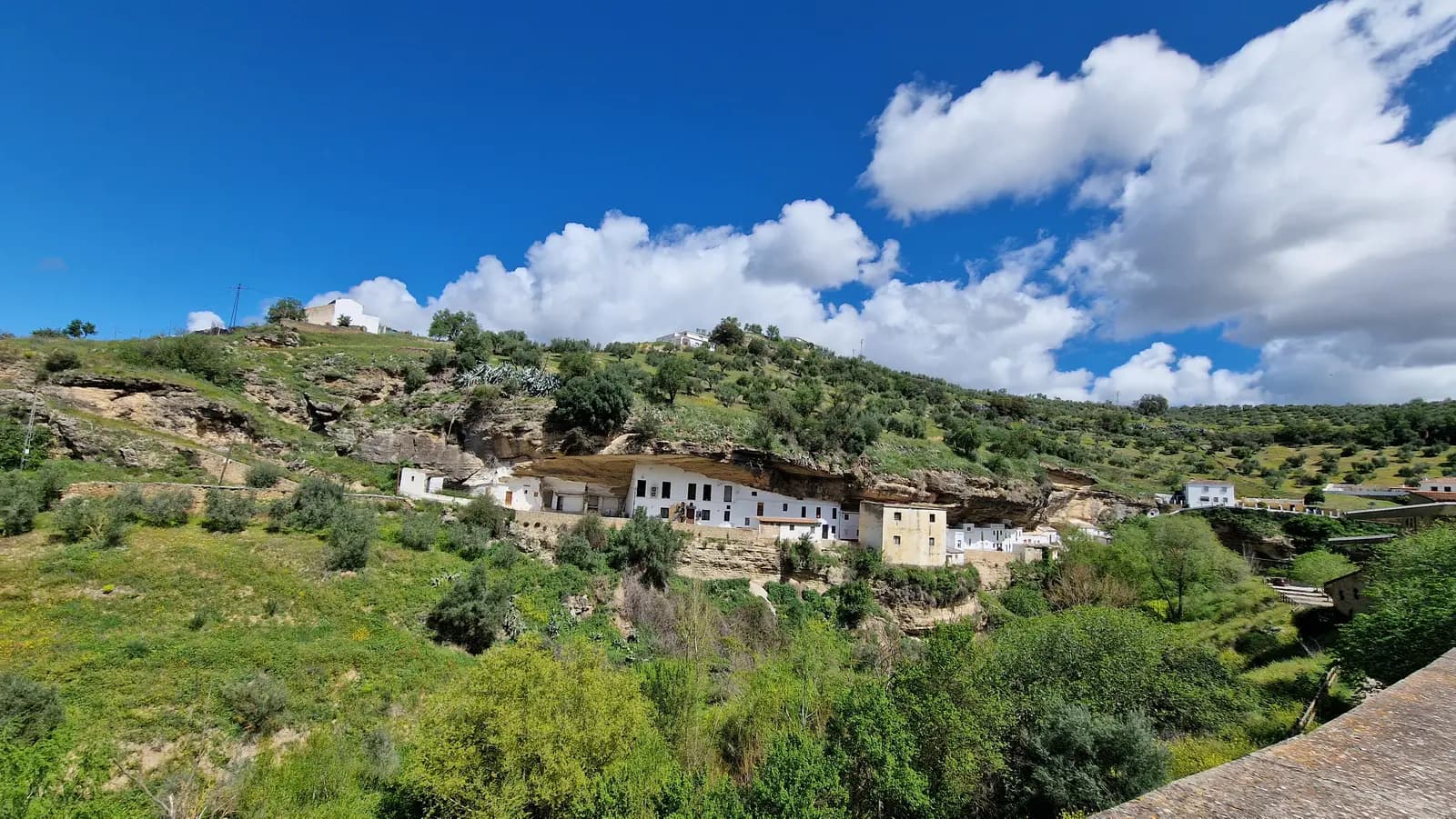
A village unlike any other on the ride: instead of building on the hillside, the people of Setenil built under it, tucking their houses beneath great overhangs of rock along the gorge of the Trejo river. The streets of Cuevas del Sol and Cuevas de la Sombra run beneath the rock roofs and are best seen on foot, with bars and cafés along them.
Tip: The streets in the centre are narrow and steep; park on the edge of the village and walk in. There is fuel just past the village at km 88.
The roadkm 87.3–106.2
The MA-7403 climbs out of Setenil to the Puerto del Monte at close to 800 metres, then the MA-7400 runs south through Arriate and the farmland of the Ronda plateau. Traffic builds as you enter Ronda along the Avenida de Málaga; follow the signs for the centre back to the Plaza de España.
Finish
The loop comes back into Ronda from the north through Arriate and finishes where it started, beside the Puente Nuevo. In the evening the light on the gorge is at its best, and the viewpoints along the clifftop on either side of the bridge are a short walk away.
Licences issued in EU countries are valid in Spain. Visitors from outside the EU generally need an International Driving Permit covering motorcycles alongside their home licence; check what applies to your licence before you ride. Carry your licence, passport and the bike's papers and insurance, as the Guardia Civil can ask for them at any stop.
Any bike from about 125 cc will make it round, but the climb to the Puerto de las Palomas is steep and the descent to Zahara is long and tight, so a light, mid-sized bike with good brakes is the most enjoyable choice. Two up on a small scooter, the pass will be hard work.
Fill up in Ronda on the way out and top up in Grazalema at km 31.6. After that the route has no fuel station for over 50 km, through the pass, Zahara and El Gastor, until Setenil at km 88. There are more stations near Arriate and on the way back into Ronda.
Spring and autumn are the best seasons, with green hills, mild temperatures and clear views. July and August are intensely hot inland; ride early and finish by midday. Grazalema is one of the rainiest places in Spain, so the mountain roads are often wet from late autumn to early spring, and in winter the pass can see fog, ice and occasional snow.
Spain drives on the right, and helmets are compulsory for rider and passenger. The roads around Ronda and Grazalema are popular with motorcyclists, and Guardia Civil speed checks are common on them, so keep to the limits. Weekends bring many riders and cyclists; a weekday morning is the quietest time. In the natural park, goats, sheep and cattle graze unfenced and can be standing on the road around any corner.
These operators run guided tours from Ronda, listed alphabetically. Contact any of them through Moto Mass.