
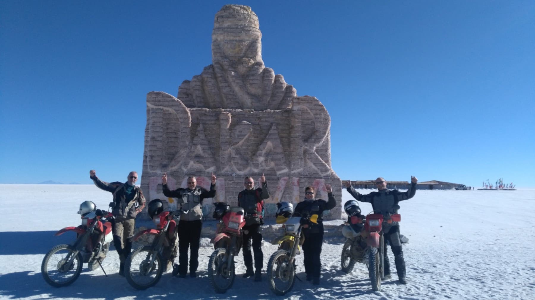
Wild Wild West: Uyuni, Tupiza and the Southern Valleys, 14 Days
Santa Cruz, Bolivia
14 days
€3,920 / person

Out of the lowlands and up the Piraí valley on Bolivia's old highway to the Andes: waterfalls at Las Cuevas, the carved rock of El Fuerte, and lunch in a cool hill town at 1,650 metres. Tarmac all the way.
Santa Cruz sits on the hot, flat edge of the Amazon basin, and the nearest mountains are a morning's ride to the west. Ruta 7, the old highway towards Cochabamba, leaves the city through El Torno, follows the Piraí river into the foothills and then climbs, corner after corner, from about 400 metres to more than 1,600. At the top is Samaipata, a small town of whitewashed houses and tiled roofs, and on the ridge above it El Fuerte, a sandstone hill carved by pre-Inca peoples and listed by UNESCO as a World Heritage Site. On the way up, the waterfalls of Las Cuevas are a few minutes' walk from the road.
This is an honest out-and-back: there is one paved road to Samaipata, and you ride home the way you came, about 240 km in all plus the side road to El Fuerte. That makes it a long day, and it suits riders who are comfortable with mountain corners and with sharing them with trucks and long-distance buses. A rented 150–250 cc bike is the right tool. If you would rather not ride it all in a day, Samaipata is well worth a night, and Las Cuevas on its own makes a shorter turnaround point.
Longest stretch without a fuel station: about 86 km, between km 36 and km 122.
Start
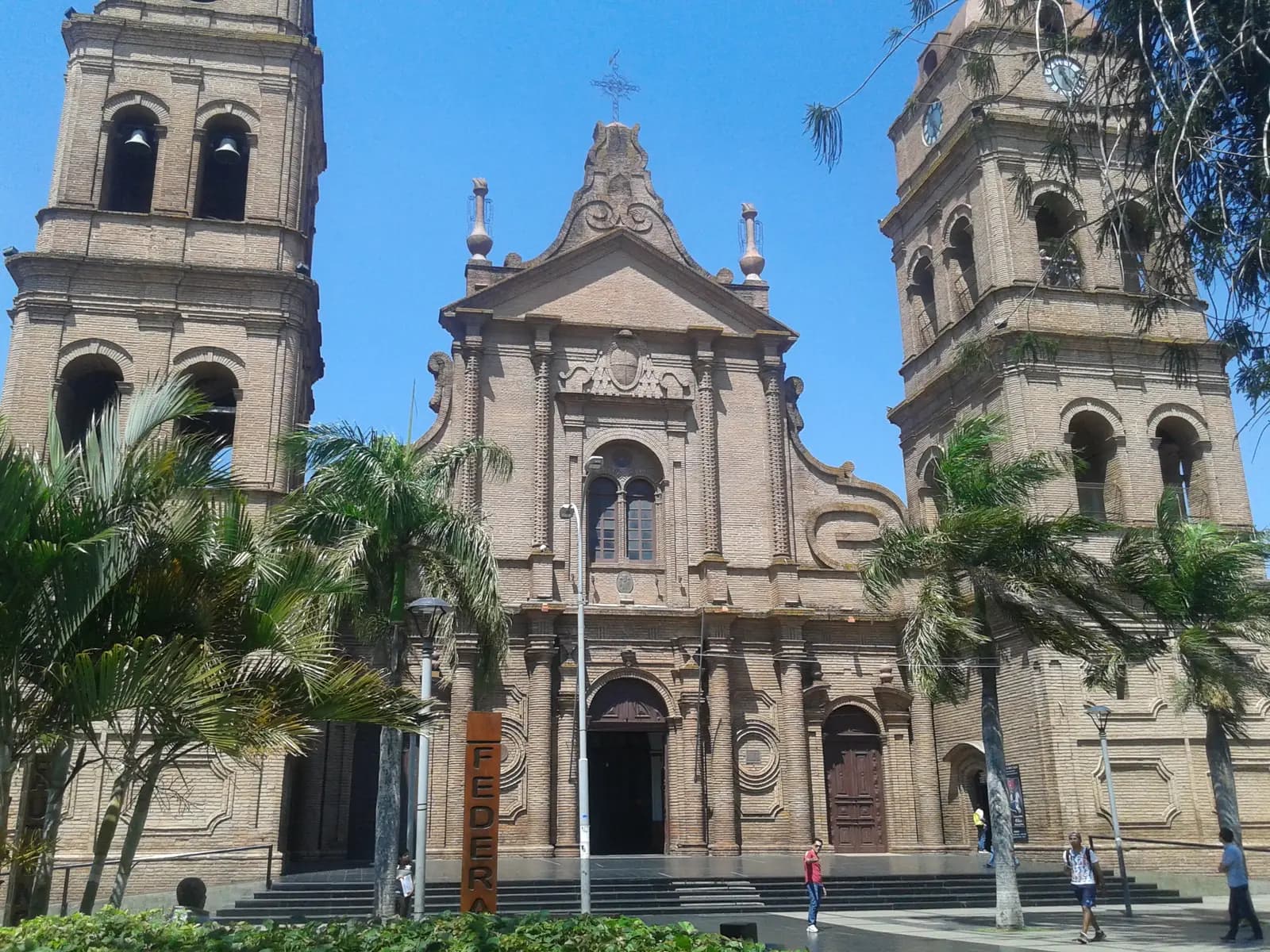
The main square of Santa Cruz, shaded by trees and faced by the brick cathedral, is the centre of the city's ring roads and the obvious place to start. Leave early: the city traffic is lighter, the lowland heat has not yet built, and you want plenty of daylight for the ride back down.
Tip: Fill up on the way out. There are many stations on Avenida Grigotá and the dual carriageway to La Guardia.
The roadkm 0–22
Avenida Cañoto and Avenida Grigotá take you south-west out of the centre to the dual carriageway that runs to La Guardia. It is flat, straight and busy, with minibuses stopping without warning and vehicles joining from both sides. Fuel stations are everywhere along here.
The roadkm 22–66
Ruta 7 narrows to two lanes and runs through El Torno, where the last fuel station before Samaipata sits at about km 36, then follows the river into the foothills past Limoncito and La Angostura. Villages bring speed bumps, dogs and people at the roadside; between them, trucks and buses overtake hard.
Viewpoint
Allow 10 min
Just beyond the village of La Angostura, the Bermejo and Piojeras rivers meet beside the road to form the Piraí, the river that runs past Santa Cruz. It is a good place to stretch your legs before the real climbing begins: from here the road leaves the valley floor and starts to wind up into the hills.
Tip: Pull well off the carriageway to stop; trucks use this stretch at speed.
The roadkm 66–99
From the source of the Piraí the road climbs through Bermejo and up into the hills, from below 800 metres to more than 1,300. This is the best riding of the day and the most demanding: corners are many and often blind, heavy trucks crawl uphill and buses come down fast, sometimes on your side of the road. In the rainy season, landslides and mud on the road are possible.
The roadkm 99–121
From Las Cuevas the road climbs again to the El Fuerte turn-off at about km 117 and Samaipata at about 1,650 metres. The air is noticeably cooler up here. The streets in the centre of town are cobbled; take them slowly.
Sight
Allow 1–2 hours
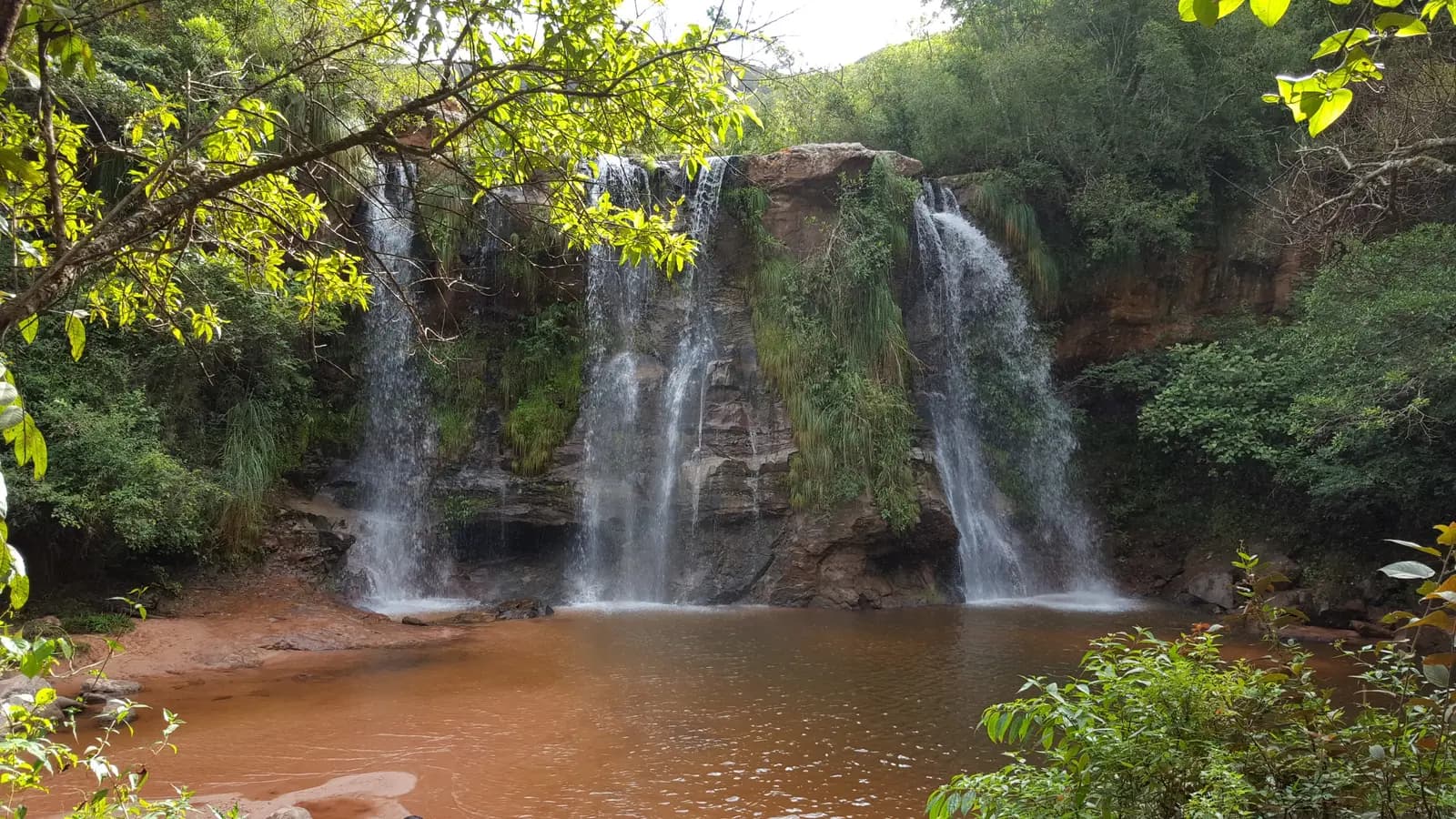
Three waterfalls on the Río Cuevas, each dropping into a pool with a sandy bank, reached on foot by a path that follows the river up from the roadside entrance. The first fall is close to the road; the second and third take longer but are usually quieter. On a hot day a swim here is the best thing on the ride.
Tip: An entrance fee is charged at the gate. Bring swimming things and sandals for the riverside path.
SightDetour
Allow 1½–2 hoursAbout 5½ km each way, up a paved side road
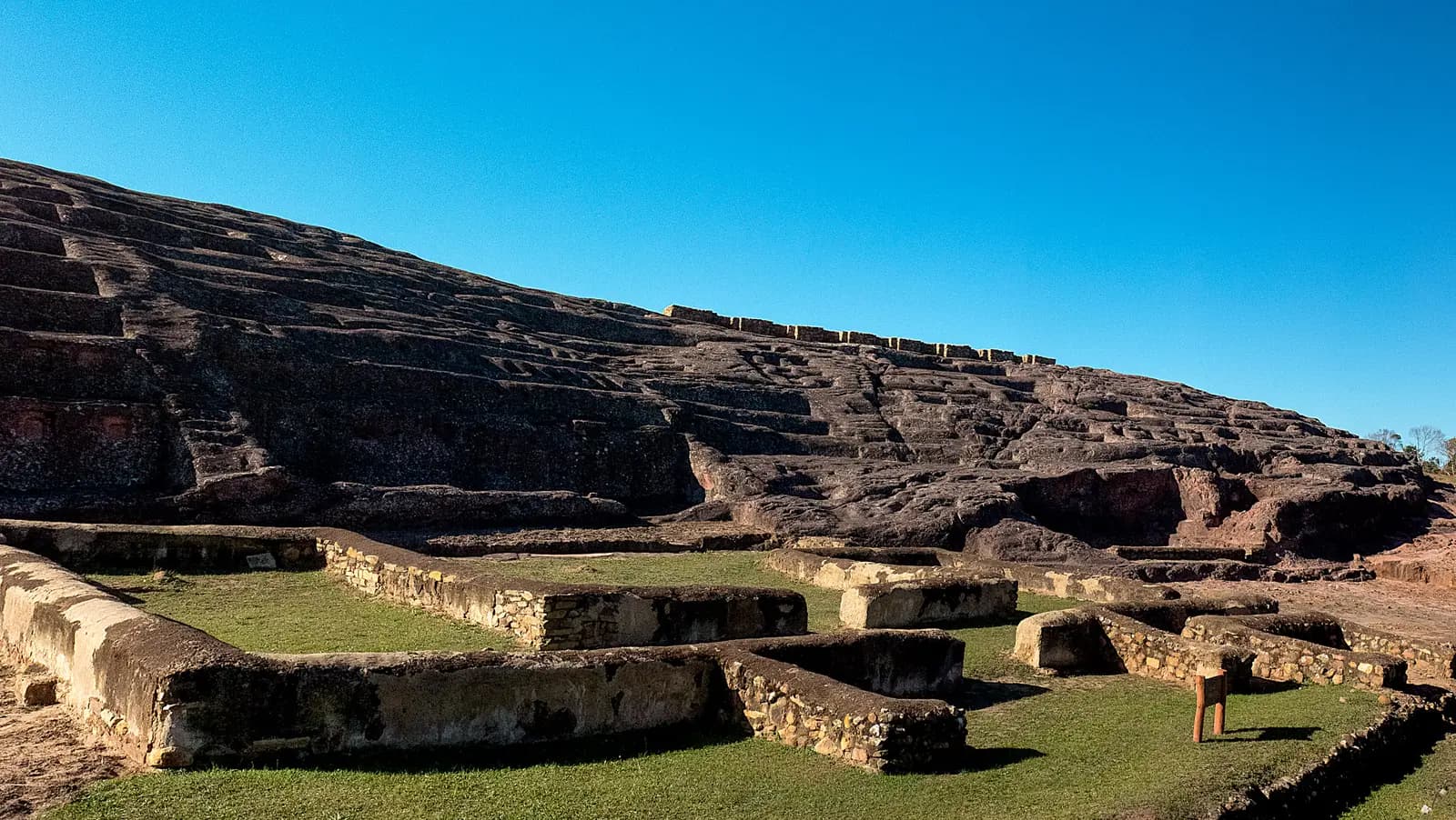
A long sandstone ridge whose top was carved into channels, niches, seats and animal figures by pre-Inca peoples, later used by the Inca and then by the Spanish. It is listed by UNESCO as a World Heritage Site. A path and viewing platforms lead around the rock, which you look at rather than walk on, and the views over the surrounding valleys are some of the best of the day.
Tip: The side road leaves Ruta 7 a few kilometres before Samaipata and climbs steadily, with a stream crossing on the way; take it slowly after rain. A fee is charged at the gate.
The roadkm 121–241.6
Ruta 7 back down to El Torno, then the dual carriageway into the city. The long descent is where tired riders make mistakes: use engine braking, keep well to your side on blind corners, and leave enough time to finish the mountain section in daylight.
Food
Allow 1 hour with lunch
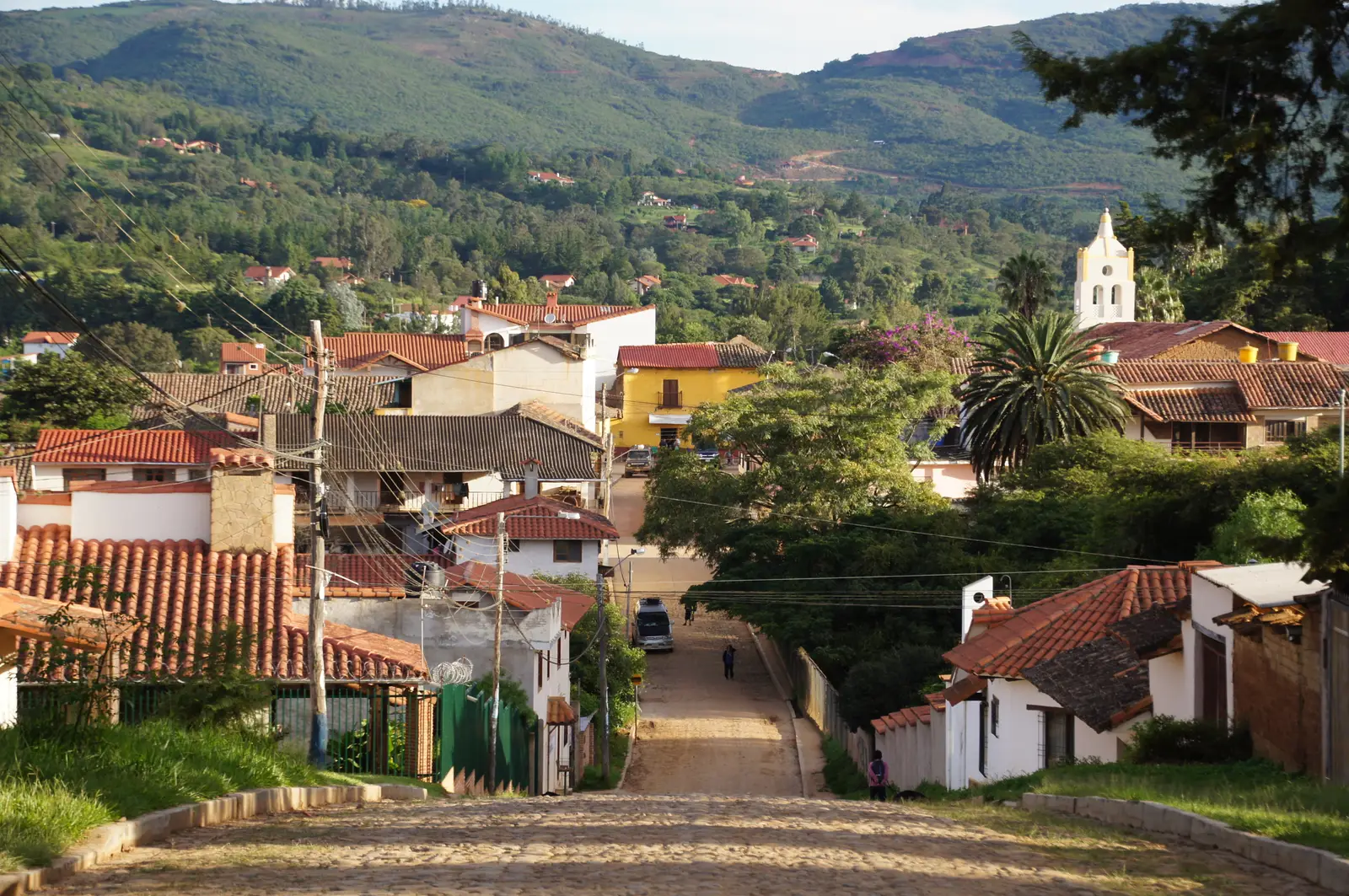
The turnaround and the highest point of the ride, at about 1,650 metres. Samaipata is a small colonial-era town of cobbled streets and tiled roofs around a leafy main square, noticeably cooler than Santa Cruz, with simple restaurants and cafés close to the plaza. It is also the gateway to Amboró National Park and the archaeological museum in town is a short walk from the square.
Tip: There is a fuel station on Ruta 7 at the edge of town. Fill up here before the ride back: the next one is near El Torno.
Finish
The ride home is all the same road in reverse, mostly downhill to the valley and then flat and fast into the city. Aim to be off the mountain section before dark, and back in the plaza in time for the evening, when the square fills with people as the heat goes out of the day.
Foreign riders generally need their home licence plus an International Driving Permit that covers motorcycles; check the current rules before you ride. Carry your licence, permit, passport and the bike's papers, as police checkpoints on Bolivian highways do stop riders. Make sure your travel insurance covers motorcycling.
The road is paved throughout, but 240 km with a long climb and a lot of truck traffic is far more comfortable on a 150–250 cc motorcycle than on a small scooter, especially two up. Check the brakes and tyres before you leave: the descent is long.
There are plenty of stations between the city and El Torno, then none until Samaipata, and the same gap on the way back. Fill up in El Torno on the way out and in Samaipata before you ride home. Stations in Bolivia sometimes run short of fuel, and foreign-plated vehicles can be charged a different price, so fill up whenever you can.
The dry season, roughly April to October, is the time to go. From about November to March heavy rain can bring landslides and mud on the mountain section. In the winter months a cold southern wind, the surazo, can bring grey, chilly days, and from about August to October smoke from land-clearing fires often hazes the views.
Bolivia drives on the right. Helmets are compulsory. Ruta 7 is a working highway that carries trucks and buses on mountain curves, so ride defensively and never assume the other lane is clear on a blind bend. Road blockades (bloqueos) occur in Bolivia and can close the road for hours or days; check for road blockades before setting out.
If the full distance in one day is more than you want, stay a night in Samaipata, which has plenty of places to sleep. It gives you time for El Fuerte, Las Cuevas and the town without hurrying, and you ride the mountain section fresh in both directions.
These operators run guided tours from Santa Cruz, listed alphabetically. Contact any of them through Moto Mass.