
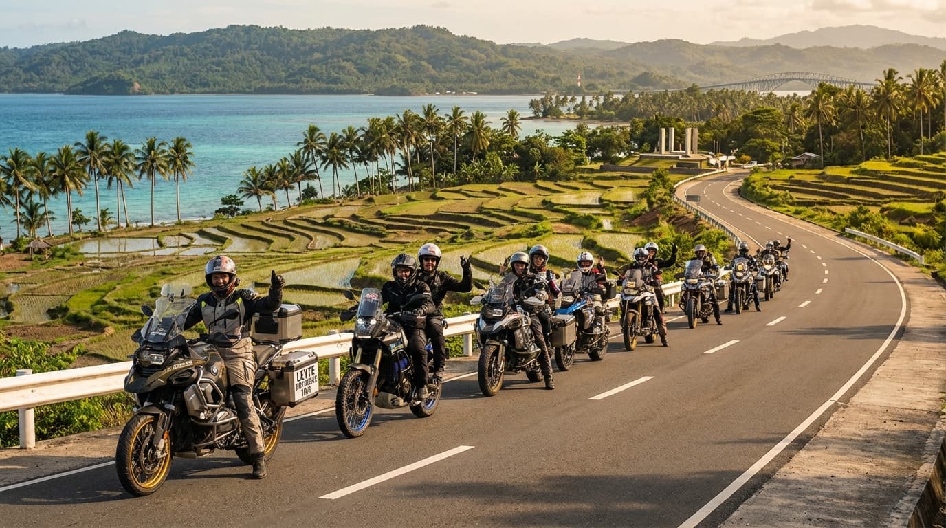
Leyte Motorbike Tour
Leyte, Philippines
4 days
Contact for price

A flat day out of Tacloban: across the San Juanico Bridge to Samar and back, down the Leyte Gulf shore where MacArthur waded ashore in 1944, and home through the rice country around Burauen and Dagami. Paved all the way.
Two things bring most visitors to Tacloban, and this ride takes in both. The first is the San Juanico Bridge, a little over two kilometres of steel and concrete curving across the strait to Samar, for decades the longest bridge in the Philippines. The second is the shore south of the city, where American forces landed on 20 October 1944 and Douglas MacArthur waded onto Red Beach at Palo to keep his promise to return. On the way you also pass the reminders of 8 November 2013, when Typhoon Haiyan, known here as Yolanda, drove a storm surge through Tacloban and the towns along Leyte Gulf. From the coast the loop turns inland and comes home through rice fields, coconut groves and quiet towns that few visitors see.
It is an easy ride in terms of roads: the whole loop stays below about 60 metres, there is no real climbing, and the surface is asphalt or concrete throughout, so a rented 125 cc scooter is plenty. Be honest with yourself about one thing: the bridge is an out-and-back. You ride the Maharlika Highway out of the city, cross to Samar, turn round and come back the same way, so the 9 km or so between Tacloban and the Samar end are ridden twice. What asks for attention is the traffic in and around Tacloban and Palo, where tricycles, jeepneys and multicabs stop wherever a passenger waves, and the village roads inland, where children, dogs, chickens and rice laid out to dry share the tarmac with you.
Longest stretch without a fuel station: about 31 km, between km 78 and km 109.
Start

The white city hall stands on Kanhuraw Hill above the downtown streets and Cancabato Bay, an easy landmark to meet at and a fitting start for a ride about 1944: after the landings, Tacloban served for a few months as the temporary seat of the Philippine Commonwealth government. The small Philippine–Japan peace park beside it is worth a look before you go.
Tip: Leave early. Downtown Tacloban fills with tricycles and jeepneys by mid-morning, and the heat builds quickly on the coast.
The roadkm 0–4.2
From city hall you drop through the downtown grid and pick up Anibong Road along the waterfront, past the Eva Jocelyn. Traffic is slow and dense: tricycles pull out and stop without warning, and jeepneys load and unload in the lane.
Sight
Allow 15 min
On 8 November 2013 the storm surge of Typhoon Haiyan carried several large ships out of the harbour and dropped them on the houses of Anibong. One of them, the cargo ship Eva Jocelyn, was left where it came to rest and is now a memorial to the thousands who died in the city. It sits right beside Anibong Road, among the homes that were rebuilt around it.
Tip: This is a neighbourhood and a place of mourning, not an attraction: park out of the way, keep your voice down and ask before photographing people.
The roadkm 4.2–26.3
The Maharlika Highway, part of the Pan-Philippine Highway, runs north-west along the strait through Cabalawan to the San Juanico Bridge. You cross to Samar, turn round and ride back the same way, then carry on through the city's southern suburbs. Buses and trucks use this road all day; on the bridge, ride steadily, keep to your lane and watch for crosswinds on the main span.
Sight
Allow 20–30 min

Opened in 1973, the bridge carries the Maharlika Highway a little over two kilometres across the San Juanico Strait, a narrow channel dotted with small wooded islands that separates Leyte from Samar. From the deck you look down on fishing boats threading between the islets; the arched steel span in the middle is the bridge's best-known silhouette. Ride across to the Samar side, turn round where it is safe, and enjoy the view again on the way back.
Tip: Don't stop on the bridge itself. Repairs began in 2025 with weight limits for heavy vehicles; check for roadworks or lane closures before you set off.
The roadkm 26.3–36.9
Gov. B. Romualdez Avenue and Manlurip Road take you through San Jose, the neighbourhood behind White Beach, where part of the 1944 landing came ashore, and then along the shore road to Red Beach and the memorial at Palo. Traffic eases after the city, but the concrete is slick when wet.
Sight
Allow 45 min

On 20 October 1944, a few hours after the first troops landed on Red Beach, General Douglas MacArthur waded ashore here with President Sergio Osmeña and his staff, and in a radio broadcast from the beach told Filipinos, 'I have returned.' Larger-than-life bronze statues of the seven men stand in a pool on the beach in the pose of the famous photograph, looking in from Leyte Gulf. The landing began the liberation of the Philippines, and the naval battle of Leyte Gulf followed in the days after.
Tip: The landing is remembered with ceremonies here every year around 20 October; the road can be busy and parts of the park closed on that day.
The roadkm 36.9–60.9
The Maharlika Highway runs south through Tanauan, Tolosa and the villages of Dulag, never far from the sea. It is fast and straight, with buses overtaking hard; in each town the speed drops sharply around the market and the church, and tricycles fill the shoulder.
The roadkm 60.9–97.4
The loop leaves the coast and heads inland on provincial roads through rice paddies, coconut groves and small towns, rising gently to the highest point of the day, about 60 metres, around Burauen. Traffic is light, but farm life spills onto the road: carabao, dogs, motorbikes with sidecars, and harvested rice spread out to dry on the edge of the tarmac.
Food
Allow 1 hour with lunch
A coastal town at the southern end of the 1944 landing beaches: while MacArthur's X Corps came ashore around Palo and Tacloban, the XXIV Corps landed on the shore near Dulag the same morning. Today it is a quiet market town and the natural place for lunch before the loop turns inland, with simple eateries around the plaza and the parish church.
Tip: Fill up before you leave the coast: there is fuel in Burauen, then none on the loop until Palo.
The roadkm 97.4–121
From Pastrana a quiet concrete road runs east through farmland to Palo, with slab joints and the odd patched section to watch for. In Palo you pass the cathedral, rejoin the Maharlika Highway briefly and take the Tacloban–Baybay South Road back into the city, busy from late afternoon.
Sight
Allow 30 min

Palo's twin-towered cathedral served as a field hospital for American troops after the landings in 1944, and in January 2015 Pope Francis came here to meet survivors of Typhoon Haiyan. Behind it rises Guinhangdan Hill, the Hill 522 of the battle, taken by American infantry in the first days after the landing.
Tip: The cathedral is a block off the main road through Palo. Dress modestly if you go inside, and avoid Sunday mornings when it is full for Mass.
Finish
The last stretch brings you back into Tacloban along the Tacloban–Baybay South Road and past the Santo Niño Shrine to the foot of Kanhuraw Hill. Downtown, the streets around the city hall and the market are full of places to eat as the evening cools.
The Philippines drives on the right. Visitors can generally ride on a valid foreign licence that covers motorcycles for a limited period after arrival, commonly given as 90 days; an International Driving Permit alongside it helps at checkpoints. Check the current rules before you ride, and check that your travel insurance covers motorcycling.
The loop is flat and paved, so any 125 cc scooter does it comfortably, two up included. What matters more is good tyres and brakes: concrete roads get slippery in the rain, and you will be braking often for tricycles and animals.
Stations are frequent around Tacloban, Palo and along the coast. Inland, the last one on the loop is in Burauen and the next is back in Palo. Village shops sell fuel in bottles if you are caught short, but fill up on the coast.
Eastern Leyte has no real dry season. March to May is the driest and also the hottest time; ride early and rest through the middle of the day. Typhoon season runs roughly from June to November, and November to January is usually the wettest time on this coast. Check the weather bulletins before you set off, and don't ride when a storm signal is up.
Helmets are compulsory for rider and passenger. Tricycles, jeepneys and multicabs stop anywhere to pick up and drop off, often without signalling, and buses overtake on the highway with little room to spare. Ride defensively, use the horn as locals do on blind approaches, and avoid riding after dark, when unlit bikes, animals and people walking on the road are hard to see.
The ride passes places of war and of disaster: the landing memorial, the cathedral at Palo and the ship at Anibong. Many families in Tacloban and Palo lost people in 2013. Dress modestly, keep your voice down and think before you photograph people.
These operators run guided tours from Tacloban, listed alphabetically. Contact any of them through Moto Mass.