
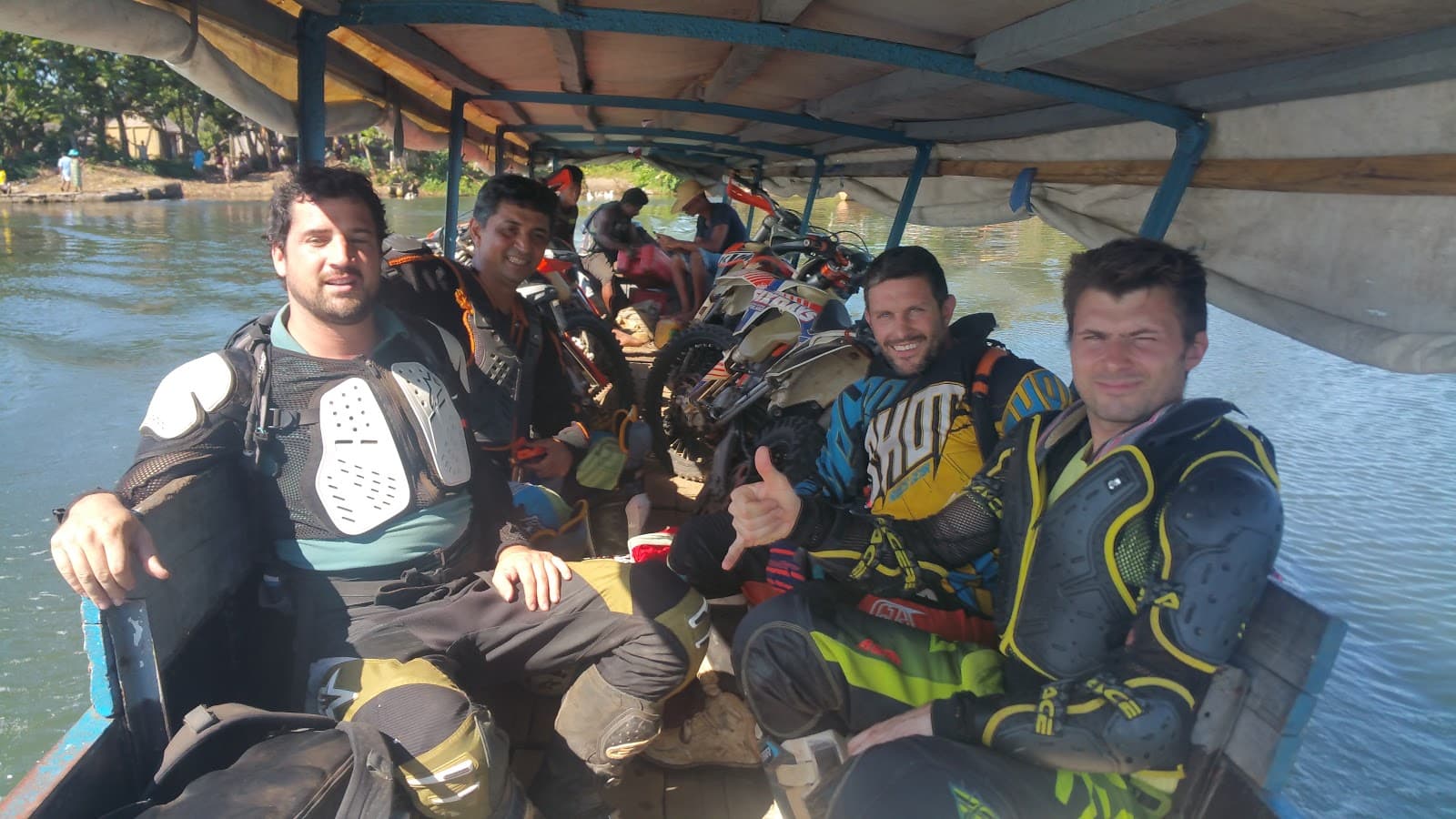
Exiting Cross Tour, 14 Days
Antananarivo, Madagascar
14 days
Contact for price

Out of Antananarivo to the royal hill of Ambohimanga, along the RN3 past the sacred hill of Ambohidrabiby, then 21 km of gravel across the highlands and home on the RN2. A short day with a lot of Madagascar in it.
The hills around Antananarivo were the heartland of the Merina kingdom, and the ride that every visitor to the capital should make goes to the most sacred of them. The Royal Hill of Ambohimanga, a UNESCO World Heritage Site, sits a short ride north of the city off the RN3. This loop goes there first, then keeps going: past Ambohidrabiby, seat of the 16th-century king Ralambo, through the market town of Talata Volonondry and up onto open highland at around 1,500 metres. A gravel road then crosses the high country south to the RN2, the main road to the east coast, which brings you back into town.
It suits riders who are happy on a mix of tarmac and gravel and don't mind city traffic. The RN3 and RN2 are paved, with patches and potholes in places; the 21 km link between them is a gravel road, firm in the dry season but rutted and slippery after rain. A rented 125–250 cc bike will manage it in the dry months, and a light trail bike is ideal. If the gravel is not for you, Ambohimanga and Ambohidrabiby make a fine half-day ride on tarmac there and back along the RN3.
Longest stretch without a fuel station: about 55 km, between km 26 and km 81.
Start
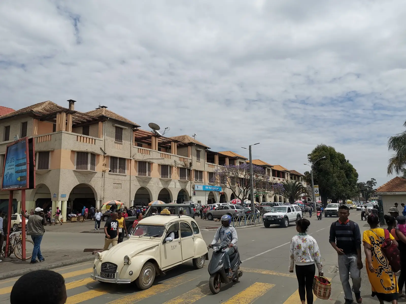
The broad avenue of arcaded buildings running from Soarano station to Analakely is the heart of the lower town and the easiest place in Antananarivo to meet. The way out north starts a few streets away, climbing towards the RN3 through Ambatomainty.
Tip: Leave early, ideally before 7 am: the traffic out of Tana is heavy and slow by mid-morning.
The roadkm 0–12
From Analakely the route climbs through Ambatomainty to pick up the RN3 heading north past Sabotsy Namehana. Traffic is dense and slow: minibuses stop without warning, handcarts and pedestrians share the road, and the junctions are a free-for-all. Keep your speed down and your eyes up. There are plenty of fuel stations in this stretch.
The roadkm 12–27
The RN3 leaves the suburbs and runs between rice fields and low hills. The turn for Ambohimanga is on the left at about km 16; the side road climbs about 5 km to the village at the foot of the royal compound, and you come back down the same way. Ambohidrabiby follows at km 21, and Talata Volonondry at km 27.
SightDetour
Allow 1½–2 hoursAbout 5 km each way
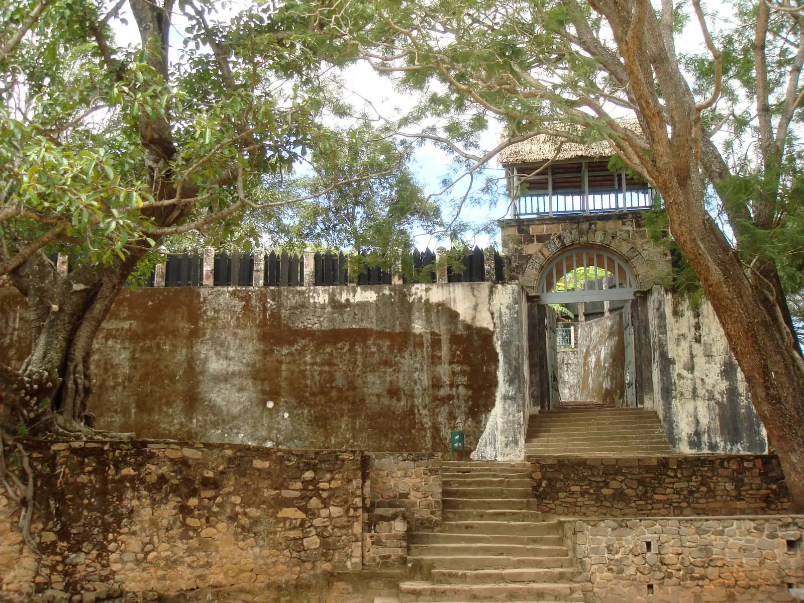
The spiritual capital of the Merina kingdom and the home of King Andrianampoinimerina, who united the highland kingdoms at the end of the 18th century. Inside the walls are his wooden house, Mahandrihono, the pavilions built for Queen Ranavalona II, royal tombs and old fig trees, and the main gate is still closed in the traditional way with a huge stone disc. It is a sacred place for many Malagasy, who come to pray and honour the ancestors, and the views from the top run across the valleys and rice fields to Antananarivo.
Tip: An entrance fee is charged. Ancestral taboos still apply on the hill, including one on pork, so don't bring it with you.
Sight
Allow 20–30 min
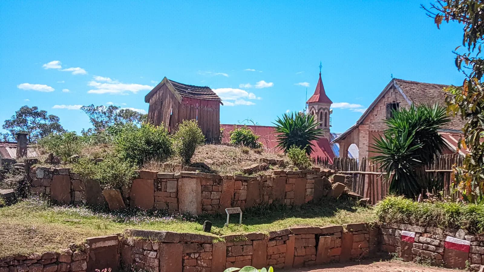
Another of the twelve sacred hills of Imerina, and the capital of King Ralambo, who reigned from 1575 to 1610. The old royal enclosure, the rova, stands a few hundred metres from the RN3 among the village houses and churches. It sees far fewer visitors than Ambohimanga and is worth a short walk round.
Tip: Ask in the village before you walk into the enclosure; it is a place of respect as much as a sight.
The roadkm 27–43
The road climbs to its high point at km 33 and rolls along at around 1,450–1,500 metres through farming country. The tarmac is better here than closer to the city, but potholes appear without warning. Watch for zebu carts, cattle and children at every village.
Food
Allow 20–30 min
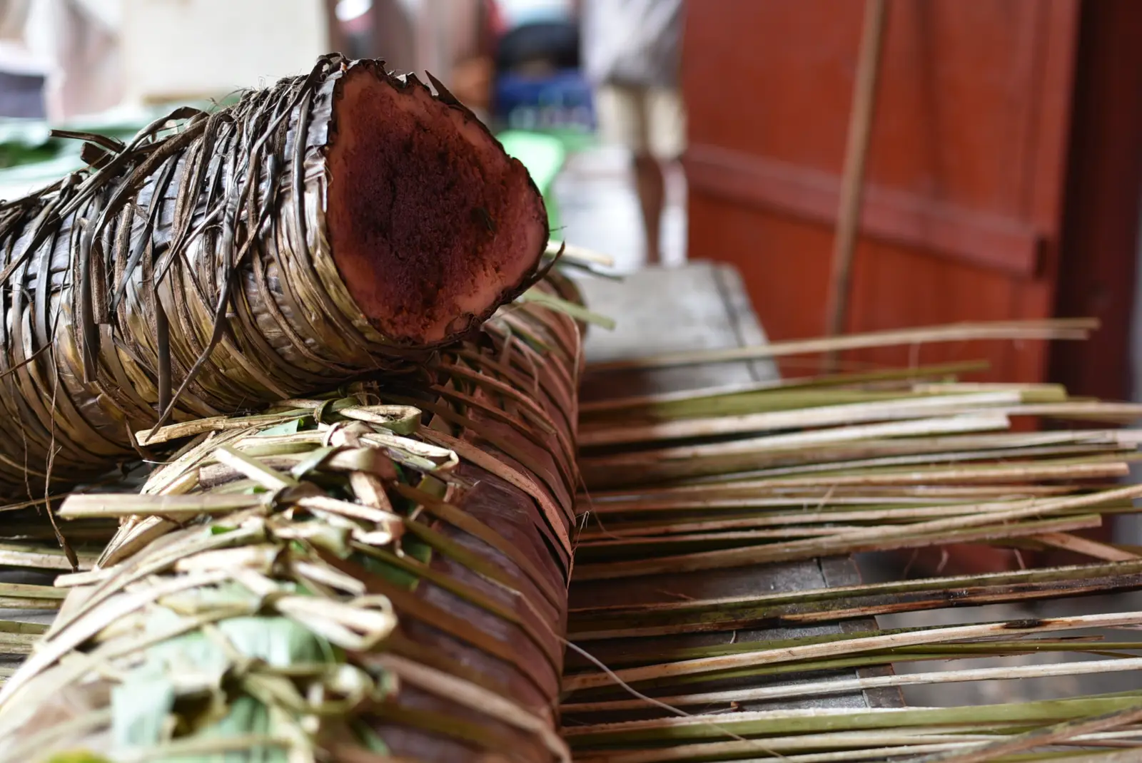
A busy market town on the RN3 (talata is Malagasy for Tuesday). It is known for koba, the dense Malagasy cake of rice flour, peanuts and banana sold wrapped in leaves, and simple roadside eateries serve rice dishes and snacks. A good place for a break before the high country.
Tip: Fill up here: the fuel station at km 26, just before the town, is the last on the route until the RN2 well past the gravel.
Viewpoint
Allow 10 min
Beyond Talata Volonondry the RN3 climbs onto the high ground and tops out at just over 1,500 metres, the highest point of the ride. Rice fields fill the valley floors, villages of brick houses sit on the ridges, and on a clear dry-season morning you can see a long way across the highlands.
Tip: Pull well off the road to stop: taxi-brousse minibuses and trucks use the RN3 at speed.
The roadkm 43–64
At Andriampamaky, about km 43, turn right off the RN3 onto the gravel road south towards Maharidaza on the RN2. It crosses open high country at 1,400–1,500 metres through small villages, with no fuel and little traffic. In the dry season it is firm and ridable at a steady pace; expect loose stones, corrugations and ruts. After rain the red earth turns to slippery mud and parts can become impassable; if in doubt, ride back the way you came.
The roadkm 64–98.3
The RN2 is the main road between Antananarivo and the port of Toamasina, and it carries a constant stream of trucks, fuel tankers and taxi-brousses. It drops off the high ground with gradients of up to about 9%, then runs west down the valley towards the city. Overtake only with a long clear view, and expect the traffic to thicken from Ambohimangakely into town.
Finish
The RN2 brings you back into the city from the east, past Ambohimangakely and through the Ambohimahitsy roundabout, then down into the lower town and the avenue where you started.
Bring your home licence and an International Driving Permit that covers motorcycles, and check the current requirements before you ride. Make sure your travel insurance covers motorcycling, and carry your licence and the bike's papers with you.
A 125–250 cc bike will do the loop in the dry season, and a light trail bike makes the gravel section easy. Check the tyres, chain and brakes before you leave; help is slow to arrive on the gravel road, so carry water and a basic puncture kit.
Fuel stations are plentiful in the city and along the RN3 as far as the outskirts of Talata Volonondry, at about km 26. There is then nothing until the RN2 at about km 81, so leave Talata Volonondry with a full tank.
May to October is the dry season and the best time for the gravel road. June to August mornings are cold at 1,500 metres, so bring a warm layer. From November to April the rains turn the gravel to mud, and from January to March cyclones can bring days of heavy rain; ride only the tarmac out-and-back to Ambohimanga then.
Madagascar drives on the right, and helmets are compulsory. Leave early to beat the traffic out of Antananarivo, and expect taxi-brousse minibuses stopping anywhere, zebu carts, cattle, bicycles and pedestrians on every road. Potholes appear suddenly, even on good tarmac. Ride in daylight only and plan to be back in town well before dark.
Ambohimanga and Ambohidrabiby are sacred places, not just sights. Dress modestly, follow any instructions about where to walk and what not to touch, and respect the taboos: pork is forbidden at Ambohimanga.
These operators run guided tours from Antananarivo, listed alphabetically. Contact any of them through Moto Mass.