
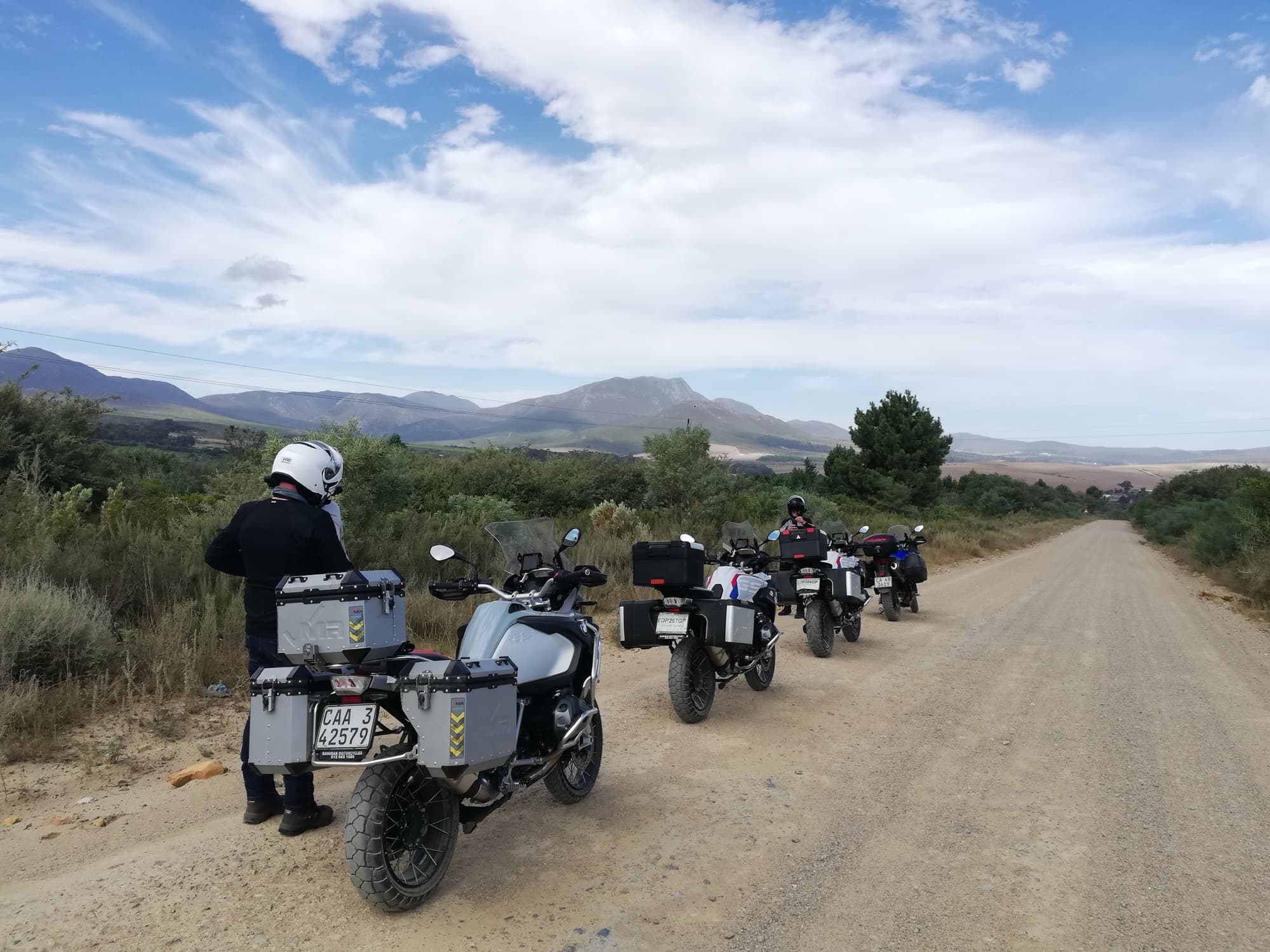
Cape Conquest, 9 Days
Cape Town, South Africa
9 days
€3,090 / person

The Cape Peninsula in a day: the Atlantic coast road out of Cape Town, the cliff-cut curves of Chapman's Peak Drive, the cliffs of Cape Point, and home along False Bay past the penguins of Boulders Beach.
Every rider in Cape Town has done this loop, and most do it again whenever visitors come. It leaves the city along the Atlantic seaboard, under the Twelve Apostles to Hout Bay, then climbs onto Chapman's Peak Drive, a road blasted into the cliffs above the sea a century ago. From Noordhoek it crosses to the wild west coast at Kommetjie and Scarborough, runs to the tip of the peninsula at Cape Point, and comes home up the warmer False Bay shore through Simon's Town, Kalk Bay and Muizenberg.
The whole loop is paved, and none of it is technically hard, so a rented scooter or small motorcycle will do it. What makes it a moderate ride is everything else: Chapman's Peak is all curves with a sheer drop on the sea side, the wind on the peninsula can be strong enough to push a light bike across its lane, and the coast roads are shared with cyclists, buses and drivers looking at the view. Two fees apply on the way, a toll on Chapman's Peak Drive and an entry fee for the Cape Point section of Table Mountain National Park.
Longest stretch without a fuel station: about 61 km, between km 39 and km 100.
Start
The red Victorian clock tower at the mouth of the old harbour is the easiest landmark in Cape Town to meet at. From here it is a few minutes through Green Point to the sea at Sea Point, and the coast road starts almost at once.
Tip: Leave early. The Atlantic seaboard and Chapman's Peak are quietest before 9 am, and the wind usually builds through the day.
The roadkm 0–24
Through Green Point and Sea Point on the M61, then the M6, Victoria Road, round Clifton and Camps Bay and along the foot of the Twelve Apostles to Llandudno and Hout Bay. The road climbs and dips with the coast, and the corners above Clifton and beyond Camps Bay are tight. Expect parked cars, pedestrians crossing to the beaches and slow traffic on sunny weekends.
The roadkm 24–33
A toll is charged on the drive. Past Hout Bay the road is cut into the mountainside high above the sea, with a low stone wall on the drop side and rockfall shelters over some sections. It is all curves and no straights, often blind; keep left, stay off the white lines and expect cyclists on the climbs and cars stopping suddenly for photos. Strong gusts come off the cliffs in a south-easter.
Viewpoint
Allow 15–20 min
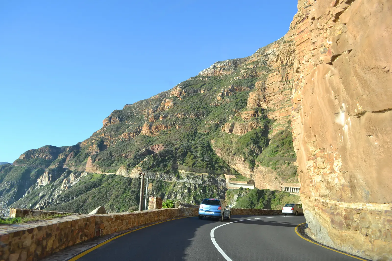
The highest point of Chapman's Peak Drive, a pull-out on the sea side looking back across Hout Bay to the Sentinel and the mountains above it. The road was cut into the cliff between 1915 and 1922, and from here you can see it curling round the mountainside below you. There are smaller lay-bys further along; use them rather than stopping on the road.
Tip: The drive is a toll road and closes for rockfall, high wind and heavy rain. Check that it is open on the morning you ride.
The roadkm 33–61
Down into Noordhoek, then the M65 Kommetjie Road crosses the valley to the west coast. Slangkop Road (M82) runs through Kommetjie, and the M65 carries on past the long beaches of Misty Cliffs and Scarborough before climbing inland across the fynbos to the national park gate. This is the most exposed stretch of the loop to crosswinds, and the last fuel for a while is around Noordhoek and on Kommetjie Road.
The roadkm 61–88
Past the gate, Cape of Good Hope Drive and Cape Point Road run through open fynbos to the car park below the lighthouse, and you ride the same road back to the gate. The surface is good, but the limit is low for good reason: ostriches, antelope and baboons cross the road, and coaches use it all day. There is no fuel inside the park.
SightDetour
Allow 20–30 minAbout 4 km each way, signed from the Cape Point road
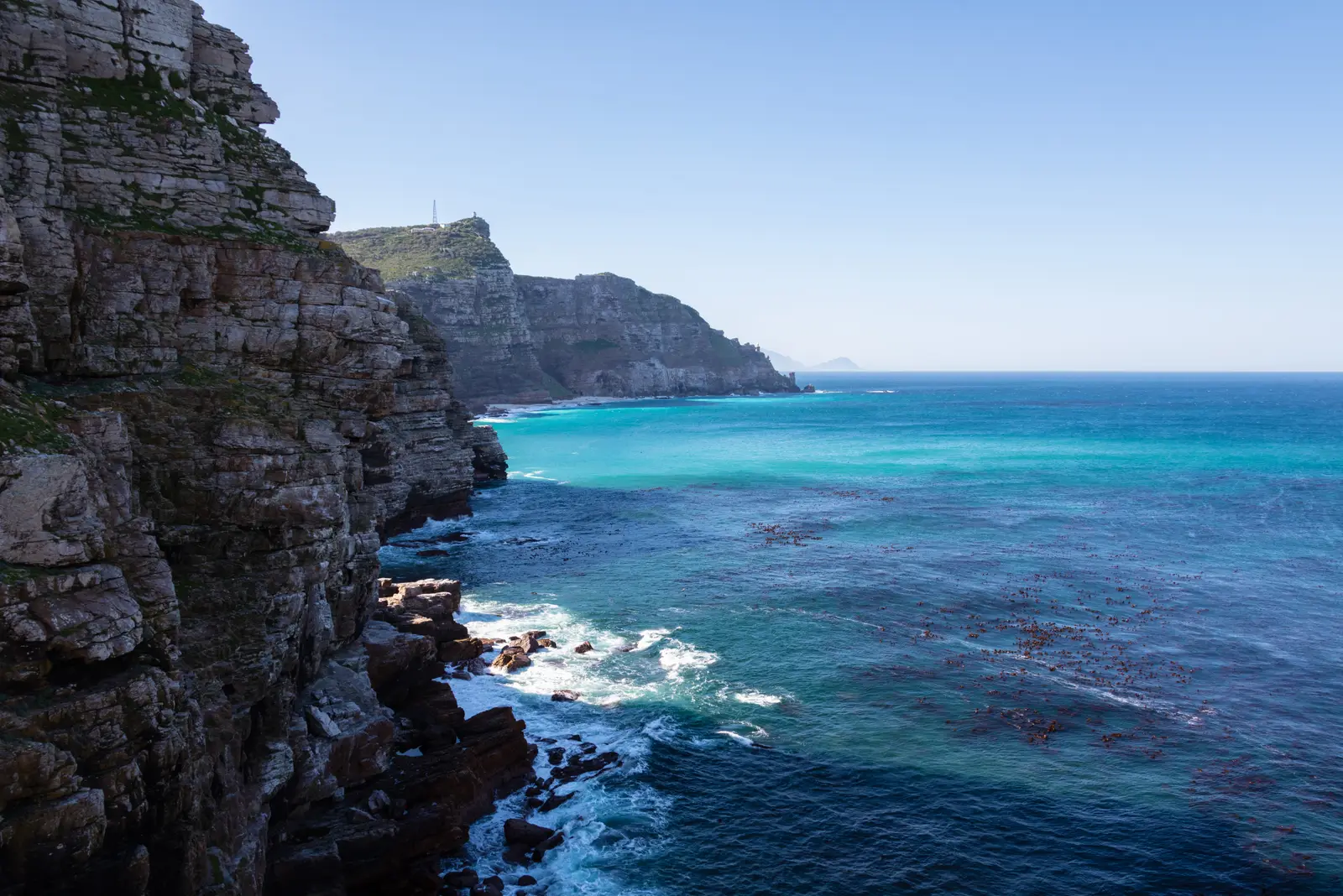
The most south-westerly point of Africa, a rocky headland reached by its own side road off the main park road, before or after Cape Point. The famous sign stands by the car park at the water's edge, and the coast here is open, wild and usually windy. Ostriches, and sometimes antelope, graze the fynbos along the way.
Tip: Ride the park roads slowly: animals wander onto them, and the speed limit inside the park is low.
Sight
Allow 1–1½ hours
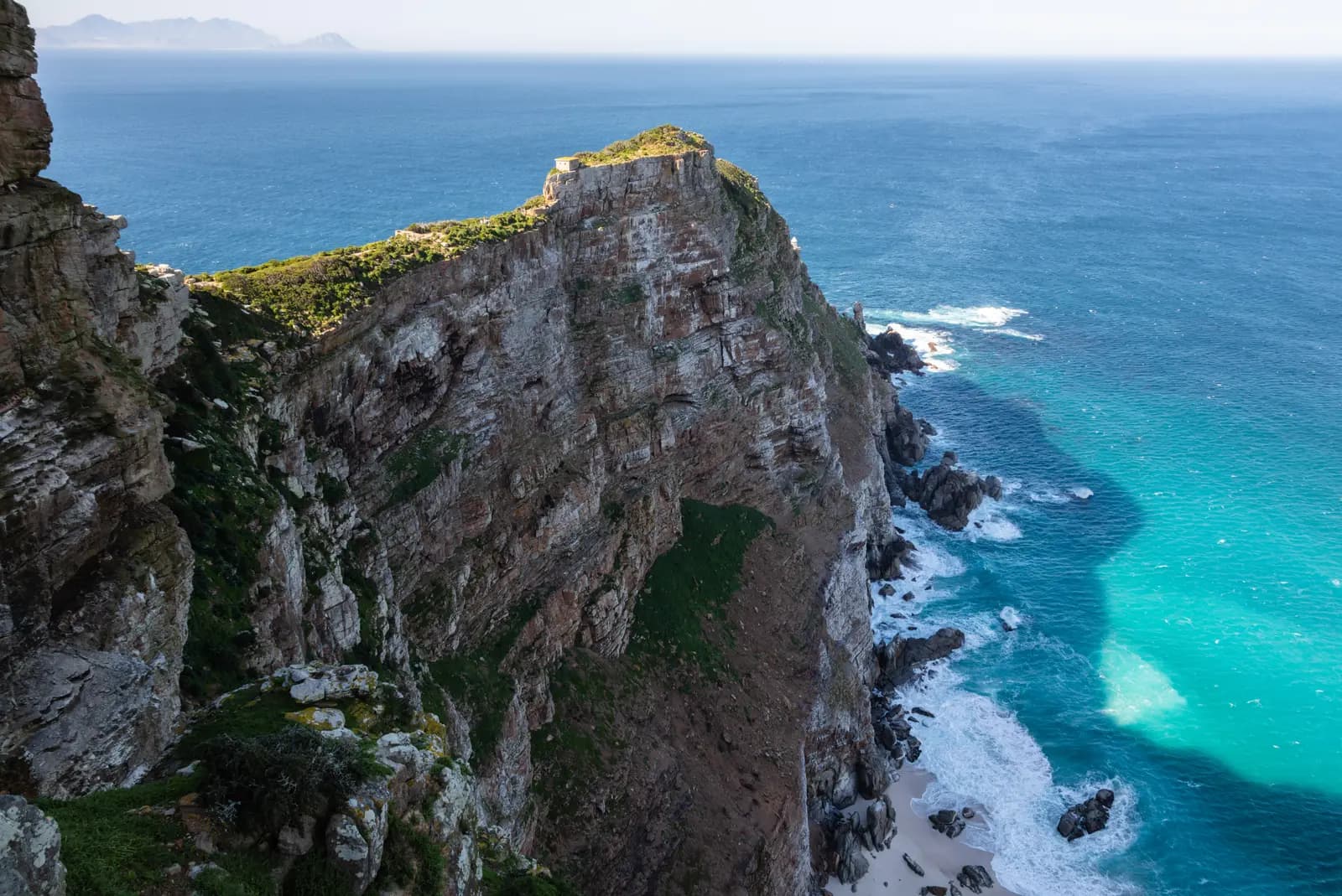
The road ends at a car park below the last high ridge of the peninsula. A steep path, or a funicular, climbs to the old lighthouse on the summit, and from there walkways run out along the cliffs with the sea on three sides. On a clear day you can see across False Bay to the mountains beyond.
Tip: Baboons live here and know that visitors carry food. Do not eat in the open, keep bags closed, and leave nothing edible on the bike.
The roadkm 88–116
The M4 drops from the gate past Smitswinkel Bay to Simon's Town, a naval town with a Victorian main street, then follows the shore through Glencairn, Fish Hoek, Kalk Bay and St James to Muizenberg, with the railway beside the sea for much of the way. Speeds are low, the road is narrow through the villages, and there is plenty of fuel again from Simon's Town onwards.
Sight
Allow 45 min–1 hour
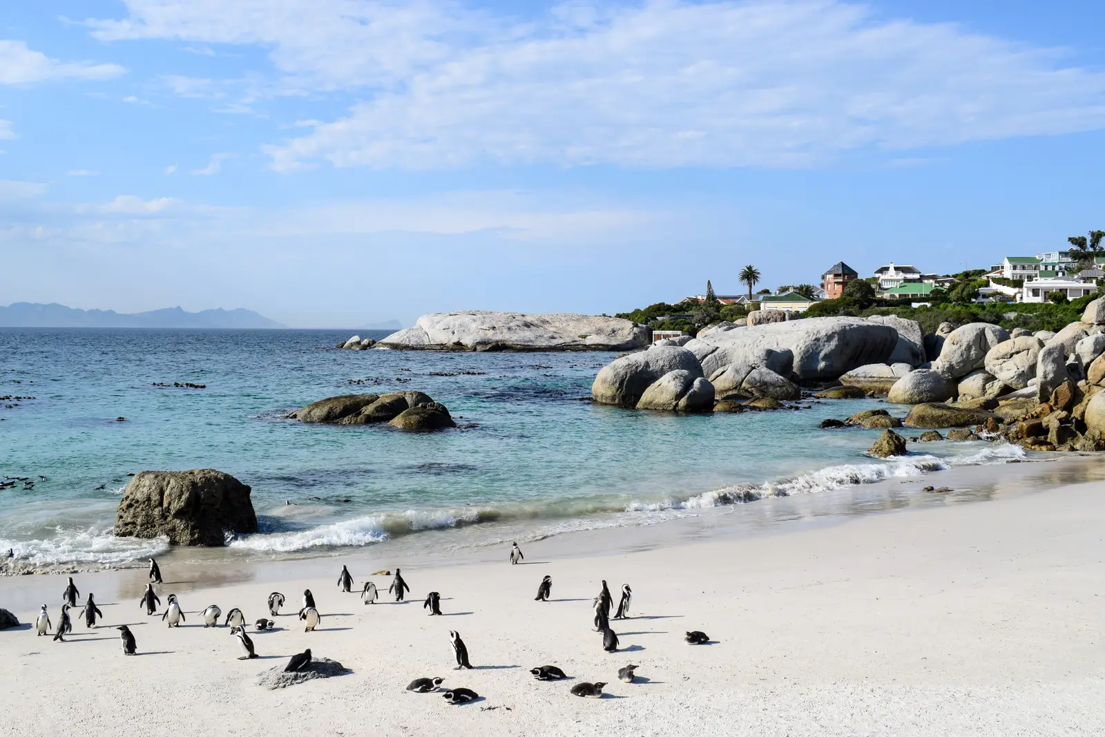
On the southern edge of Simon's Town, a colony of African penguins lives among huge granite boulders on a sheltered cove. Boardwalks lead from the road to viewing platforms above the beach, close enough to watch the birds come and go from the water.
Tip: Boulders has its own entry fee, separate from the Cape Point gate. Park in the signed areas off the main road and do not try to touch or feed the penguins.
Food
Allow 1 hour with lunch
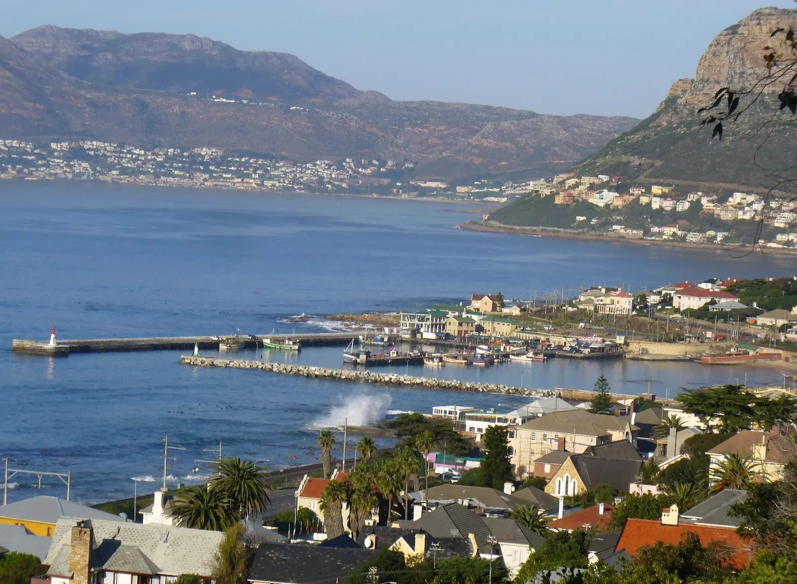
A working fishing harbour squeezed between the mountain and the sea, with the railway running along the shore beside the road. Boats land their catch on the quay, and the main road is lined with places selling fish and chips, coffee and cake. It is the natural lunch or late-afternoon stop on the way home.
Tip: Main Road through Kalk Bay and St James is narrow and slow, with cars parked along it. Watch for doors opening.
The roadkm 116–143
Steenberg Road (M42) climbs to the M3, which runs north along the eastern side of Table Mountain through Constantia, Wynberg and Newlands before joining the N2 and Nelson Mandela Boulevard into the city centre. It is fast and busy at rush hour; ride in the left lane and watch for cars merging at the many junctions.
Finish
The M3 brings you back round the eastern side of Table Mountain, past Newlands Forest and the University of Cape Town, and drops into the city with the mountain on your left. The loop finishes back at the Waterfront, where the harbour is a good place to sit and watch the boats as the day ends.
South Africa accepts a foreign driving licence that is in English, carries your photo and covers motorcycles. If yours does not, carry an International Driving Permit with it. Check that your travel insurance covers riding a motorcycle or scooter of the size you hire.
A 125 cc scooter will make it round, but the loop is long and the wind is strong, so a 150–300 cc motorcycle is a far more comfortable choice, especially two up. The M3 home is a fast urban freeway; on a small scooter, keep to the left lane.
There are plenty of stations in the city, in Hout Bay and around Noordhoek and Kommetjie. After that there are none for about 60 km, across the southern peninsula, through the park to Cape Point and back, until Simon's Town. Fill up on Kommetjie Road at the latest.
Chapman's Peak Drive is a toll road and the Cape Point section of Table Mountain National Park charges an entry fee at the gate, higher for foreign visitors; Boulders Beach charges its own. Chapman's Peak closes when there is a risk of rockfall, usually after heavy rain or in very strong wind, so check that it is open before you set out. The park gate has set opening times, so do not arrive late in the day.
November to April is dry and warm, but this is also the season of the south-easter, the strong summer wind that can make Chapman's Peak and the Cape Point road hard work on a light bike; mornings are usually calmer. From June to August cold fronts bring rain and storms off the Atlantic, but the days between them can be clear and still.
South Africa drives on the left, and helmets are compulsory for rider and passenger. The coast roads are popular with cyclists, especially on weekend mornings, and with tour buses later in the day. Baboons at Cape Point and along the southern peninsula will take food from bags and bikes, so never carry food where they can see it. Ride the loop in daylight.
These operators run guided tours from Cape Town, listed alphabetically. Contact any of them through Moto Mass.
Free ride routes