
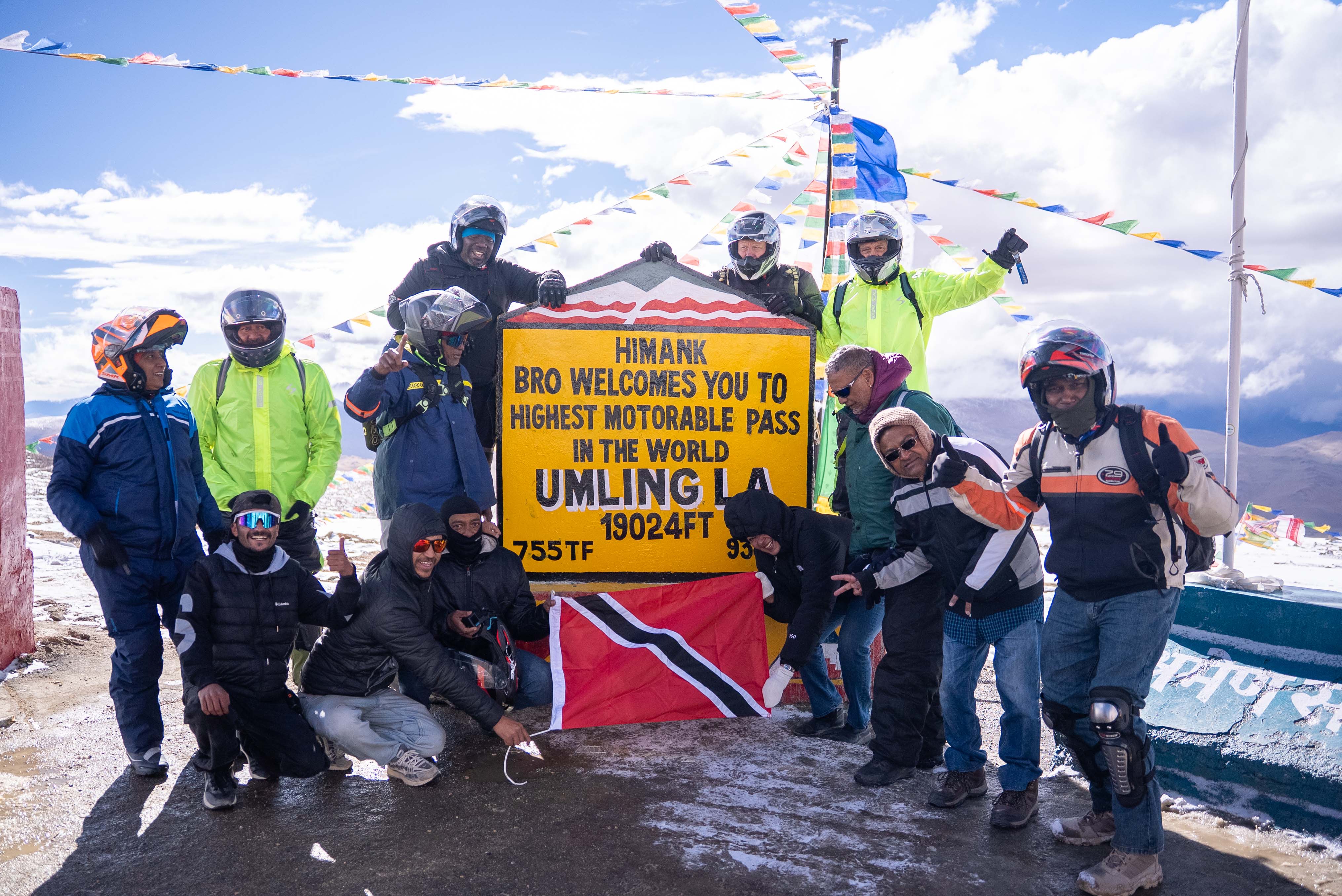
Ladakh Guided Motorbike Tour: Khardung La, Pangong Tso and Umling La
Leh, Ladakh, India
11 days
$3,000 / person

The great Himalayan road ride: from the Kullu valley through the Atal Tunnel and over four high passes to Leh, topping out at Tanglang La. About 427 km, usually ridden in three days, with a free GPX for the whole route and for each day.
The Manali to Leh highway is the road most riders mean when they talk about riding in the Himalaya. It leaves Manali, at about 1,900 metres, climbs to the Atal Tunnel under the Pir Panjal range and comes out in Lahaul, a dry, open valley that feels a world away from the forests behind you. From Jispa it climbs into empty high country: Baralacha La, the Sarchu plain, the Gata Loops, Nakee La and Lachulung La, the long tableland of the More Plains and finally Tanglang La, at about 5,330 metres, before dropping into the Indus valley and on to Leh.
It is about 427 km one way, more than half of it above 4,000 metres, and most riders take three days with nights at Jispa and Sarchu. Two long days, sleeping at Jispa, are possible for riders who are already acclimatised; four, with an extra night low down, is kinder to anyone arriving from the plains. Most of the road is now paved, but expect broken stretches, gravel where the road is being rebuilt and streams of meltwater running across it, especially in June and early July. The altitude matters more than the road: plan your nights so you sleep as low as you can, and read the altitude note below before you go.
Longest stretch without a fuel station: about 351 km, between km 69 and km 420.
Get an email when we add a new free ride in India. Nothing else.
One email per new route. Unsubscribe with one click.
The usual way to split the ride, with the town most riders sleep in each night. Download the whole route, or one day at a time.
Day 1km 0–91.1
91 km↑ 2,270 mOvernight: Jispa
Up the Solang valley to the Atal Tunnel, through it into Lahaul, then down the Chandra valley to Tandi and up the Bhaga valley past Keylong to Jispa. Short on the map, but traffic is heavy as far as the tunnel. Fill up at Tandi or Keylong: there is no more fuel on the road for over 300 km.
GPX for day 1Day 2km 91.1–175.1
84 km↑ 1,870 mOvernight: Sarchu
Past Darcha and Zing Zing Bar the road climbs to Baralacha La, about 4,890 metres, the first of the high passes, then drops to the Sarchu plain and its seasonal tent camps. A short day, which leaves time for meltwater crossings and helps with the altitude: you sleep around 1,000 metres higher than the night before.
GPX for day 2Day 3km 175.1–426.5
251 km↑ 2,980 mFinish: Leh
The big day: the Gata Loops, Nakee La and Lachulung La, tea and food at the tents of Pang, the More Plains and Tanglang La, the highest point of the ride. Then a long descent through Rumtse to the Indus valley at Upshi and up the valley to Leh. Start early and aim to be over Tanglang La by early afternoon.
GPX for day 3Start
The busy hill town at the head of the Kullu valley is where most rides to Leh begin, and the last big town on the road: ATMs, mechanics, gear shops and bike rental. Spend at least one night here before you go, more if you have come up from the plains.
Tip: Leave early on day one: traffic towards the Atal Tunnel builds through the morning, especially at weekends.
Day 1: Manali to Jispa
The roadkm 0–28.4
NH3 climbs north out of Manali through Palchan and up the Solang valley to the tunnel's south portal at about 3,000 metres. Tourist traffic, taxis and buses are heavy, especially in the morning and at weekends; expect queues near the tunnel.
Sight
Allow 10 min
A 9.02 km road tunnel under the Pir Panjal range, opened in 2020 at about 3,000 metres. It replaced the old road over Rohtang Pass for most traffic and keeps Lahaul open in winter. On the far side the landscape changes at once, from forest to bare rock and a wide, dry valley.
Tip: Every vehicle entering Lahaul and Spiti has to be registered (a free online e-pass); have it ready for the check beyond the north portal.
The roadkm 28.4–91.1
Through the tunnel and down the Chandra valley past Sissu to Tandi, at under 2,900 metres the lowest point after Manali, where the Chandra and Bhaga rivers meet. Then up the Bhaga valley past Keylong to Jispa. Quieter than the Manali side, with falling rock and roadworks in places.
Fuel
The district headquarters of Lahaul and the last town of any size before Leh, on the slope above the Bhaga river. Together with Tandi, a few kilometres back at the confluence of the Chandra and Bhaga, it is your last sure place to fill up.
Tip: Fill the tank and any spare can here or at Tandi; the next pump is around 325 km away.
Food
Allow Overnight
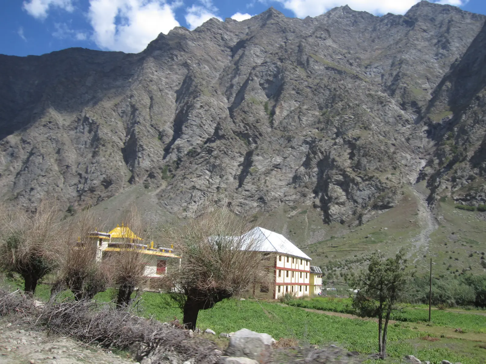
A small village on the Bhaga river at around 3,200 to 3,300 metres, with guesthouses and camps strung along the road. It is the most popular first night: high enough to start acclimatising, low enough to sleep reasonably well.
Day 2: Jispa to Sarchu
The roadkm 91.1–175.1
Past Darcha the road leaves the last villages behind and climbs steadily past Zing Zing Bar to Baralacha La at about 4,890 metres. Snowmelt streams cross the road on both sides of the pass, deepest in the afternoon. Beyond it the road drops gently to the open Sarchu plain.
Viewpoint
Allow 10 min
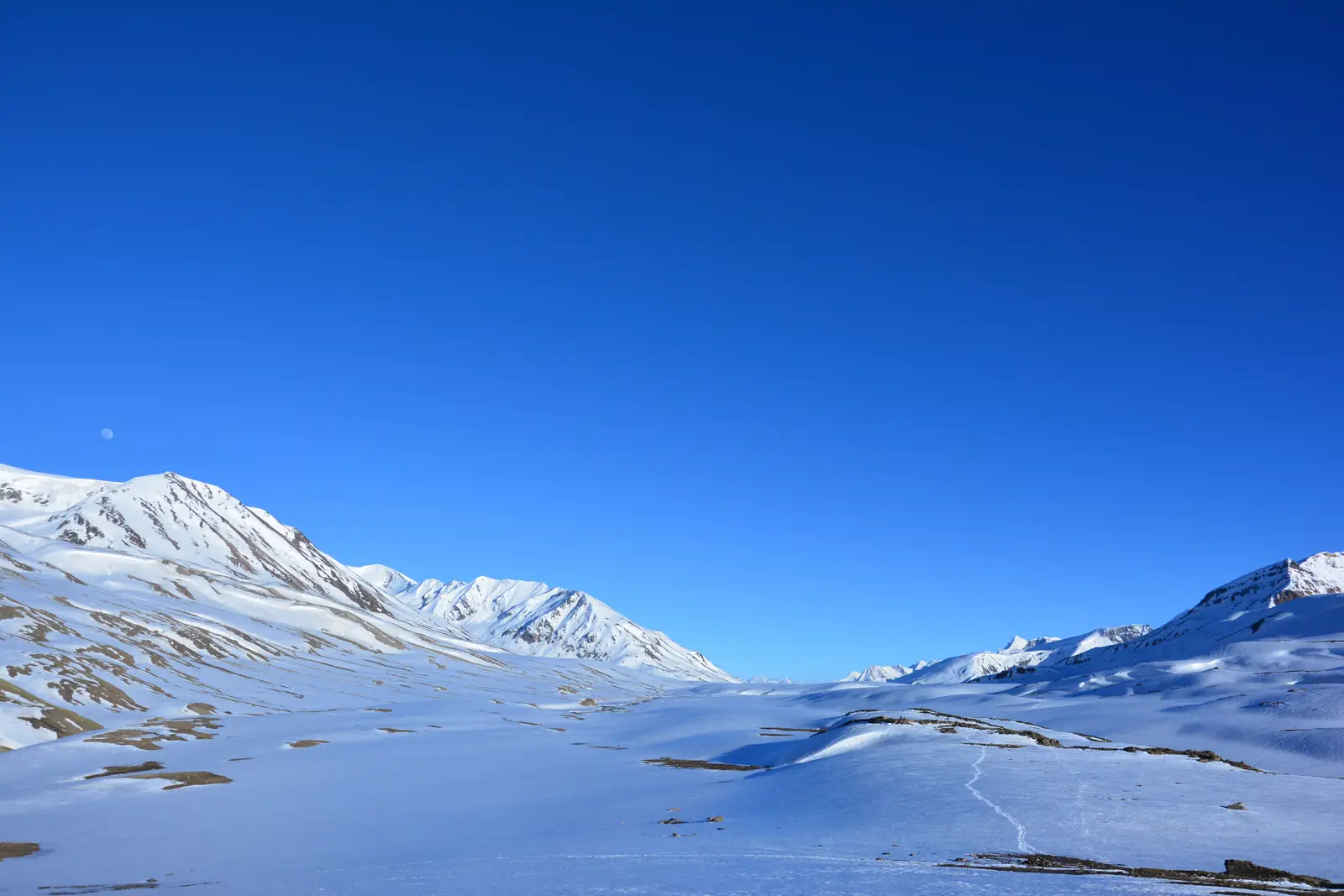
The first high pass, at about 4,890 metres, where the roads to Ladakh and to Spiti meet in the snow. Early in the season the road runs between walls of snow, and the small lake of Suraj Tal lies just below the top on the Himachal side.
Tip: Meltwater can make the crossings below the pass deep by afternoon; cross it in the morning.
Food
Allow Overnight
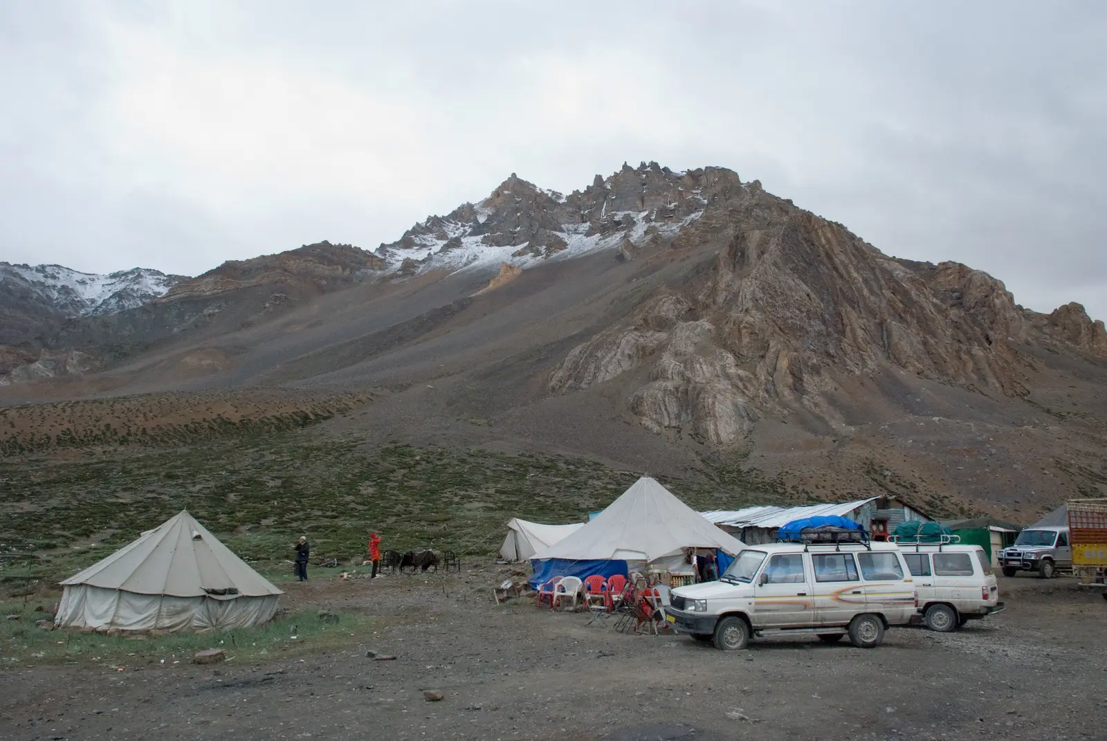
A wide, grassy plain at about 4,250 to 4,300 metres on the border between Himachal Pradesh and Ladakh. There is no village, only seasonal tent camps that open for the riding season. It is cold at night even in summer, and many people sleep badly here because of the altitude.
Tip: If anyone in your group has a worsening headache, vomiting or confusion, go down rather than on.
Day 3: Sarchu to Leh
The roadkm 175.1–251.1
After the Tsarap river the Gata Loops climb in around twenty hairpins to Nakee La, commonly given as 4,739 metres, followed closely by Lachulung La at about 5,059 metres. The descent to Pang runs through a narrow gorge where the road surface is often poor.
Viewpoint
Allow 15 min
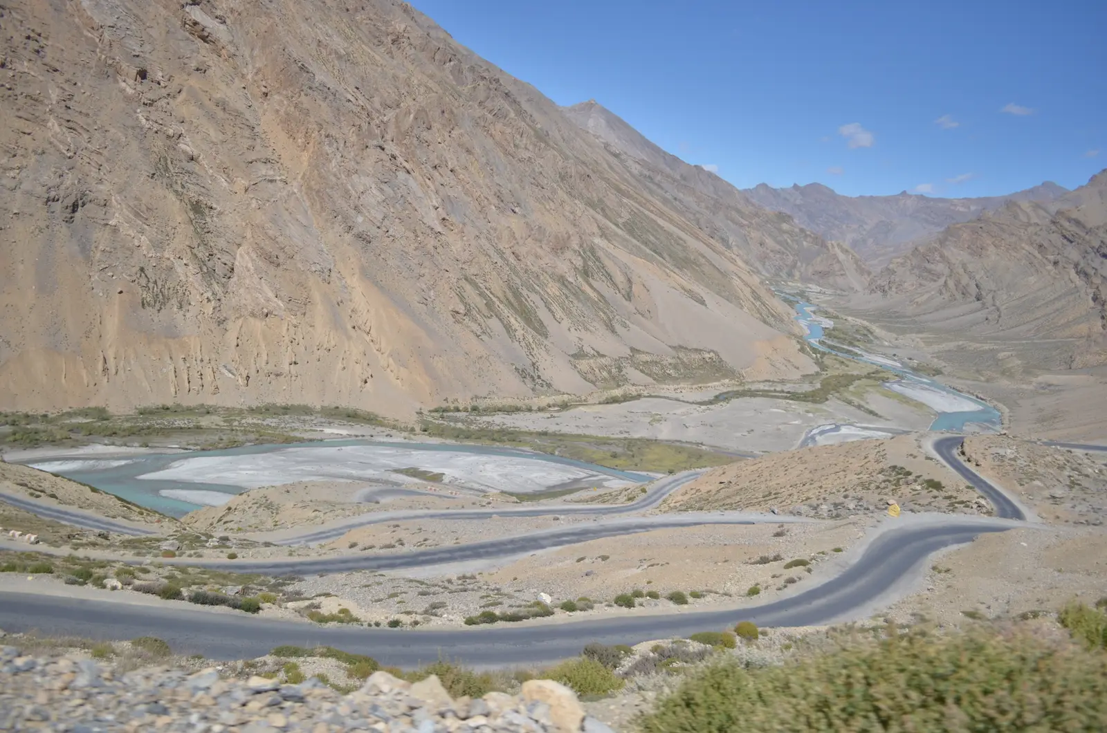
A long ladder of hairpin bends, around twenty of them, that lifts the road from the Tsarap valley towards Nakee La. Looking back from the top bends you see the whole staircase of road below you and the river in its gorge.
Tip: Trucks take the hairpins wide; stay on your side and don't stop on the bends themselves.
Viewpoint
Allow 10 min
The third pass, commonly given as 5,059 metres, a short ride beyond Nakee La. The descent towards Pang runs through a narrow valley of eroded rock pinnacles, one of the most striking stretches of the whole road.
Tip: Don't linger at the top if you feel the altitude: a few minutes for a photo is enough.
Food
Allow 1 hour
A cluster of tent restaurants and an army camp at about 4,500 metres, the natural lunch stop on the big day. Some riders sleep here, but it is higher than Sarchu, so it is a hard night for anyone not acclimatised.
Tip: Eat and drink here: there is little else until the Indus valley.
The roadkm 251.1–377.7
Beyond Pang the road runs for roughly 40 km across the More Plains, a high, flat tableland where it is easy to ride faster than you should. Then the long climb to Tanglang La, about 5,330 metres, and a descent of almost 2,000 metres through Rumtse to the Indus at Upshi.
Viewpoint
Allow 10 min
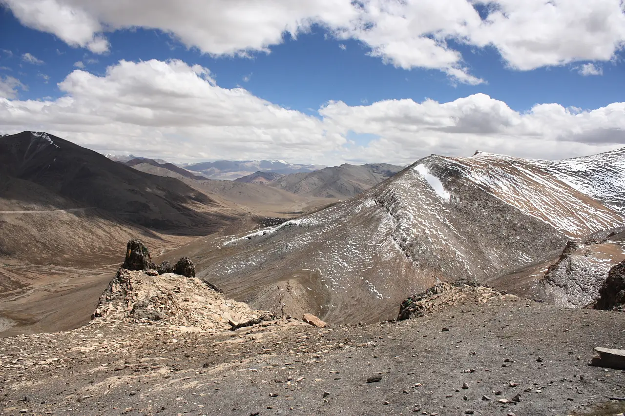
The highest point of the ride, at about 5,330 metres (signboards and surveys disagree by a few metres), reached after the long climb from the More Plains. Prayer flags mark the top, and the view runs back across the plains to the peaks of the Zanskar range.
Tip: It is often below freezing up here, even in summer; put on warm layers before the climb, not at the top.
Sight
Allow 15 min
Where the road from the passes meets the Indus, back down at about 3,400 metres. Visitors entering Ladakh are registered at the checkpoint here, and from Upshi the valley road is wider and faster all the way to Leh.
Tip: Keep your ID and vehicle papers handy for the checkpoint.
The roadkm 377.7–426.5
From Upshi the highway follows the Indus north-west through Karu, where a fuel station sits about a kilometre off the road, and into Leh. More traffic, army trucks and villages; take it easy after three days at altitude.
Finish
The road ends in Leh, the capital of Ladakh, at about 3,500 metres, below the old palace on its ridge. Main Bazaar is the centre of town, with guesthouses, cafés, mechanics and permit agents a few streets away.
Tip: Rest for at least two days in Leh before riding anything higher, such as Khardung La.
Altitude is a bigger risk on this ride than the road. You sleep at around 4,250 metres or more at Sarchu, and cross three passes above 4,700 metres in a day. Take at least one night in Manali first, keep the first night at Jispa, drink plenty, skip alcohol, and rest for at least 48 hours in Leh, as the Leh district health advisory asks every visitor. A headache with nausea or dizziness is acute mountain sickness; confusion, unsteadiness or breathlessness at rest are emergencies: go down at once.
The full Manali to Leh guide: acclimatisation, permits and stages →The highway itself needs no permit when you ride through the Atal Tunnel; the Rohtang Pass permit applies only to the old road over the pass. Every vehicle entering Lahaul and Spiti must be registered online (free). Foreign riders need nothing more for the highway and Leh town, but need a Protected Area Permit, arranged through a registered Leh agent, for areas beyond Leh such as Nubra Valley and Pangong Tso. Rules change; check before you go.
Foreign riders need a licence that covers motorcycles and a 1949 International Driving Permit. Most riders hire a Royal Enfield in Manali. A Manali rental can ride to Leh, but Leh's taxi and bike unions do not accept Manali-registered rentals for sightseeing beyond Leh, so many riders switch to a Leh rental there. Carry a puncture kit, a spare clutch and brake lever, and know how to use them.
Check what you need to ride in India →Fill up at Tandi or Keylong, about 61 and 68 km from Manali on this route. On the map the next station on the highway itself is on the edge of Leh, some 350 km on; a pump at Karu, about a kilometre off the road near km 395, shortens the gap to around 325 km. Bikes with a small tank need a spare can: running dry at 4,500 metres is a serious problem.
The road is shut by snow in winter and usually opens to tourists in late May or June, after the Border Roads Organisation clears the passes; it stays open until October, but snow can close it for days at either end. June brings snow walls and the deepest water crossings; July and August are the busiest months, with monsoon rain on the Manali side; September is clear, quieter and colder at night. Check the road status before you set off.
Leh riding weather, month by month →India drives on the left and helmets are compulsory. Expect army convoys, trucks on the hairpins, landslides and roadworks. Snowmelt streams across the road rise during the day, so cross them in the morning and walk a deep one first. Mobile signal is patchy or absent for long stretches between Darcha and Upshi. Don't ride after dark, and tell someone your plan for each day.
These operators run guided tours from Manali, listed alphabetically. Contact any of them through Moto Mass.
Leh, Ladakh, India
11 days
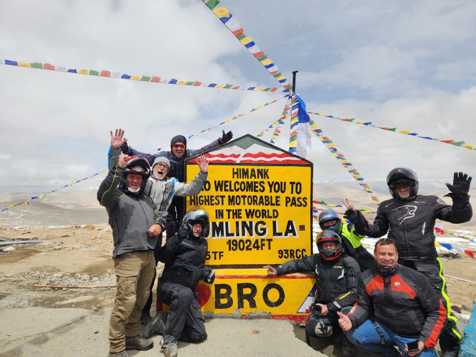
Leh, India
12 days
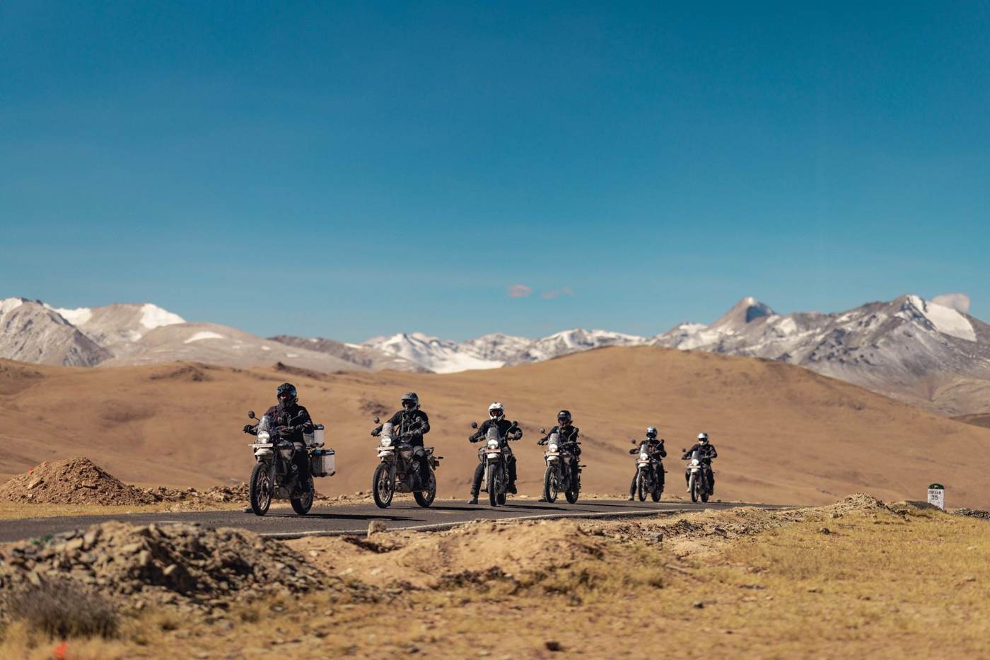
Ladakh and Zanskar, India
11 days
Get an email when we add a new free ride in India. Nothing else.
One email per new route. Unsubscribe with one click.