7 Day Enduro Tour
Canggu, Indonesia
7 days
IDR 49,000,000 / person

Out of the beach traffic and up through Tabanan to the UNESCO-listed rice terraces of Jatiluwih, on to the cool highland lake at Bedugul and its temple on the water, then home down the main north–south road past the royal temple of Taman Ayun. Tarmac all the way.
From Canggu the ride every rider eventually wants to do heads north, away from the surf and the cafés, into Tabanan, the regency that grows much of Bali's rice. Quiet village roads climb the slopes of Mount Batukaru to Jatiluwih, where terraces farmed for centuries spread across the hillside, part of the subak landscape that UNESCO lists as World Heritage. From there the loop crosses to the main north road and climbs to Bedugul, at well over a thousand metres, where Pura Ulun Danu Beratan stands at the edge of Lake Beratan. The way home drops all the way back to the coast on the old Denpasar–Singaraja road, with a last stop at Taman Ayun, the moated royal temple of Mengwi.
It is a long day in Bali terms. The kilometres are moderate, but the first and last hour are spent in the island's busiest traffic, and the climb to Jatiluwih follows narrow, steep village roads. The whole loop is paved and a rented 125 cc scooter manages it solo, though a 150 cc bike is more comfortable on the climbs. It suits riders already at ease in Asian traffic. Expect to start in tropical heat and reach Bedugul in cool air, often in cloud or rain, so pack a warm, waterproof layer.
Longest stretch without a fuel station: about 31 km, between km 32 and km 62.
Start
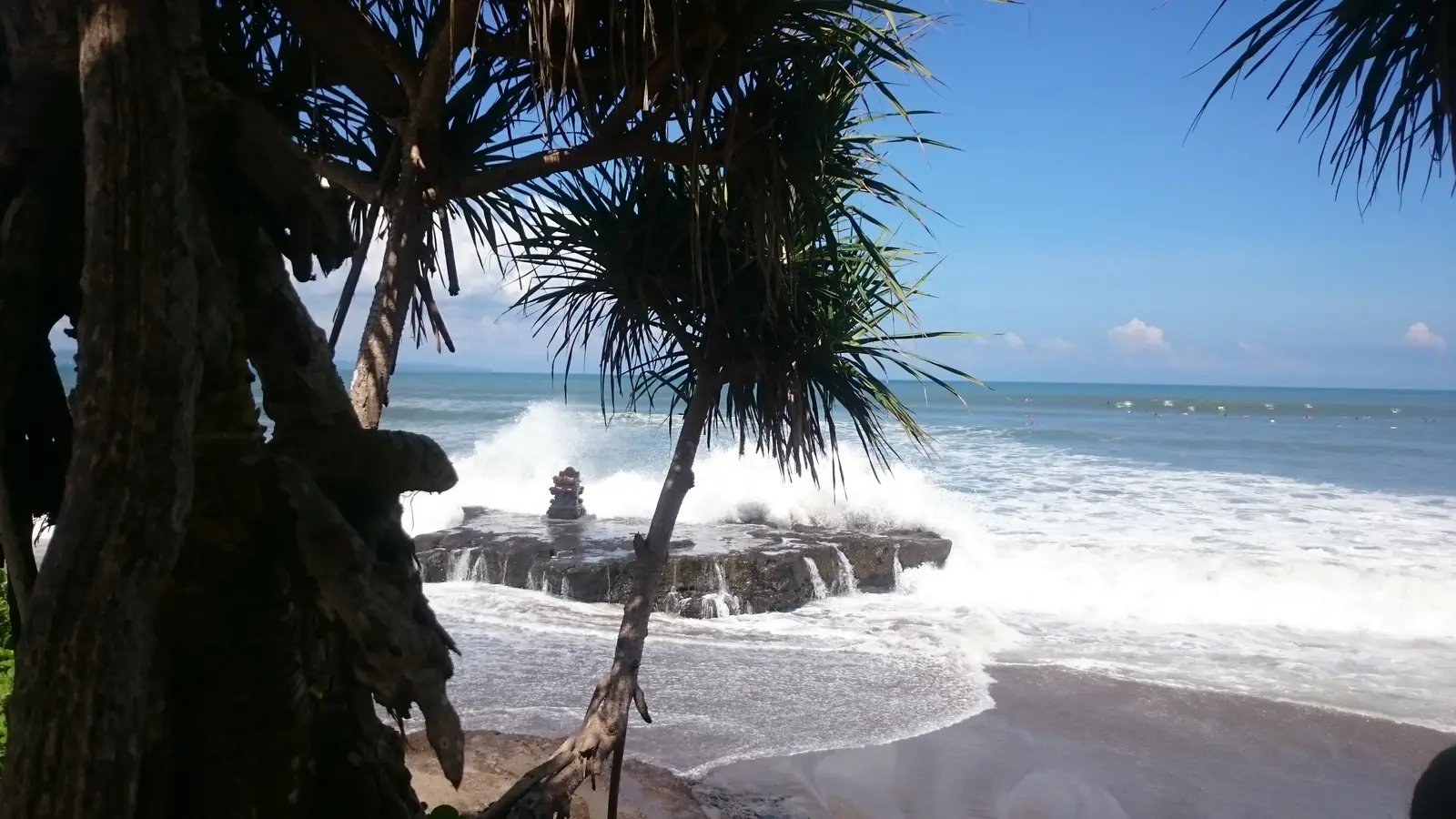
The small temple at the top of Batu Bolong beach is a landmark everyone in Canggu knows, at the end of one of its busiest streets. Surfers fill the water in front of it from first light. Leave as early as you can: Canggu's narrow streets jam by mid-morning, and the high ground around Bedugul is usually clearest before the midday cloud builds.
Tip: Canggu's streets have little room and a lot of scooters; give yourself time to settle in before the main roads.
The roadkm 0–17.7
Jalan Pantai Batu Bolong and Jalan Raya Canggu take you west out of Canggu through Pererenan and Munggu, then a short stretch of bypass leads to Jalan Tanah Lot, which runs north-east to Kediri. It is slow and crowded: scooters pass on both sides, cars stop without warning, and building lorries share the narrow roads. Keep left and keep calm.
The roadkm 17.7–32
A short run on road 3, the main road to the ferry for Java, which carries heavy trucks, brings you into Tabanan town. From the centre, Jalan Gunung Agung and Jalan Tabanan III lead north, climbing gently between rice fields and villages from little more than 100 metres to about 300 metres. Fill your tank before km 32: after that there is no fuel station for about 30 km.
The roadkm 32–48
The loop leaves the main road in Penebel district and climbs the slopes of Mount Batukaru on narrow village roads through Tengkudak. The gradients reach about 8% around km 38 and again near km 44, and the corners are tight; watch for gravel washed onto the road, farm trucks and people on foot. The road tops out at about 750 metres before dropping into the terraces at Jatiluwih.
Viewpoint
Allow 1 hour
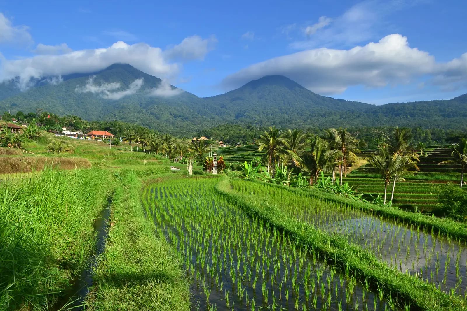
One of the largest sweeps of rice terraces in Bali covers the hillside below Mount Batukaru, and the road runs right through them. They belong to the subak system, the shared irrigation channels and water temples through which Balinese farmers have divided their water for about a thousand years, and they are part of the cultural landscape that UNESCO inscribed as World Heritage in 2012. Marked walking paths lead out along the dykes between the fields; the terraces look different with every stage of the crop, from flooded mirrors after planting to gold before the harvest.
Tip: A visitor fee is charged at checkpoints on the road into the terraces; keep the ticket until you have left.
The roadkm 48–61.2
From Jatiluwih the road runs east through the heart of the terraces, then on to the junction near Senganan, where you turn north-east onto Jalan Senganan-Apuan-Baturiti. The terrace road is narrow and busy with sightseers who stop anywhere for a photo. The last few kilometres climb steadily to the junction with road 2, the main Denpasar–Singaraja road, at about 800 metres.
The roadkm 61.2–73.5
Road 2 climbs north through Baturiti to Candikuning and the shore of Lake Beratan, to about 1,300 metres at its highest. It is wide and well surfaced but busy with buses and trucks, and near the top cloud and rain are common, so the road is often wet. Around Candikuning the loop runs past the market on one road and returns on another. The stretch from the junction to Candikuning is ridden again on the way down.
Food
Allow 30 min
Candikuning is the village around the lake at Bedugul, and its market on the main road sells the produce of the cool highlands: fruit, vegetables, spices and cut flowers, alongside the strawberries grown on the farms around it. Simple restaurants and stalls nearby make it the natural place for lunch, and a hot drink if the cloud has come down.
Tip: The botanic gardens, Kebun Raya Bali, are signposted from the road here if you want to walk among the trees for an hour.
Sight
Allow 1 hour
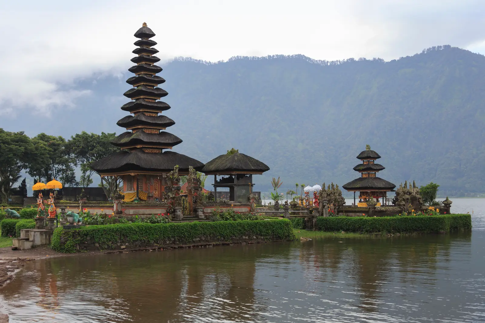
The temple of the goddess of Lake Beratan, whose water feeds the springs and rice fields of the lowlands, dates from the 17th century. Its best-known shrines, tiered black-thatched merus, stand on small islands just off the shore, so they seem to float on the lake when the water is high, with forested hills rising behind. It is one of the most photographed temples in Bali.
Tip: An entrance fee is charged at the gate; bring something warm, as the lakeside is often cool and damp even when the coast is hot.
The roadkm 73.5–124.5
Road 2 drops all the way back towards the coast, past the junction you came up by at km 81 and on through villages to Mengwi, descending from about 1,250 metres to under 150. It is a fast road with long bends and heavy trucks; use the engine to brake, keep left and let faster traffic pass. After Taman Ayun the loop follows road 3 briefly at Kapal, then Jalan Raya Abianbase, Dalung and Padonan back into Canggu, all in heavy suburban traffic.
Sight
Allow 45 min
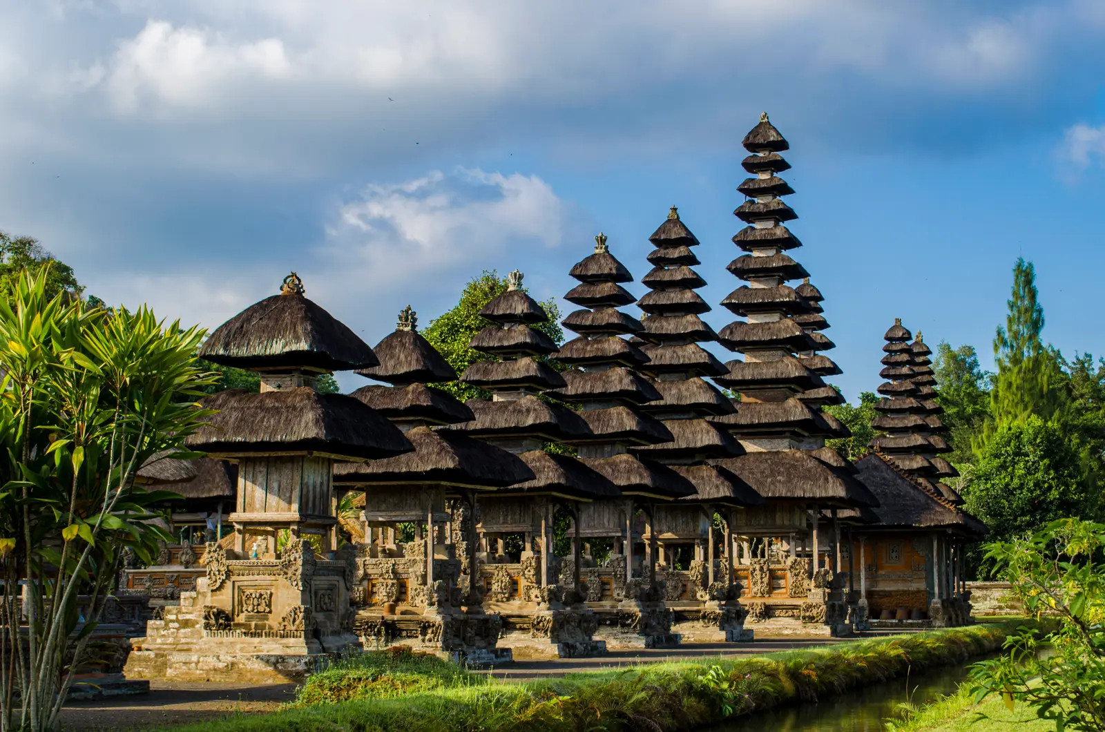
The royal family temple of the old kingdom of Mengwi, built in the 17th century and surrounded by a wide moat. Inside the walls a lawn leads to an inner courtyard of tall tiered shrines, which visitors see from a path around the outside wall. Taman Ayun is another part of the UNESCO-listed subak landscape, and after a day in the mountains its gardens are a quiet, flat place to stretch your legs.
Tip: An entrance fee is charged; from here the finish is less than 20 km away, though it is the slowest part of the ride.
Finish
The loop ends where it began, at the top of Batu Bolong beach. The beach faces west; if you have timed it well you arrive for sunset, when crowds gather on the sand to watch it.
Tip: The last few kilometres through Canggu are often the slowest of the day; ride them patiently.
Indonesia requires a motorcycle licence: bring your home licence together with an International Driving Permit that covers motorcycles. Bali police run checkpoints and do stop foreign riders. Most travel insurance will not pay out if you ride without the right licence, so check before you rent.
A 125 cc automatic scooter is what most riders use and is enough for this loop solo. Two up, a 150 cc scooter makes the steep village climbs to Jatiluwih and the long pull to Bedugul easier. Check the brakes and tyres before you leave: the descent from Bedugul is long, and the roads near the top are often wet.
There are fuel stations along the way to Tabanan, in the town and on the road north of it, then none until the main road at Baturiti, about 30 km later, after the climb to Jatiluwih. Fill up before you turn off for the climb. Road 2 has stations all the way down to Mengwi. Villages also sell fuel from roadside stalls.
The dry season, roughly April to October, gives the best chance of clear views. From about November to March the rainy season brings heavy downpours, usually in the afternoon, and the steep village roads can turn slippery. Whatever the month, Bedugul is far cooler than Canggu and often in cloud or drizzle: ride up in the morning and bring a warm, waterproof layer.
Balinese temple ceremonies and processions happen all year and can close a road for a while; wait or follow the locals' detour, and never ride through a procession. On Nyepi, the Balinese Day of Silence (in March most years), the whole island shuts down and the roads are closed to all but emergency traffic. At the temples, cover your shoulders and knees; sarongs are often provided at the entrance.
Indonesia drives on the left. Helmets are compulsory for rider and passenger. Canggu and the roads around it are among the most congested on the island, so expect scooters to pass on both sides and vehicles to pull out from shops and side roads without looking. In the villages watch for dogs, chickens and children on the road, and on road 2 for trucks and buses overtaking on the bends.
These operators run guided tours from Canggu, listed alphabetically. Contact any of them through Moto Mass.
Free ride routes