
Dragon Rider
Sekotong, Indonesia
10 days
Contact for price

West Lombok's classic loop from Senggigi: north along the cliff road past the Malimbu viewpoints to the Gili boat harbour at Bangsal, over the forested Pusuk Pass where macaques sit by the road, then back through the old water gardens and temples around Mataram. Tarmac all the way.
North of Senggigi the coast road leaves the hotels behind and starts to climb and dip around a string of headlands. From the bends above Malimbu you look back along the bays to Mount Agung on Bali, across the Lombok Strait, and ahead to the three Gili islands floating off the north-west tip of Lombok. The road ends at Pemenang, where boats leave for the Gilis from Bangsal, and from there the loop turns inland and climbs over the Pusuk Pass through thick forest, with long-tailed macaques waiting along the verge. The descent brings you to the plain around Mataram, Lombok's capital, where two of the island's best-known Balinese-era sites, the temple at Lingsar and the water gardens at Narmada, make an easy run east before you head back to the sea through the old port of Ampenan.
The whole loop is paved, and a rented 125 cc scooter is enough. The coast road is the most demanding part: narrow, with blind bends, short steep rises and a drop to the sea on your side of the road. The pass is a single climb to a little over 300 metres, gentle on the north side and steeper coming down. The second half, through the suburbs and towns around Mataram, is flat but busy, with heavy scooter traffic, trucks and horse carts. It suits riders who are comfortable in Indonesian traffic and want a day that mixes coast, forest and culture without a long ride.
Longest stretch without a fuel station: about 39 km, between km 6 and km 45.
Start
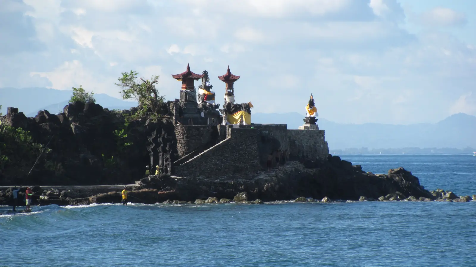
A small Hindu temple built out onto a black volcanic rock at the southern end of Senggigi, with shrines and gateways right at the water's edge. The name means "hollow rock", after the hole worn through the outcrop beneath it. It faces west across the Lombok Strait towards Mount Agung, Bali's holiest mountain, and it sits right beside the coast road, which makes it an easy place to meet.
Tip: Leave in the morning: the coast is clearest early, and the light on the bays north of Senggigi is best before midday.
The roadkm 0–17
Jalan Raya Meninting and Jalan Raya Senggigi take you north through Senggigi, then the road narrows into Jalan Raya Malimbu and starts to wind over the headlands, with short, steep rises and drops and the sea right beside you. Corners are tight and blind, and cars park at the viewpoints. Fill up as you leave Senggigi: the station at km 6 is the last for nearly 40 km.
Viewpoint
Allow 20–30 min
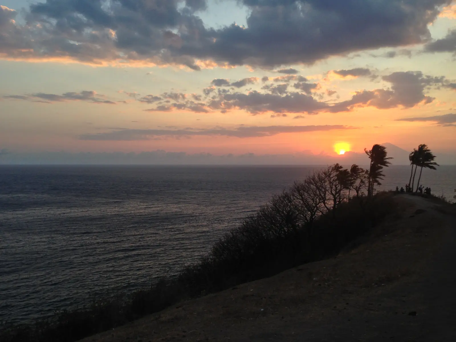
The coast road climbs over the headlands at Malimbu, and the bends at the top are lined with lookouts above the sea. To the south the bays curve back towards Senggigi; to the north you see the three Gili islands, Trawangan, Meno and Air, lying low off the tip of Lombok. On a clear day Mount Agung stands over the water to the west, and in the evening this is one of the island's favourite sunset spots.
Tip: Pull right off the road: the lookouts are on blind bends, and cars and vans stop and turn here without warning.
The roadkm 17–26
Past Malimbu the road drops to the coast and runs flatter past the bay at Teluk Nare, where private boats leave for the Gilis, to the junction town of Pemenang. Traffic picks up here, with horse carts, minibuses and scooters. The short road north to Bangsal leaves from Pemenang.
SightDetour
Allow 20 minAbout 1 km each way
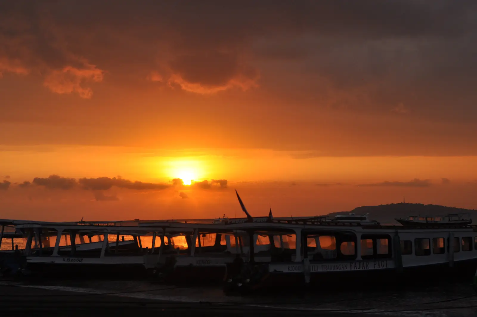
The harbour at the end of a short road north of Pemenang is where public boats leave for the Gili islands, and the beach is lined with long wooden boats waiting to load. The Gilis have no motor traffic, so your bike stays on Lombok; it is worth riding down for a look at the boats and the islands across the water. North Lombok was hit hard by the 2018 earthquakes, and many buildings along the road here have been rebuilt since.
Tip: The harbour road is busy with horse carts and people offering transport and boat tickets; a polite no is enough if you are only looking.
The roadkm 26–42
The loop turns south and climbs through farmland into the forest, rising from under 20 metres to a little over 300 at the top. The north side is a steady climb with easy bends; the south side drops harder, at about 8% in places, down into Gunungsari. Watch for monkeys on the road, slow trucks on the climb, and fallen branches or mud after heavy rain.
Viewpoint
Allow 20–30 min
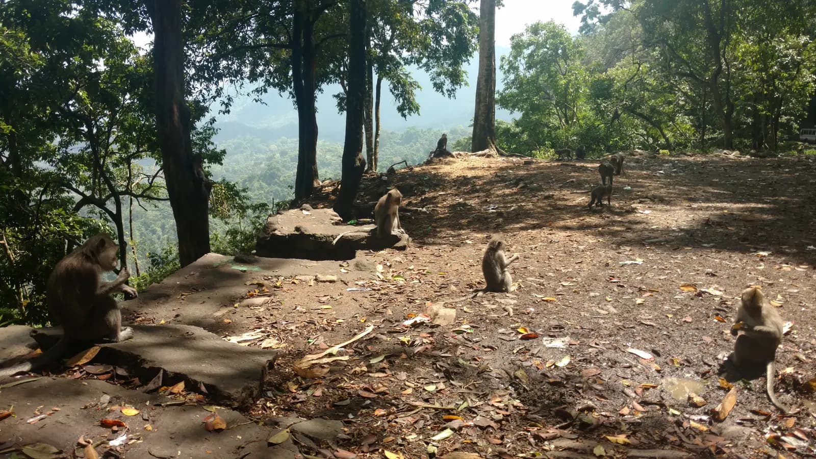
The top of the pass, a little over 300 metres up, is the highest point of the loop and the heart of the Pusuk forest, the tall woodland that covers the ridge between the north coast and the Mataram plain. Grey long-tailed macaques gather along the road here, sitting on the walls and wandering between parked bikes. Simple stalls at the top sell drinks and snacks, and there are views out through the trees over the forested hills.
Tip: Don't feed the monkeys or carry food in your hands; they grab bags and anything loose, so keep your helmet on or locked away.
The roadkm 42–66
The road runs down through Gunungsari onto the plain and past the northern edge of Mataram, then turns east along Jalan Gora 2 through rice fields and villages to Lingsar, climbing gently to about 140 metres. From Lingsar it continues to Narmada and the main road. There are fuel stations again from km 45 onwards.
Sight
Allow 45 min
A temple complex built in the early 18th century, during the period of Balinese rule over west Lombok, and unusual because it is shared: one courtyard is Hindu, the other belongs to followers of Wetu Telu, the Sasak form of Islam blended with older local belief. Both communities hold ceremonies here, including the Perang Topat, when the two sides throw rice cakes at each other. A pool in the temple is home to sacred eels.
Tip: Wear long trousers or a sarong and a sash; covered legs are expected inside the courtyards.
Sight
Allow 45–60 min
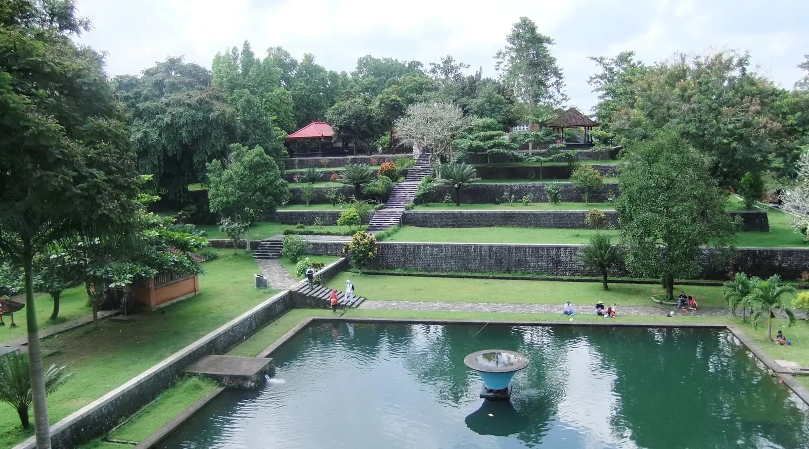
Water gardens built for the Balinese kings of Mataram in the 18th century, laid out around spring-fed pools with terraced lawns rising behind them. The gardens are said to represent Mount Rinjani and its crater lake, so that the king could make offerings here when he could no longer climb the mountain. A small temple, Pura Kalasa, stands in the grounds, and families come to picnic under the trees.
Tip: Taman Narmada is right beside the main road in Narmada; the town is a good place for lunch before the ride back through Mataram.
The roadkm 66–88
The main road leads west through Cakranegara and Mataram, Lombok's capital, on busy streets where some roads are one-way; follow the flow of traffic. At Ampenan, the old port with its colonial-era shophouses, you meet the sea again and turn north on Jalan Raya Meninting along the coast back to Batu Bolong.
Finish
The coast road from Ampenan brings you back north to the temple on the rock, in time to see the sun go down behind Bali if you have taken the day slowly. The beach just north of the temple is a good place to watch it.
Indonesia requires a motorcycle licence: bring your home licence together with an International Driving Permit that covers motorcycles. Lombok police run checkpoints and do stop foreign riders, especially around Senggigi and Mataram. Most travel insurance will not pay out if you ride without the right licence, so check before you rent.
A 125 cc automatic scooter is what most riders use and is enough for this loop. Check the brakes and tyres before you leave: the coast road has steep little descents, and the south side of the Pusuk Pass is a long, steeper descent into Gunungsari.
Fill up in Senggigi. There is a station just north of town at km 6, then nothing on the coast road or over the pass until Gunungsari. Villages sell fuel in bottles from roadside stalls, but leave Senggigi with a full tank. Around Mataram there are stations every few kilometres.
The dry season, roughly April to October, is the best time. From about November to March the rainy season brings heavy downpours, usually in the afternoon, and the forest on the Pusuk Pass stays wet and slippery long after rain. Ride the coast in the morning for the clearest views, and allow time to be back at Senggigi for sunset.
The macaques on the Pusuk Pass are wild animals and can bite. Do not feed them, keep food out of sight, and do not leave anything loose on the bike when you stop. They also cross and sit on the road, so ride the forest section slowly.
Indonesia drives on the left. Helmets are compulsory for rider and passenger. Expect scooters to pass on both sides, vehicles to pull out from shops and side roads without looking, horse carts in Pemenang and Ampenan, and dogs and children on the road in the villages. On the coast road, stay well left on the blind bends: other drivers often cut the corners.
These operators run guided tours from Senggigi, listed alphabetically. Contact any of them through Moto Mass.
Free ride routes