7 Day Enduro Tour
Canggu, Indonesia
7 days
IDR 49,000,000 / person

Bali's classic ride from Ubud: past the Tegallalang rice terraces and up to the rim of the Batur caldera, then home by a different road past the holy springs of Tirta Empul and the Elephant Cave. Tarmac all the way.
Ask riders in Ubud where to go for a day and most will point north, uphill, to Kintamani. The road climbs out of town through the Tegallalang rice terraces and a long chain of woodcarving villages, the air cooling as you go, until it arrives on the rim of the Batur caldera, more than a thousand metres above where you started. From the edge you look down on Mount Batur, an active volcano with black lava fields spilling from its flanks, and the crater lake curving around its foot. The way home is a different road, south through Tampaksiring, passing two of Bali's most important ancient sites.
It is a short loop in kilometres, but Bali's roads are slow: narrow, busy, and shared with trucks, tour vans and hundreds of scooters. The surface is paved the whole way and a rented 125 cc scooter will manage it. It suits riders who are already at ease in Asian traffic; the climbs are steady rather than steep, but the cloud that often settles on the rim can make the top section cool, wet and misty.
Start
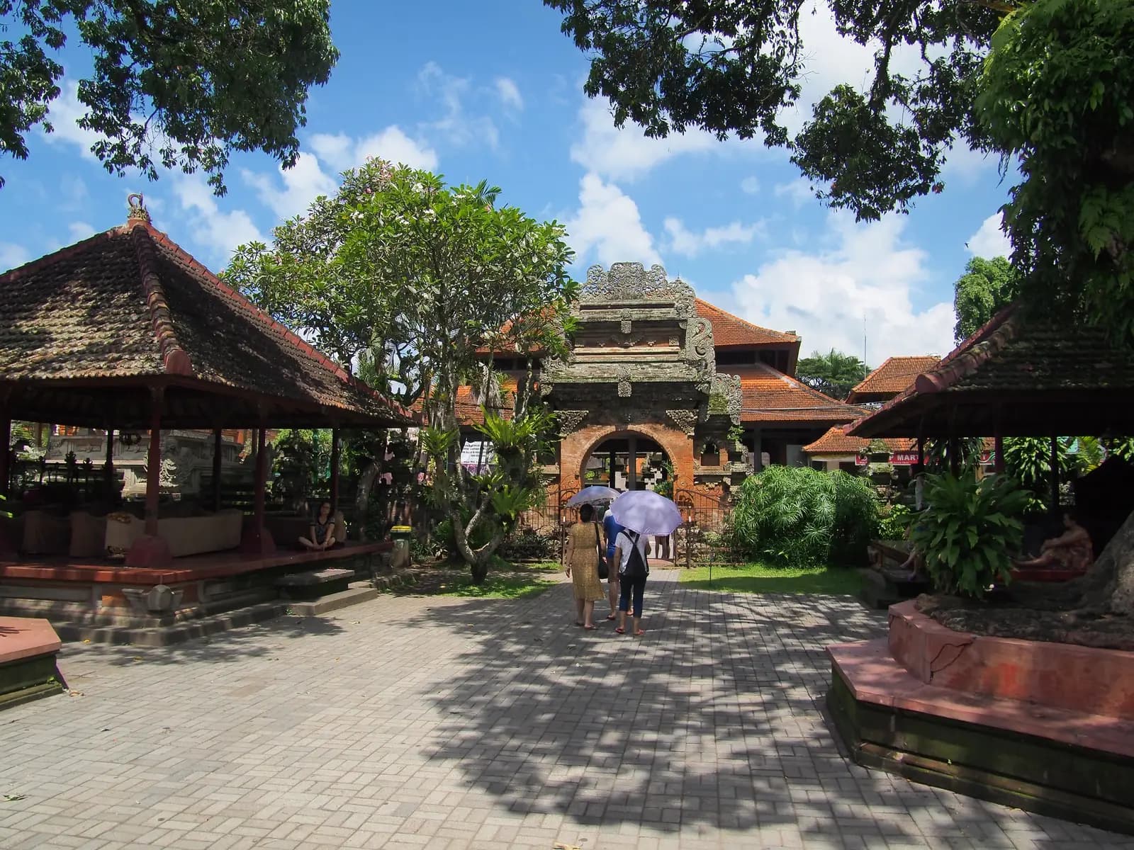
Puri Saren Agung, the palace of Ubud's royal family, stands at the town's main crossroads where Monkey Forest Road meets Jalan Raya Ubud. Everyone knows it, which makes it the easiest place to meet. Leave early: the streets of central Ubud jam up by mid-morning, and the rim is usually clearest before the midday cloud builds.
Tip: Ubud's centre has several one-way streets; follow the traffic flow rather than your memory of the walk.
The roadkm 0–11
Jalan Raya Ubud and Jalan Raya Andong take you out of town, then the road runs north to Tegallalang between craft shops and rice fields. It is slow going: tour vans, scooters and pedestrians all share a narrow road, and around the terraces vehicles stop and pull out without warning.
Viewpoint
Allow 30–60 min
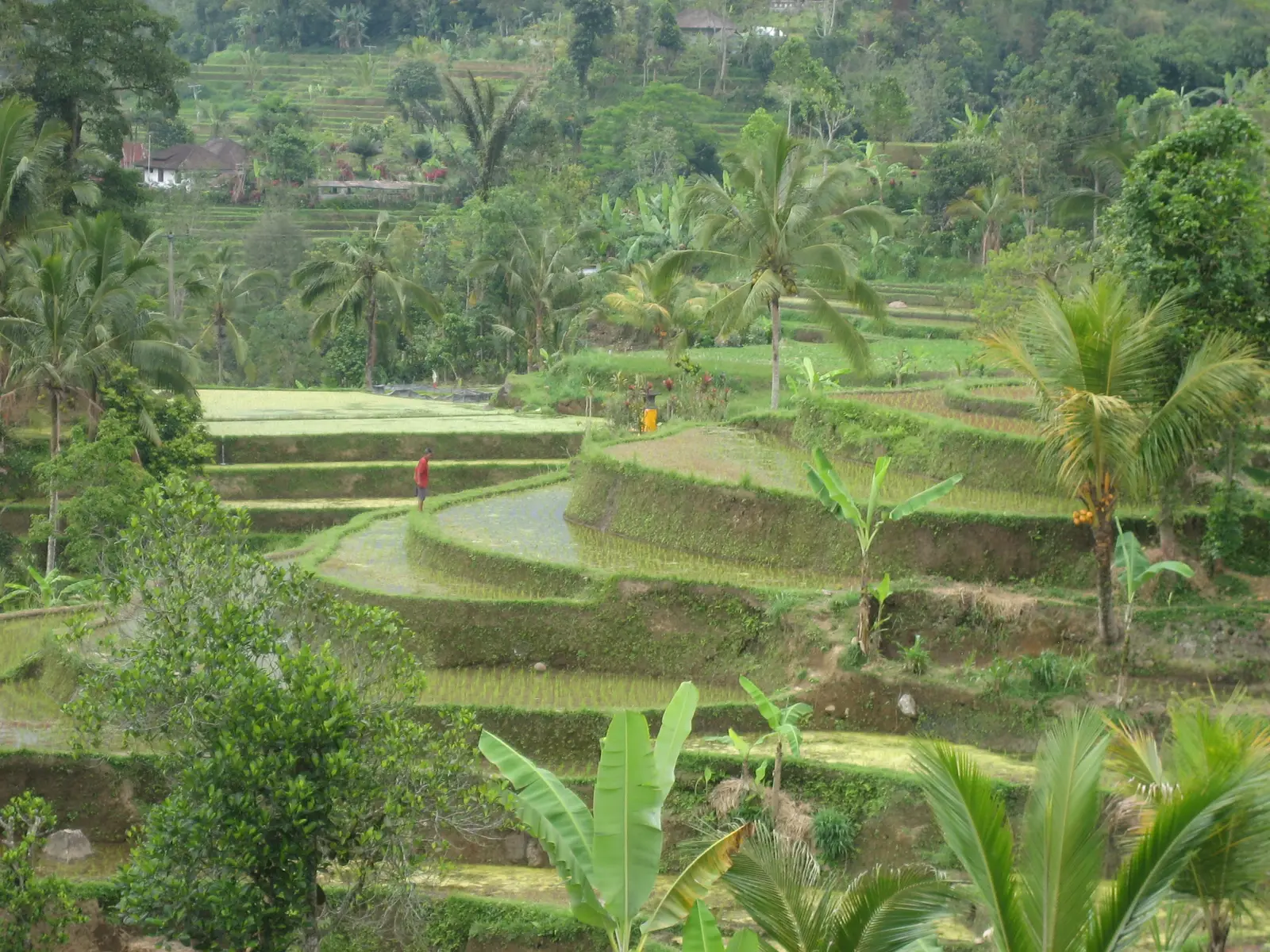
The most photographed rice terraces in Bali fall away from the east side of the road into a palm-filled valley. They are still farmed, watered by subak, the centuries-old system of shared irrigation channels that Balinese villages manage together. Paths lead down into the terraces from the roadside; even a few minutes' walk takes you away from the crowds at the top.
Tip: By mid-morning tour vans line the road, so arrive early and watch for people stepping out between vehicles.
The roadkm 11–29
North of Tegallalang the traffic thins and the road climbs steadily through Pujung and Sebatu, villages known for their woodcarving, with the forest closing in towards the top. The gradients are gentle and the corners easy, but expect potholes, villagers on foot, dogs and slow trucks. It gets noticeably cooler as you go, from about 200 metres in Ubud to over 1,200 metres at the top, and the last kilometre before the rim is the steepest, up to about 10%.
The roadkm 29–32
The climb ends at the rim road. The detour to Pura Ulun Danu Batur goes left, north-west along the rim; the loop turns right and follows the caldera edge east to Penelokan, with the volcano and lake appearing between the buildings. Cars and buses stop and turn across the road at every viewpoint, and the surface can be wet from cloud even when it has not rained.
SightDetour
Allow 45 minAbout 3 km each way, north along the rim road
One of Bali's most important temples, dedicated to the goddess of Lake Batur, whose waters are believed to feed the island's springs and rice fields. It once stood down by the lake; after an eruption in 1926 buried the old village, the temple was moved up here to the rim. Its courtyards, tiered shrines and split gates stand out against the sky, and the road to it runs along the caldera edge.
Tip: Visitors must wear a sarong and sash, usually available at the entrance; bring your own if you would rather not borrow one.
Viewpoint
Allow 30 min
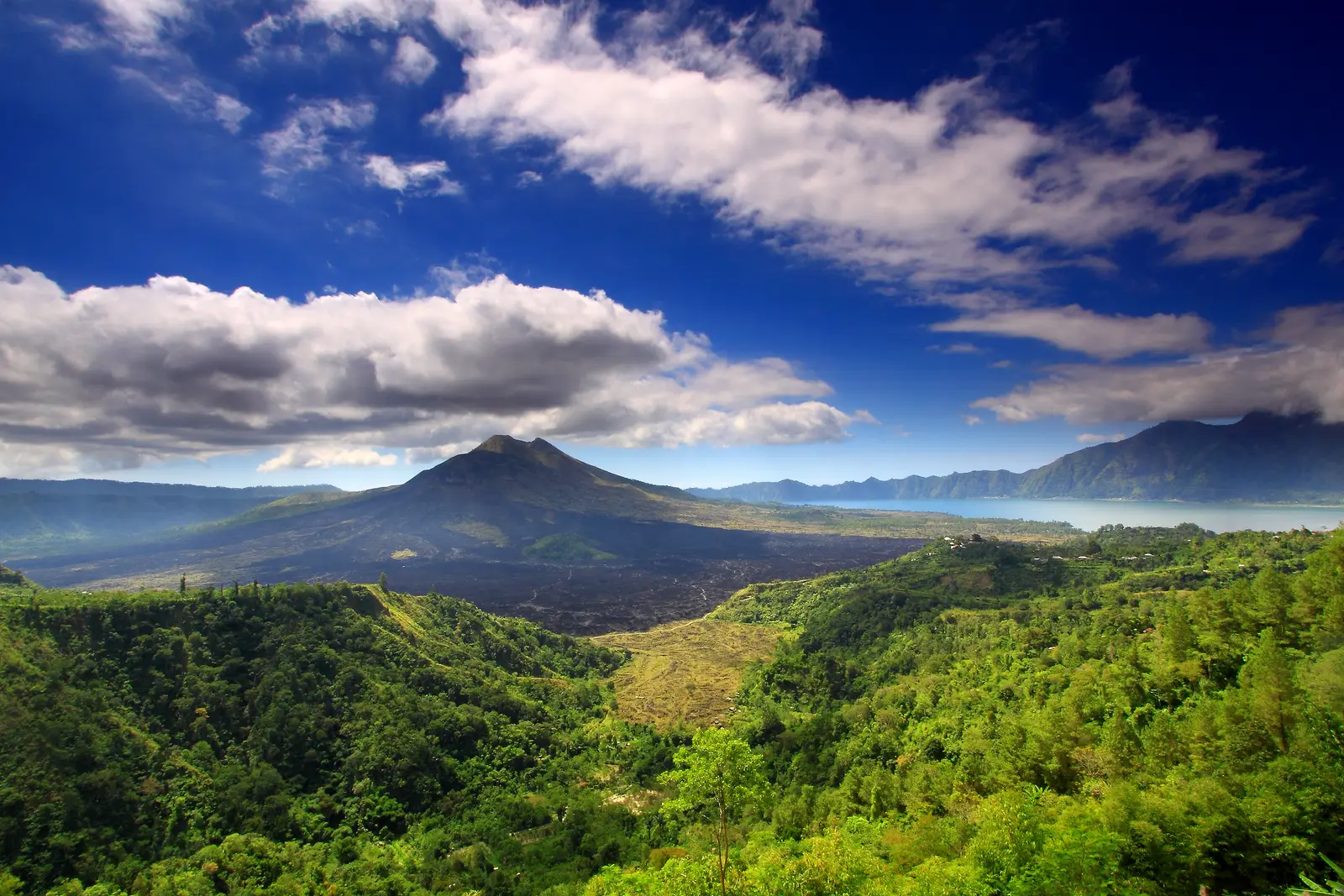
The name means "place to look", and it is the reason for the ride. The rim road here is the highest point of the loop, about 1,350 metres. From the rim you see the whole caldera at once: the cone of Mount Batur, the dark lava flows from its past eruptions, and the crescent of Lake Batur with Mount Abang rising behind it. Simple restaurants along the rim road serve lunch with the view.
Tip: Cloud often fills the caldera by late morning; if you arrive in fog, give it half an hour before giving up, as it can clear as fast as it came.
The roadkm 32–50
From Penelokan the main road heads south and drops steadily through farmland, forest and villages to Tampaksiring and Tirta Empul. It is wider and faster than the road up, and it carries heavy trucks; keep left, and let faster traffic by rather than holding a line in the middle of the lane.
Sight
Allow 1 hour
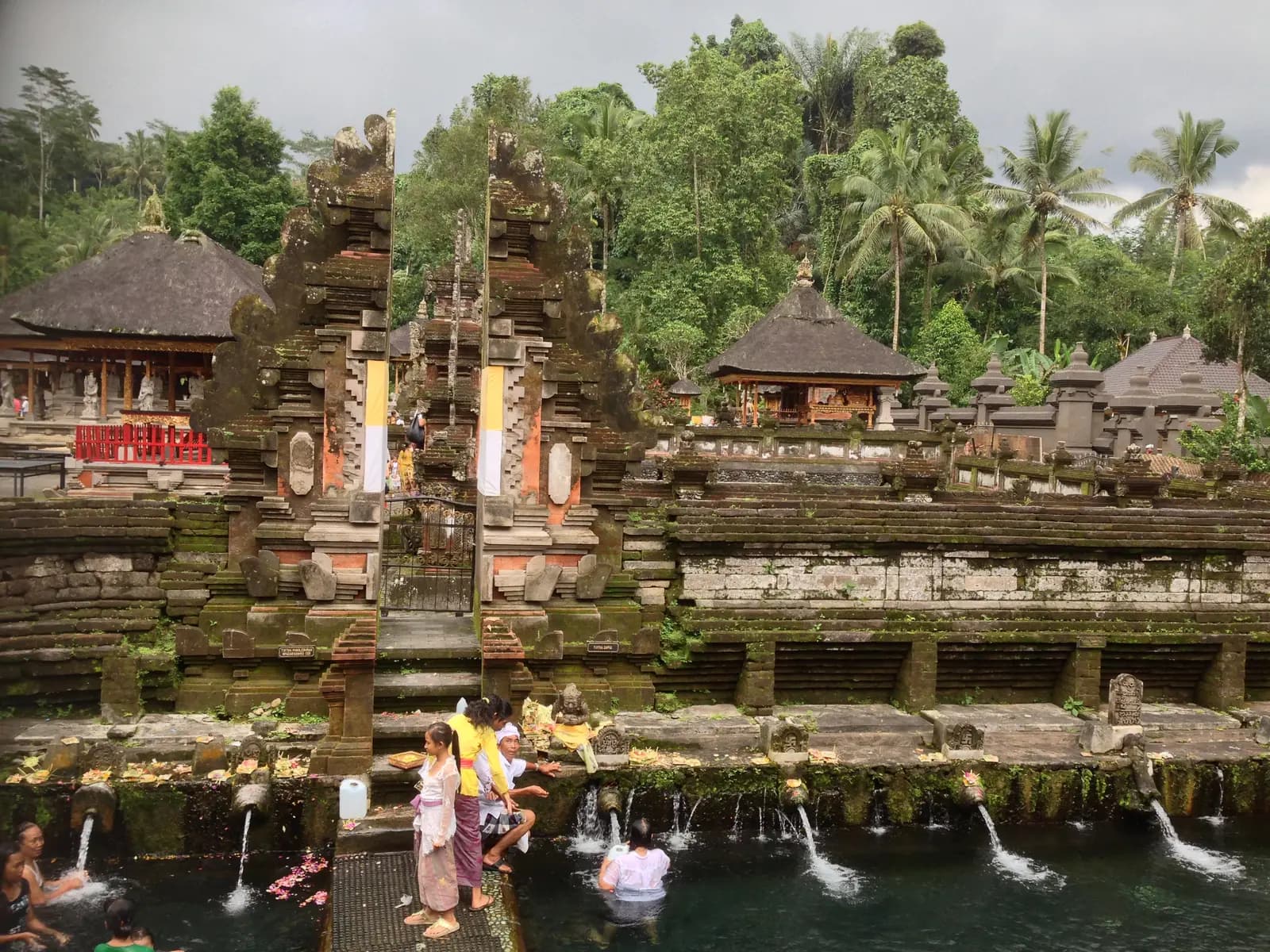
A water temple built around a holy spring more than a thousand years ago. Balinese come to purify themselves in the long bathing pools, moving from spout to spout under the cold water, and visitors may join in if they follow the ritual and dress for it. On the hill above stands a presidential palace built for Sukarno.
Tip: Gunung Kawi, a row of royal shrines carved into a cliff, is a short ride further down the road in Tampaksiring, reached by a long flight of steps.
The roadkm 50–64
The road continues south through a string of villages into Pejeng and Bedulu, an old royal heartland packed with temples, then past Goa Gajah. Traffic builds again as you near Ubud, and temple ceremonies here can bring processions onto the road.
Sight
Allow 45 min
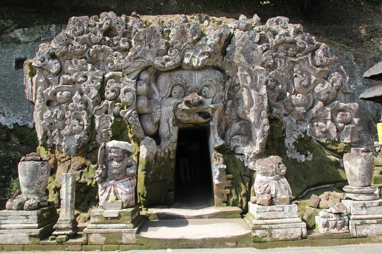
The Elephant Cave: a small sanctuary dating back around a thousand years, entered through the mouth of a demonic face carved into the rock. In front of it are bathing pools with water flowing from statues of nymphs, and beyond them a path leads down into a shady ravine. It sits right beside the road, a few minutes before you reach Ubud.
Tip: Bedulu and neighbouring Pejeng, which you ride through just before, are full of old temples; Pura Penataran Sasih in Pejeng keeps a huge bronze drum known as the Moon of Pejeng.
The roadkm 64–68
The loop turns north through Peliatan and back into the centre of Ubud. Afternoon traffic is heavy and parking scooters spill into the road; take it slowly through the one-way streets to the finish.
Finish
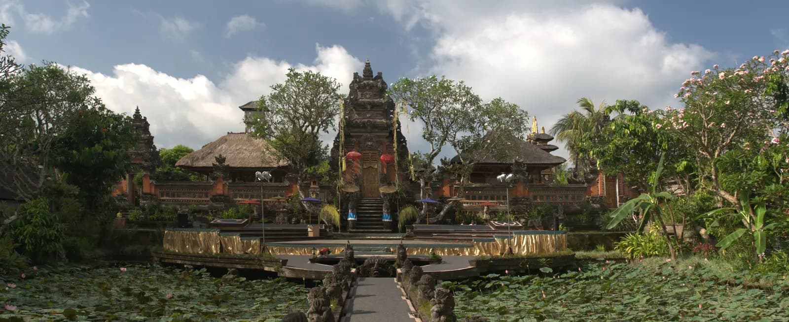
The loop finishes a short walk west of the palace at the lotus-pond temple dedicated to Saraswati, goddess of learning and the arts. A walkway leads between the ponds to the carved temple gate, and in the evening the courtyard is used for traditional dance performances.
Indonesia requires a motorcycle licence: bring your home licence together with an International Driving Permit that covers motorcycles. Bali police run checkpoints and do stop foreign riders. Most travel insurance will not pay out if you ride without the right licence, so check before you rent.
A 125 cc automatic scooter is what most riders use and is enough for this loop solo. Two up, a 150 cc scooter makes the long climb to the rim easier. Check the brakes and tyres before you leave: the descent from Penelokan is long, and the roads can be wet near the top.
There are fuel stations in Ubud, along the road through Tegallalang and on the main road south from Penelokan. Villages also sell fuel from roadside stalls, but leave Ubud with a full tank and top up before the climb if it is low.
The dry season, roughly April to October, gives the best chance of clear views. From about November to March the rainy season brings heavy downpours, usually in the afternoon. Whatever the month, Kintamani is much cooler than Ubud and often in cloud: ride up in the morning and bring a waterproof layer.
Balinese temple ceremonies and processions happen all year and can close a road for a while; wait or follow the locals' detour, and never ride through a procession. On Nyepi, the Balinese Day of Silence (in March most years), the whole island shuts down and the roads are closed to all but emergency traffic.
Indonesia drives on the left. Helmets are compulsory for rider and passenger. Expect scooters to pass on both sides, vehicles to pull out from shops and side roads without looking, and dogs on the road in the villages. Mount Batur is an active volcano: in the rare event of raised volcanic activity, check local warnings before riding to the rim.
These operators run guided tours from Ubud, listed alphabetically. Contact any of them through Moto Mass.
Free ride routes