

Dalat Countryside Easy Rider Tour
Dalat, Vietnam
1 day
$36 / person

Dalat's big day loop: pine plateau at 1,500 metres, a long descent down the Ta Nung pass to the coffee country around Nam Ban, a thundering waterfall, and the Prenn pass home. Tarmac all the way.
Dalat sits on a pine-covered plateau about 1,500 metres up, and the riding starts the moment you leave the lake. This loop heads north towards Langbiang, the mountain that watches over the city, then takes quiet back roads west across the plateau before dropping down the Ta Nung pass, one of the prettiest descents in the Central Highlands. At the bottom are the coffee and flower farms around Nam Ban and Elephant Falls, the widest and wildest of Dalat's waterfalls. The way home is a fast run through farmland and a climb back up the Prenn pass, past Datanla Falls.
It is a full day out rather than a hard one. The roads are paved throughout, so a rented 125 cc scooter will manage, but the Ta Nung descent is long and twisting and the Prenn pass carries buses and lorries. It suits riders who are comfortable on mountain roads and in mixed traffic. The whole loop stays above about 850 metres, so even in the dry season the mornings are cool.
Start
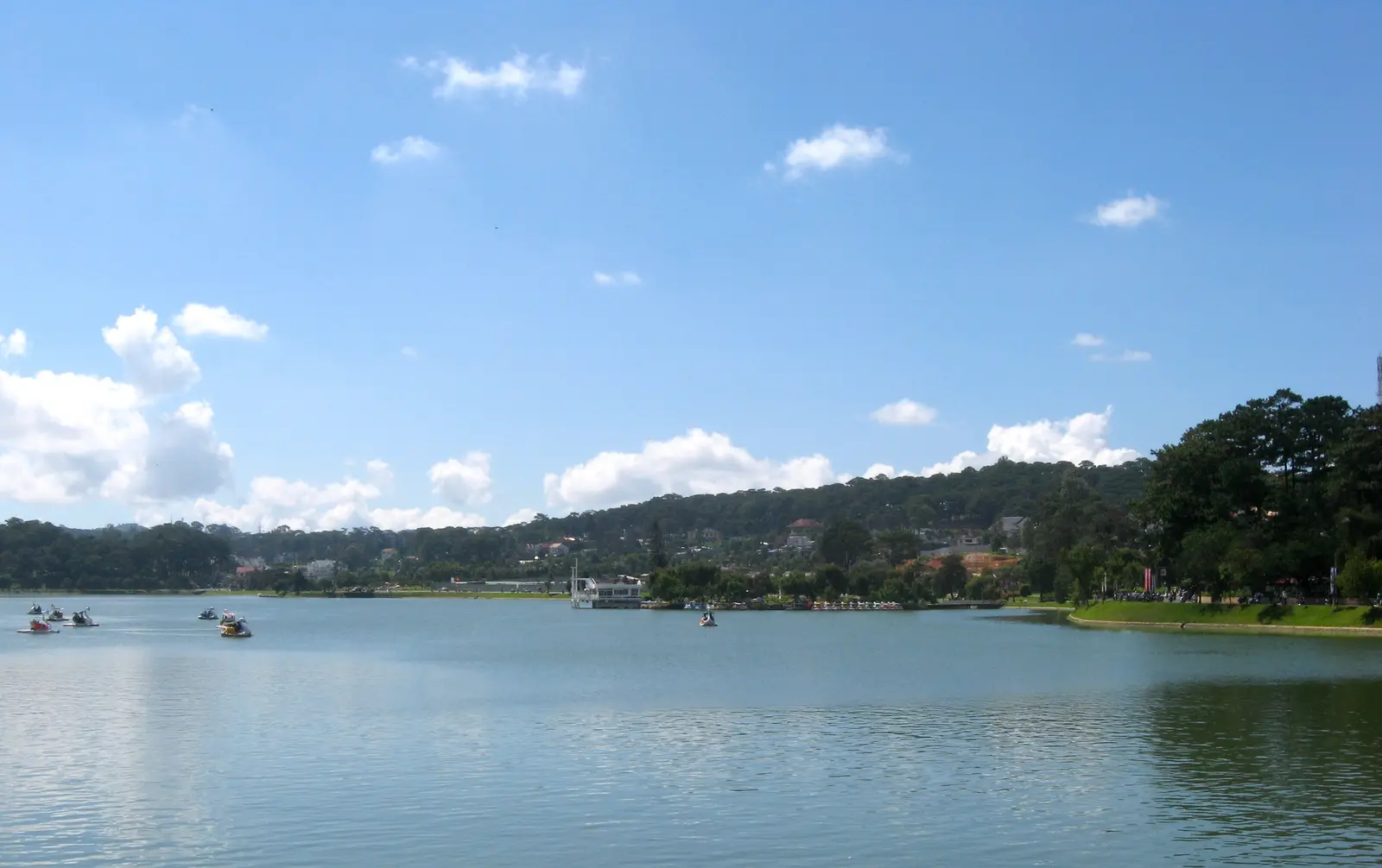
The lake in the middle of Dalat is the city's natural meeting point, ringed by pines, villas and a lakeside road. The market and the streets where most scooters are rented are a short walk up the hill. Set off early: the plateau is cool and quiet before 8 am, and the clouds often build after midday.
Tip: There are fuel stations on the way out of town and plenty more along the loop, so you can fill up as you go.
The roadkm 0–6.1
Dinh Tien Hoang and Nguyen Cong Tru lead you from the lake to Xo Viet Nghe Tinh, which climbs gently north past greenhouses and villas to the highest point of the loop, about 1,540 metres. Town traffic is light early in the morning but busy later; watch for scooters entering from side streets.
The roadkm 6.1–15
At the junction (straight on for the Langbiang detour) the loop turns west onto the Ankroet road and then the Cam Ly–Phuoc Thanh road, quiet back roads through pine forest and farms at around 1,500 metres. The road is narrow with blind bends, and farm trucks and tractors use it; keep well to the right.
ViewpointDetour
Allow 1–2 hoursAbout 5 km each way from the Ankroet turn, a little more to the foot of the mountain
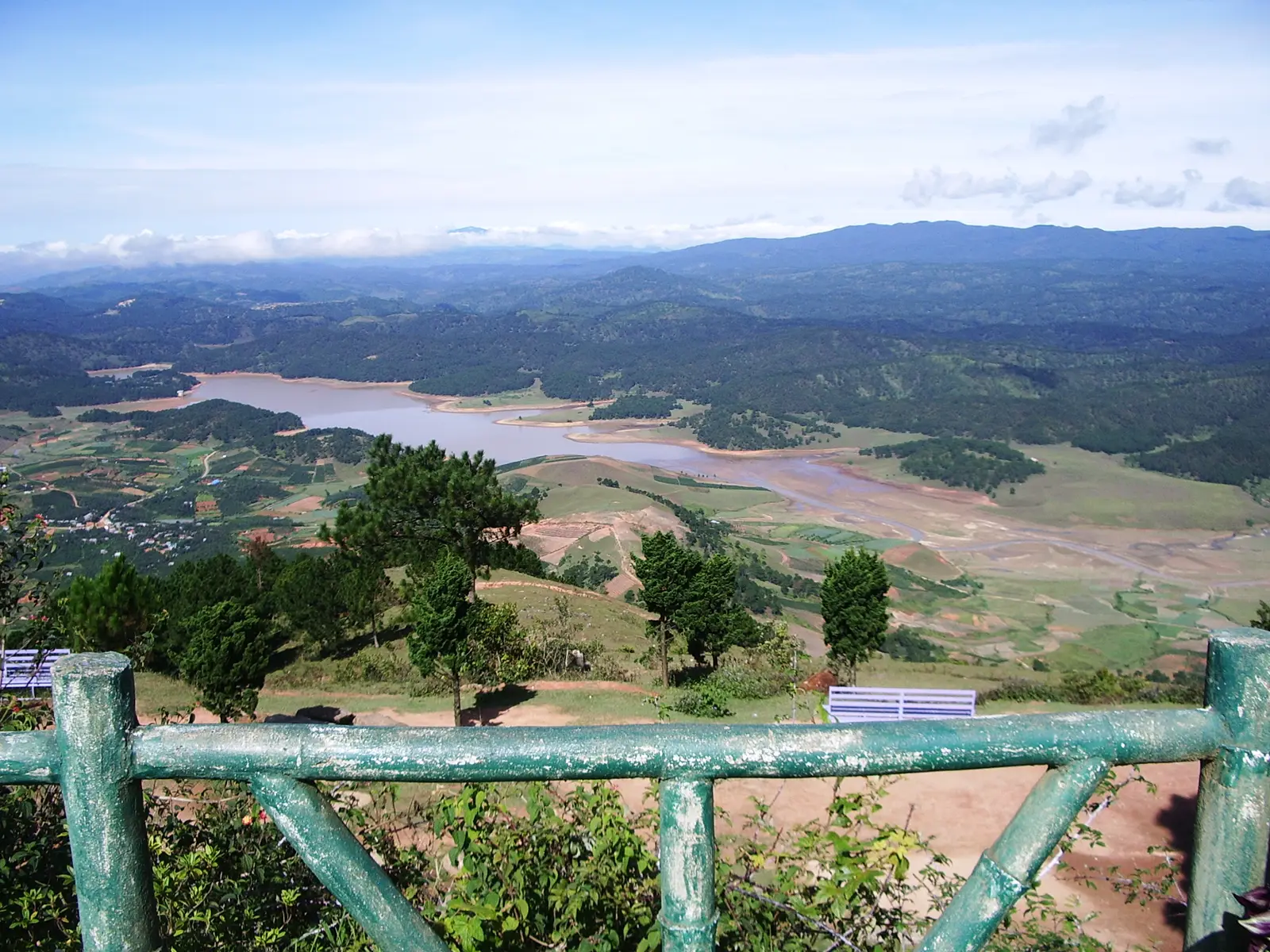
Where the loop turns west onto the Ankroet road, carry straight on instead to Lac Duong, the K'Ho town at the foot of Langbiang. The mountain's twin peaks are named after the lovers K'Lang and H'Biang of local legend, and the area is part of the Langbiang biosphere reserve. At the tourist area at its foot, four-wheel-drive vehicles take visitors up to Radar Hill for a view over the reservoirs and farms below, and trails lead on towards the summit.
Tip: Clear mornings give the best views; by early afternoon cloud often sits on the peaks.
The roadkm 15–45.7
Route 725 drops from about 1,500 metres to the loop's lowest point, about 850 metres, through pine hills, coffee farms and villages, the best riding of the day. The steepest pitches are around 7–8%, the bends are many and some are tight. Watch for gravel and red mud washed onto the road after rain, and for trucks climbing in the middle of the road. Nam Ban and Elephant Falls come towards the bottom, at km 37.
Viewpoint
Allow 15 min
A few kilometres after the back roads join Route 725, the plateau falls away and the views open west over folded hills of pine, coffee and vegetable plots. A roadside viewpoint here is a good place to stop as the Ta Nung descent gets going. K'Ho villages and farms line the road further down.
Tip: The descent that follows is long, so check your brakes here and plan to use engine braking in a lower gear.
Sight
Allow 1–1½ hours with lunch
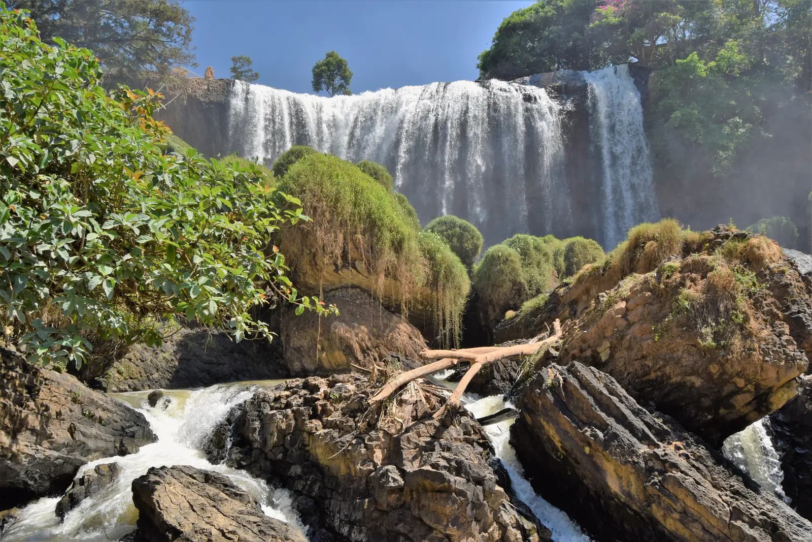
At Nam Ban the river pours over a wide ledge of dark rock into a gorge, and the noise reaches you before the view does. Rough steps and paths lead down beside the falls to the rocks at the bottom. Next door, Linh An Pagoda looks over the gorge with a tall white statue of the Bodhisattva of Compassion, and Nam Ban itself has simple restaurants for lunch.
Tip: The steps to the bottom are steep and wet with spray; wear proper shoes and take it slowly, especially in the rainy season. An entrance fee is charged.
The roadkm 45.7–71.7
Route 27 runs east through coffee and vegetable country to Phi Nom, where you join Route 20, the main highway between Dalat and Ho Chi Minh City. Route 20 is fast and carries buses, coaches and lorries; ride defensively and expect overtaking from both directions.
The roadkm 71.7–81.9
The road climbs back to the plateau, gaining nearly 400 metres with gradients up to about 8%, past Prenn Falls and Datanla Falls. It is the main road into Dalat from the south, so traffic is heavy; keep right and let faster vehicles pass. Ba Thang Tu street then brings you down to the lake.
Sight
Allow 45 min
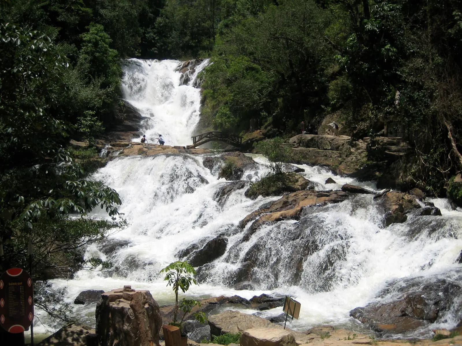
On the upper part of the Prenn pass, a forest trail drops to Datanla, a series of cascades tumbling through jungle in a narrow valley. A rail-mounted sled runs down to the falls for those who would rather not walk back up. It is the last stop before the city and a good one to end on.
Tip: It is busy at weekends and on Vietnamese holidays; a late weekday afternoon is quieter. An entrance fee is charged.
Finish
Ba Thang Tu street brings you off the pass and back to the lake. As the light goes, the night market sets up on the steps and streets around Dalat Market, a short walk away, and the lakeside road is a pleasant place to end the day.
Vietnam requires a licence for any motorcycle over 50 cc: a Vietnamese licence, or an International Driving Permit issued under the 1968 Vienna Convention that covers motorcycles. Travel insurers often refuse claims from riders without the right licence; check yours before you ride.
A 125 cc scooter manages the loop solo. Two up, or if you want an easier time on the Prenn climb with traffic around you, a 150 cc scooter or a small motorcycle is more comfortable. Check the brakes before setting off: the Ta Nung descent is long.
Fuel is easy on this loop. There are stations on the way out of Dalat, several on Route 725 around Nam Ban, and more on Routes 27 and 20, so you never ride far from one.
December to March is dry, clear and cool, the best time to ride. The rainy season runs roughly from May to October, with heavy afternoon storms that make the steep bends slippery and wash mud onto the road; if you ride then, go early and be off the passes by early afternoon. Morning fog is common on the plateau all year.
Dalat is about 1,500 metres up and the loop never drops below about 850 metres. Mornings can be cold, especially from December to February, so bring a warm layer and gloves, and rain gear in any season.
Vietnam drives on the right. Helmets are compulsory for rider and passenger. Expect scooters to pull out without looking and buses to overtake on bends, especially on Route 20 and the Prenn pass. Police checks on riders do happen, so carry your licence, permit and the bike's registration papers.
These operators run guided tours from Dalat, listed alphabetically. Contact any of them through Moto Mass.
Free ride routes