
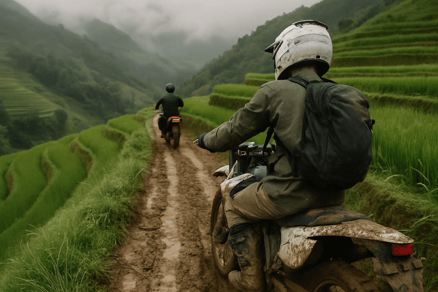
Ha Giang Dirt Bike Tour, 4 Days
Ha Giang, Vietnam
4 days
$480 / person

Vietnam's best-known motorcycle loop, ridden over three or four days: Heaven's Gate, the karst plateau around Dong Van, the Ma Pi Leng Pass above the Nho Que river and the quiet valley road home through Du Gia. Paved all the way, with a free GPX for the whole loop and for each day.
 2
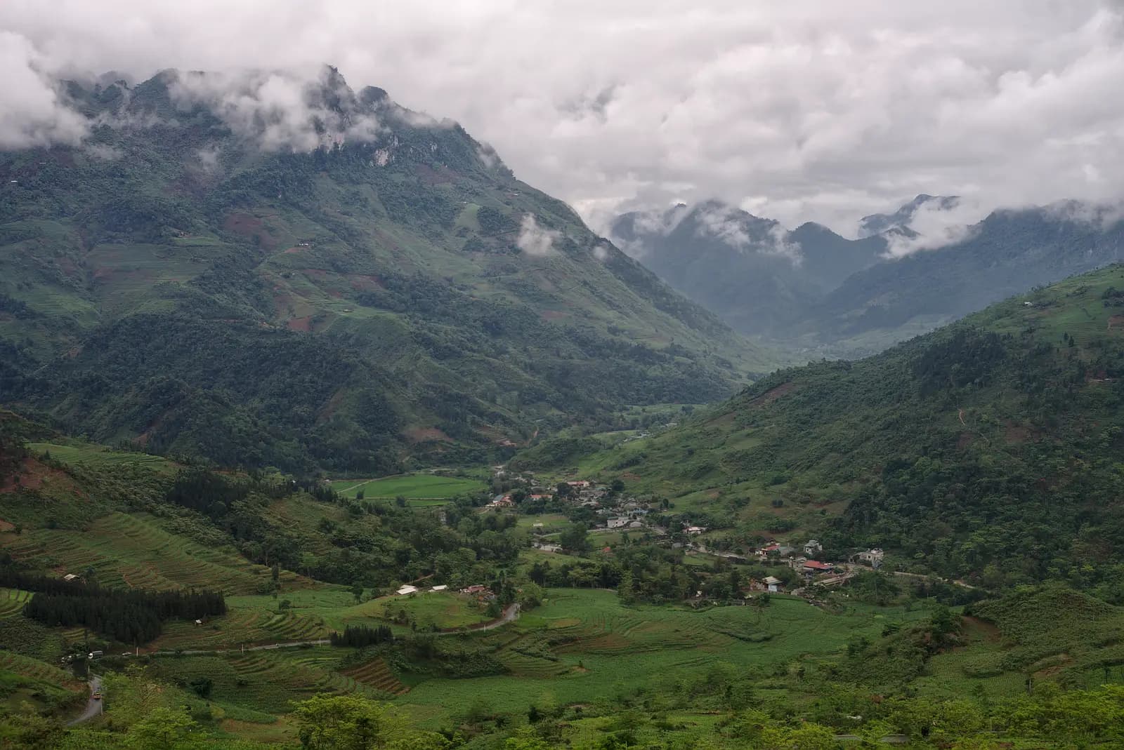
Viewpoint · km 32.8
Bac Sum Pass
 3
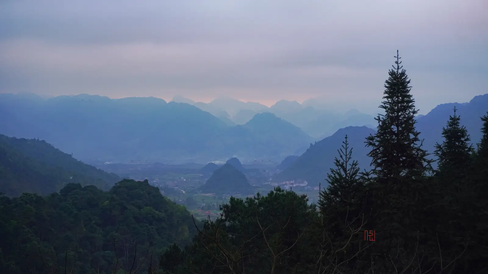
Viewpoint · km 44.2
Quan Ba Heaven's Gate
Food · km 97.1
Yen Minh
Viewpoint · km 108.5
Tham Ma slope
 6
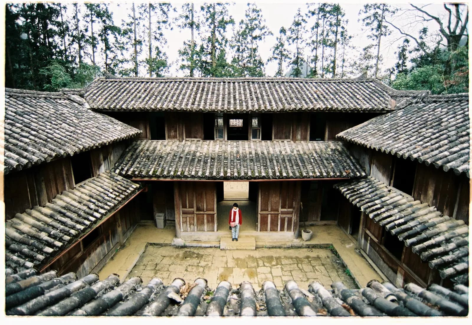
Sight · km 130.2
Vuong family palace, Sa Phin
 7
Sight · km 139.9
Lung Cu flag tower
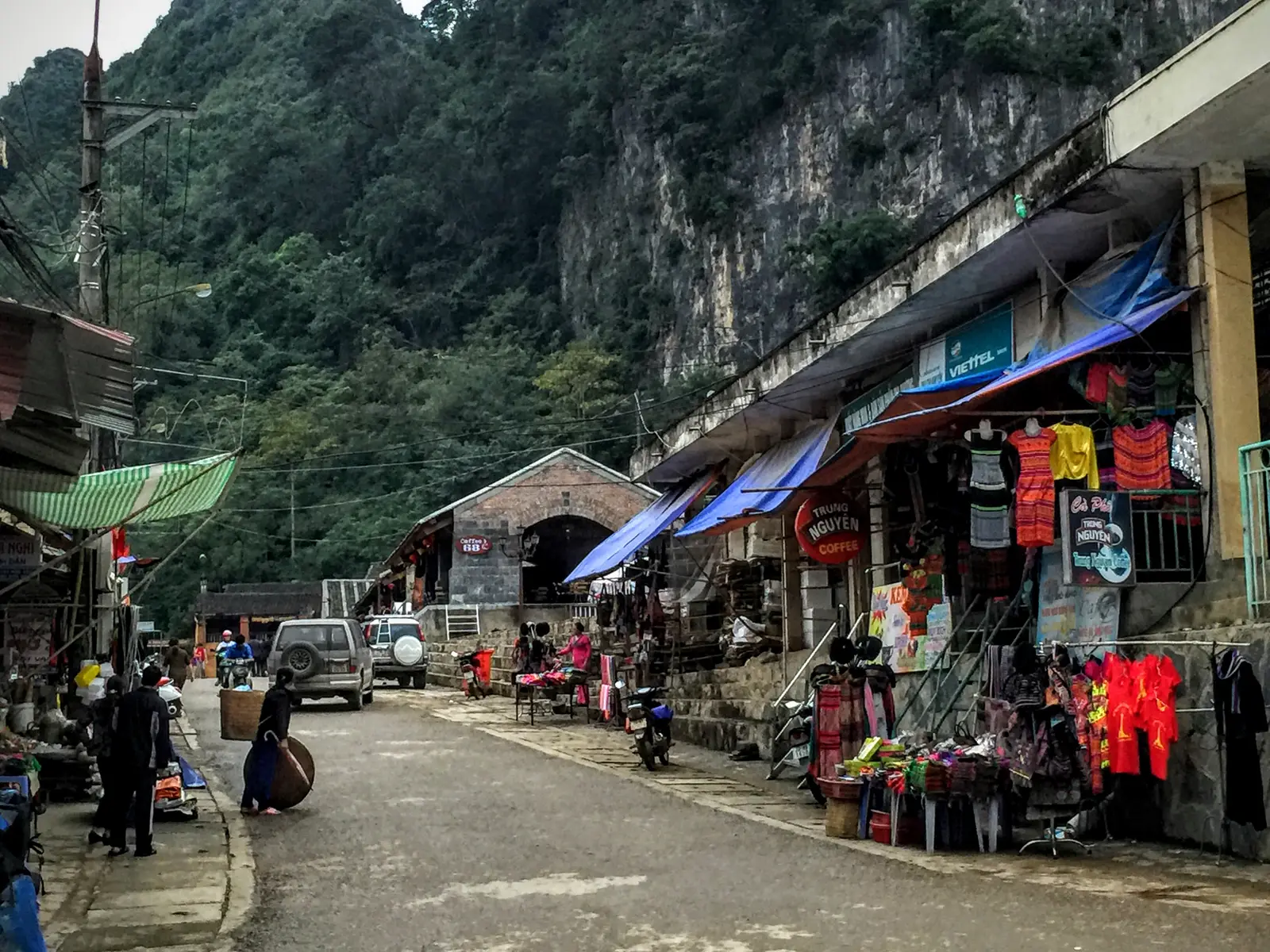 8
Food · km 144.6
Dong Van
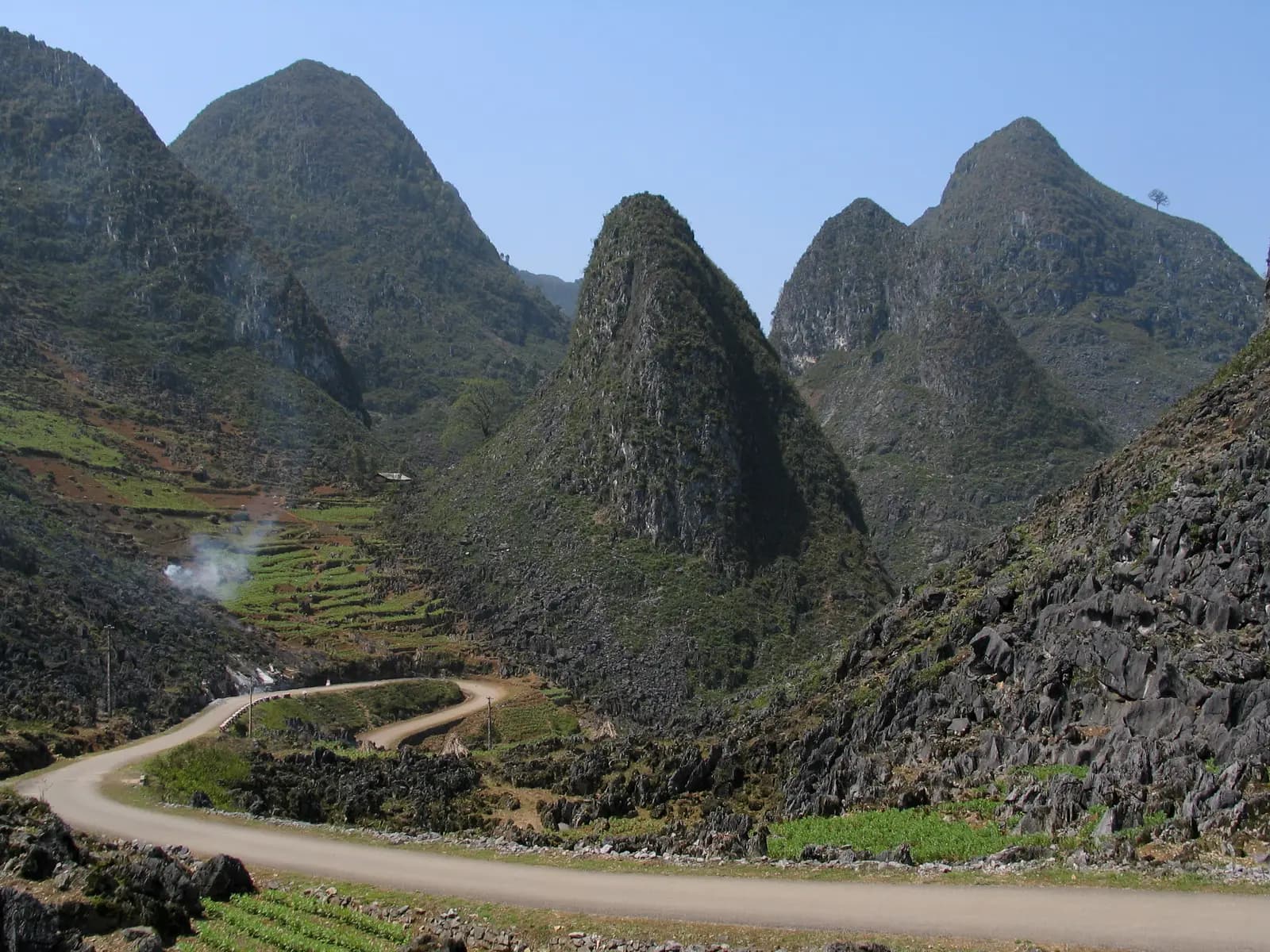 9
Viewpoint · km 156
Ma Pi Leng Pass
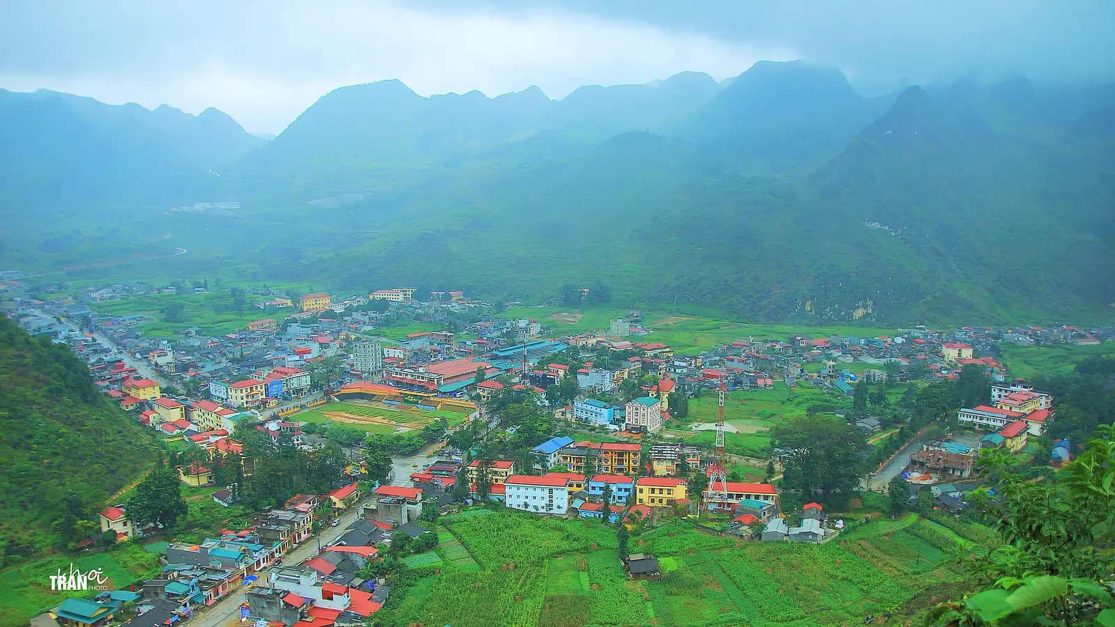 10
Food · km 166.9
Meo Vac
Food · km 245.1
Du Gia
The Ha Giang Loop is the ride people come to northern Vietnam for. From Ha Giang city it climbs Highway 4C over Heaven's Gate to Yen Minh, crosses the grey limestone of the Dong Van Karst Plateau, a UNESCO Global Geopark on the Chinese border, then follows the Ma Pi Leng Pass, a road cut into the cliff above the Nho Que river, to Meo Vac. From there most riders turn south on Provincial Road 176 through Mau Due and the green valley at Du Gia, and come home on Highway 34, so the loop never rides the same road twice.
It is about 313 km with more than 7,500 metres of climbing, which sounds short for four days until you ride it: the road rarely runs straight or level for long, and every pass has a view worth stopping for. The surface is paved throughout, so a rented 110 to 125 cc semi-automatic will do it, but the corners are steep and blind, trucks and buses share them, and fog and rain are common. It suits riders with real mountain experience. If that is not you, a local driver or a guided group can take you round instead (see the practical notes).
Longest stretch without a fuel station: about 44 km, between km 201 and km 245.
Also on Moto MassHa Giang to Heaven's Gate and Yen Minh: only have a day? Ride the first leg, to Heaven's Gate and Yen Minh, as an out-and-back from Ha Giang.
The usual way to split the ride, with the town most riders sleep in each night. Download the whole loop, or one day at a time.
Day 1km 0–97.1
97 km↑ 1,910 mOvernight: Yen Minh
Up the valley on Highway 4C, then the big climb: the Bac Sum switchbacks and Quan Ba Heaven's Gate, at a little over 1,100 metres the first great view of the loop. Lunch in Tam Son, then a quieter valley road and a pine-forest climb before the drop into Yen Minh. If you only have three days, keep going to Dong Van today.
GPX for day 1Day 2km 97.1–144.6
48 km↑ 1,590 mOvernight: Dong Van
A short day on the map and a long one in practice. The road climbs the Tham Ma slope onto the karst plateau, passes the Lung Cam valley and tops out near 1,500 metres by Sa Phin, where the Vuong family's palace sits in its valley. Most riders add the side trip to the Lung Cu flag tower on the Chinese border, about 25 km each way, before evening in Dong Van.
GPX for day 2Day 3km 144.6–245.1
101 km↑ 2,770 mOvernight: Du Gia
The day most riders remember. Ma Pi Leng first, with the Nho Que river hundreds of metres below, then Meo Vac. From there Provincial Road 176 drops to Mau Due, the natural lunch stop, and climbs again over the hills to Du Gia, a village in a valley of rice fields. It is the hardest day: about 100 km with more than 2,700 metres of climbing on a narrower road. If you are short of time, you can instead turn north at Mau Due to Yen Minh and ride day one's road back to Ha Giang, as some three-day tours do in one long day.
GPX for day 3Day 4km 245.1–313.1
68 km↑ 1,260 mFinish: Ha Giang
Provincial Road 176 winds south out of the Du Gia valley, over one more ridge and down to Highway 34, which runs west back to Ha Giang. Leave time for the waterfall near Du Gia in the morning; the last stretch on Highway 34 is easy riding with more traffic. Some tours return a different way, west from Du Gia through Duong Thuong and Lung Tam to Tam Son and back over Heaven's Gate.
GPX for day 4Day 1: Ha Giang to Yen Minh
The roadkm 0–26
Highway 4C leaves Ha Giang and follows the valley north, staying between about 100 and 230 metres. Easy riding past villages and fields, but with local traffic, school children, dogs and livestock on the road. Several fuel stations.
Start
The marker at the start of Highway 4C, beside 26-3 Square in the centre of Ha Giang, is where Loop riders take their first photo. Most rental shops, guesthouses and tour companies are within a few streets. Set off early on day one: the mountains are usually clearest in the morning before cloud builds over the passes.
Tip: Fill up on the way out; the last stations before Yen Minh are in and just beyond Tam Son, at about km 49 and km 57.
The roadkm 26–57
From about 210 metres to over 1,100 metres at Heaven's Gate, then down through Tam Son to the valley floor at around 440 metres. Corners are tight and often blind, trucks and buses use the whole road, and fog is common near the top. Sound your horn before blind bends as local riders do.
Viewpoint
Allow 20 min
After the flat run up the valley, Highway 4C climbs in a stack of hairpins from about 350 metres to over 650 metres in five kilometres. Pull-outs at the top look back down the switchbacks and over the valley you have just left. It is the first real view of the loop and a good place for a coffee.
Tip: Trucks swing wide on these hairpins; stay on your side and don't stop on the bends for photos.
Viewpoint
Allow 20 to 30 min
Cổng Trời Quản Bạ, the pass at the top of the first big climb, a little over 1,100 metres. Just over the top the ground falls away to the Tam Son valley and the two rounded hills locals call the fairy mountains. This is the gateway to the Dong Van Karst Plateau Geopark, and from here north the landscape is limestone.
Tip: Fog often sits on the pass on winter mornings. Tam Son, just below, is the easiest lunch stop of day one.
The roadkm 57–97.1
A quieter road along the valley, then a climb to almost 1,000 metres through pine forest and a winding descent into Yen Minh. After the rainy season expect broken edges and gravel where landslides have been cleared. No fuel station on this stretch.
Food
Allow Overnight
A small market town in a river valley and the usual first night of a four-day loop. Guesthouses and simple restaurants line the main road. The descent into town from the pine forest above loses about 400 metres in six kilometres, so arrive in daylight.
Tip: There are fuel stations just past town, at about km 98 and km 100; fill up before the plateau.
Day 2: Yen Minh to Dong Van
The roadkm 97.1–144.6
The Tham Ma hairpins, then the Chin Khoanh bends and the Lung Cam valley, climbing to the loop's highest point near 1,490 metres above Sa Phin. Grey rock walls replace the forest, villages are small and far apart, and the wind can be strong and cold on the open plateau.
Viewpoint
Allow 15 min
Dốc Thẩm Mã, a tight run of hairpins that lifts the road from the Yen Minh valley towards the plateau, close to 1,000 metres at the top. The roadside lookout at the top is one of the classic photos of the loop, with the road snaking up the slope below you.
Tip: Park well off the road at the lookout: riders coming up the hairpins can't see you until late.
Sight
Allow 45 min
Built in the early 1900s for the Vuong family, Hmong leaders who governed this part of the plateau, the palace is a fortified complex of stone and timber courtyards in a quiet valley just off Highway 4C. It is a national heritage site and one of the few historic buildings on the loop.
Tip: There is an entrance fee. The road climbs to the highest point of the loop, close to 1,500 metres, just before the turn-off.
SightDetour
Allow 1 hourAbout 25 km each way
A flag tower on a hilltop at Lung Cu, near Vietnam's northernmost point and the border with China. Steps lead up the hill and stairs inside the tower to a platform under a huge national flag, with views over the plateau and into China. The side road leaves Highway 4C a few kilometres before Dong Van.
Tip: Ride it on day two before checking in at Dong Van; the road is narrow and there is no reason to ride it in the dark.
Food
Allow Overnight
The town at the heart of the plateau, under limestone cliffs. Its old quarter is a short row of traditional houses around the old market, and the town fills with stalls on market day. It is the usual second night, with plenty of guesthouses and places to eat.
Tip: Fill up at the station at about km 146 as you leave: the next is in Meo Vac.
Day 3: Dong Van to Du Gia, over Ma Pi Leng
The roadkm 144.6–167
The famous stretch. The road climbs out of Dong Van to the monument at the top of Ma Pi Leng, then runs along the gorge wall with a long drop on the river side. Speeds are low and the views constant; the hazard is other riders and vans stopping wherever they like. Keep right, don't overtake on blind bends, and park only where the shoulder is wide.
Viewpoint
Allow 30 to 60 min
The road between Dong Van and Meo Vac is cut into the side of a gorge, with the Nho Que river a thin green line far below. It was built by hand between 1959 and 1965 by youth volunteers and local workers, part of what Vietnamese call the Happiness Road, and a monument and small museum stand at the top of the climb. Lookouts follow one after another for several kilometres.
Tip: Stop only at the marked pull-outs; the road is narrow with a drop on one side, and buses use it too.
Food
Allow 30 min
A district town in a bowl of mountains at the far end of Ma Pi Leng, and an overnight stop for riders who split the loop differently. Its Sunday market is one of the biggest in the region, drawing people from the surrounding villages. Here the loop leaves Highway 4C for Provincial Road 176.
Tip: Fill up here: there are two stations in town, and the next ones are about 17 km on and near Mau Due, at about km 185 and km 201.
The roadkm 167–245.1
Provincial Road 176 is the quiet half of the loop. It drops more than 1,000 metres from the hills above Meo Vac to Mau Due, under 300 metres, then climbs and falls again over a series of passes to Du Gia. The road is narrow, with patched or broken sections and occasional roadworks; take it slowly, especially after rain.
Food
Allow Overnight
A village in a wide valley of rice fields, well away from the busier northern half of the loop. Homestays here are used to riders, and a waterfall with a pool where people swim is a short ride from the village. It is the usual last night of the four-day loop.
Tip: There is a fuel station in Du Gia; fill up for the ride home, as the next is about 40 km away near Highway 34.
Day 4: Du Gia back to Ha Giang
The roadkm 245.1–282
Out of the valley over one more ridge, close to 1,000 metres, then a long winding descent to Highway 34 at under 200 metres. Traffic is light; watch for gravel on the corners and animals on the road through villages.
The roadkm 282–313.1
An easy, mostly level run west into Ha Giang. It is the busiest road of the day, with trucks and buses, and there are fuel stations near the city.
Finish
Highway 34 brings you back into Ha Giang and to the square where you started. If you are heading on to Hanoi, buses leave from the city's bus station.
To ride in Vietnam you need a licence valid here for motorcycles: a Vietnamese licence, or your home licence with an International Driving Permit issued under the 1968 convention. Vietnam does not recognise 1949-convention permits, the kind issued in the United States and Australia. Police check foreign riders on the loop, and travel insurance usually will not pay out if you ride without a valid licence.
Check what you need in Vietnam →The Dong Van plateau lies along the border with China, and police check foreigners' passports and visas there. In 2026 the provincial police have been giving visitors guidance on getting a border-area entry permit. Tour companies arrange it for their riders; if you ride on your own, ask your accommodation or rental shop in Ha Giang about the current process before you set off. Keep your passport with you: homestays and hotels have to declare foreign guests.
There are three common ways to do the loop. Self-ride: rent a bike in Ha Giang and set your own pace; it suits experienced riders with a valid licence. Easy rider: a local driver rides and you sit on the back, so you need no licence or mountain experience. Guided tour: you ride in a group with a guide and usually a support vehicle, which suits riders who want the riding without the planning. Many Ha Giang companies offer all three.
September to November is usually dry and clear, with rice harvest in September and buckwheat flowers on the plateau in October and November. March and April are mild. The rainy season, roughly May to September, brings heavy storms, fog and landslides that can close the road for hours. From December to February it is cold at altitude, sometimes near freezing, and often foggy; bring warm layers and gloves.
There are stations in every town on the loop, but the gaps between them are long by mountain standards: about 40 km between Tam Son and Yen Minh, between Mau Due and Du Gia, and from Du Gia to Highway 34. Fill up whenever you pass one. Village shops sell bottled fuel in an emergency, but it is better avoided.
Vietnam drives on the right, and helmets are compulsory for rider and passenger. Highway 4C carries trucks and buses that take the whole road on hairpins; large vehicles expect right of way, so give it to them. Expect livestock, children and roadworks, and never ride after dark. Medical care on the loop is basic, and serious injuries mean a long transfer to Hanoi.
A 110 to 125 cc semi-automatic, the usual rental bike in Ha Giang, is enough for one rider; two up, a bigger bike makes the climbs easier. Check brakes and tyres before you leave. Since 2025 Ha Giang has been part of Tuyen Quang province, so maps may show Tuyên Quang. Mobile data drops out in the mountains; download an offline map or the GPX.
Quan Ba and Dong Van, on the plateau at about 1,000 m.
Average high/low in °C and monthly rain. How we rate months
| Month | Riding | High | Low | Rain | Rain days | PM2.5 | Why |
|---|---|---|---|---|---|---|---|
| January | Mixed | 15 °C 59 °F | 10 °C 49 °F | 89 mm | 15 | 22 | see note |
| February | Mixed | 17 °C 62 °F | 11 °C 51 °F | 60 mm | 13 | 18 | see note |
| March | Good | 21 °C 70 °F | 14 °C 58 °F | 97 mm | 18 | 26 | |
| April | Mixed | 24 °C 75 °F | 17 °C 63 °F | 122 mm | 18 | 29 | wet |
| May | Mixed | 26 °C 79 °F | 20 °C 67 °F | 213 mm | 23 | 15 | wet |
| June | Poor | 27 °C 81 °F | 21 °C 70 °F | 259 mm | 27 | 11 | very wet |
| July | Mixed | 28 °C 82 °F | 21 °C 70 °F | 246 mm | 27 | 10 | wet |
| August | Poor | 27 °C 81 °F | 21 °C 69 °F | 280 mm | 26 | 9 | very wet |
| September | Mixed | 26 °C 78 °F | 20 °C 68 °F | 191 mm | 21 | 11 | wet |
| October | Good | 23 °C 73 °F | 17 °C 62 °F | 102 mm | 14 | 13 | |
| November | Good | 20 °C 68 °F | 14 °C 57 °F | 78 mm | 13 | 17 | |
| December | Mixed | 15 °C 60 °F | 9 °C 49 °F | 58 mm | 11 | 21 | see note |
Rain days: days with at least 1 mm. Averages of daily values, 2015 to 2024, for Tam Son (Quan Ba) and Dong Van, corrected to riding elevation. Reanalysis smooths mountains and local showers, so read these as a regional picture rather than a forecast. PM2.5 in µg/m³ from the CAMS global model, 2022 to 2025; it tends to read lower than ground monitors during smoke episodes.
Climate data: Open-Meteo / ERA5, 2015 to 2024 (CC BY 4.0). More on Ha Giang Loop weather
These operators run guided tours from Ha Giang, listed alphabetically. Contact any of them through Moto Mass.
Ha Giang, Vietnam
4 days
Ha Giang, Vietnam
4 days
Ha Giang, Vietnam
6 days

Northern Vietnam, Vietnam
14 days

Ha Giang, Vietnam
5 days
Free ride routes
Get an email when we add a new free ride in Vietnam. Nothing else.
One email per new route. Unsubscribe with one click.