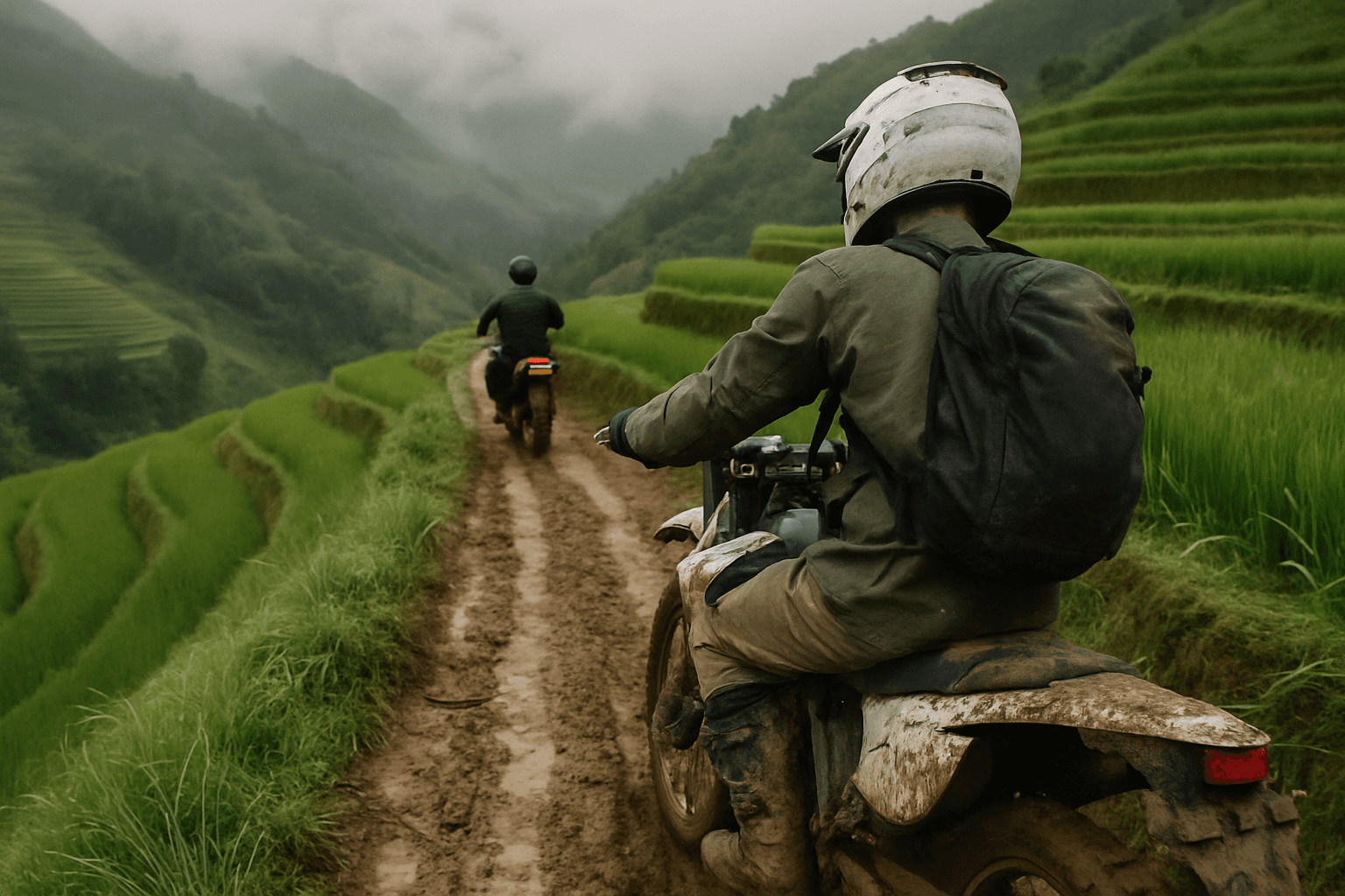
Ha Giang Dirt Bike Tour, 4 Days
Ha Giang, Vietnam
4 days
$480 / person

The first and best-known leg of the Ha Giang Loop as a day ride: the Bac Sum switchbacks, Quan Ba Heaven's Gate at over 1,100 metres, the twin mountains of Tam Son and the pine road to Yen Minh. Tarmac all the way, there and back.
The Ha Giang Loop, the circuit through the karst mountains of Vietnam's far north to Dong Van and Meo Vac, is usually ridden over three or four days. Its first leg, Highway 4C from Ha Giang to Yen Minh, works on its own as a day ride, and for many riders it holds the views they remember most: the hairpins of Bac Sum, the pass at Quan Ba Heaven's Gate looking down on the Tam Son valley, the two rounded hills locals call the twin mountains, and a pine-covered climb before the drop into Yen Minh.
This is an honest out-and-back: you ride Highway 4C north to Yen Minh, have lunch, and ride the same road home, which is no hardship because everything looks different in the other direction. It is a long day, nearly 200 kilometres with more than 4,000 metres of climbing, but the road is paved throughout and a rented 110–125 cc bike will manage it. The difficulty is the length, the steep mountain corners and the trucks and buses that share them, so it suits riders with some mountain experience who are happy to start early.
Longest stretch without a fuel station: about 81 km, between km 57 and km 138.
The roadkm 0–26
Highway 4C leaves Ha Giang and follows the valley north through Ngoc Duong and Minh Tan, staying between about 110 and 220 metres. It is easy riding past villages and fields, but there is local traffic, school children, dogs and livestock on the road. There are several fuel stations along this stretch.
Start
The marker at the start of Highway 4C, beside 26-3 Square in the centre of Ha Giang, is where Loop riders take their first photo, and it is easy to find. Leave early: the ride is long, and the mountains are usually clearest in the morning before cloud builds over the passes.
Tip: There are several fuel stations on the way out; the last ones before Yen Minh are in and just beyond Tam Son, at about km 49 and km 57.
The roadkm 26–44
The big climb of the day: from about 220 metres to over 1,100 metres in 18 km. Bac Sum's hairpins come first, then a steadier climb past Quyet Tien to the pass. Corners are tight and often blind, trucks and buses use the whole road, and fog is common near the top. Sound your horn before blind bends as local riders do.
Viewpoint
Allow 20 min
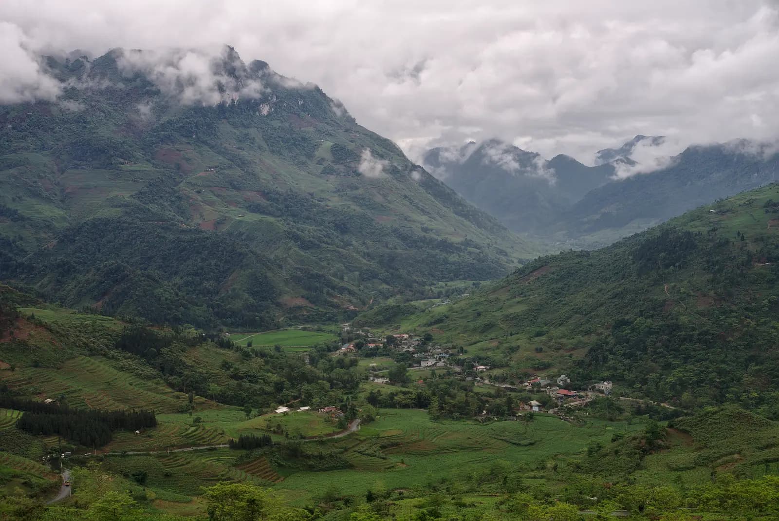
After the flat run up the valley, Highway 4C turns into the mountains and climbs in a stack of hairpins from about 350 metres to over 650 metres in five kilometres. At the top, roadside cafés and pull-outs look back down the switchbacks and over the valley you have just left. It is the first real view of the day and a good place for a coffee.
Tip: The hairpins are tight and trucks swing wide on them; stay on your side and don't stop on the bends for photos.
The roadkm 44–57
Down from the pass into Tam Son town, past the twin mountains, then a long descent to the valley floor at around 440 metres. Fill up at Tam Son (about km 49) or the station near km 57: these are the last ones on the map before Yen Minh.
Viewpoint
Allow 20–30 min
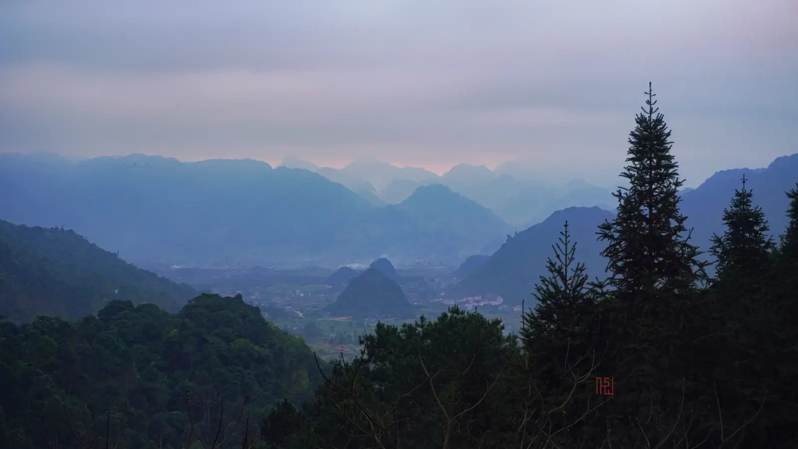
Cổng Trời Quản Bạ, the pass at the top of the climb and the highest point of the ride, a little over 1,100 metres. Just over the top the ground falls away to the Tam Son valley: a small town, rice fields and limestone peaks fading into the distance. The pass is the gateway to the Dong Van Karst Plateau Geopark, and from here north limestone shapes the landscape.
Tip: Fog often sits on the pass, especially on winter mornings; if it is socked in, ride on and look again on the way back.
Viewpoint
Allow 15 min
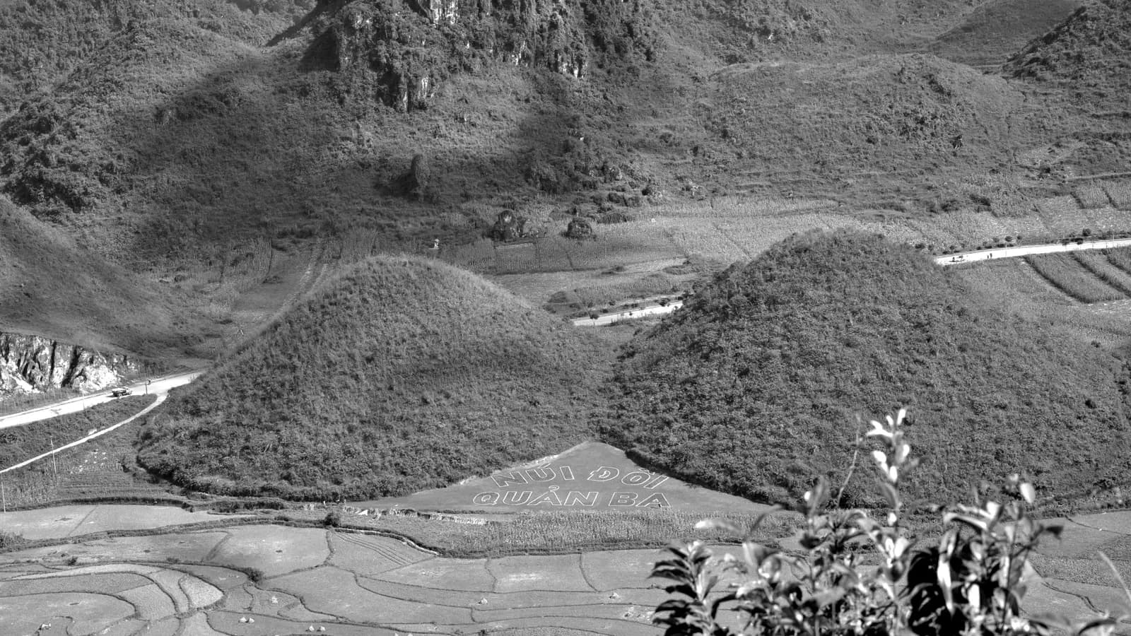
Two smooth, rounded hills rising side by side from the paddy fields beyond Tam Son town. In Vietnamese they are Núi Đôi, the twin mountains, or Núi Cô Tiên, the fairy mountains, and they are one of the best-known sights in the north. The road passes close by, and a viewpoint sits just off it.
Tip: Tam Son town, just before, has simple restaurants, and there is a fuel station just after: fill up, as the next one on the map is about 80 km of riding away.
The roadkm 57–97.4
A quieter stretch along the valley through Can Ty and Bach Dich communes, then a climb to almost 1,000 metres through pine forest and a winding descent into Yen Minh. Traffic is lighter here, but the road is narrower, and after the rainy season expect broken edges and gravel where landslides have been cleared.
Viewpoint
Allow 10 min
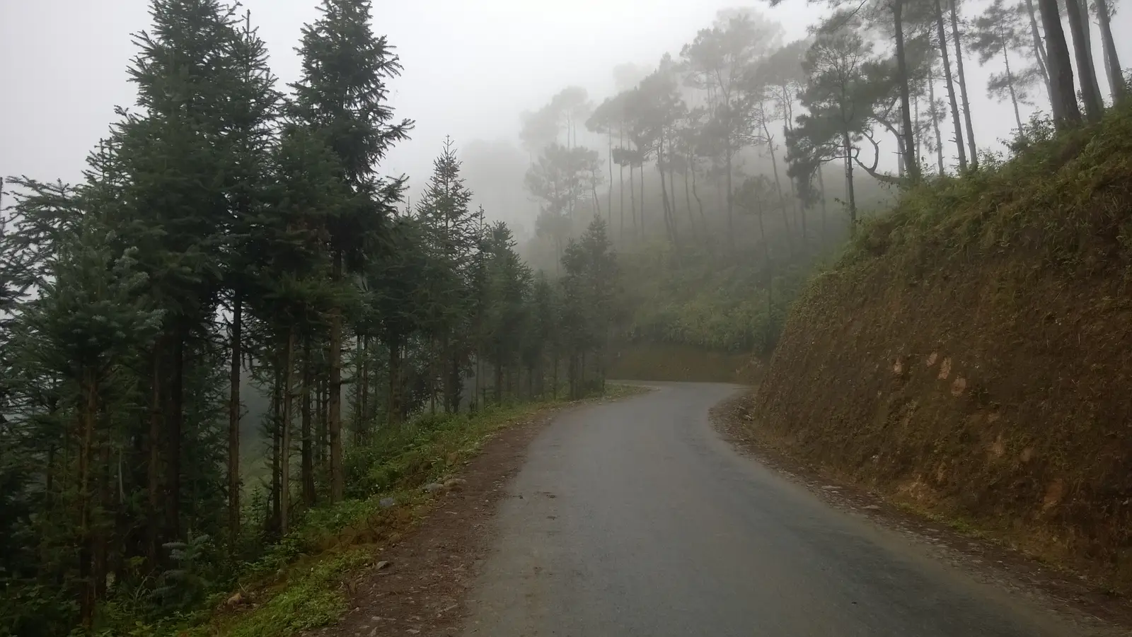
Around Bach Dich the road climbs again, to nearly 1,000 metres, and runs through stands of pine and fir before dropping to Yen Minh. In cloud the trees loom out of the mist; on a clear day the slopes open to long views over the valleys. It is the quietest, coolest part of the ride.
Tip: The descent to Yen Minh loses about 400 metres in six kilometres; take it in a low gear.
Food
Allow 1 hour with lunch
A small market town in a river valley and the turning point of the day. Simple restaurants and cafés line the main road, and it is a common first-night stop for riders doing the full Loop, so it is used to visitors. Eat, rest and turn round: the way home starts with the climb back up to the pines.
Tip: Aim to leave Yen Minh by early afternoon so the descent of Bac Sum is behind you before dark.
The roadkm 97.4–194.6
Back over the pine climb, through Tam Son, up to Heaven's Gate and then the long descent down Bac Sum to the valley: about 900 metres down in 18 km. Use the engine and a low gear rather than riding the brakes, and watch for fading light and tired eyes in the last hour into Ha Giang.
Finish
Back down Bac Sum and along the valley to the square where you started. The streets around the square and along the river have plenty of places to eat, and if the day has given you a taste for it, the rest of the Loop, north to Dong Van and Meo Vac, starts on the same road.
To ride in Vietnam you need either a Vietnamese motorcycle licence or an International Driving Permit issued under the 1968 Vienna Convention that covers motorcycles. Check which convention your permit is issued under before you travel. Many travel insurers will not cover you if you ride without the right licence, so read your policy before you rent.
A 110–125 cc semi-automatic, the usual rental bike in Ha Giang, is enough for one rider. Two up, a larger bike makes the climbs much easier. Check the brakes and tyres before you leave: the descents from Heaven's Gate and Bac Sum are long and steep.
On the way out there are stations at about km 5, 15, 23 and 37, then in and just beyond Tam Son at km 49 and 57; you pass the same stations again on the way back. None is mapped in Yen Minh, so the stretch to plan for is about 80 km, from km 57 to Yen Minh and back to that same station: leave Tam Son with a full tank. Village shops sell bottled fuel in an emergency.
October and November are usually dry and clear, and March and April are mild. The rainy season, roughly May to September, brings heavy afternoon storms, fog and landslides that can close the road for hours. From December to February it is cold at Heaven's Gate, often foggy and drizzly; bring warm layers and gloves.
Vietnam drives on the right, and helmets are compulsory for rider and passenger. Highway 4C carries trucks, buses and, in season, large groups of riders on the Loop. Overtake only where you can see well ahead, keep right on blind bends and expect animals and people on the road through villages. Weekends and Vietnamese public holidays are the busiest times.
Since 2025 Ha Giang has been part of Tuyen Quang province, so maps and addresses may show Tuyên Quang rather than Hà Giang. Mobile data works in the towns but drops out in the mountains; download an offline map before you go.
These operators run guided tours from Ha Giang, listed alphabetically. Contact any of them through Moto Mass.
Ha Giang, Vietnam
4 days
Ha Giang, Vietnam
4 days
Ha Giang, Vietnam
6 days

Northern Vietnam, Vietnam
14 days

Ha Giang, Vietnam
5 days
Free ride routes