
Highlights
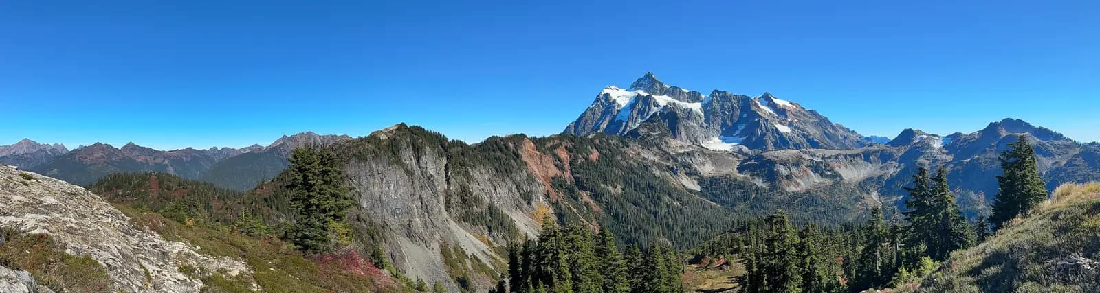
Ask riders in Seattle or Bellingham for the one day ride in western Washington and most will name the Mount Baker Highway. State Route 542 follows the Nooksack River from the farms east of Bellingham into the forest of the North Cascades, then climbs in a string of hairpins past Picture Lake and Heather Meadows to Artist Point, a parking area on a ridge at about 5,100 feet with Mount Baker on one side and the glaciers of Mount Shuksan on the other. This ride gets there the long way: south first along Chuckanut Drive, the old Pacific Highway cut into the cliffs above Chuckanut and Samish Bays, then east on quiet back roads past Lake Whatcom and up the South Fork valley to join the mountain highway at Deming.
It is about 150 miles and 8,500 feet of climbing, all paved. The first 45 miles, to Deming, are farm, lake and forest roads; from there the Mount Baker Highway climbs for about 43 miles to its dead end at Artist Point, and you ride home back down it. Nothing is technically hard, but Chuckanut Drive is narrow with no shoulder and the top of the mountain road is steep and tight, so it suits riders who are at ease on twisting two-lane roads. The top section is open only in summer and early autumn. Seattle riders usually ride up I-5 to start it, or make a weekend of it.
Longest stretch without a gas station: about 63 miles, between mile 57 and mile 119.
The ride, stop by stop
- 1mile 0
Start
Fairhaven Village Green
Fairhaven was a boom town of the 1890s before it became Bellingham's south end, and its streets of red-brick buildings around the Village Green still look the part. It is an easy place to meet, with parking nearby, and Chuckanut Drive begins a few blocks away, so you are above the water within minutes of setting off.
Tip: There is a gas station at the edge of Fairhaven as you leave. The next on the route is near Bow Hill Road, about 17 miles away.
The roadmiles 0–13
Chuckanut Drive
SR 11Narrow two-lane tarmac, no shoulder, sharp cornersState Route 11 leaves Fairhaven and for about 10 miles is cut into the wooded cliffs of Chuckanut Mountain above the water, with Larrabee State Park below and tight hairpins where it crosses Oyster Creek. There is no shoulder, the rock wall is close on one side and the guardrail on the other, and cyclists and cars stopping at the turnouts are part of the deal; keep your speed down in the blind corners. It then drops onto the flat farmland of the Samish flats and runs straight to Bow.
- 2mile 5.4
Sight
Larrabee State Park
Allow 20–30 min
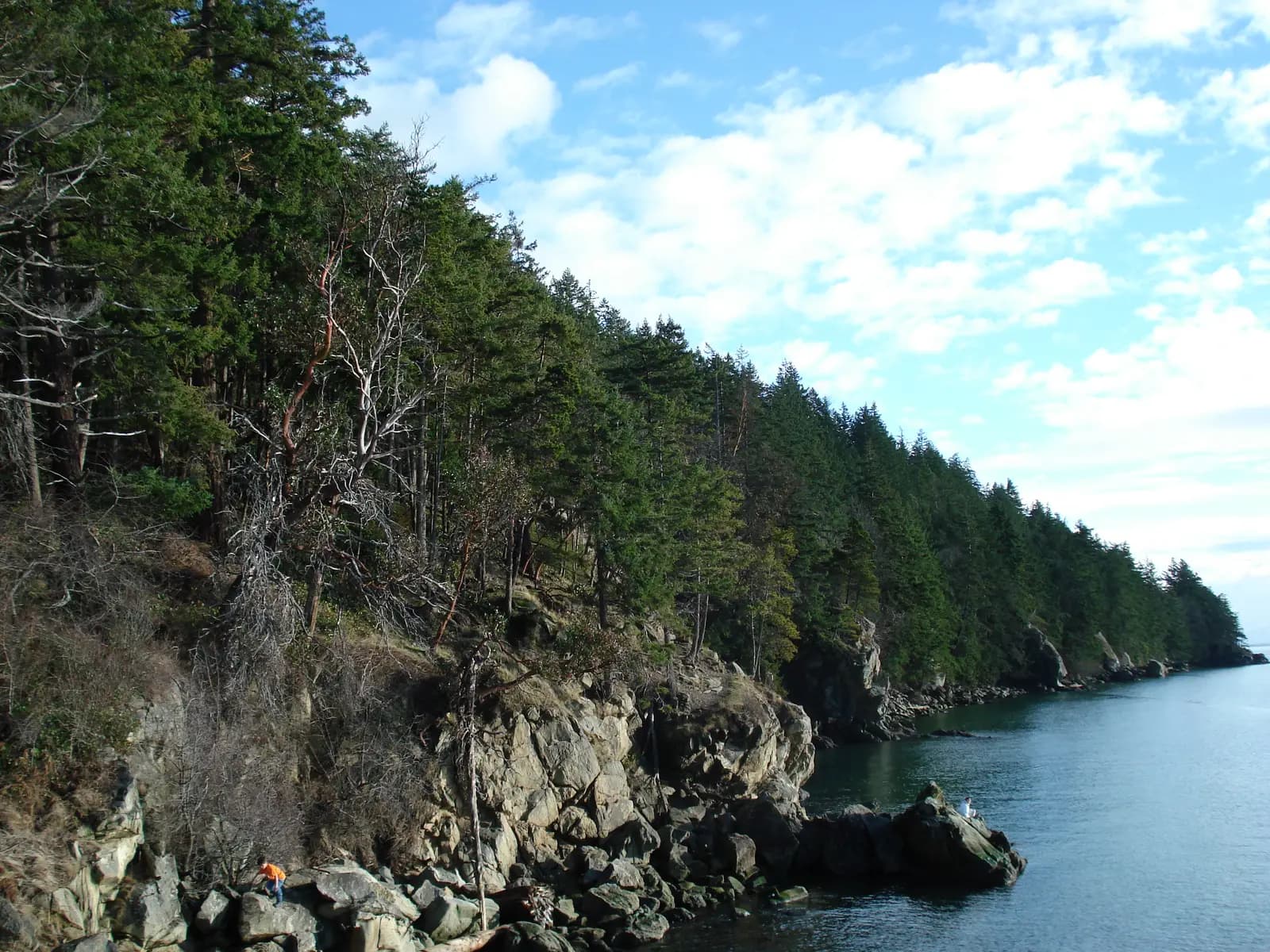
Photo: Cody Logan (aka clpo13), CC BY-SA 3.0 Washington's first state park runs along the shore below Chuckanut Drive, with sandstone ledges, small coves and views west across the water to the San Juan Islands. A short walk from the parking area leads down to Wildcat Cove, and the turnouts on the drive further south look out over Chuckanut and Samish Bays. It is the obvious first stop, and a place to come back to at sunset.
Tip: Parking in Washington state parks needs a Discover Pass, which you can buy at the park or online; the roadside turnouts on Chuckanut Drive do not.
The roadmiles 13–34
Back roads to Lake Whatcom
Bow Hill RoadOld Highway 99 NorthOld Highway 99 North Road(PNT) Alger Cain Lake RoadAlger Cain Lake RoadCain Lake RoadSouth Bay DrivePark RoadTwo-lane county roadsBow Hill Road climbs east under I-5, and Old Highway 99 North runs up the far side of the freeway through Alger. Alger Cain Lake Road and Cain Lake Road then wind through forest and past small lakes to South Bay Drive, which follows the shore of Lake Whatcom for about 3½ miles in a run of easy, flowing curves. Park Road crosses the hill to State Route 9. These are local roads with driveways and farm traffic, but they are quiet for most of the day.
The roadmiles 34–64
Up the Nooksack valleys
SR 9SR 542Mount Baker HighwayTwo-lane highway, open and fastState Route 9 runs north through the dairy farms of the South Fork valley past Acme and Van Zandt to Deming, where you turn east onto the Mount Baker Highway. From here the road follows the North Fork of the Nooksack through Kendall and Maple Falls, which has the last gas on the ride, about 56 miles from the start. It is open, easy riding; watch for tractors and for cars turning into farm driveways.
- 3mile 63.8
Food
Glacier
Allow 45 min with lunch
The last settlement on the Mount Baker Highway, a small community among tall firs where the farmland gives way to the national forest. A few simple places to eat line the highway, and the Glacier Public Service Center, a ranger station at the east end of the village, has maps and current trail and road information in season. It makes a good lunch stop on the way up or the way down.
Tip: There is no gas in Glacier. The last station is in Maple Falls, 7 miles back down the valley.
The roadmiles 64–88
The mountain highway
Mount Baker HighwaySR 542Two-lane tarmac, steep hairpins near the topPast Glacier the highway enters the Mount Baker–Snoqualmie National Forest and runs through big firs and cedars beside the river, gently at first. After Nooksack Falls it starts to climb in earnest: about 4,200 feet in the 24 miles from Glacier, most of it in the last 10 miles, through tight hairpins past the ski area to Heather Meadows. The final 2.7 miles to Artist Point are narrow and steep, up to about 9%, with snowbanks and drop-offs, and are open only in summer and early autumn.
- 4mile 71.1
SightDetour
Nooksack Falls
Allow 20 minAbout half a mile each way
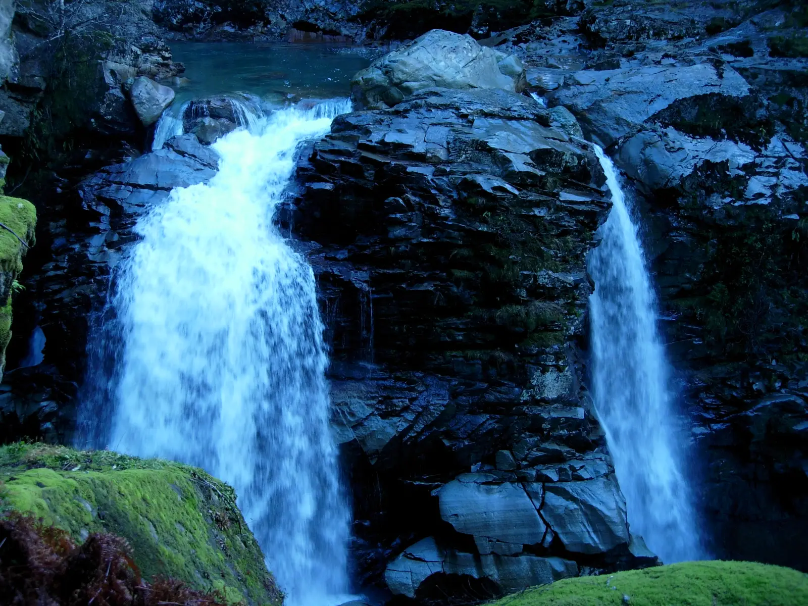
Photo: Chris.Ott at English Wikipedia, Public domain The North Fork of the Nooksack River drops about 88 feet into a narrow rock gorge, split in two by a buttress of dark stone. A short walk from the small parking area leads to a fenced overlook above the falls, and the old hydroelectric plant beside them once supplied the mines of the Mount Baker mining district.
Tip: Wells Creek Road, the side road to the falls, is gravel; ride it slowly. Stay behind the fence at the overlook, where the rock is wet and the drop is sheer.
- 5mile 84.5
Viewpoint
Picture Lake
Allow 20–30 min
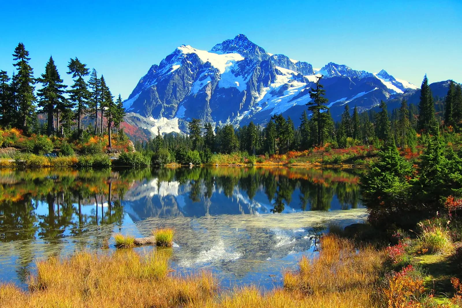
Photo: Michal Osmenda from Brussels, Belgium, CC BY-SA 2.0 Near the top of the climb, the highway runs one way around a small lake at about 4,100 feet, and on a still morning Mount Shuksan stands reflected in it: the view printed on countless calendars. A short level path circles the water. Just above, Heather Meadows has the Forest Service visitor center in a stone warming hut built by the Civilian Conservation Corps in 1940, open in summer.
Tip: Parking here, at Heather Meadows and at Artist Point needs a Forest Service recreation pass. If you have none, buy a day pass on the recreation.gov app or at the fee machine near the visitor center.
- 6mile 87.7
Viewpoint
Artist Point
Allow 45–60 min
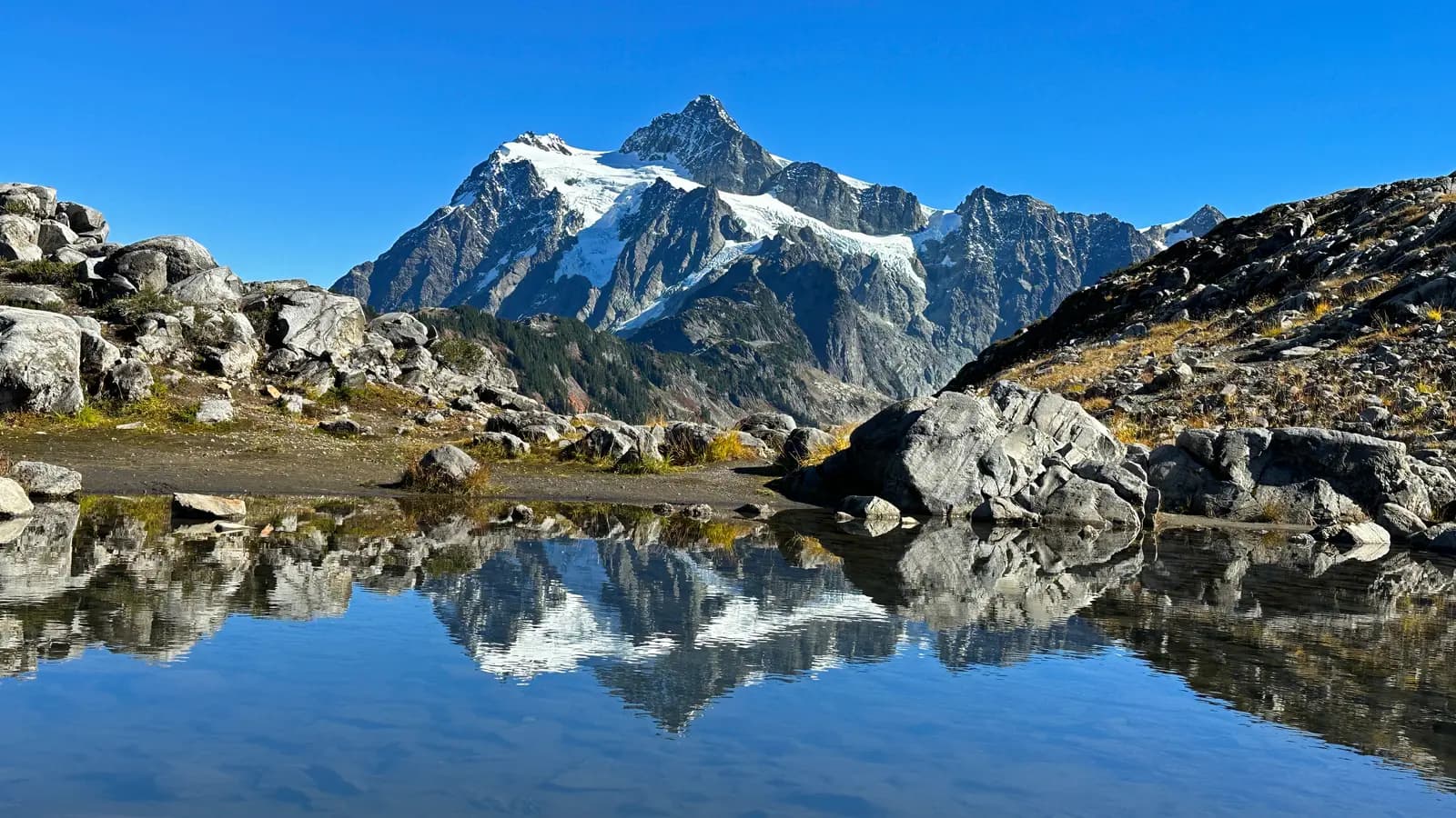
Photo: Jeffhollett, CC BY-SA 4.0 The end of the road and the highest point of the day, at about 5,100 feet on Kulshan Ridge. Mount Baker fills the view to the south-west and Mount Shuksan the view to the east, with heather, rock and small tarns in between. Even a 15-minute walk along the ridge paths, past the lingering snowbanks, takes you away from the car park and into the mountains.
Tip: It is much colder up here than in Bellingham, and cloud can sit on the ridge when the valley is clear. Bring a warm layer, and check the WSDOT mountain pass page for SR 542 before you set off to make sure the last stretch is open.
The roadmiles 88–150
Back down to Bellingham
SR 542Mount Baker HighwaySR 9I 5SR 11Two-lane highway, then 4 miles of interstateThe same highway all the way back, downhill to the valley and then gently down the river. Use the engine to slow you on the hairpins rather than the brakes, and watch for cars stopping suddenly for views. Below Deming the highway runs with State Route 9 to Nugents Corner and on into Bellingham, where I-5 takes you south for about 4 miles to the Fairhaven exit and the start of Chuckanut Drive.
- 7mile 150.5
Finish
Fairhaven Village Green
The Mount Baker Highway brings you back into Bellingham, and a short run down I-5 returns you to Fairhaven, where the brick streets have plenty of places to eat and the waterfront looks west towards the islands at sunset.
Before you ride
Licence and helmets
You need a motorcycle licence: a US licence with a motorcycle endorsement, or for visitors a home licence that covers motorcycles, usually with an International Driving Permit. Rental companies set their own rules on licences and age. Washington requires a DOT-compliant helmet for every rider and passenger, and lane splitting is not legal anywhere in the state. There are no tolls on this route.
Season and closures
The highway is plowed all winter as far as the ski area at Heather Meadows, but the last 2.7 miles to Artist Point are buried in snow for much of the year. WSDOT usually opens them between June and mid-July, depending on the snowpack, and closes them for the winter between mid-October and November 1, earlier if the first heavy snow comes sooner. The highway also closes for short periods for events and autumn maintenance. Check the WSDOT mountain pass report for SR 542 and the WSDOT travel map on the day you ride.
Fuel and phone signal
Fill up in Maple Falls, about 56 miles from the start. There is no gas above it, so the ride to Artist Point and back to Maple Falls is about 62 miles without a station. Mobile signal fades beyond Glacier and is unreliable in the mountains, so download an offline map before you leave.
When to ride
July to September, when the road to Artist Point is open and the meadows are clear of snow, though banks of it can line the car park well into summer. August brings the most reliable weather; in September the huckleberry and blueberry bushes around Heather Meadows turn red and the crowds thin. This is a wet, maritime climate: even in summer, low cloud can hide the mountains for days, so look at the forecast for the upper mountain and not just Bellingham.
Passes and parking
Parking at Picture Lake, Heather Meadows and Artist Point needs a Forest Service recreation pass (a Northwest Forest Pass, an Interagency Pass or a day pass), and parking in Larrabee State Park needs a Washington Discover Pass. On summer weekends the Artist Point car park fills by late morning, and motorcycles are no exception; arrive early or come on a weekday.
Traffic and wildlife
Chuckanut Drive is popular with cyclists and sightseers, so do not count on passing anyone in its corners. On the Mount Baker Highway expect slow visitors near the top, cyclists on the climb, and deer and the occasional black bear in the forest, especially early and late in the day. Rockfall and gravel collect in the corners after rain.
Ride further
Liked riding this one on your own? Moto Mass lists small, local operators who run guided motorcycle tours in these countries.
Free ride routes