
Highlights
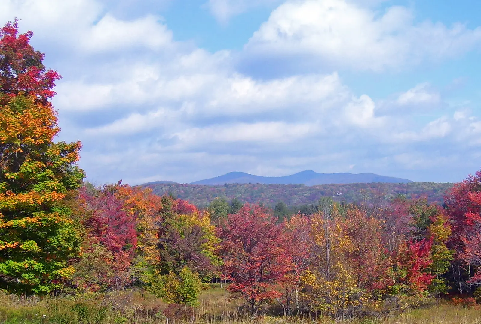
The Catskills rise straight out of the Hudson Valley a few miles west of Kingston, and the riding is about the roads between the peaks: creek valleys, high hollows and the steep-sided passes the locals call cloves and notches. This loop strings together the ones riders talk about. Route 28 takes you out past the Ashokan Reservoir, then the Peekamoose Road squeezes through a wooded gorge beside Rondout Creek. Frost Valley Road climbs to the loop's high point, about 2,700 feet, beneath Slide Mountain, the tallest peak in the range. After lunch in Phoenicia, Route 214 threads Stony Clove Notch and Route 23A drops off the escarpment through Kaaterskill Clove, the gorge the Hudson River School painters made famous.
It is a full day, but not a hard one. Every mile is paved, and nothing on it troubles a road bike of any size, though the Peekamoose and Frost Valley roads are narrow, patched and often without a centre line, and the Kaaterskill Clove descent is steep with a tight hairpin. There are no tolls and no motorways. The catch is fuel and phone signal: between Shokan and Phoenicia you ride about 63 miles with no gas station on the route and long stretches with no cell coverage, so leave Route 28 with a full tank.
Longest stretch without a gas station: about 63 miles, between mile 13 and mile 76.
The ride, stop by stop
- 1mile 0
Start
Old Dutch Church
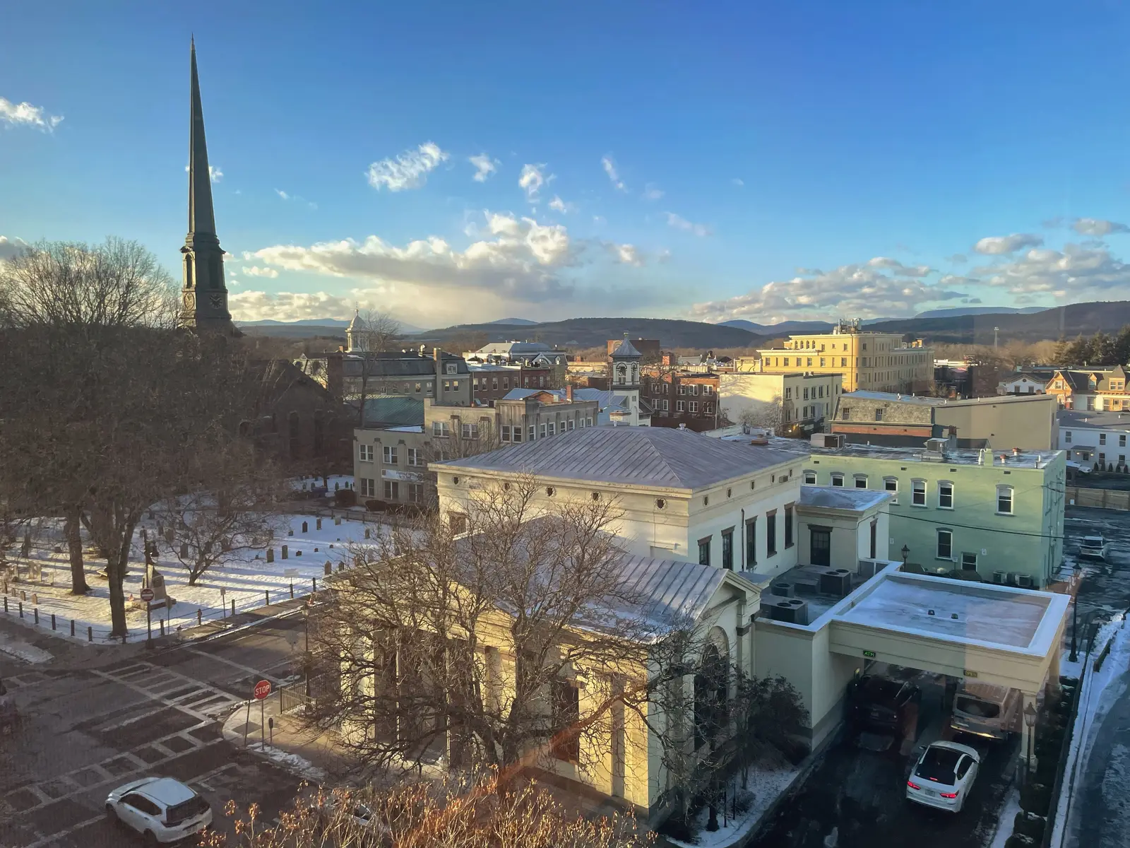
Photo: Amy Lavine, CC BY-SA 4.0 Start in Uptown Kingston's Stockade District, the grid of streets that was the walled Dutch settlement of the 1650s. The Old Dutch Church on Wall Street, a bluestone church of 1852 for a congregation founded in 1659, stands in a churchyard where George Clinton, New York's first governor, is buried. Kingston was briefly the state's first capital in 1777, and the Senate House where the first state senate met is a block away.
Tip: Fill up as you leave town or along Route 28 before Shokan: after that there is no gas on the route for about 63 miles.
The roadmiles 0–17
Kingston and the Ashokan
NY 28Wide main highwayA few blocks of town take you onto Route 28, which climbs gently west out of the Hudson Valley and then runs along the north shore of the reservoir. It is fast, wide and busy with weekend traffic heading for the mountains. This is the last gas for 63 miles: the last station on the route is at about mile 13, around Shokan.
The roadmiles 17–33
The Peekamoose Road
NY 28ACR 42Narrow two-lane tarmac, patched, often no centre lineRoute 28A takes you south from Boiceville to West Shokan, where County Route 42 turns up the hollow. It climbs about 1,000 feet in 5 miles, with short pitches around 12%, then runs down the wooded gorge of Rondout Creek to Sundown. The road is narrow, the corners blind and the surface broken in places; floods have washed sections away before. On summer weekends expect parked cars and people walking near the Blue Hole and Buttermilk Falls.
- 2mile 17.6
Viewpoint
Ashokan Reservoir and Rail Trail
Allow 20–45 min
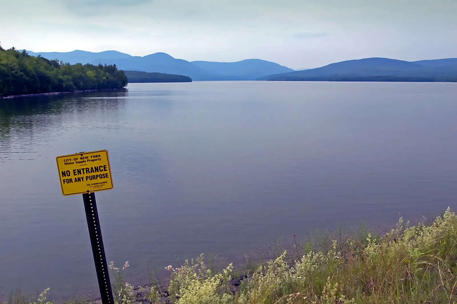
Photo: David Goehring, CC BY 2.0 Route 28 follows the north shore of the Ashokan Reservoir, built for New York City's water supply and finished in 1915 over the sites of several villages that were moved to make way for it. From the road you see the water mostly through the trees. For the open view, stop at the Boiceville Bridge trailhead of the Ashokan Rail Trail, just off Route 28 where Route 28A turns south, and walk east along the old railway bed beside the shore, with the high peaks across the water.
Tip: The shoreline off the trail is city water-supply land: no swimming, wading or walking down to the water.
- 3mile 30.1
Sight
Peekamoose Blue Hole
Allow 30–60 min
A deep, clear pool in Rondout Creek, a short walk from the road through the forest, and one of the best-known swimming holes in the state. Just before it, Buttermilk Falls spills down the hillside right beside the Peekamoose Road, with a small parking area next to it. Even if you don't swim, this is the place to stop and listen to the creek in the quietest valley of the ride.
Tip: On summer weekends and holidays the state limits visits to the Blue Hole with permits booked in advance; check the DEC website before you go, and park only in the marked lots, never on the road.
The roadmiles 33–47
Rondout Reservoir and Claryville
CR 46CR 153NY 55ANY 55CR 19Two-lane tarmac, gentleCounty roads take you south out of the valley to Route 55A along the Rondout Reservoir, another of New York City's reservoirs, with a pull-off signed as a bald eagle viewing area. Through Grahamsville, County Route 19 heads north up the Neversink valley to Claryville. Open farmland and easy, flowing bends.
The roadmiles 47–67
Frost Valley Road
CR 157CR 47Narrow two-lane tarmac, climb and steep descentCounty Roads 157 and 47 follow the West Branch of the Neversink up Frost Valley and over the loop's high point, about 2,700 feet, on the shoulder of Slide Mountain, then descend through Oliverea beside the young Esopus Creek to Big Indian. The top of the descent is steep, around 10%. This is the remotest stretch: no gas, little traffic, and usually no phone signal.
The roadmiles 67–88
Esopus valley and Stony Clove
NY 28NY 214Two-lane tarmacRoute 28 runs east down the Esopus valley to Phoenicia, wide and easy. Route 214 then climbs about 1,200 feet over 10 miles up Stony Clove, steadily rather than steeply, with sweeping bends below the notch and tighter ones through it, before dropping to Route 23A between Hunter and Tannersville.
- 4mile 75.8
Food
Phoenicia
Allow 1 hour with lunch
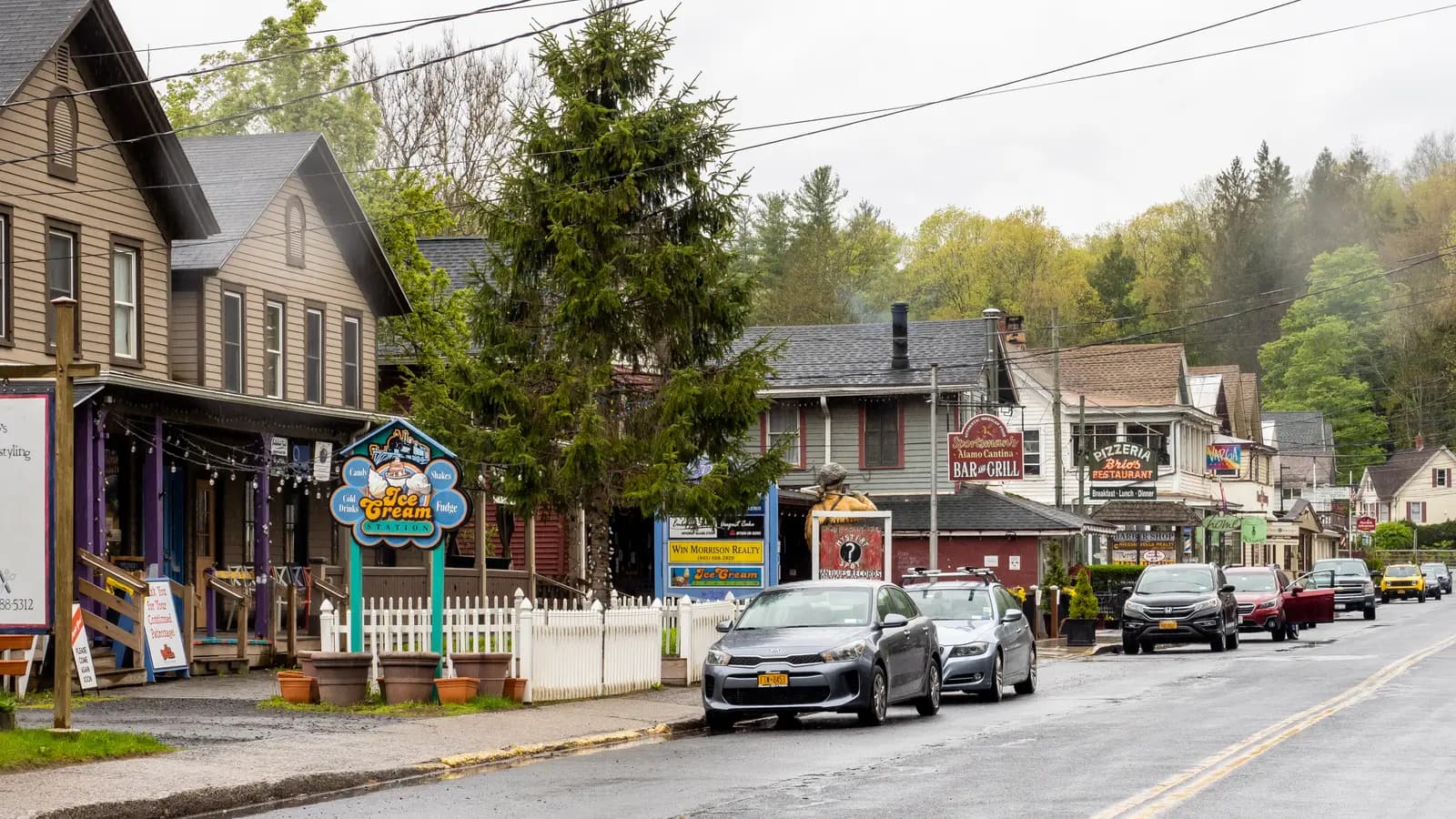
Photo: ajay_suresh, CC BY 2.0 A small mountain village on Esopus Creek and the natural lunch stop: Route 214 leaves Main Street at the west end of the village, and the diners, cafés and delis are a short way east along it. In summer the creek fills with people floating down it on inner tubes, and anglers come for its trout.
Tip: Phoenicia is your first gas since Shokan. Fill up here; the next stations are around Tannersville and Haines Falls.
- 5mile 85.4
Viewpoint
Stony Clove Notch
Allow 15 min
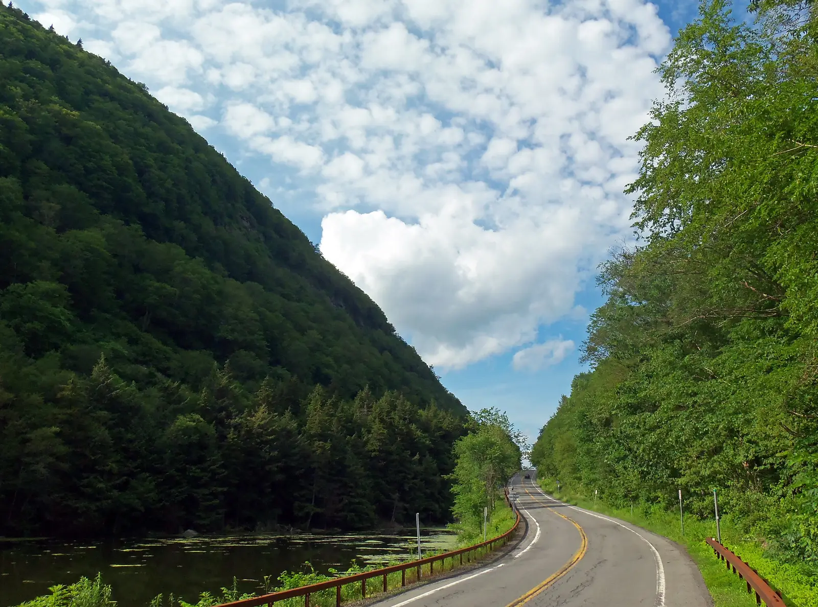
Photo: Daniel Case, CC BY-SA 3.0 Route 214 climbs steadily up the Stony Clove from Phoenicia until the walls close in and the road squeezes past Notch Lake at the top of the pass, a little over 2,000 feet up. Just before the lake is the state's Devil's Tombstone campground, named after a big boulder by its entrance. It is one of the most striking pieces of road in the Catskills, and a good place to pull over and look up at the cliffs on either side.
Tip: Stop only in the pull-offs by the lake; the road through the notch is narrow, with little shoulder.
The roadmiles 88–119
Kaaterskill Clove and home
NY 23ANY 32ANY 32US 9WTwo-lane tarmac, steep descent, then valley roadsRoute 23A runs through Tannersville and Haines Falls, then drops through Kaaterskill Clove: from Tannersville to Palenville it falls about 1,500 feet in 6½ miles, with gradients near 10%, a sharp hairpin at Bastion Falls, rock walls and little room to pass. Go down in a low gear, and watch for stopped cars, hikers and cyclists. From Palenville, Routes 32A and 32 cross the flat valley through Saugerties, with a short run on US 9W, and back into Kingston.
- 6mile 93.8
Sight
Kaaterskill Clove and Bastion Falls
Allow 15 min, or 1 hour for the main falls
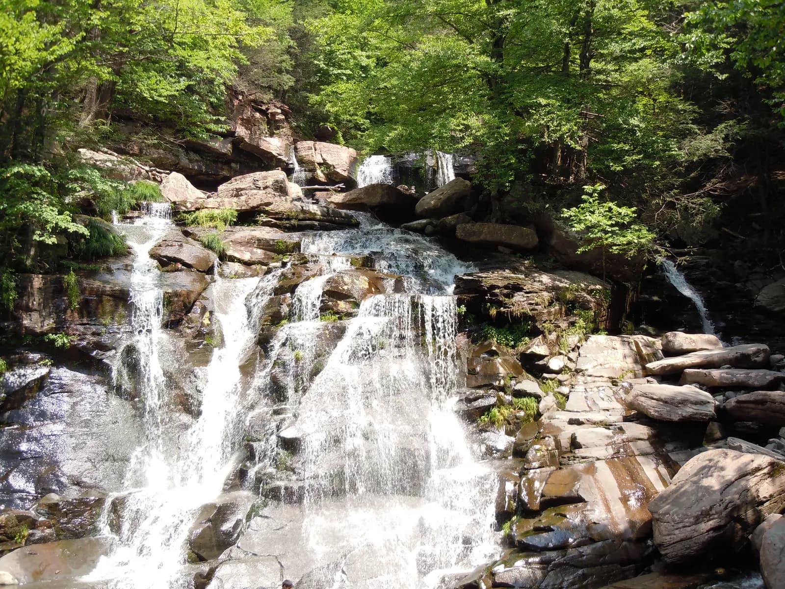
Photo: Wildhart, CC BY-SA 3.0 Route 23A drops off the escarpment through Kaaterskill Clove, the gorge painted again and again by Thomas Cole and the Hudson River School. At a tight hairpin the road crosses the creek beside Bastion Falls, which tumbles over ledges right by the roadside. Above it, Kaaterskill Falls drops in two tiers about 260 feet in all, one of the tallest waterfalls in New York.
Tip: For Kaaterskill Falls, turn off in Haines Falls before the descent: North Lake Road and then Laurel House Road lead to a parking area a short walk from a viewing platform over the falls. Don't stop or walk on Route 23A in the clove.
- 7mile 119.4
Finish
Old Dutch Church
Route 32 brings you back through Saugerties and down Flatbush Road into Kingston. The Stockade District's streets are lined with restaurants and bars, and the loop ends where it began, at the church on Wall Street.
Before you ride
Licence and insurance
You need a motorcycle licence: in the US, a licence with a motorcycle (class M) endorsement. Visitors can usually ride on a home licence that covers motorcycles, normally with an International Driving Permit; rental companies set their own rules, so check with yours. Bikes registered in New York must carry liability insurance.
Helmets and the law
New York requires every rider and passenger to wear an approved helmet, and riders to wear eye protection such as goggles or a face shield. Traffic drives on the right. Lane splitting is not legal in New York.
Fuel
There are plenty of stations in Kingston and along Route 28 as far as Shokan, then none on the route for about 63 miles until Phoenicia. Plan on a full tank at Shokan. After Phoenicia, gas is easy to find around Tannersville and Haines Falls, in Palenville and in Saugerties. Village stations may close in the evening, though most pumps take a card at any hour; US pumps often ask for a ZIP code, so foreign cards may need to pay inside.
When to ride
May to October. October brings the autumn colour, usually best in the first half of the month on the high ground, and the heaviest weekend traffic. From November to April the high roads can see snow and ice, and spring leaves sand, potholes and frost heaves on the county roads. Check 511NY for closures before you set out; the Peekamoose Road in particular has been closed for flood repairs in the past.
Wildlife, signal and safety
Deer are a real hazard at dawn and dusk; black bears live here too. There is little or no phone signal in the Peekamoose and Frost Valley hollows and through Stony Clove, so download an offline map before you go. Speed limits drop sharply through the hamlets, and police do enforce them.
Tolls
The loop itself has no tolls. If you reach Kingston on the New York State Thruway (I-87), that is a toll road with cashless tolling: E-ZPass, or a bill sent by mail to the vehicle's owner, which on a rental usually comes back to you with a fee.
Ride further
Liked riding this one on your own? Moto Mass lists small, local operators who run guided motorcycle tours in these countries.
Free ride routes