
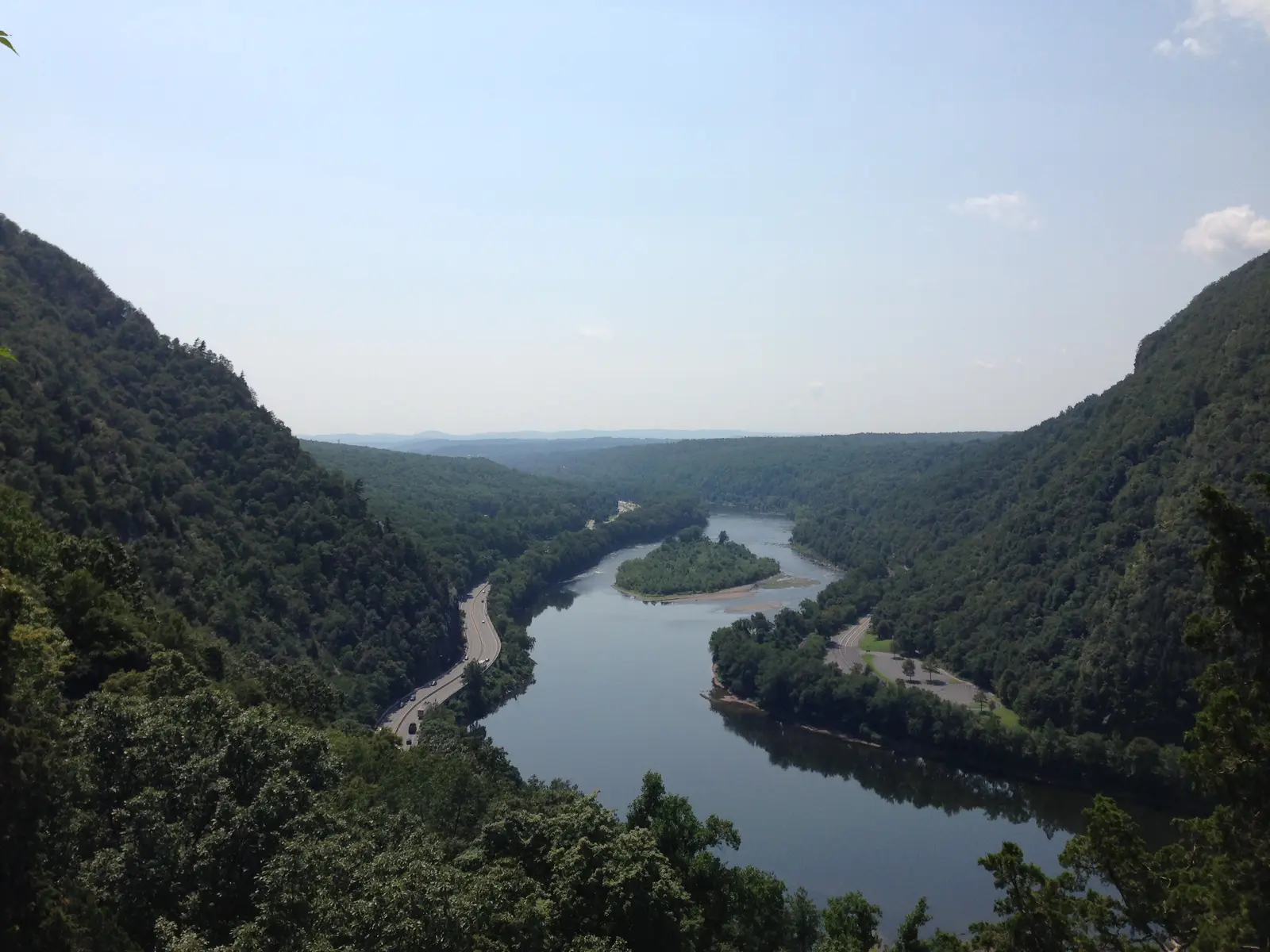
Highlights
An hour from Morristown the suburbs run out against the Kittatinny Ridge, and behind it lies the Delaware Water Gap National Recreation Area: forty miles of river valley bought up in the 1960s for a dam that was never built. The farms and hamlets were emptied and the forest came back. This loop crosses the ridge to Millbrook, rides Old Mine Road down the New Jersey bank to the Gap itself, then returns north up the Pennsylvania side on US 209 and home over the ridge at Culvers Gap.
It is a full day: 142 miles with about 7,600 feet of climbing, though no single climb is long. The roads are paved throughout. The country roads out of Morristown and the park road on the Pennsylvania side are easy riding; Old Mine Road is the opposite, narrow and patched, with stretches posted at 15 mph and a single-lane section, so it suits riders who are happy to go slowly on a tight, rough lane. The last hour is fast highway home.
Longest stretch without a gas station: about 23 miles, between mile 72 and mile 96.
The ride, stop by stop
- 1mile 0
Start
Morristown Green
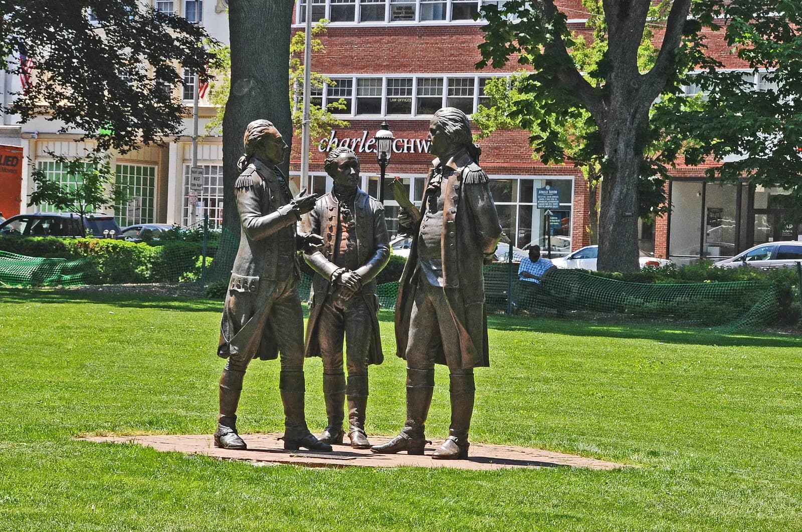
Photo: Jerrye & Roy Klotz, MD, CC BY-SA 3.0 The town square has been common ground since the early 1700s, and Washington's army spent two winters encamped around Morristown during the Revolution. A bronze group on the Green shows Washington with Lafayette and Hamilton. It is an easy place to meet, and County Route 510 leaves from its western corner straight towards the hills.
Tip: Leave early on a summer weekend: you want to be on Old Mine Road before the river traffic and the day-trippers.
The roadmiles 0–23
Out through the horse country
CR 510CR 513CR 517NJ 182Two-lane tarmac, rolling, one short climbCounty Route 510 heads west through Mendham and Chester among estates and paddocks, then Route 513 runs to Long Valley. There Route 517 climbs Schooley's Mountain, about 500 feet in under 2 miles of good bends, before dropping into Hackettstown. Traffic is light early on weekends; watch for cyclists on the hills and for cars pulling out of driveways.
The roadmiles 23–40
To Hope and Blairstown
US 46CR 611CR 521Two-lane tarmac, gentleSix miles of US 46 west of Hackettstown, then County Route 611 turns off through farmland to Hope and Route 521 rolls on to Blairstown. Easy, open riding with long views of the ridge ahead. Fill up in Blairstown: the next fuel is 23 miles away on the far side of the river.
- 2mile 33.7
Sight
Hope
Allow 15 min
Moravian settlers from Pennsylvania laid out Hope in 1769 as a planned village, one of the earliest in the country, and named it for the hope of eternal life. The community moved away within a couple of generations, but its stone gristmill, church and cemetery still stand, and the village has barely grown since.
Tip: Blairstown, about 6 miles on, has the last fuel before the park; fill up there, not later.
The roadmiles 40–48
Over the Kittatinny Ridge
CR 602Two-lane tarmac, winding, steep descentMillbrook Road (Route 602) climbs about 900 feet in 6 miles to the crest of the ridge at about 1,250 feet, where the Appalachian Trail crosses. It then drops about 600 feet in just over a mile into Millbrook, the steepest stretch of the day: low gear, and watch for leaves and gravel in the corners.
- 3mile 47.5
Sight
Millbrook Village
Allow 30–45 min
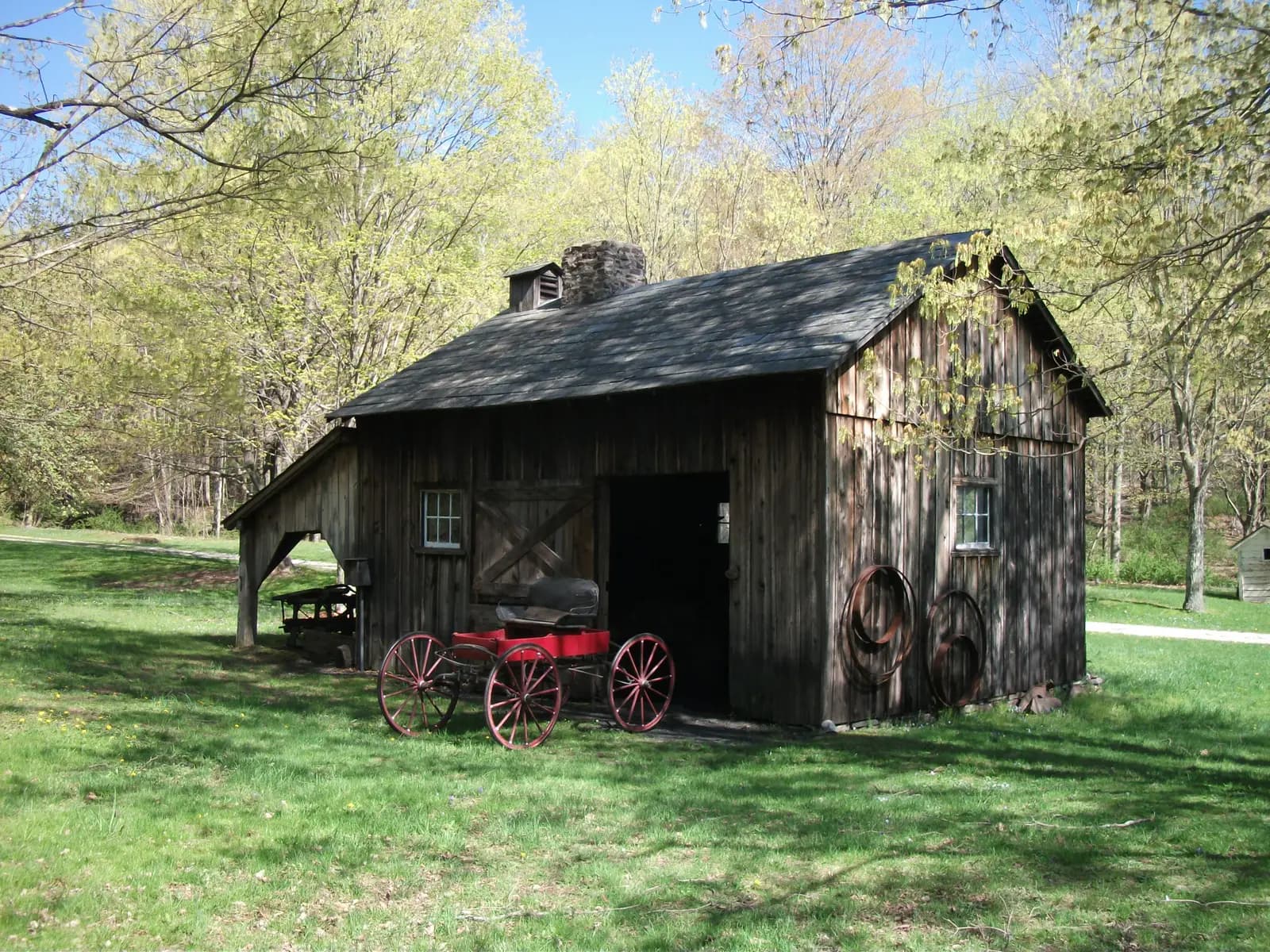
Photo: Dougtone, CC BY-SA 2.0 A gristmill was built here in 1832 on the new turnpike, and by 1875 Millbrook had about 75 people, a store, a church, a school and a blacksmith. Then the mill closed and the village faded. The Park Service has kept the surviving houses and barns and moved in others from elsewhere in the valley, so you can wander a whole 19th-century hamlet, with the road running straight through it.
Tip: Buildings open only on some summer and autumn days, when volunteers run demonstrations; the lanes and exteriors are worth the stop on any day.
The roadmiles 48–60
Old Mine Road
Old Mine RoadNarrow, patched tarmac, no shouldersTwelve miles down the New Jersey bank, first through woods to the river at Calno, then past old farmhouses, cornfields and the Worthington State Forest to the Gap. Much of it has no centre line, some stretches are posted at 15 mph, and a bridge near Van Campens Glen has been down to one lane for repairs. Expect potholes, tree roots, wet leaves, deer and oncoming cars on blind bends. Most of it, from Millbrook to the Worthington State Forest, closes in winter.
- 4mile 59.7
Viewpoint
Kittatinny Point
Allow 20 min
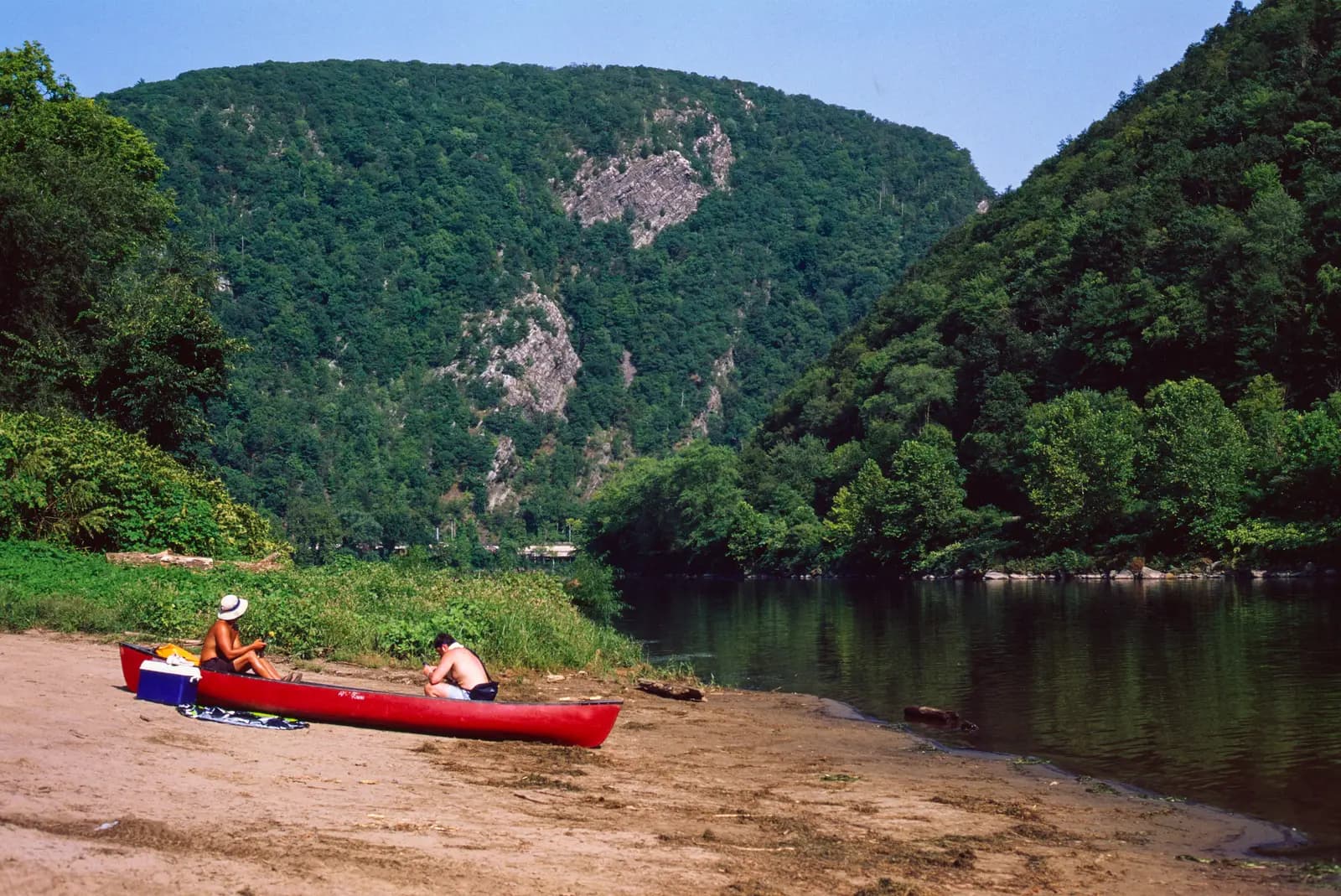
Photo: RollerFanatic000, CC BY-SA 4.0 Old Mine Road ends at the river in the mouth of the Gap. Mount Tammany on the New Jersey side and Mount Minsi in Pennsylvania rise more than 1,100 feet straight from the water, two halves of the same ridge that the Delaware has cut clean through. The Appalachian Trail crosses the river here on the I-80 bridge.
Tip: The ramps here are tight: the route joins I-80 east for a moment and loops back west through Kittatinny Point, so follow the route line rather than the first sign you see.
The roadmiles 60–93
US 209 up the Pennsylvania side
I 80US 209Two-lane highway, smooth and gentleI-80 crosses the Delaware Water Gap Toll Bridge into Pennsylvania, then US 209 takes you north through Marshalls Creek and Bushkill and into the park. The rest is 30 miles of quiet, sweeping road through woods and old fields, past the end of the Dingmans Ferry Bridge, one of the last privately owned toll bridges in the country. Park rangers enforce the speed limit, and there is no fuel between Bushkill and the Milford area.
- 5mile 90.6
SightDetour
Raymondskill Falls
Allow 30 minAbout half a mile each way
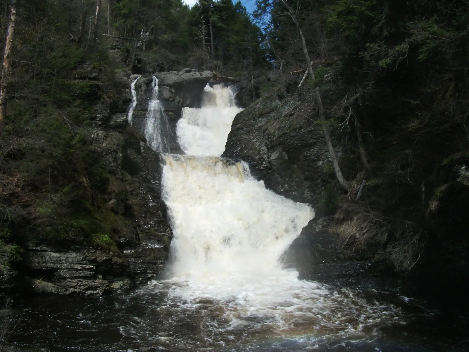
Photo: Doug Kerr from Albany, NY, United States, CC BY-SA 2.0 Three cascades drop about 150 feet in total down a hemlock ravine, which makes this the tallest waterfall in Pennsylvania. A short trail leads from the parking area on Raymondskill Road to wooden platforms at the top and middle of the falls.
Tip: The trail is only 0.3 mile but drops about 180 feet, so allow for the walk back up in riding boots. The upper parking lot is closed from early January to mid-April.
- 6mile 93
FoodDetour
Milford
Allow 1 hour with lunchAbout a mile each way
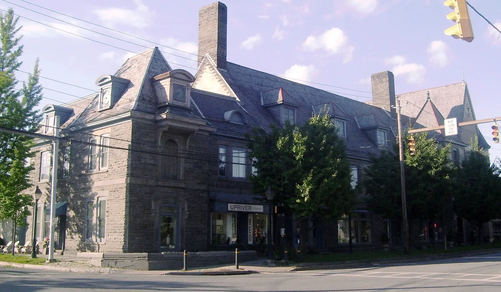
Photo: Beyond My Ken, CC BY-SA 4.0 The Pike County seat is a small grid of Victorian streets laid out in 1796, with the courthouse, stone Forest Hall and plenty of places to eat along Broad Street. Grey Towers, the family home of Gifford Pinchot, first chief of the US Forest Service, stands on the edge of town as a National Historic Site. It is the natural lunch stop, about 93 miles in.
Tip: The route turns onto US 206 for the bridge just south of town; carry straight on into the centre and come back the same way.
The roadmiles 93–142
Culvers Gap and home
US 206NJ 15I 80I 287Two-lane highway, then interstateUS 206 crosses back into New Jersey on the Milford–Montague bridge and runs south through Stokes State Forest, climbing over the ridge at Culvers Gap, just over 900 feet, past Kittatinny Lake. Then Route 15 takes over through Lafayette and Sparta to Dover, busier and faster, then I-80 east and I-287 south bring you back to Morristown in the last 15 miles. Expect heavy traffic on the interstates on Sunday afternoons.
- 7mile 142
Finish
Morristown Green
The highway brings you back into Morristown along Morris Street, a few blocks from Washington's Headquarters, the Ford Mansion where he wintered in 1779–80, now part of Morristown National Historical Park. The Green is ringed with places to eat and sit.
Before you ride
Licence and helmets
You need a motorcycle endorsement (M) on a US licence. Visitors need a home licence that covers motorcycles, usually with an International Driving Permit; rental companies set their own rules. New Jersey requires a helmet for every rider and passenger. Pennsylvania lets riders over 21 go without one if they have two years' riding experience or have passed an approved safety course; the simple answer on a two-state loop is to keep it on.
Tolls and park fees
The I-80 Delaware Water Gap Toll Bridge charges westbound into Pennsylvania and no longer takes cash: E-ZPass, or Toll By Plate, which sends a bill to the registered owner (on a rental, the company passes it on). Coming back over the Milford–Montague bridge into New Jersey is free. There is no entrance fee to ride the park's roads; some beaches and river accesses charge a day-use fee in summer.
Fuel
Fuel is easy in the first and last hours and scarce in the middle. Fill up in Blairstown before the ridge; the next stations are just past the toll bridge in Pennsylvania, then none along US 209 in the park until the Milford area. New Jersey is full-service by law, so an attendant pumps your fuel; ask if you'd rather fill a motorcycle tank yourself. In Pennsylvania you pump your own.
When to ride and closures
May to October. The best weeks are mid-October, when the ridge turns red and gold, and early summer mornings. In winter Old Mine Road between Millbrook and the Worthington State Forest closes from early January, or the first heavy snow, until mid-April, and park roads close for repairs at other times. Check the Current Conditions page of the Delaware Water Gap National Recreation Area on nps.gov before you set off, and 511NJ and PennDOT 511PA for the highways.
Traffic, wildlife and signal
Deer are everywhere, especially at dawn and dusk, and black bears live in these woods. Summer weekends bring canoe and tubing traffic to the river roads and slow cars on Old Mine Road; a weekday or an early start is far calmer. Phone signal is patchy inside the park, so download the map before you leave Blairstown.
Ride further
Liked riding this one on your own? Moto Mass lists small, local operators who run guided motorcycle tours in these countries.
Free ride routes