
Highlights
South of Columbia the Susquehanna stops behaving like a lowland river. Dammed at Safe Harbor and Holtwood, it lies wide and still in a gorge several hundred feet deep, and the hills on either side are cut by creeks into steep, wooded ridges. Locals call them the River Hills, and the roads that wriggle down to the water and climb back out are the best riding within reach of Lancaster. This loop rides River Road along the Lancaster County bank to Columbia, crosses the long concrete arches of the Veterans Memorial Bridge into York County, works south along the ridges and down to Lake Aldred, then crosses back on the Norman Wood Bridge to the Pinnacle and Pequea Creek before winding home through Amish farmland to Strasburg and Penn Square.
It is about 86 miles, all paved, with around 5,500 feet of climbing, which tells you how much of it is up and down: nothing here is higher than about 840 feet, but the roads in and out of the river gorge reach 11 to 12 per cent. Corners are tight and often blind, the lanes are narrow, and between the hills the roads are shared with tractors, deer and horse-drawn buggies. Any bike will do it; a light, nimble one with good brakes will enjoy it most. There is no fuel on the route for 67 miles, so leave Lancaster full.
Longest stretch without a gas station: about 67 miles, between mile 4 and mile 71.
The ride, stop by stop
- 1mile 0
Start
Penn Square
The square at the crossing of King and Queen Streets is the heart of Lancaster, with the Soldiers and Sailors Monument in the middle and Central Market, one of the oldest farmers' markets in the country, a few steps away in its 1889 brick market house. For a single day in September 1777 the Continental Congress met in this town, having fled the British in Philadelphia. Leave by West Orange Street; within 10 minutes you are among fields.
Tip: Fill your tank before you go: the last station on the route is in Millersville, under 4 miles out, and the next is 67 miles later.
The roadmiles 0–10
Out of Lancaster
PA 999North George StreetSouth Duke StreetLong LaneConestoga BoulevardCity streets, then quiet two-lane roadsWest Orange Street and Route 999 take you out through the college town of Millersville, where the last fuel station on the route stands under 4 miles from the start. Long Lane and Conestoga Boulevard then run south-west through open farmland, straight and easy, towards the river.
The roadmiles 10–23
River Road to Columbia
River RoadPA 441Two-lane tarmac, narrow, with short steep climbsAt Safe Harbor, where the Conestoga River meets the Susquehanna, River Road turns north. It is not a flat riverside road: it climbs over the shoulder of Turkey Hill to nearly 600 feet, drops back to the river at Washington Boro and the Blue Rock Heritage Center, then joins Route 441 along the water into Columbia. Watch for cyclists, farm traffic and gravel washed onto the corners.
The roadmiles 23–31
Over the river to Long Level
PA 462PA 624Long bridge, then two-lane tarmacRoute 462 crosses the Susquehanna on the Veterans Memorial Bridge, almost a mile of concrete arches that was the longest multiple-arch concrete bridge in the world when it opened in 1930; an earlier bridge on this crossing was burned in 1863 to keep Confederate troops out of Lancaster County. In Wrightsville, Route 624 climbs past Highpoint Scenic Vista, falls back to the river at Long Level on the shore of Lake Clarke, and climbs away again.
- 2mile 26.1
Viewpoint
Highpoint Scenic Vista
Allow 15 min
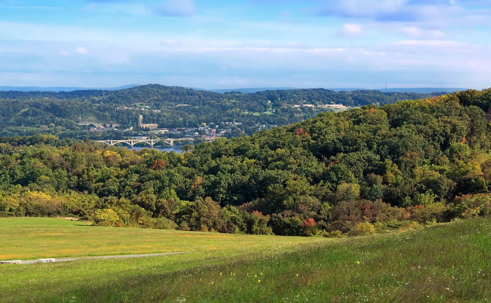
Photo: Nicholas A. Tonelli, CC BY 2.0 A grassy hilltop above Wrightsville, signed off Route 624 as it climbs from the river. From the top you look straight back across the Susquehanna to Columbia and the arches of the bridge you have just crossed, with the Lancaster County hills beyond. The Mason-Dixon Trail passes across the summit.
Tip: Early on a cool morning the river is often under fog; give it an hour and the view opens up.
The roadmiles 31–50
York County ridges and Lake Aldred
PA 425Indian Steps RoadPA 74Two-lane tarmac, rolling, with steep descents and climbsRoute 425 rolls south along farm ridges at around 700 feet, quiet and sweeping, then plunges through woods to the river at York Furnace at up to 11 per cent. Indian Steps Road follows the water past the museum and climbs back out at up to 12 per cent, the steepest pull of the day, tight and shaded, before Routes 425 and 74 take you over the highest ground of the ride, about 840 feet near Airville.
- 3mile 43.1
Sight
Indian Steps Museum
Allow 20–45 min
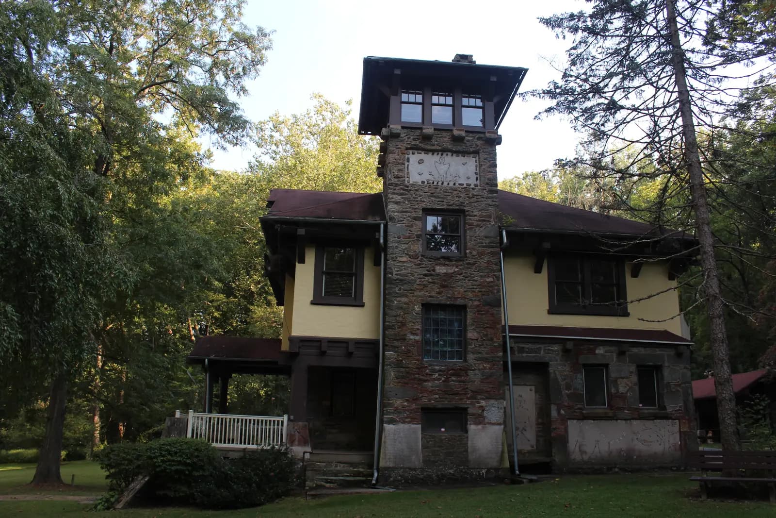
Photo: Adampricestudios, CC BY-SA 3.0 Route 425 drops through the woods to the river at York Furnace, and Indian Steps Road follows the shore of Lake Aldred past this odd and handsome house. A York judge, John Vandersloot, built it between 1908 and 1912 as a memorial to Native American culture, setting artefacts and inscriptions into its walls. It is a pleasant, shady place to stop by the water before the steep climb back up the ridge.
Tip: The museum opens only on limited days, mostly in the warmer months, so check before planning around a visit.
The roadmiles 50–61
Norman Wood Bridge and the east bank
PA 372River RoadBridge Valley RoadTwo-lane tarmac, steep and twistingRoute 372 drops to the Norman Wood Bridge and climbs steadily from the river to Holtwood. River Road then runs north along the Lancaster County bluffs, a switchback of short climbs and descents of up to about 11 per cent through woods and past farms, with the turn for the Pinnacle near the top. Bridge Valley Road winds down to the river at Pequea. Expect wet leaves and moss on the shaded corners well after rain.
- 4mile 52.4
Sight
Lock 12 Historic Area
Allow 20–30 min
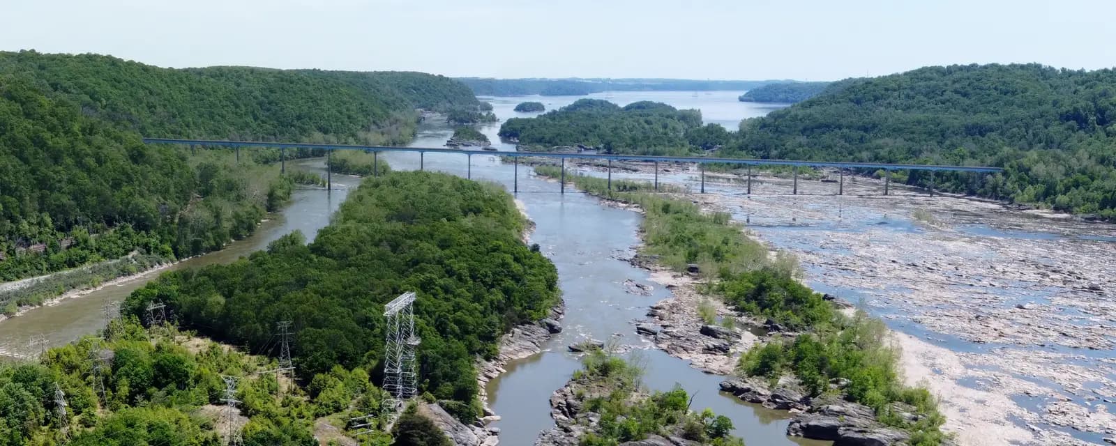
Photo: Dlthewave, CC BY-SA 4.0 At the York County end of the Norman Wood Bridge, the stone walls of Lock 12 survive from the Susquehanna and Tidewater Canal, which carried boats between Wrightsville and the Chesapeake Bay through much of the 19th century, lifting them past the river's falls in 28 locks. Beside it stands a rebuilt lime kiln from the canal era. Below you, the river spreads into a maze of rock channels and islands downstream of Holtwood Dam.
Tip: Turn off Route 372 at the York County end of the bridge, just before you cross; there is no stopping on the bridge itself.
- 5mile 56.6
ViewpointDetour
Pinnacle Overlook
Allow 20–30 minAbout 1 mile each way
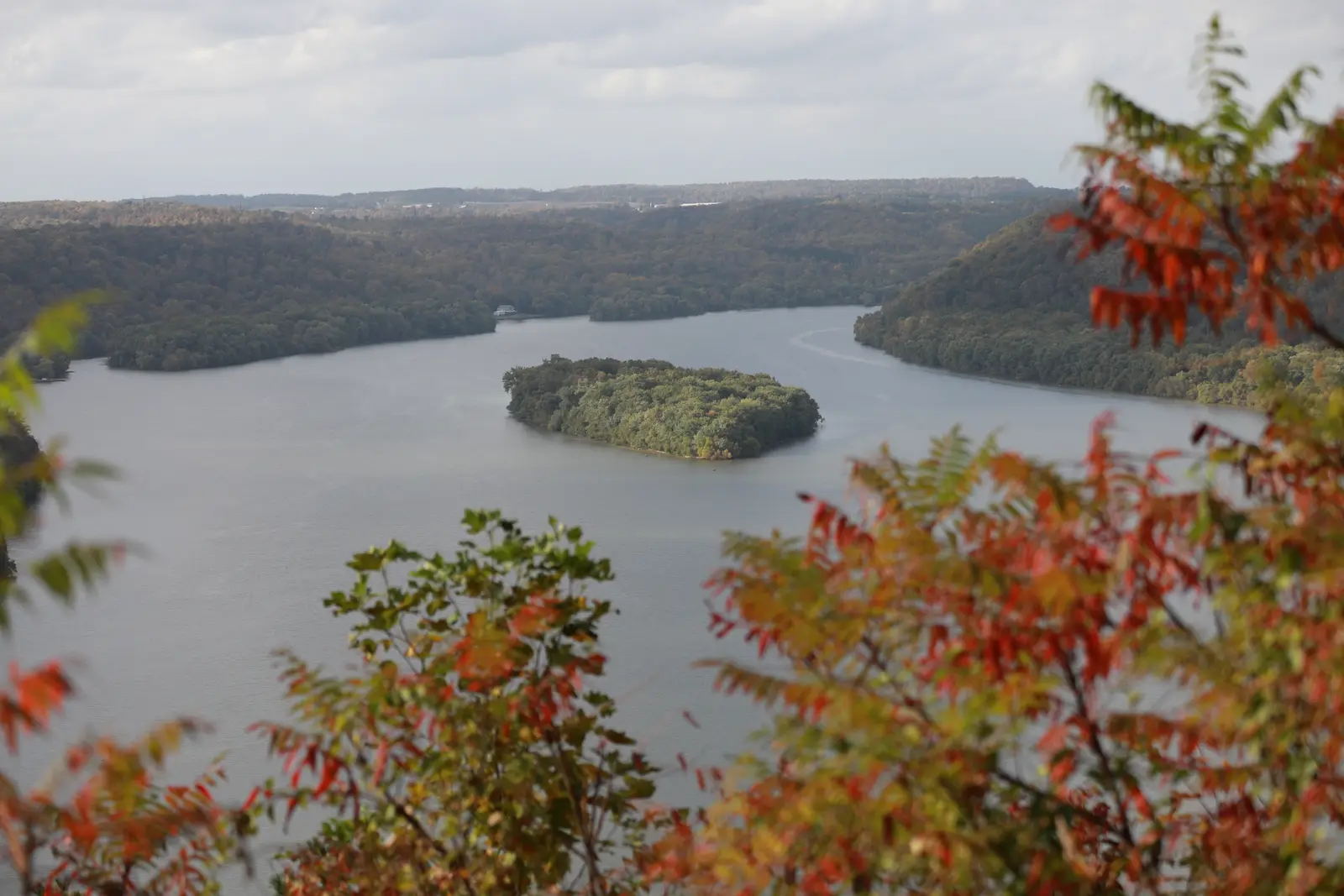
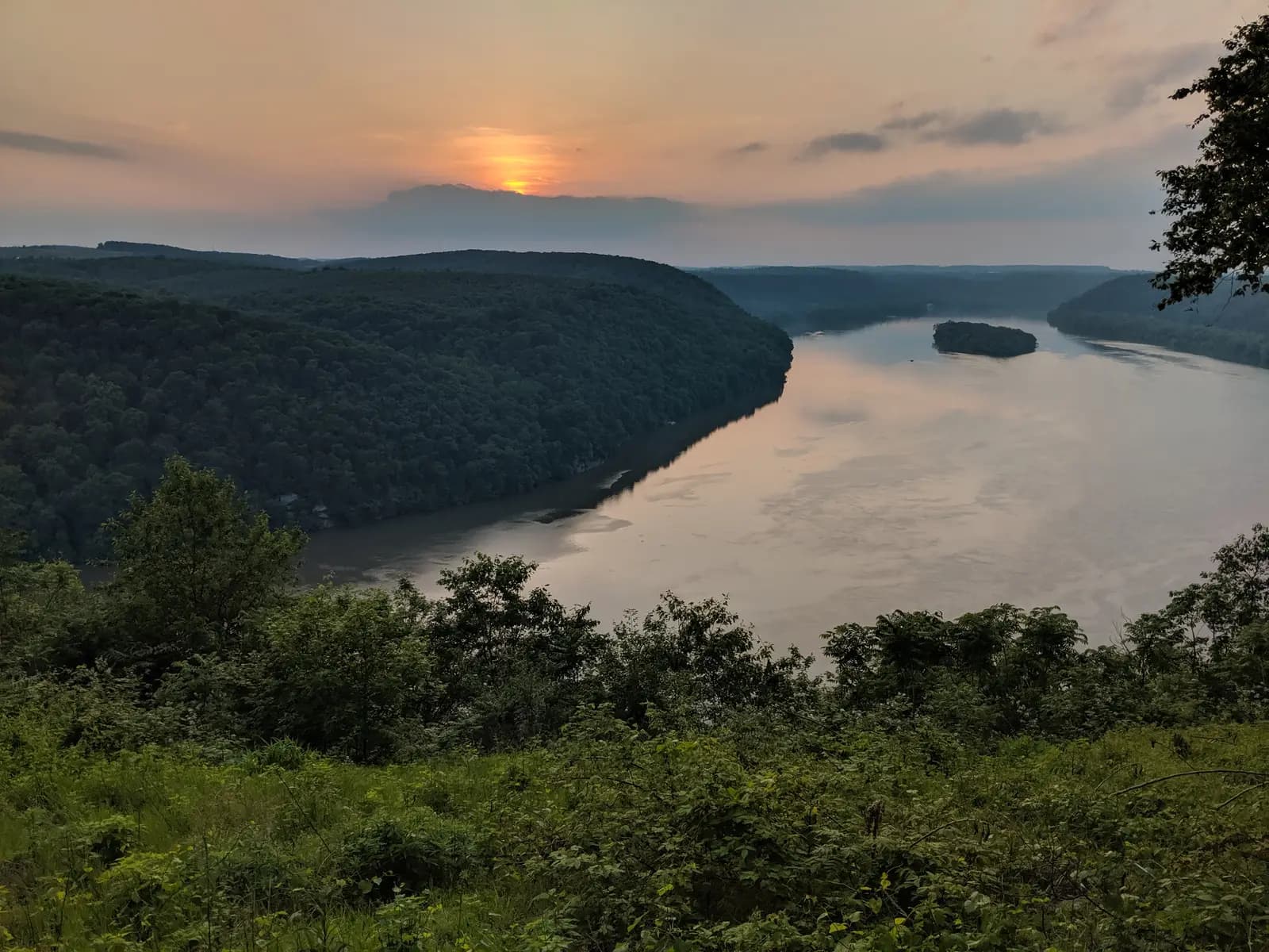
Photo: Thomas Herr, CC BY-SA 4.0 The finest view on the lower Susquehanna. From a rocky point high above Lake Aldred you look upriver along the gorge, the wooded hills dropping straight to the water and small islands strung down the middle. The Conestoga Trail passes through, and evening light from the west makes it the classic sunset spot of the River Hills.
Tip: Pinnacle Road West, the lane out to the overlook from River Road, is narrow and often has leaves and twigs on it; take it slowly.
The roadmiles 61–86
Pequea Creek and Amish country
PA 324Baumgardner RoadWest Penn Grant RoadLampeter RoadPA 741Lancaster AvenueStrasburg PikePA 462East Orange StreetTwo-lane tarmac, twisting then open farm roadsRoute 324 follows Pequea Creek upstream through a narrow wooded valley, past the Colemanville Covered Bridge and Martic Forge, with corners that tighten without warning. Above Marticville the country opens out, and farm roads lead east through Amish country to Strasburg: crests, blind farm entrances, buggies and steel-wheeled farm machinery. Fuel returns near Willow Street, about 71 miles in. Lancaster Avenue, Strasburg Pike and Route 462 then bring you back into the city.
- 6mile 76.9
Sight
Strasburg
Allow 30–60 min
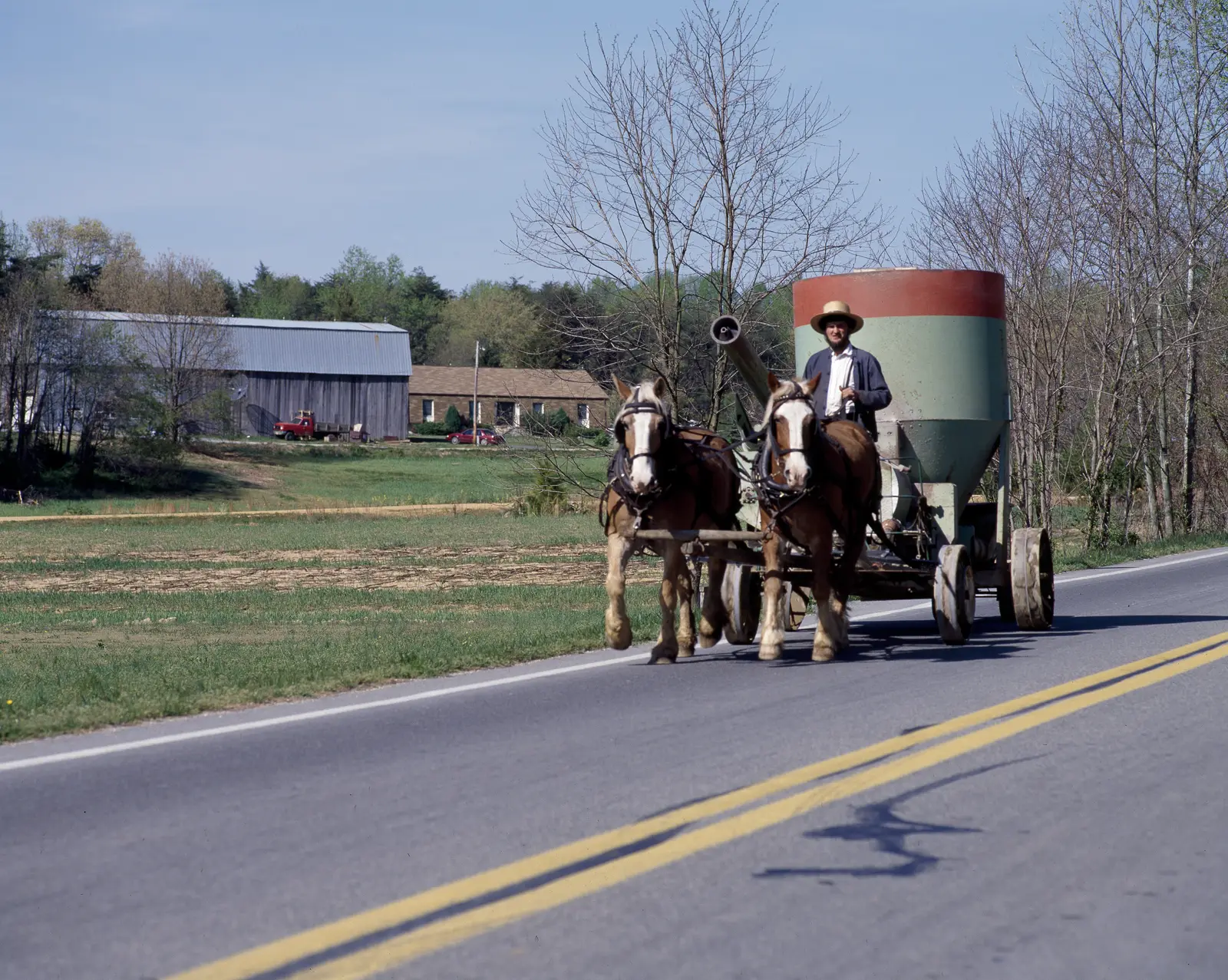
Photo: Carol M. Highsmith, Public domain The last miles cross the farmland of Lancaster County's Amish and Old Order Mennonite families: tidy barns, fields worked with horses, and grey-topped buggies on the road. Strasburg, an old village of brick and stone houses on Route 741, is the place to stop. A mile or so east of the centre on the same road, the steam trains of the Strasburg Rail Road, founded in 1832, and the Railroad Museum of Pennsylvania face each other.
Tip: Sunday mornings bring many buggies onto the roads around here; be patient behind them.
- 7mile 85.9
Finish
Penn Square
Strasburg Pike and Route 462 bring you back into the city through the old streets east of the square. Downtown Lancaster has plenty of places to eat within a short walk of the monument.
Before you ride
Licence and helmet
You need a motorcycle licence: a US licence with a motorcycle endorsement (class M), or for visitors a home licence that covers motorcycles, usually together with an International Driving Permit. Rental companies set their own rules on licences, age and insurance. Pennsylvania requires a DOT-compliant helmet unless you are 21 or older and have either held a motorcycle licence for at least two full years or completed a PennDOT-approved safety course; if you are visiting, simply wear one. Eye protection is required for every rider.
Horse-drawn buggies
Amish and Old Order Mennonite families travel by horse and buggy every day of the week, and in the dark grey buggies of Lancaster County are hard to see in shade, over crests and at dusk; look for the orange slow-moving-vehicle triangle. Close on them slowly, pass wide only where you can see well ahead, and keep the revs and the exhaust note down near horses, which can shy. Expect horse droppings and grooves worn by steel wheels on the road surface.
Fuel and phone signal
Fill up in Lancaster or Millersville. Between Millersville and the outskirts of Willow Street the route passes no station for 67 miles; Columbia and Wrightsville, at about 22 miles, are the places to detour if you need fuel. Mobile signal is weak or absent down in the river gorge at York Furnace and Lock 12, so carry an offline map.
When to ride
May, June, September and October are the best months, and late October brings the autumn colour to the River Hills. Midsummer is hot and humid, with afternoon thunderstorms. From December to March, shaded corners on the steep river roads can hold ice long after the open fields have cleared. There are no tolls on this route; PennDOT's 511PA site lists road works and closures.
Deer and road surface
Pennsylvania has a very large deer population, and the wooded river hills are full of them. Ride with extra care at dawn and dusk, above all in October and November. The descents to the river are steep and shaded, so watch for gravel, wet leaves and moss in the corners, and use engine braking rather than riding the brakes.
Weekends and local traffic
Strasburg, Route 741 and the roads east of Lancaster are busy with visitors at weekends and in summer, while the river roads stay quiet. On weekdays expect tractors, school buses and trucks on the farm roads. Much of the route is marked with a double yellow line; keep well right on blind corners, where oncoming cars often cut across.
Ride further
Liked riding this one on your own? Moto Mass lists small, local operators who run guided motorcycle tours in these countries.
Free ride routes