
Highlights
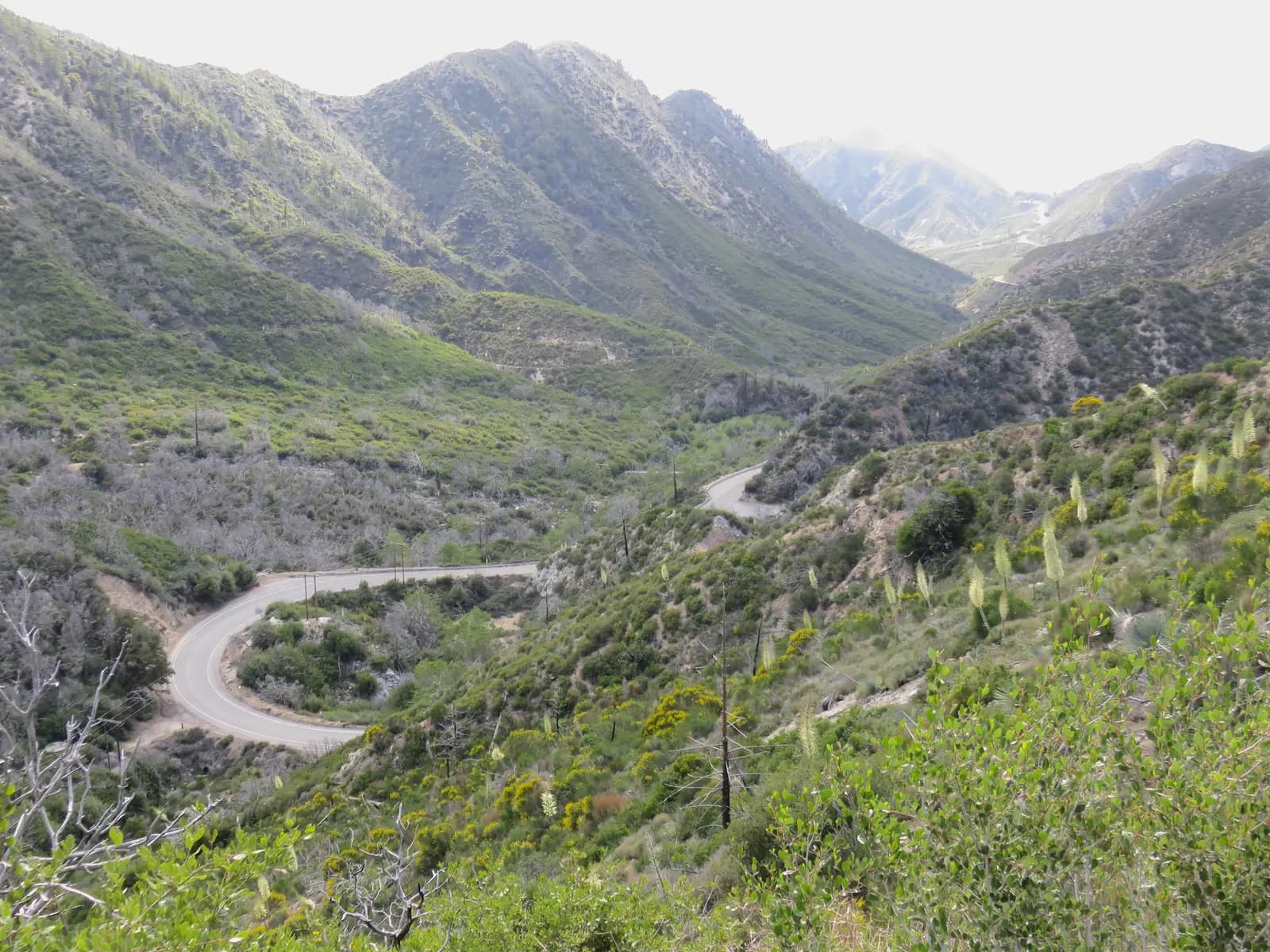
State Route 2 leaves the suburbs at La Cañada Flintridge and climbs straight into the San Gabriel Mountains. The Angeles Crest Highway is the road Los Angeles riders name first: well-engineered curves from chaparral to pine forest, rising from about 1,300 feet to almost 5,500. This loop rides it 27 miles to Newcomb's Ranch, the roadhouse where riders have met for decades, then turns back for 8 miles and drops home through two canyons: Upper Big Tujunga Canyon Road, a short stretch of Angeles Forest Highway, and Big Tujunga Canyon Road down to Sunland.
It is a half day for riders comfortable on mountain roads: 68 miles and about 7,100 feet of climbing, all paved, with only those 8 miles of the Crest ridden twice. The Crest punishes mistakes. It has a long record of serious motorcycle crashes and the California Highway Patrol watches it closely. Beyond Newcomb's Ranch the highway continues to Islip Saddle, Dawson Saddle, Vincent Gap and Wrightwood, but that section has had long closures for storm damage, rockslides and snow. When Caltrans QuickMap shows it open, it is worth riding as a longer day.
Longest stretch without a gas station: about 62 miles, between mile 0 and mile 62.
The ride, stop by stop
- 1mile 0
Start
Angeles Crest Highway at Foothill Boulevard
The Crest begins at this junction in La Cañada Flintridge, a few hundred yards from the Foothill Freeway (I-210) exit, with a gas station on the corner. Turn north and the climb starts almost at once; within a couple of miles the houses are gone and the city is spread out behind you.
Tip: Fill the tank here. There is no fuel on the loop until Sunland, about 61 miles away.
The roadmiles 0–14
Up from La Cañada
CA 2Two-lane highway, steady climbThe Crest gains about 3,300 feet in its first 14 miles on a steady grade, with long, well-sighted corners and turnouts for slower traffic. The houses are gone within a couple of miles and the city spreads out behind you. Expect cyclists on the climb and cars pulling out of the vista turnouts.
- 2mile 8.5
Viewpoint
Clear Creek Vista
Allow 10 min
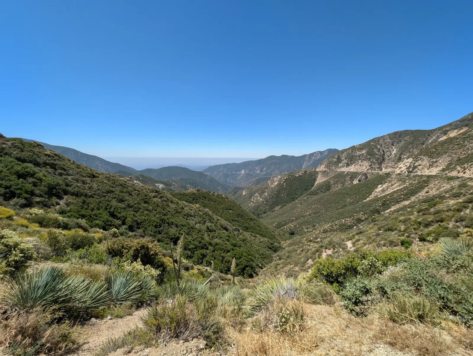
Photo: RuggyBearLA, CC BY 2.0 A turnout at about 3,600 feet where the first climb eases off and the view opens down the canyons towards the city. Just beyond it, at Clear Creek, Angeles Forest Highway (N3) forks left; keep right on the Crest. On the way home you join N3 further north, above Big Tujunga.
Tip: Pull right off the road to stop: traffic comes round the bend at speed.
- 3mile 14
Sight
Red Box
Allow 15 min, or 1 hour with Mount Wilson
A saddle at about 4,600 feet with a Forest Service station, a car park and the turn-off for Mount Wilson. The side road climbs about 5 miles each way to the summit, its broadcast towers and the historic Mount Wilson Observatory, with views over the whole Los Angeles basin on a clear day. If you skip it, Red Box is still the natural place to stretch after the first climb.
Tip: Mount Wilson Road is narrower and slower than the Crest. Allow an extra hour if you take it.
The roadmiles 14–27
Red Box to Newcomb's Ranch
CA 2Two-lane highway, fast sweepersThe road dips to about 4,400 feet, then climbs through pine forest past the Upper Big Tujunga turn-off (about 18½ miles in; you take it on the way back) and Chilao, topping out near 5,500 feet before Newcomb's Ranch. These are the fastest, most open corners of the day, and the ones where riders most often get it wrong. The limit is 55 mph and lower on signed curves, and the Highway Patrol is often here, especially at weekends.
- 4mile 26.5
Food
Newcomb's Ranch
Allow 30–60 min
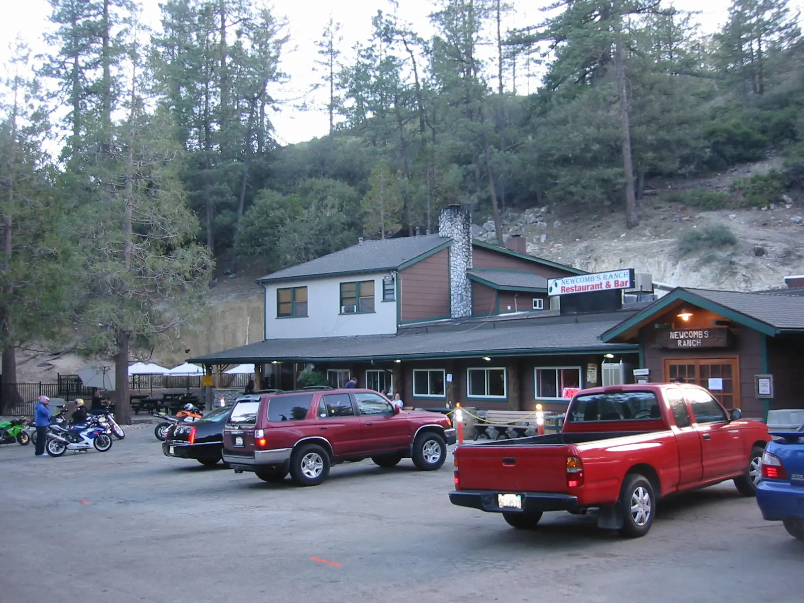
Photo: Tobin from Rochester, NY, USA, CC BY-SA 2.0 The roadhouse at about 5,300 feet has been the meeting point for riders on the Crest for decades. On weekend mornings its car park is often lined with motorcycles, and it is the only place on the loop to sit down with a coffee or a meal. It sits in pine forest just past the Chilao turn-off, and it is where this loop turns round.
Tip: Opening days vary and it has closed for long spells after fires and storms, so carry water and something to eat rather than counting on it.
The roadmiles 27–35
Back down the Crest
CA 2Two-lane highway, same road in reverseFrom Newcomb's you ride 8 miles back the way you came, over a short rise and then mostly downhill, to the Upper Big Tujunga Canyon Road junction. The corners you climbed now come at you faster; brake early and keep right in the blind ones. If the Crest is open beyond Newcomb's, you can instead continue east to Islip Saddle and Dawson Saddle, but check Caltrans QuickMap first: that section has been closed for long periods.
The roadmiles 35–44
Upper Big Tujunga Canyon Road
Upper Big Tujunga Canyon RoadTwo-lane county road, narrower and quieterUpper Big Tujunga Canyon Road drops about 1,300 feet in 9 miles, following the upper canyon down to Angeles Forest Highway. It is narrower and quieter than the Crest, with tighter corners, little traffic and few places to stop. Watch for rocks and gravel washed onto the road after rain.
The roadmiles 44–61
Angeles Forest Highway and Big Tujunga Canyon
N3 Angeles Forest HwyBig Tujunga Canyon RoadMount Gleason AvenueWide two-lane highway, then a canyon roadTurn left onto Angeles Forest Highway (N3) for 4½ miles. It is wide and fast and carries more through traffic than the Crest, so expect cars at speed. Then turn right onto Big Tujunga Canyon Road, which passes the dam overlook and follows the canyon down to Sunland, losing about 1,700 feet in 12 miles, with tight, rocky corners and fallen stones after rain. Mount Gleason Avenue takes you down to Foothill Boulevard.
- 5mile 50.4
Viewpoint
Big Tujunga Dam Overlook
Allow 10 min
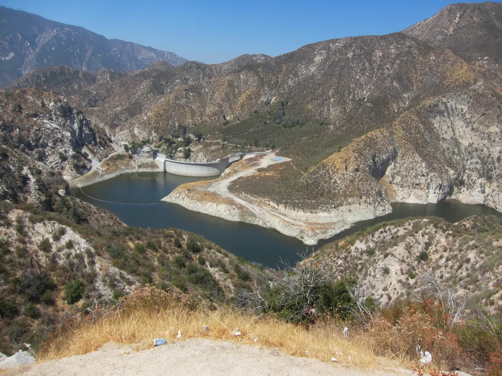
Photo: Shannon1, CC BY-SA 4.0 A pull-out above Big Tujunga Canyon looks down on a concrete arch dam from the early 1930s and the reservoir behind it, with bare, steep canyon walls on every side. It is the last view of the mountains before the road drops to Sunland.
Tip: The pull-out is on a bend; slow down early and check your mirrors before you turn in.
The roadmiles 61–68
Foothill Boulevard home
Foothill BoulevardCity streetsThe last 7 miles through Tujunga and La Crescenta are ordinary city riding, with traffic lights, turning cars and plenty of gas stations.
- 6mile 68.3
Finish
Angeles Crest Highway at Foothill Boulevard
Foothill Boulevard brings you back through Tujunga and La Crescenta to the corner where you started. The Foothill Freeway is a few hundred yards away if you are heading on across the city.
Before you ride
Licence and insurance
You need a motorcycle endorsement (Class M1 in California) on a US licence. Visitors need a home licence that covers motorcycles, usually with an International Driving Permit; rental companies set their own rules on age and experience. California requires liability insurance, so check what a rental includes.
Which bike
Any road motorcycle will do it; the whole loop is paved. Check your tyres and brakes before you go: there are several thousand feet of descent and no help nearby if something fails.
Fuel
There is no fuel on the Angeles Crest Highway or in the canyons. Fill up at the start; the next stations are on Foothill Boulevard in Sunland and Tujunga, about 61 miles on. Many pumps ask for a US ZIP code; with a foreign card, pay inside first.
Closures and when to ride
The Crest east of Newcomb's Ranch, past Islip Saddle and Vincent Gap to Wrightwood, has had long closures for storm damage, rockslides and winter snow, and wildfires have closed parts of the forest for months at a time. Upper Big Tujunga Canyon Road can also close after fires or storms, and Angeles Forest Highway and Big Tujunga Canyon Road have had weekday daytime closures for repair work. Check Caltrans QuickMap for CA 2, the Los Angeles County Public Works road closures list for the county roads, and the Angeles National Forest alerts page before you leave; when the high section is open, it is a fine extension. Spring and autumn are best. Summer is hot in the canyons, and winter can bring snow and ice on the Crest around Newcomb's.
Enforcement and safety
The Highway Patrol enforces the Crest closely, and the limit is 55 mph at most. Running wide in a corner is the classic mistake here, and cars cut blind turns too, so keep right. California requires helmets for riders and passengers. Lane splitting is legal in California, though there is little call for it on this loop. A weekday morning is the quietest time to ride.
In the mountains
Phone coverage is patchy to absent for most of the mountain roads, so download offline maps and tell someone your route. Watch for deer at dawn and dusk and for rocks on the road. Parking at some developed sites in the forest, such as trailheads and picnic areas, may require a recreation pass; check before you ride.
Ride further
Liked riding this one on your own? Moto Mass lists small, local operators who run guided motorcycle tours in these countries.
Free ride routes