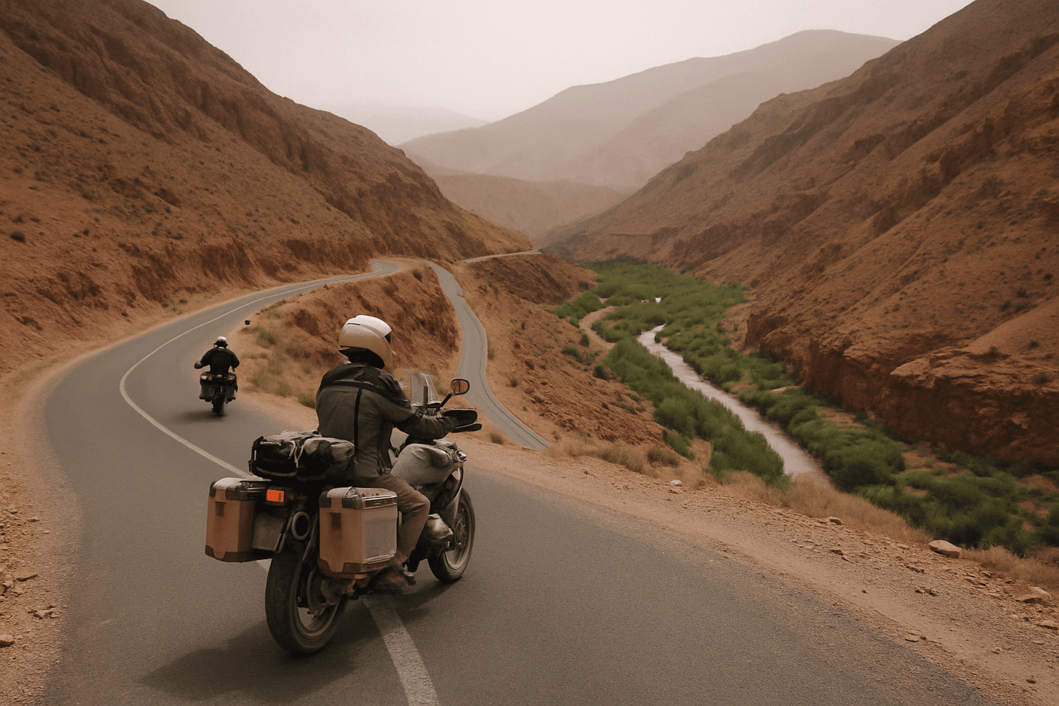
East Project Enduro Circuit – 5 Days from Marrakech
Marrakech, Morocco
5 days
€1,300 / person

Marrakech's easiest escape into the High Atlas: up the gorge to Asni, across a high farming plateau with the snow peaks in front of you, and down to a lake for lunch. Tarmac nearly all the way.
From the rooftops of Marrakech the High Atlas looks close enough to touch, and this is the ride that takes you there and back before dinner. The loop leaves the medina by the Kasbah gates, crosses the olive groves of the Haouz plain and climbs through the gorge below Moulay Brahim to Asni, the market town at the mouth of the Imlil valley. From there a quiet provincial road, RP2024, doubles back over the Kik plateau, a high, open stretch of wheat fields and Berber villages with the Toubkal massif filling the southern skyline, before dropping to the reservoir at Lalla Takerkoust and running home across the plain.
It suits riders who want real mountain scenery without a full mountain day: the climbs are steady rather than savage, and the busiest road is the first one. The route is paved almost throughout, with one short stretch above the lake mapped as gravel, so a rented 125–250 cc bike will manage it. If you have the time and the legs, the side trip from Asni up to Imlil, the village at the foot of Toubkal, is the finest piece of road in the area.
Longest stretch without a fuel station: about 58 km, between km 31 and km 90.
Start
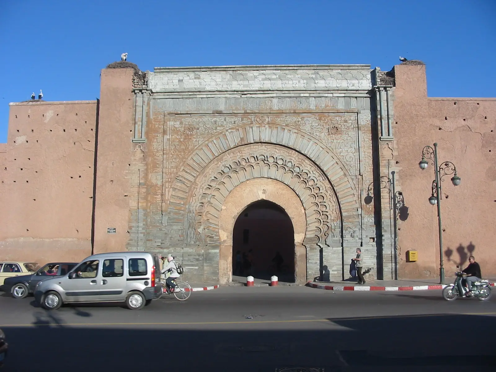
The carved stone gate of the Kasbah, beside the Saadian Tombs, is the most recognisable meeting point on the south side of the medina, and it puts you a few hundred metres from Bab Er-Robb, the gate the road to Asni leaves by. Set off early: the traffic out of the city is lightest before 8 am, and you will be in the mountains before the heat builds.
Tip: There are fuel stations on the way out of the city and in Tahannaout; fill up there, because there is none after that until the plain north of the lake.
The roadkm 0–30
Leave the medina through Bab Er-Robb and follow Boulevard Résidence Royale onto RN7, which runs dead straight across the plain through olive groves, climbing so gently you barely notice it. Traffic is heavy on the edge of the city and lorries, buses and shared taxis overtake hard all the way; keep right and leave space. There are plenty of fuel stations on this stretch.
The roadkm 30–46.7
RN7 passes through Tahannaout, the last town with fuel on the loop, then enters the mountains and climbs through the gorge below Moulay Brahim. The corners are wide and well surfaced, but expect slow lorries on the climb, police checks at the town entrances, and rebuilding work in the villages. The loop leaves RN7 at the RP2024 junction just before Asni.
SightDetour
Allow 1–2 hours with the rideAbout 17 km each way from the RP2024 junction, through Asni
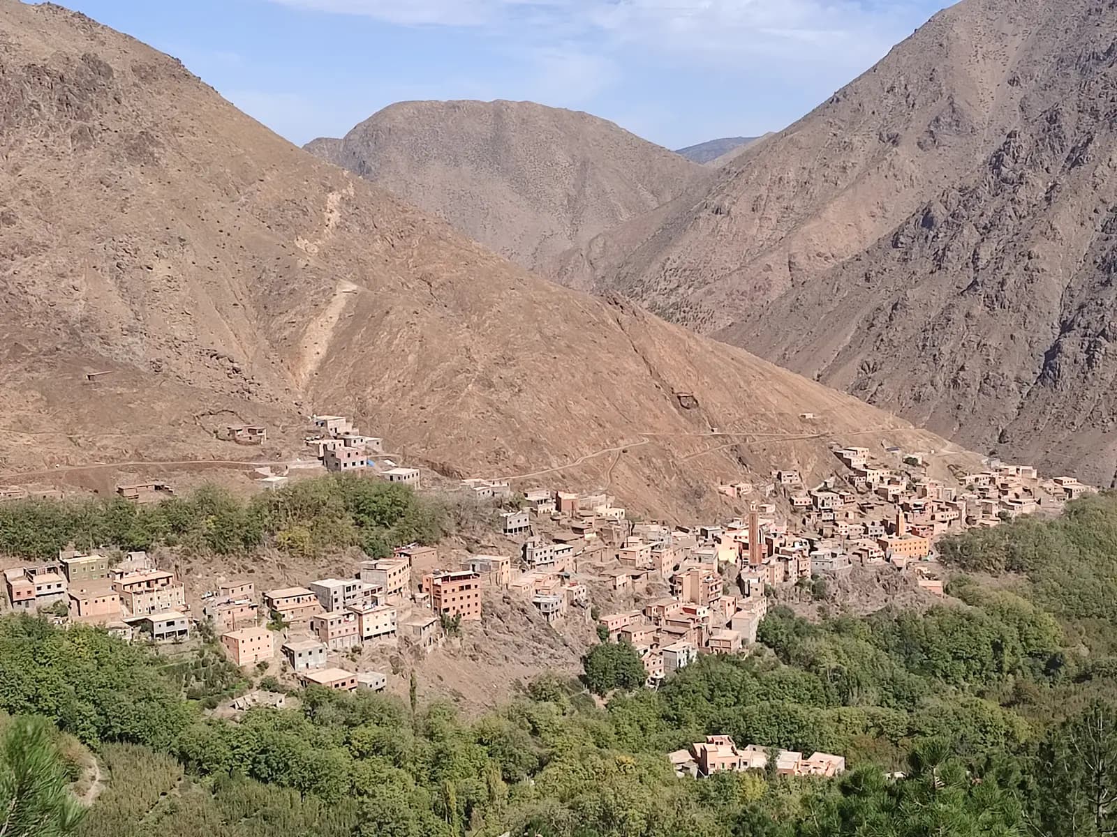
The road south from Asni, RP2030, follows the Rheraya valley up to Imlil, the trailhead for Jebel Toubkal, the highest mountain in North Africa. It is paved all the way, narrow and climbing, with terraced fields and stone villages stacked on the slopes. It turns a half-day loop into a full day, but it is the most dramatic road anywhere near Marrakech.
Tip: Allow at least an extra hour, ride back down in a low gear, and turn round in the village rather than following the tracks beyond it.
The roadkm 46.7–64
RP2024 doubles back north, climbs through Moulay Brahim and comes out onto the Kik plateau, the highest part of the loop at a little over 1,300 metres. The road is narrower and quieter than RN7, running through farmland and small villages with the snow peaks to your left. Watch for livestock, children and farm vehicles, and for loose stones on the bends.
CoffeeDetour
Allow 30 minAbout 1.5 km each way on RN7
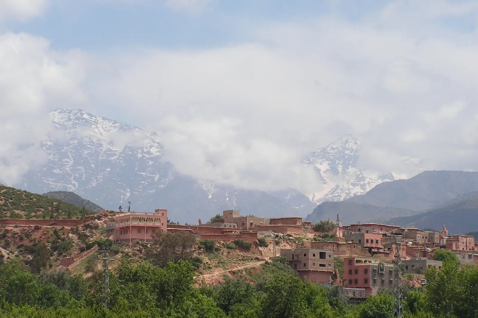
A small market town where the Imlil valley opens out, with orchards along the river and the high peaks behind. Its weekly souk on Saturday draws people down from the surrounding villages, and the roadside cafés make it the natural first break of the day.
Tip: The loop turns off onto RP2024 just before the town; ride on into Asni for your break, then come back to the junction.
Sight
Allow 15 min
RP2024 climbs back north from the Asni junction to this hillside town, built around the shrine of the saint it is named after and one of the best-known pilgrimage places in the region. Below it, the gorge you rode up on RN7 cuts through the first ridge of the Atlas.
Tip: The streets through town are narrow and busy with pedestrians and minibuses; take it slowly.
Viewpoint
Allow 15 min
The western edge of the Kik plateau, where the road tips over towards the lake. A paragliding launch sits on the ridge just above the road, and the view takes in the line of the High Atlas to the south and the Haouz plain stretching away towards Marrakech. It is the best place on the loop to stop and look back at where you have been.
Tip: The descent that follows is long and winding; check your brakes have cooled after the plateau and use the gears.
The roadkm 64–79.6
From the plateau edge the road winds down to the reservoir at Lalla Takerkoust, dropping about 500 metres by the time you reach the water. Take the corners in a low gear. A short stretch around km 71 is mapped as gravel: slow down and ride it upright. The road then runs past the lake to the village and the dam.
Food
Allow 1 hour with lunch
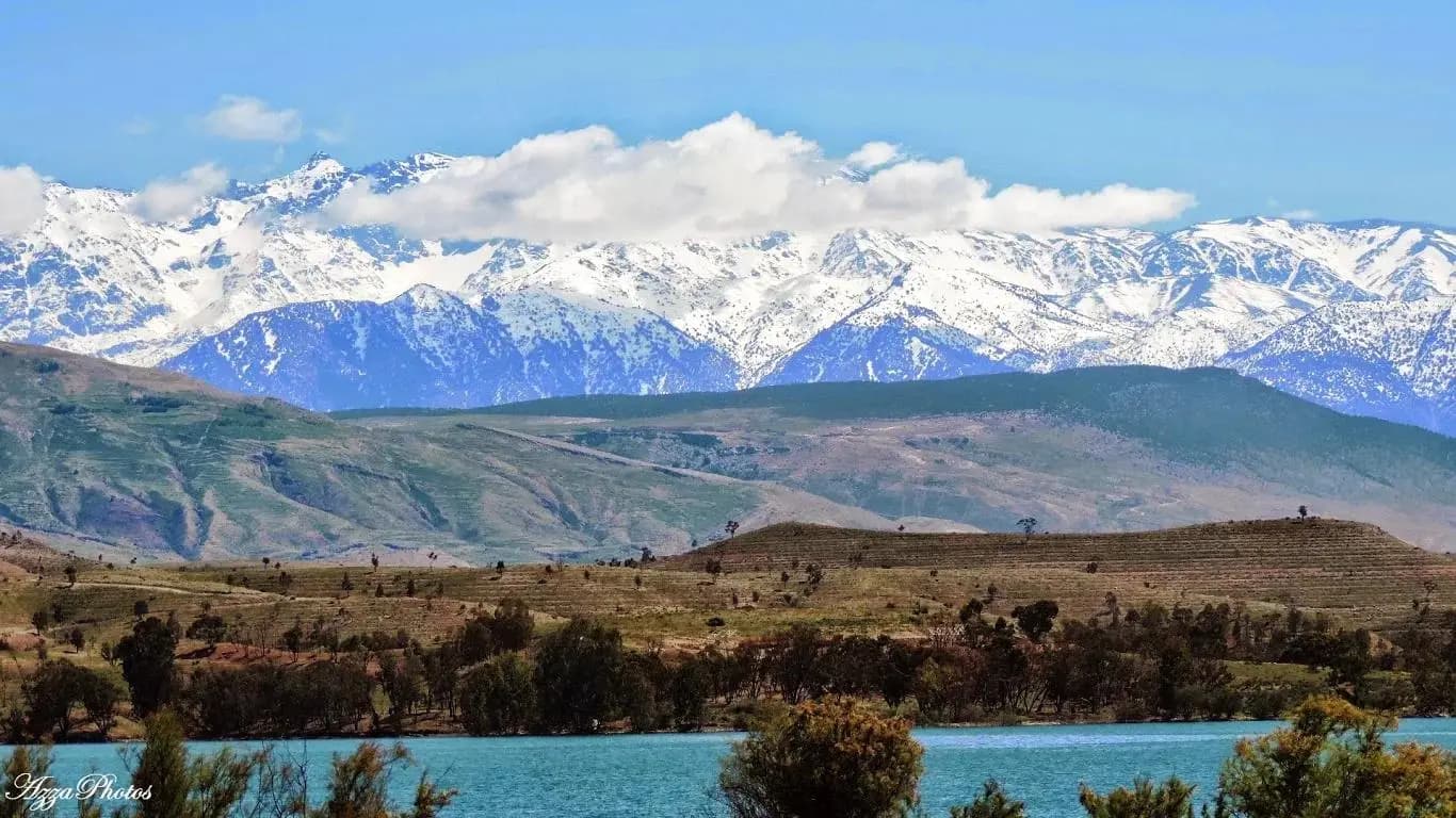
A reservoir behind a dam on the N'Fis river, with the mountains you have just crossed rising behind the water. Cafés and restaurants sit near the shore around the village, which makes it the lunch stop of the ride. The water level rises and falls a long way with the year's rainfall, so the shoreline can be far from the road after a dry winter.
Tip: Most restaurants sit on side tracks down to the shore; park where the surface is firm.
The roadkm 79.6–114.2
RP2009 heads north-east across the plain, fast and straight, with fuel again from km 89. It joins RN7 on the outskirts of Marrakech, and the last few kilometres retrace the road you left by in the morning. Traffic thickens towards the city in the late afternoon.
Finish
The loop comes back into the city on the same road you left by and finishes at Bab Er-Robb, the city gate a few steps from Bab Agnaou where you started. Jemaa el-Fnaa is a short walk north once the bike is parked, and by late afternoon its food stalls are setting up.
Bring your home licence with a motorcycle category, and an International Driving Permit covering motorcycles alongside it; it is generally required for visitors and police may ask for it. Check that your travel insurance covers riding a motorcycle of the size you rent, and carry the bike's papers with you.
A 125 cc scooter will make it round solo, but a 150–250 cc motorcycle is much happier on the climb to Asni, two up, and on the Imlil detour. Check the brakes and tyres before you leave: the descent from the plateau to the lake is long.
There are plenty of stations on the way out of Marrakech and in Tahannaout, around km 30. After that there is no station on the loop for nearly 60 km, until the plain north of the lake, and none on the Imlil detour. Leave Tahannaout with a full tank, especially if you are riding to Imlil.
Spring and autumn are best: March to May, and October and November. Summer heat on the plain is fierce, so ride early if you go then. In winter the high peaks are snow-covered and beautiful, but the plateau is cold, days are short and heavy rain can wash mud and stones across mountain roads.
Police and gendarmerie checkpoints are frequent on Moroccan roads, often at the entrance to towns, and speed checks with radar are common; slow down for them and have your papers ready. The September 2023 earthquake struck Moulay Brahim, Asni and Imlil hard, and rebuilding has been going on since: expect roadworks, lorries and the odd temporary diversion.
Morocco drives on the right, and helmets are compulsory for rider and passenger. RN7 out of Marrakech is busy with lorries, buses and shared taxis that overtake hard; on the plateau and around the lake, watch for donkeys, flocks of sheep, cyclists and children by the road in every village.
These operators run guided tours from Marrakech, listed alphabetically. Contact any of them through Moto Mass.
Marrakech, Morocco
5 days
Marrakech, Morocco
3 days

Morocco, Morocco
10 days

Morocco, Morocco
5 days

Moroccan Mountains, Morocco
6 days
Morocco, Morocco
14 days
Free ride routes