

High Atlas Mountains Tour – 6 Days from Ouarzazate
Ouarzazate, Morocco
6 days
€1,450 / person

Ouarzazate's classic day ride: the earthen ksar of Aït Benhaddou, the red gorges of the Ounila valley and the Glaoui kasbah at Telouet, then home down the N9 from just below Tizi n'Tichka. Tarmac all the way.
Before the French built the road over Tizi n'Tichka, caravans crossing the High Atlas between Marrakech and the Sahara came down the Ounila valley, past Telouet and Aït Benhaddou. This loop rides that old route uphill from Ouarzazate: the ksar of Aït Benhaddou, a string of earthen villages along a river that has cut a red canyon through the hills, and the kasbah of the Glaoui family at Telouet. From there a mountain road climbs to the N9 just below the pass, and the main road carries you back down to the desert edge.
The ride climbs from about 1,100 metres to a little under 2,200, so the air on top is cooler than in town. The Ounila valley road is now paved the whole way, but it is narrow, with sand and stones on the corners and few places to stop for help; the N9 home is a wide, fast main road shared with trucks and buses. A rented 125–250 cc motorcycle copes well. It suits riders who are happy with a long day, mountain corners and a 70 km stretch without fuel.
Longest stretch without a fuel station: about 71 km, between km 9 and km 80.
Start
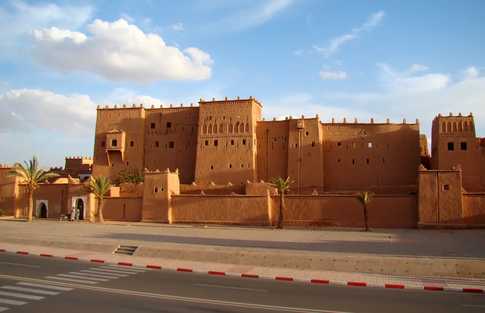
The long earthen walls and towers of Taourirt, once a Glaoui family kasbah, stand on the main avenue at the eastern end of Ouarzazate's centre and are the easiest landmark in town to meet at. Set off early: the light is soft, the road west is quiet and in the warmer months the heat builds fast after mid-morning.
Tip: Fill up before you leave town. After the stations on the western edge of Ouarzazate there is no fuel for about 70 km.
The roadkm 0–23
The N10 heads west out of town across a flat, stony plateau, past the film studios on the edge of Ouarzazate. It is straight and fast, with trucks, buses and minibuses. Gendarmerie checkpoints are common at the edge of town. The last fuel stations before Telouet are in the first 9 km.
The roadkm 23–40
At Tabouraht the RP1506 turns north and runs gently up to Aït Benhaddou, then on past Tamdaght with the river gardens below the road. Watch for tour minibuses turning in and out, pedestrians and children in the villages, and dogs.
Sight
Allow 1–2 hours
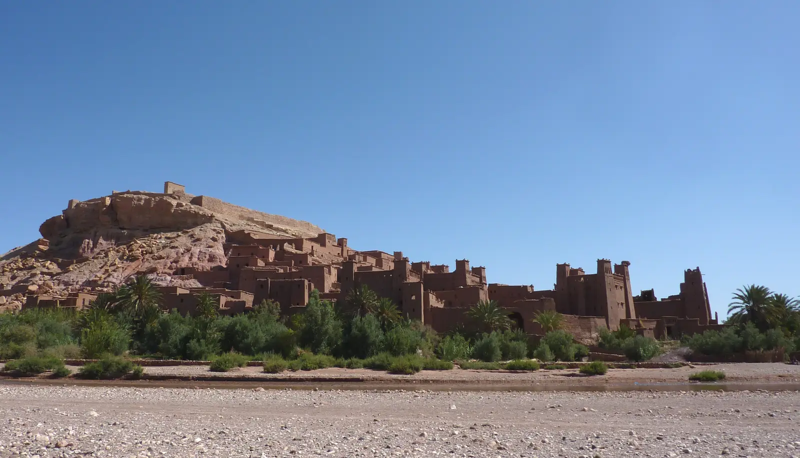
A fortified ksar of earth-built houses and towers stacked up a hillside above the Ounila river, on the old caravan route between the Sahara and Marrakech. It is a UNESCO World Heritage Site and one of the most filmed places in Morocco. The road runs through the newer village on the opposite bank; walk across the river and climb the lanes to the ruined granary at the top for the view over the valley.
Tip: Leave the bike in the new village and cross on foot. Mornings are quieter and cooler than the middle of the day, when tour groups arrive from Marrakech.
Sight
Allow 15–30 min
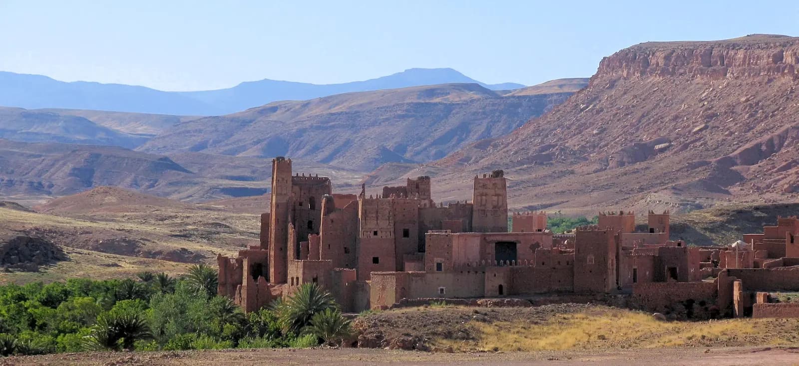
A few kilometres up the valley, the crumbling kasbah of Tamdaght rises beside the road with storks nesting on its towers and the river gardens below. It is far quieter than Aït Benhaddou and a good place to see how these earthen buildings weather when nobody repairs them.
Tip: The walls are fragile mud brick; look from outside rather than climbing on the ruins.
The roadkm 40–79
The road climbs steadily up the valley from about 1,350 to over 1,800 metres, through Anmiter and a string of earthen villages, often along the rim of the gorge. It is narrow, and the corners collect sand, gravel and fallen stones, especially after rain. Traffic is light, but meet oncoming vans and trucks with room to spare. There is no fuel on this stretch.
Viewpoint
Allow 10–15 min
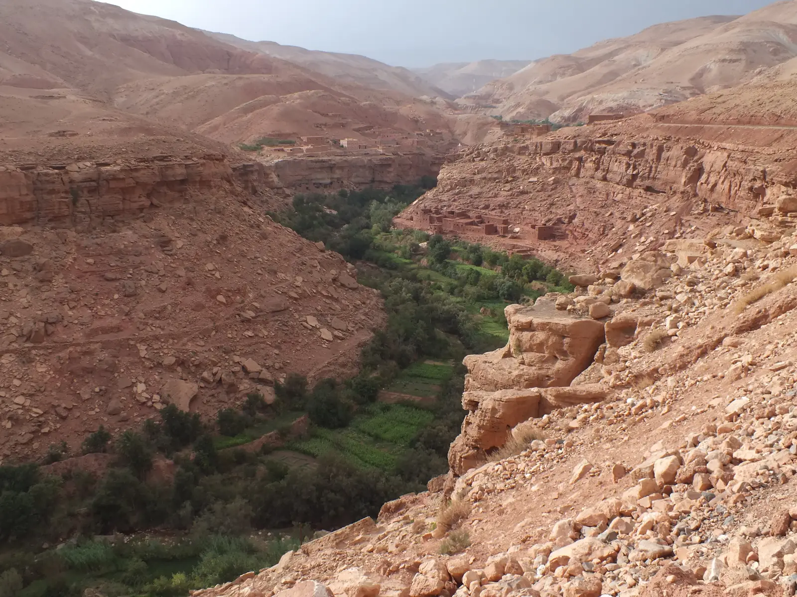
Above Tamdaght the valley narrows and the road runs along the rim of a canyon the Ounila river has cut through red rock. Far below, a ribbon of trees and terraced fields follows the water, while everything above it is bare stone. Pull over where the road widens and look down.
Tip: Stop only where you can get fully off the road; the valley road is narrow and drivers coming the other way do not expect parked bikes on a bend.
Sight
Allow 1–1½ hours with lunch
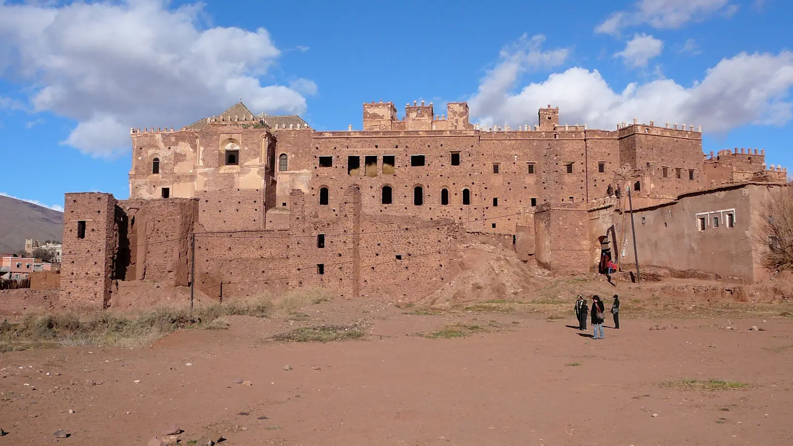
The seat of the Glaoui family, who controlled the caravan route over the High Atlas and ruled much of southern Morocco in the first half of the twentieth century. From outside it is a sprawl of collapsing earthen walls; inside, a few reception rooms survive with painted cedar ceilings, carved plaster and tiled walls. The village below has simple restaurants and is the natural lunch stop.
Tip: An entry fee is charged at the kasbah. Telouet has the only fuel between Ouarzazate and the N9, but leave town with a full tank rather than rely on it.
The roadkm 79–98
From Telouet the RP1506 climbs west through open, bare mountains to meet the N9 at about 2,100 metres. The air is noticeably cooler and it can be windy. The surface is generally sound, but expect loose stones and patched sections.
The roadkm 98–159
The highest point of the loop, just under 2,200 metres, comes a couple of kilometres after the junction. Then the N9 sweeps down through Ighrem n'Ougdal, Agouim and Amerzgane, losing nearly 1,000 metres. It is the main road between Marrakech and the south: smooth and wide, but busy with trucks, coaches and fast cars overtaking on the bends. Fuel stations return between Ighrem n'Ougdal and Agouim.
ViewpointDetour
Allow 15–20 minAbout 3.5 km each way, north up the N9
Where the Telouet road meets the N9, the loop turns left and heads home. Turn right instead and a short climb brings you to Tizi n'Tichka, the pass that carries the main road between Marrakech and the south over the High Atlas. Stalls at the top sell fossils and minerals, and the view opens north over the folded mountains towards Marrakech.
Tip: From December to February snow can fall here and the pass is sometimes closed for a day or two; check conditions in Ouarzazate before you ride.
The roadkm 159–185.5
The N9 joins the N10 and you ride the morning's road back east across the plateau into town. With the sun behind you in the late afternoon it is an easy cruise, but stay alert at the checkpoint and the roundabouts on the way in.
Finish
The N9 runs down through Agouim and Amerzgane, joins the morning's road and brings you back into Ouarzazate past the walls of Taourirt. In the late afternoon the low sun turns the kasbah walls deep orange.
Bring a full licence that covers motorcycles. An International Driving Permit alongside your home licence is generally required or recommended for foreign riders, so carry both, plus your passport and the bike's papers. Check that your rental includes insurance and that your travel insurance covers motorcycling.
A 125–250 cc motorcycle is plenty, and a small trail bike is ideal for the narrow valley road and its loose corners. A scooter will manage the tarmac, but the climb to over 2,000 metres is long and the N9 is fast, so something with more power is more comfortable, especially two up.
Fill up in Ouarzazate. After the stations on the western edge of town, the only fuel before the N9 is in Telouet, around km 80; don't count on it. On the N9 there are stations again from a few kilometres past Ighrem n'Ougdal. Carry water as well: shade and shops are scarce in the Ounila valley.
Spring (March to May) and autumn (September to November) are the best times. In summer Ouarzazate is very hot, often near 40 °C in the afternoons, so ride early. Winter days are often clear and pleasant in the valleys, but cold at altitude, and snow can fall on the high ground near the N9 between December and February. Heavy autumn storms can wash mud and stones onto the valley road.
Gendarmerie checkpoints are frequent on Moroccan main roads, usually at the edges of towns and at junctions. Slow right down at the stop sign, stop if waved over, and have your licence, passport and the bike's papers ready. Speed checks are common on the N9 and N10.
Morocco drives on the right. Helmets are compulsory for rider and passenger. Expect pedestrians, donkeys, sheep, goats and dogs on the road through the villages, and children who run out to wave. On the N9, trucks and coaches are slow on the climbs and fast on the descents, and cars overtake on blind bends; keep well to the right.
These operators run guided tours from Ouarzazate, listed alphabetically. Contact any of them through Moto Mass.
Ouarzazate, Morocco
6 days

Morocco, Morocco
16 days
Ouarzazate, Morocco
7 days

Morocco, Morocco
5 days
Morocco, Morocco
14 days
Free ride routes