5 Days Motorcycle Tour from Merzouga to Zagora
Merzouga, Morocco
5 days
$2,520 / person

North from Errachidia up the valley of the Ziz: over the shoulder of the Hassan Addakhil lake, down into palm-filled narrows and through the Legion's tunnel to the mountain town of Rich. An out-and-back on good tarmac, with the gorge seen twice in different light.
Most riders pass through Errachidia on their way south to the dunes, but the best road from the town runs the other way. The Ziz river, which feeds the long string of oases down to Erfoud and Rissani, comes out of the High Atlas through a series of red-rock narrows north of town. The N13 follows it: past the reservoir held back by the Hassan Addakhil dam, through a valley of palm groves and earthen villages, and into the gorge, where the road goes straight through a spur of rock in a short tunnel cut by soldiers of the French Foreign Legion. Beyond it the valley opens out and climbs gently to Rich, a market town ringed by bare mountains, where you turn round for lunch.
This is an out-and-back on the same road, and it is better for it: you see the gorge in soft morning light on the way up and in warmer afternoon light on the way home. The N13 is the main road between the Tafilalet and Midelt, so it is paved and well kept throughout, with moderate traffic including trucks and buses. The climbs are gentle, from about 1,000 metres in Errachidia to just over 1,300 at Rich. A rented 125–250 cc motorcycle copes easily, and the ride suits anyone who wants a relaxed half day of mountain scenery before or after the desert. The dunes of Erg Chebbi at Merzouga are a separate trip far to the south and are soft sand, not for road bikes.
Longest stretch without a fuel station: about 40 km, between km 9 and km 48.
Start
Errachidia's main avenue crosses the Ziz on a bridge at the eastern side of the centre, and it is the easiest place in town to meet. The town, once called Ksar es Souk, is the administrative capital of the Tafilalet, the oasis region where Morocco's ruling Alaouite dynasty has its roots. Head west along the avenue and turn north onto the N13 at the edge of town.
Tip: Fill up on the way out of town: the stations on the N10 and the start of the N13 are the last for about 40 km.
The roadkm 0–9
The N10 runs west along the avenue through town, then the N13 turns north past El Khank. Expect cars, taxis, bicycles and pedestrians on the avenue and a gendarmerie checkpoint on the edge of town. Several fuel stations line this stretch; the last before the gorge is around km 8.
The roadkm 9–30
The road climbs steadily from about 1,080 metres to a little over 1,300 on a bare ridge east of the reservoir, with long sweeping bends, then drops again to the river at about 1,160 metres. Crosswinds can be strong on the open ridge, and sand blows onto the road on the exposed corners.
Viewpoint
Allow 15 min
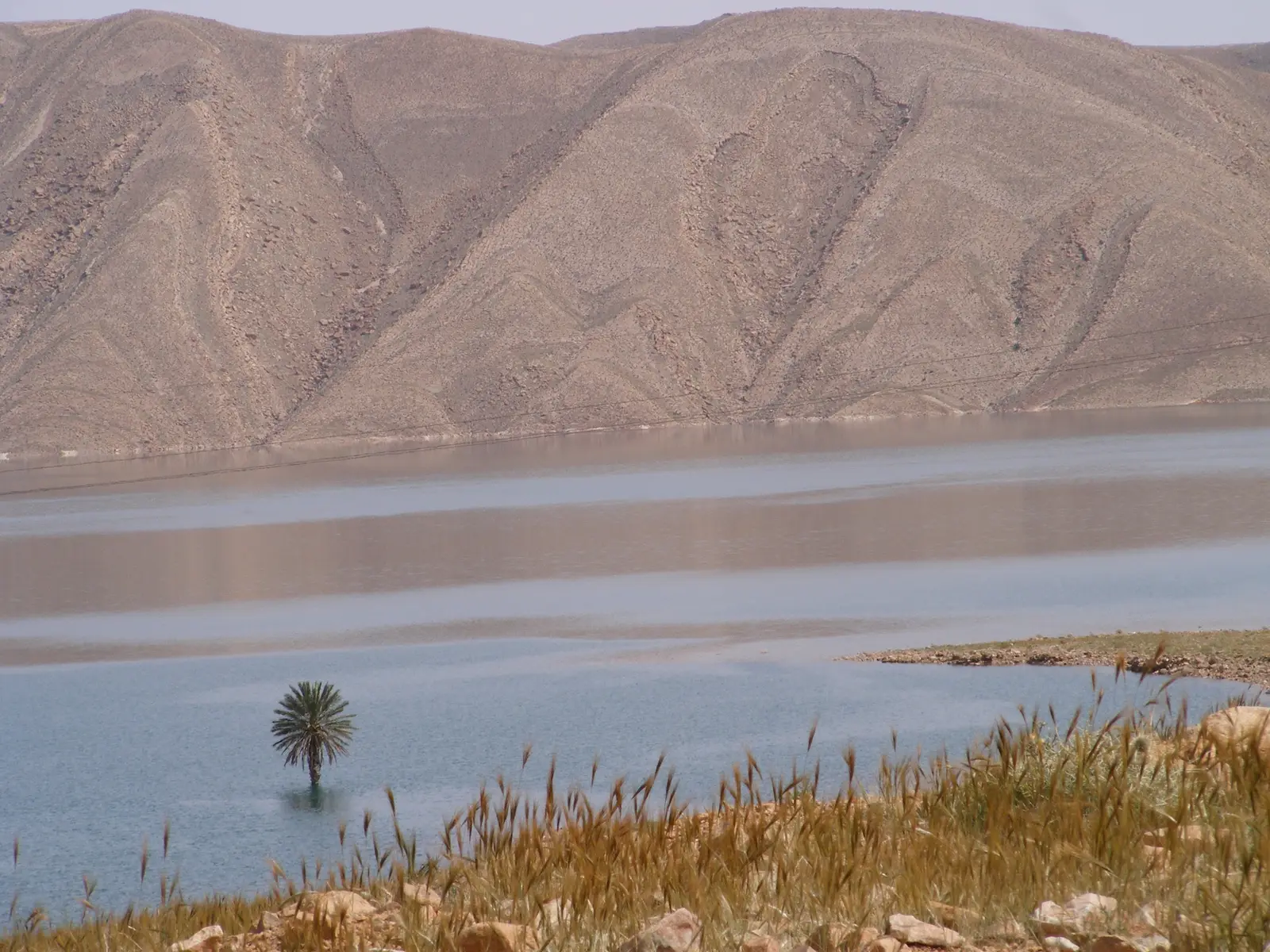
North of El Khank the N13 climbs over a bare ridge above the reservoir of the Hassan Addakhil dam, which stores the Ziz's floodwater for the oases downstream. Near the top of the climb, the highest part of the ride, you look down on the lake lying among brown, folded hills. The water level changes a great deal from year to year, and after dry winters the lake can shrink well back from the old shoreline.
Tip: Pull fully off the road at the viewpoint; trucks come over the crest at speed.
Viewpoint
Allow 10–15 min
Coming down off the ridge, the road meets the river again above the lake, and the view opens up the valley: a band of date palms and small fields along the water, earthen villages at its edges, and bare rock on either side. It is the clearest picture on the ride of how a desert river supports life in this region.
Tip: Stop on the way up: in the morning the sun lights the valley from the side and the palms stand out against the rock.
The roadkm 30–50
The N13 follows the river through palm groves and villages, then into the gorge, where it is cut into the rock above the water with low stone walls on the drop side. The tunnel comes at about km 43. Bends are tighter here and visibility is limited, so watch for trucks cutting corners and for fallen stones after rain. Fuel stations appear again from around km 48.
Sight
Allow 20–30 min
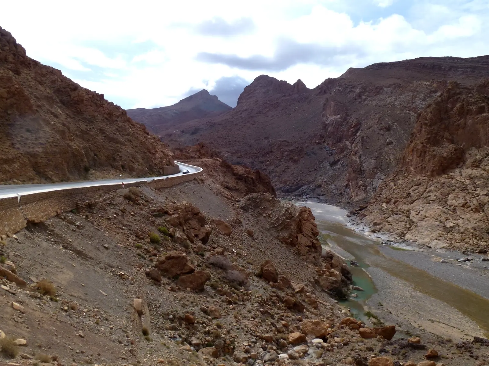
In the narrowest part of the gorge, the road goes through a spur of rock in a short tunnel instead of following the river round it. It was cut by soldiers of the French Foreign Legion when the road was built during the colonial period, which is how it got its name. Just beyond it there is a viewpoint where you can look back down on the river looping round the spur below steep red walls.
Tip: The tunnel is short and narrow, with a 40 km/h limit; lift your sunglasses before you go in and never stop inside.
The roadkm 50–67.6
Past the gorge the valley widens and the road climbs gently to about 1,320 metres. Around km 65 you leave the N13 and follow the RR704 west into Rich. The main road is straight here and traffic moves fast; slow down through the villages.
The roadkm 67.6–135.3
The same road home, mostly downhill. The gorge and the climb over the ridge above the lake look quite different in the afternoon light. Late in the day the low sun in the west can dazzle on the bends, so ride with your lights on, and slow right down for the checkpoint and the roundabouts back in town.
Food
Allow 1 hour with lunch
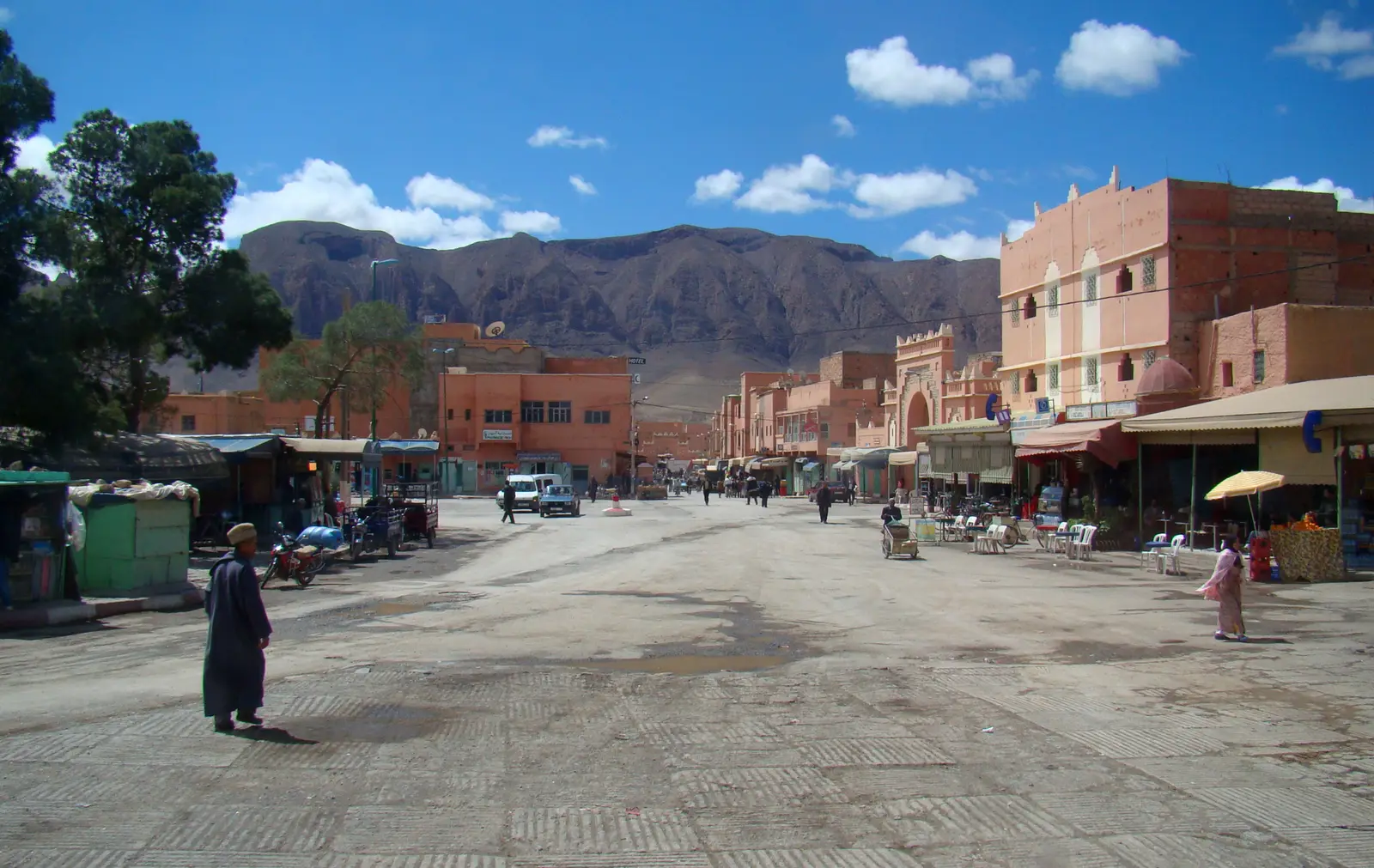
A small market town in a wide basin at the foot of the High Atlas, with ochre-and-pink buildings along a broad main street and bare ridges all around. Simple restaurants and cafés serve grilled meat and tagines, and it is the natural place to rest before turning back. The town sits a few kilometres off the N13 on a short side road.
Tip: The air here is cooler than in Errachidia and the wind can be strong in the basin; bring a layer for the ride back.
Finish
The way home is the same road in reverse, through the tunnel, down the valley and over the ridge above the lake, then back into Errachidia along the N10. In the late afternoon the low sun lights the gorge walls from the west and the palm groves glow.
Bring a full licence that covers motorcycles. An International Driving Permit alongside your home licence is generally required or recommended for foreign riders, so carry both, plus your passport and the bike's papers. Check that your rental includes insurance and that your travel insurance covers motorcycling.
Any 125–250 cc motorcycle or scooter will manage: the whole ride is paved main road with gentle gradients. Something with a little more power is more comfortable on the open stretches, where trucks overtake and the wind can push a light bike around.
Fill up in Errachidia. After the last stations on the N13 north of town there is no fuel until just past the gorge, around km 48, and there are more on the N13 a few kilometres before the turn-off for Rich. Carry water: there is little shade in the gorge and the air is very dry.
October to April is the best time. From June to September the Tafilalet is extremely hot, often over 40 °C in the afternoon, so if you must ride then, start at dawn and be back by late morning. Winter days are usually clear and pleasant, but mornings are cold and Rich, at over 1,300 metres, can be chilly. Strong winds can blow at any time of year, bringing sand across the road, and heavy autumn storms occasionally wash mud and stones down into the gorge.
Gendarmerie checkpoints are frequent on Moroccan main roads, usually at the edges of towns and at junctions. Slow right down at the stop sign, stop if waved over, and have your licence, passport and the bike's papers ready. Speed checks are common on the N13.
Morocco drives on the right. Helmets are compulsory for rider and passenger. The N13 is a through route, so expect trucks, buses and fast cars overtaking on the straights. In the villages watch for pedestrians, children, donkeys, sheep and goats on the road, and in the gorge for stones on the tarmac after wind or rain.
These operators run guided tours from Errachidia, listed alphabetically. Contact any of them through Moto Mass.
Free ride routes