
Highlights
South of Carmel, Highway 1 leaves the last houses behind and is cut into the side of the Santa Lucia Mountains, hundreds of feet above the Pacific. There are no towns to speak of, only a scatter of houses, campgrounds and gas pumps in the Big Sur valley, and the road is the reason most people come. This ride takes it from Monterey's waterfront across Bixby Creek Bridge, past the lighthouse on Point Sur and through the redwoods of the Big Sur valley to McWay Falls, then rides it all again northbound, when it feels like a different road. Rather than finish on the same highway, it turns inland at Carmel for Carmel Valley and the tight climb over Laureles Grade.
It is an out-and-back of about 103 miles, all paved, with around 7,700 feet of climbing in short rises and falls rather than one big pass. Nothing here is technical, but the corners are endless, the drop-offs are real and the traffic is the hardest part: rental cars, RVs and drivers stopping wherever the view takes them. Any bike that is comfortable on a twisting two-lane road will do; the reward is in riding it early, before the coast fills up.
Longest stretch without a gas station: about 21 miles, between mile 8 and mile 29.
The ride, stop by stop
- 1mile 0
Start
Fisherman's Wharf
Monterey's old wooden wharf sits at the edge of the harbour, beside Custom House Plaza and the adobe buildings of Monterey State Historic Park, among them the Custom House, the oldest government building in California. There is parking by the wharf and an easy run out of town: a few blocks of streets, then Highway 1 south over the hill to Carmel.
Tip: Fill up before you leave. There are stations in Monterey and Carmel, and the last one heading south is in Carmel Highlands, about 8 miles out.
The roadmiles 0–8
Out of Monterey
CA 1 BusinessCA 1Town streets, then four-lane highwayA few blocks of town streets lead to Highway 1, which runs as a divided four-lane road over the hill past Carmel before narrowing to two lanes at the Carmel River. It is the busiest part of the ride and the last of the easy fuel: the final station heading south is in Carmel Highlands, about 8 miles from the start.
The roadmiles 8–29
The cliffs to Big Sur
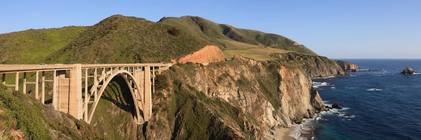
CA 1Two-lane tarmac, narrow shoulders, steep drop-offsThis is the coast road at its most dramatic. Past Point Lobos and Garrapata the highway clings to the cliffs, crosses Bixby Creek Bridge at about 18 miles and climbs to around 550 feet at Hurricane Point, which is often windy enough to push a bike across its lane. Riding south, your lane is the one on the ocean side, with the views and the drop right beside you. Point Sur and its open pasture follow before the road turns inland. Guardrails are intermittent and the shoulder is often only a strip of gravel.
- 2mile 18.1
Viewpoint
Bixby Creek Bridge
Allow 15 min
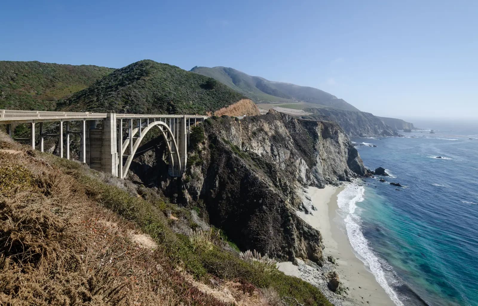
Photo: Tuxyso, CC BY-SA 3.0 The bridge everyone has seen in a car advert: a single concrete arch, built in 1932, carrying the road more than 260 feet above Bixby Creek. The classic view is from the pull-out on the ocean side at the north end, looking south along the deck to the cliffs beyond. The dirt Old Coast Road that leaves from the north end of the bridge is not part of this ride.
Tip: The pull-out fills by mid-morning and people step into the road for photos. Slow right down before you turn in, and leave by looking both ways twice.
- 3mile 23.3
Viewpoint
Point Sur
Allow 10 min
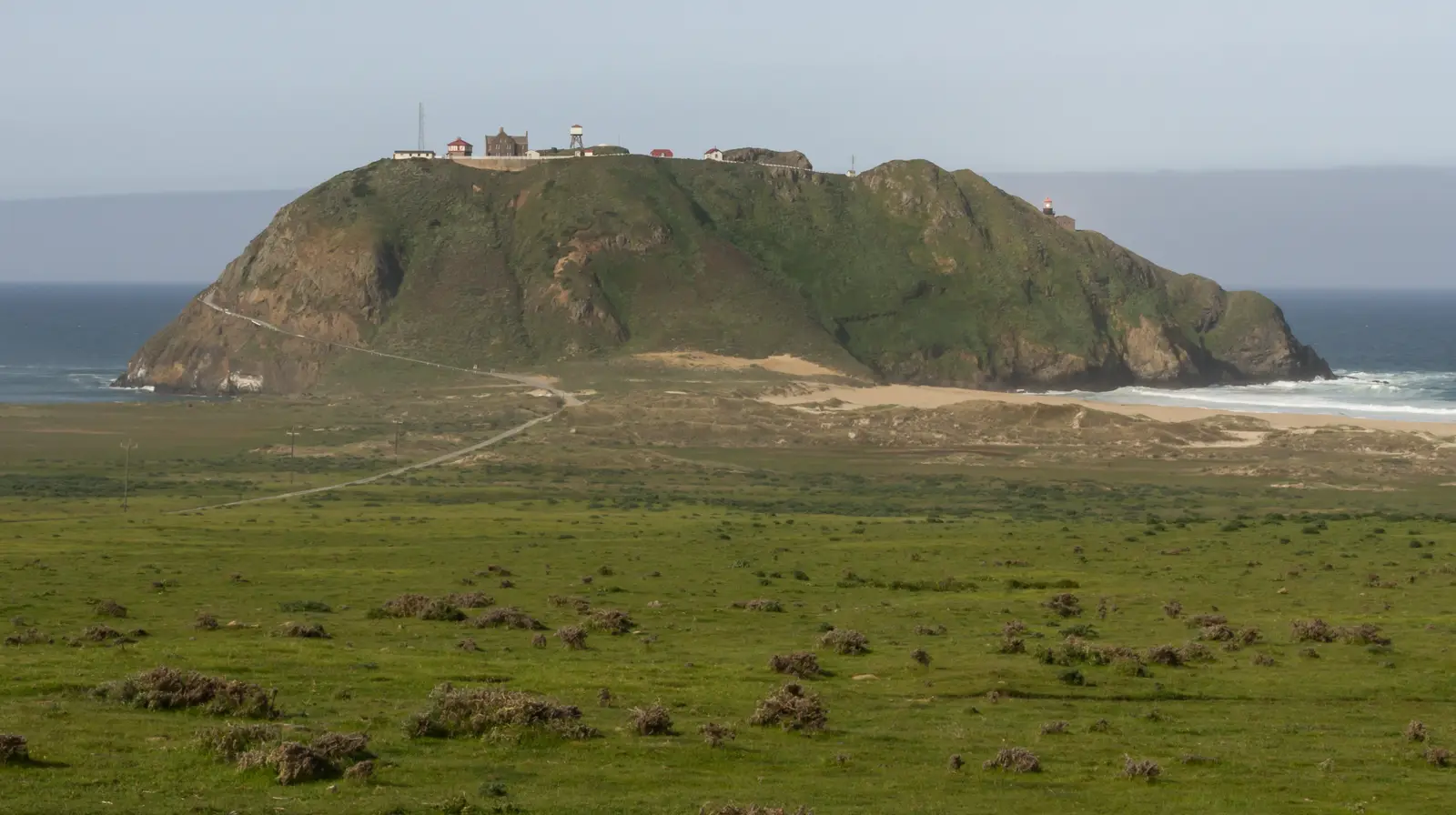
Photo: Frank Schulenburg, CC BY-SA 3.0 After the climb over Hurricane Point the road drops to a rare stretch of open pasture, and Point Sur rises out of the sea ahead: a volcanic rock joined to the shore by a sandbar, with a light station on top that has guided ships since 1889. You see it best from the shoulder of the highway as you approach from the north.
Tip: The light station is part of Point Sur State Historic Park and can only be visited on a guided tour; you cannot ride out to the rock.
The roadmiles 29–42
The Big Sur valley and south
CA 1Two-lane tarmac, forest then high cliffsThrough the redwoods of the Big Sur valley, past the gas pumps and the state park, then a climb to about 950 feet on the slopes above the sea near Nepenthe, the cliff-top restaurant that has been a Big Sur landmark for decades. From there the road runs high and quiet, corner after corner, to Julia Pfeiffer Burns State Park and McWay Falls, where you turn back. There is no fuel south of the valley on this ride.
- 4mile 31.1
Sight
Pfeiffer Big Sur State Park
Allow 45–90 min
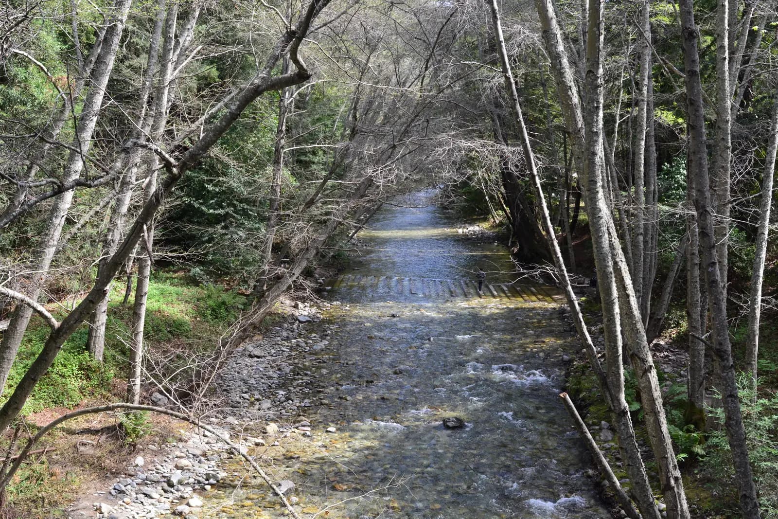
Photo: Joe Mabel, CC BY-SA 4.0 In the Big Sur valley the highway turns inland and runs through redwoods along the Big Sur River, the only stretch of the ride where the ocean disappears. Pfeiffer Big Sur State Park has short, shaded trails through the redwood groves and along the river, and the cool air under the trees is welcome on a hot day. The valley is also where you find the gas pumps, a general store and simple places to eat.
Tip: A state park day-use fee is charged at the entrance kiosk. Big Sur Station, the ranger station just south of the park entrance, has maps and road information.
- 5mile 41.8
Sight
McWay Falls
Allow 30–45 min
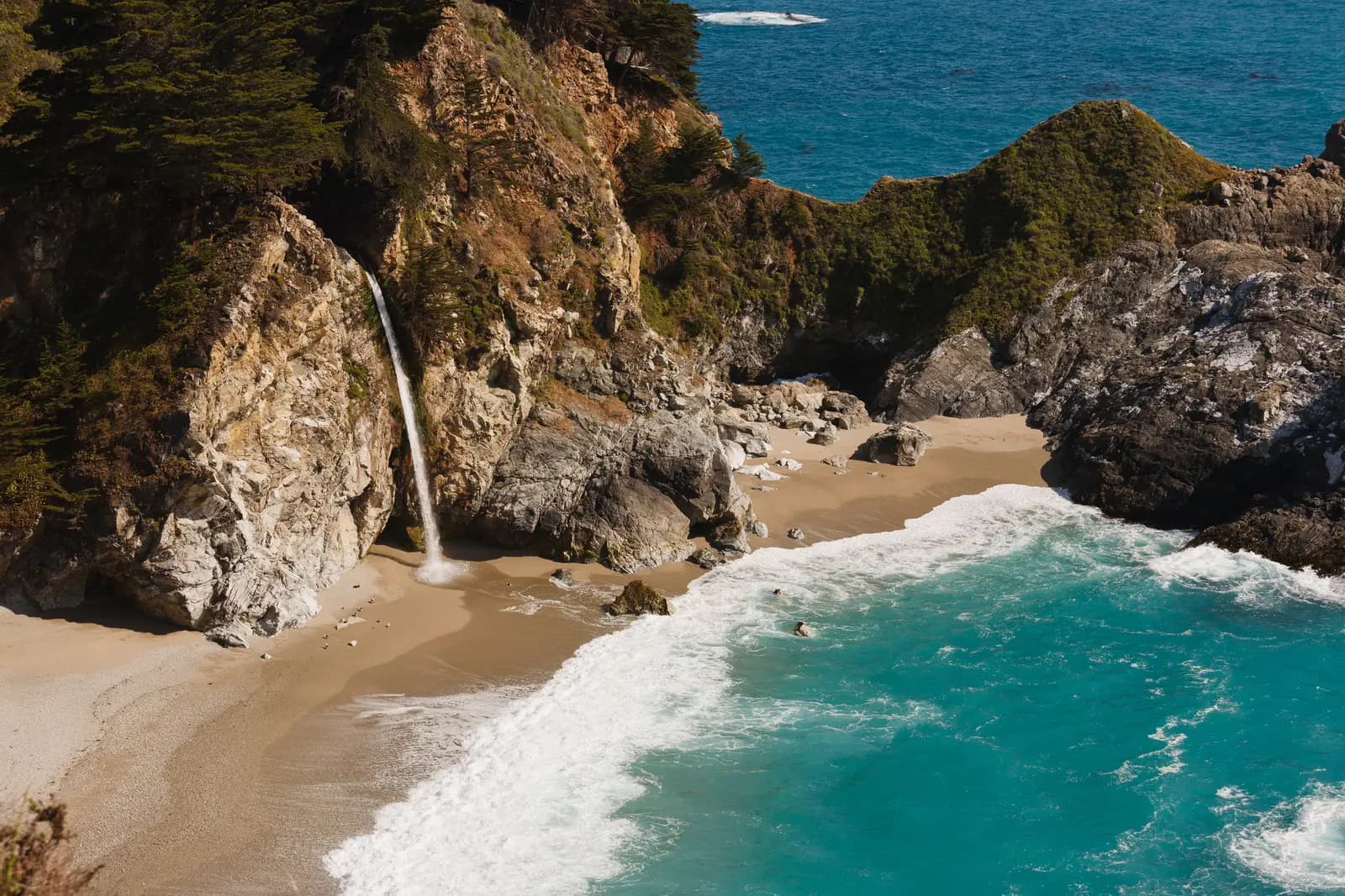
Photo: King of Hearts, CC BY-SA 3.0 The turnaround. In Julia Pfeiffer Burns State Park, McWay Creek drops about 80 feet off a granite cliff onto the sand of a turquoise cove. A short, level path from the car park passes under the highway to an overlook; the beach itself is closed to visitors. It is one of the most photographed views in California, and the walk is worth taking off your helmet for.
Tip: Highway 1 continues south past Lucia to Ragged Point, but that stretch has been closed for long periods by landslides, including Paul's Slide and Regent's Slide. Check Caltrans QuickMap before you think of going further.
The roadmiles 42–79
Back north to Carmel
CA 1Two-lane tarmac, the same road northboundThe same 37 miles in reverse, with the ocean now across the oncoming lane and views you missed on the way down. Traffic is heavier than in the morning and the turnouts fill with stopped cars; be ready for drivers braking hard or pulling out without looking. Fill up in the Big Sur valley if you need to: the next station is in Carmel Highlands, 21 miles on.
The roadmiles 79–94
Carmel Valley and Laureles Grade
CR G16CR G20Two-lane county roads, tight and steep on the gradeCarmel Valley Road runs east along the valley floor for about 9 miles, easy and mostly straight. Laureles Grade then climbs north in tight, often blind bends to nearly 1,300 feet and drops just as steeply to Highway 68, with gradients up to about 10%.
- 6mile 91.9
Viewpoint
Laureles Grade
Allow 10 min
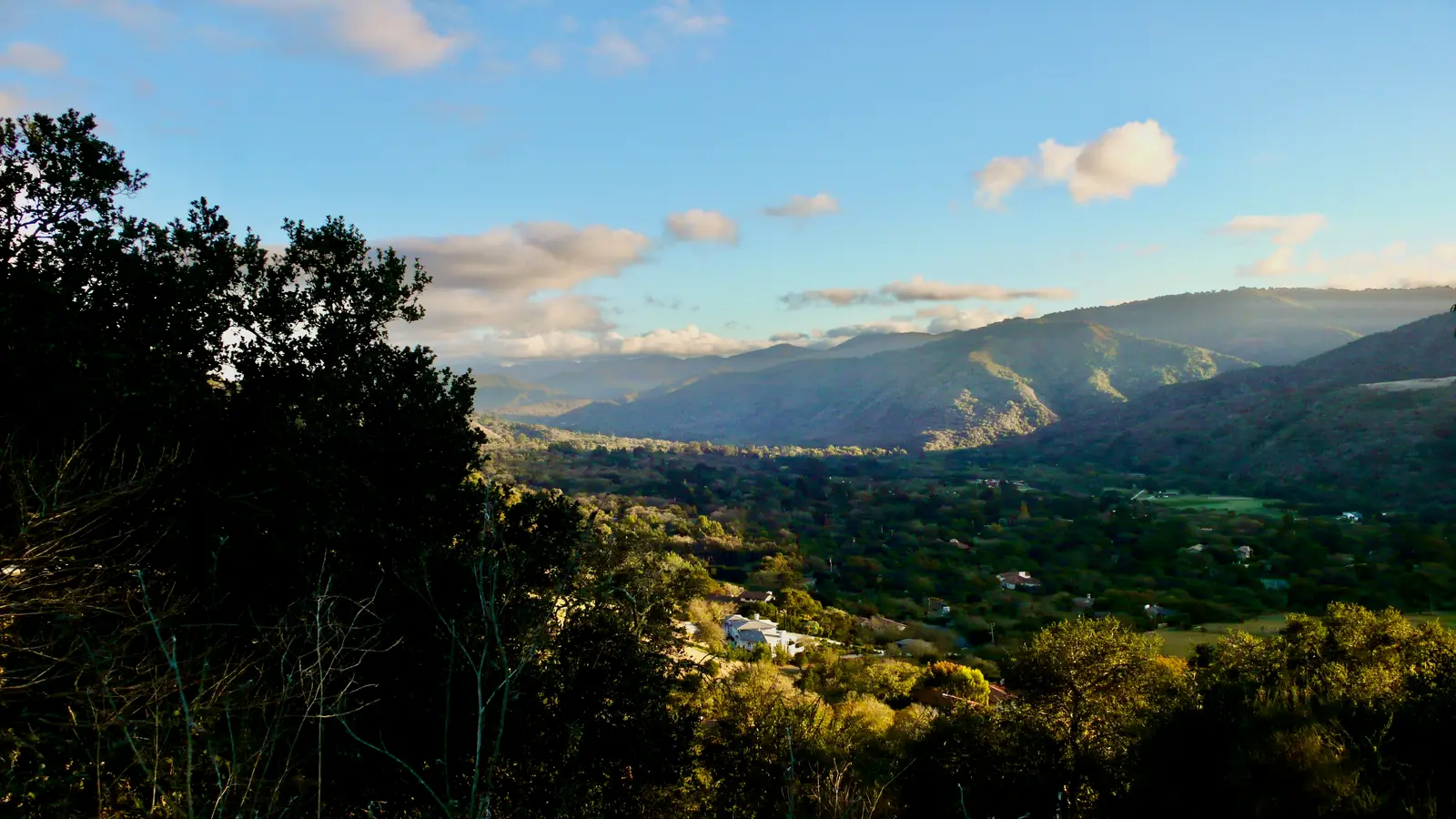
Photo: David Balmer, CC BY 3.0 Back in Carmel, the ride turns inland up Carmel Valley, warmer and drier than the coast and often in sunshine when the shore is in fog. Laureles Grade then climbs out of the valley in a string of tight bends to the highest point of the day at nearly 1,300 feet, with the oak-covered valley spread out behind you. It is short, steep and a lot of fun after a day of sweeping coastal corners.
Tip: Gradients reach about 10% on both sides of the summit. Local traffic uses it as a shortcut to Highway 68, so expect cars coming the other way in the middle of blind bends.
The roadmiles 94–103
Highway 68 into Monterey
CA 68Busy two- and four-lane highwayThe Monterey–Salinas highway carries commuter traffic back towards the coast, with WeatherTech Raceway Laguna Seca, home of the Corkscrew, in the hills just north-east of the junction. Expect queues into Monterey in the late afternoon; lane splitting is legal in California, but do it slowly and only when traffic is stopped or crawling.
- 7mile 103.5
Finish
Fisherman's Wharf
Highway 68 brings you back down into Monterey and the wharf, where the day ends with the harbour, the sea lions on the breakwater and plenty of places to eat.
Before you ride
Licence and insurance
You need a motorcycle licence: a US licence with a motorcycle endorsement (class M), or for visitors a home licence that covers motorcycles, usually together with an International Driving Permit. Rental companies set their own rules on licences, age and insurance, so check before you book. California requires a DOT-compliant helmet for every rider and passenger.
Road closures
Highway 1 on the Big Sur coast closes for landslides, washouts and fire, sometimes for months, and the stretch south of McWay Falls has seen some of the longest closures. Check Caltrans QuickMap or the Caltrans road information line on the morning you ride, and again before you plan anything beyond the turnaround. There are no tolls on this route.
Fuel and phone signal
Fill up in Monterey or Carmel. The only fuel on the coast is a handful of pumps in the Big Sur valley, around 29 miles from the start, and you should not count on them late in the day. Mobile signal is patchy or absent for long stretches south of Carmel, so download an offline map and tell someone your plans.
When to ride
September and October bring the clearest, warmest days on the coast. April and May are green and full of wildflowers. From June to August a marine fog often sits on the coast until midday or all day, turning the views grey and the road damp. Winter storms bring rain, rockfall and the highest chance of closures.
Traffic and turnouts
Weekends and summer holidays bring heavy traffic, and much of the road is double yellow line with few safe places to pass. California law requires slow vehicles with five or more vehicles behind to pull into a turnout, and riders should do the same when a queue builds. Watch for cyclists, cars stopped on the shoulder and deer at dawn and dusk. The California Highway Patrol patrols the coast regularly.
What is not on the route
Motorcycles are not allowed on 17-Mile Drive, the private toll road through Pebble Beach next to Carmel, so don't plan on adding it. Point Lobos, Pfeiffer Big Sur and Julia Pfeiffer Burns are state parks that charge a day-use fee for parking inside; roadside parking outside them fills early on busy days.
Ride further
Liked riding this one on your own? Moto Mass lists small, local operators who run guided motorcycle tours in these countries.
Free ride routes