
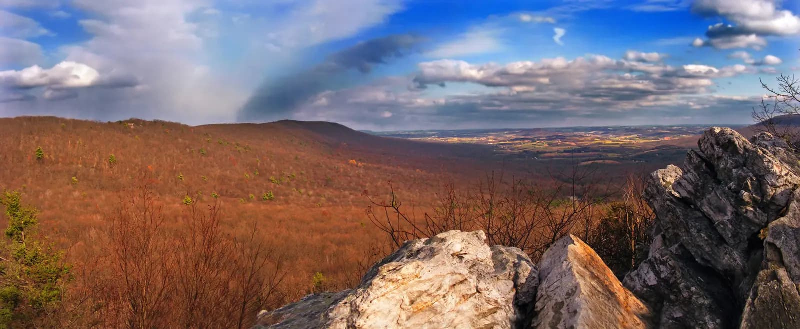
Highlights
North of Reading, the Blue Mountain runs across the map like a ruler: one long, even ridge of the Appalachians, part of the Kittatinny Ridge, with the farms of Berks County on one side and the valleys of Schuylkill County on the other. This loop crosses it twice. It leaves the Pagoda on the crest of Mount Penn, runs out past Blue Marsh Lake on PA 183 and climbs over the ridge, follows PA 895 along its northern foot, then turns up Hawk Mountain Road for the steepest climb of the day to Hawk Mountain Sanctuary, where thousands of hawks and eagles ride the ridge's updrafts every autumn. The way home is all back country: down the Maiden Creek valley past a covered bridge, through Fleetwood and the stone farms of the Oley Valley, and up the back of Mount Penn to where you started.
It is about 78 miles with about 5,000 feet of climbing, paved throughout, and most of it is easy two-lane state highway through farmland. The exception is Hawk Mountain Road: about 2 miles of grades up to roughly 13% and tight bends from Drehersville to the sanctuary, then a long descent to Kempton. Take it in a low gear and it is fine on any bike, rented or your own, but it is no place for a nervous first ride. Autumn is the season to come, for the colour and the migration; the price is weekend crowds at the sanctuary, so leave early.
The ride, stop by stop
- 1mile 0
Start
The Pagoda
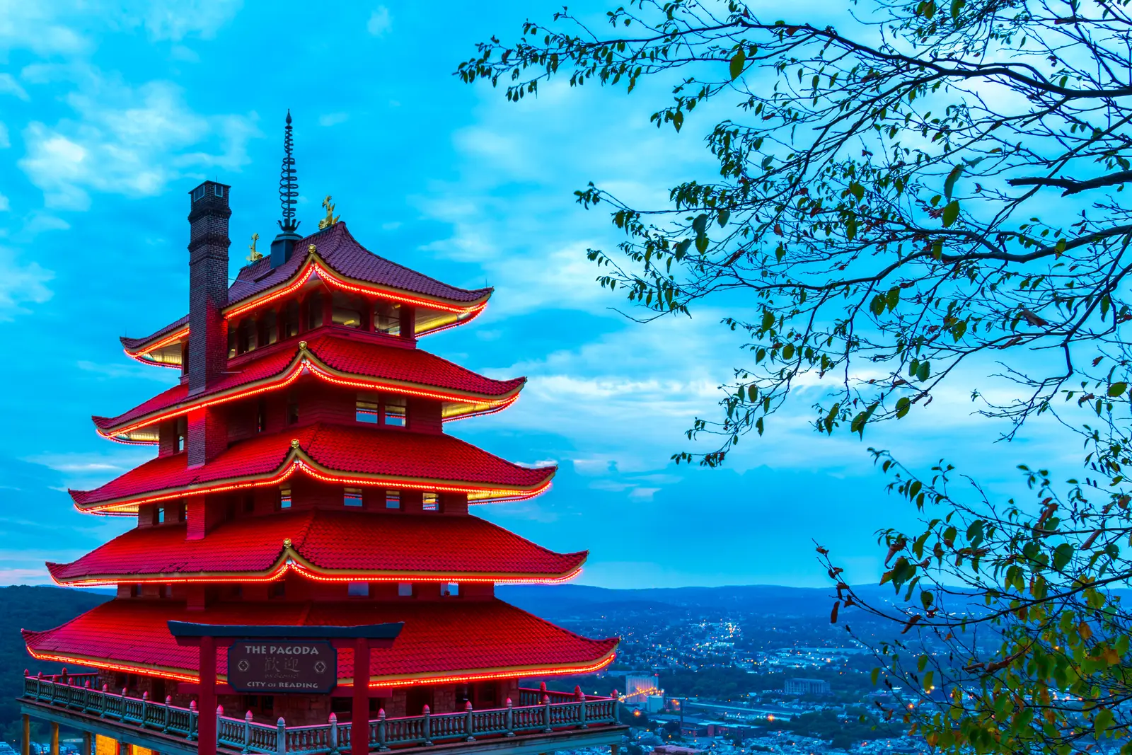
Photo: firoz-ansari, CC BY-SA 4.0 Reading's landmark: a seven-storey Japanese-style pagoda built on the crest of Mount Penn in 1908 as the centrepiece of a resort that never opened, and owned by the city for more than a century. From the stone wall in front of it the whole of Reading lies below you, with the Schuylkill River and the hills you are about to ride into beyond. It is the obvious meeting point, with parking beside the building.
Tip: The roads to the Pagoda are gated from 9 pm to 7 am, so you cannot start or finish here in the dark. The interior has been closed at times for restoration; the grounds and the view are open whenever the gates are.
The roadmiles 0–8
Off Mount Penn and across Reading
Hill RoadUS 422 Business AlternateUS 422US 222Steep hill road, city streets, then expresswayDuryea Drive and Hill Road wind down the west face of Mount Penn in a string of bends, steep in places at around 8%. Perkiomen Avenue and Penn Street then take you straight through downtown and across Penn Square, over the Schuylkill and into West Reading, where you join the West Shore Bypass, US 422 and then US 222, for about 4½ miles of divided expressway to the PA 183 exit. City traffic lights and buses are the only real hazard; on a weekend morning it is quick.
The roadmiles 8–28
PA 183 and the Blue Mountain
PA 183Two-lane highway, then a four-lane climbBernville Road heads north-west into open country, crosses two arms of Blue Marsh Lake, skirts Bernville and passes Strausstown, crossing Interstate 78 on the way. From the edge of the farmland the road climbs about 820 feet in just over 3 miles, with grades of up to about 10%, to the top of the Blue Mountain at about 1,400 feet, the highest point of the loop. It widens to four lanes over the crest, where the Appalachian Trail crosses, then drops into Schuylkill County to meet PA 895 at Summit Station.
- 2mile 11.9
Viewpoint
Blue Marsh Lake
Allow 5 min
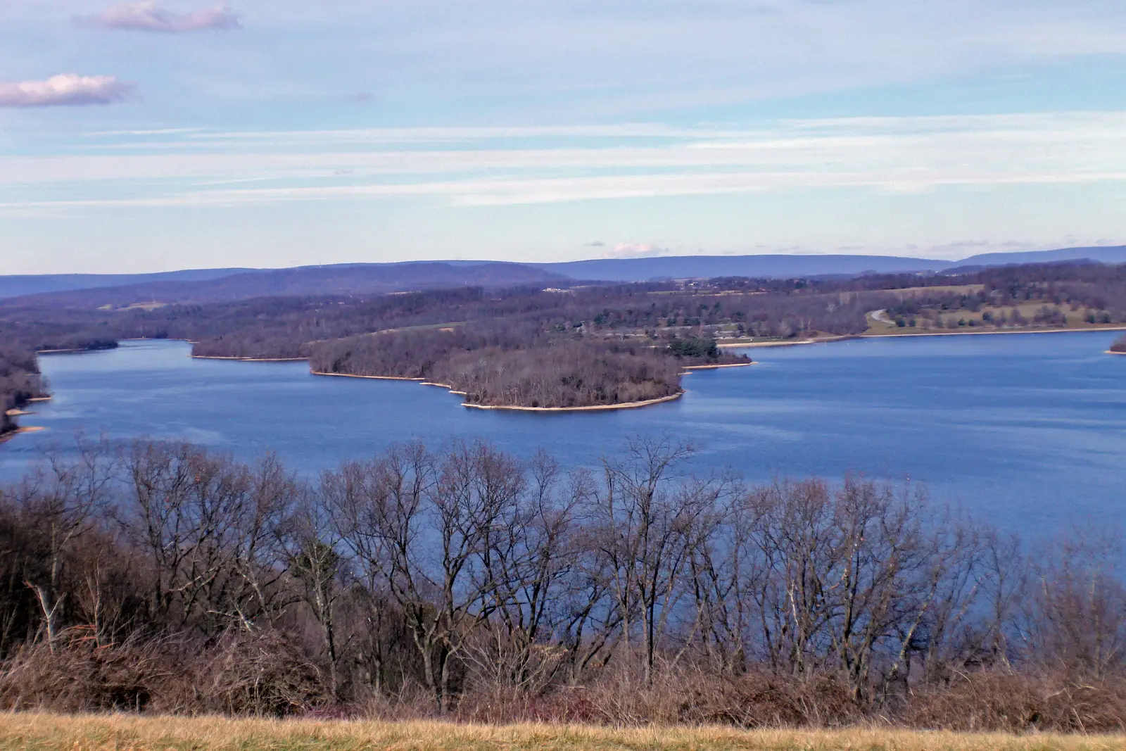
Photo: BerksCountyUpdate, CC BY-SA 4.0 About 12 miles out, PA 183 crosses two arms of Blue Marsh Lake on low bridges, the first proper glimpse of open country after the city. The lake is a flood-control reservoir on Tulpehocken Creek, ringed by woods, fields and a long trail.
Tip: There is nowhere to stop on the bridges themselves. If you want a break by the water, the lake's day-use areas lie on side roads around the shore.
The roadmiles 28–41
PA 895 under the ridge
PA 895PA 61Two-lane highway, briefly four-lanePA 895 runs east for about 13 miles along the northern foot of the Blue Mountain, through farmland and the small borough of Auburn, with the long wall of the ridge on your right. It shares PA 61 for about 1½ miles of four-lane highway; a few miles south, PA 61 squeezes through the gap the Schuylkill River has cut in the ridge at Port Clinton. Leave PA 61 at the PA 895 exit and follow it to Drehersville, where Hawk Mountain Road turns off to the right.
The roadmiles 41–50
Hawk Mountain Road
Hawk Mountain RoadNarrow two-lane road, very steep climb and long descentThe best and hardest stretch of the ride. From Drehersville the road climbs about 800 feet in 2 miles to the sanctuary, with grades of up to about 13% and tight bends, on a road much narrower than anything so far. Stay in a low gear, keep right on the blind corners and expect visitors' cars turning in and out at the top. Beyond the sanctuary the road passes Schaumboch's Tavern, a stone building from about 1793 now used by the sanctuary, then descends through the woods and the hamlet of Eckville, at up to about 11%, to the farm valley and PA 143. Kempton, with the station of the WK&S heritage railroad, lies less than a mile to the east.
- 3mile 43
Sight
Hawk Mountain Sanctuary
Allow 1–2 hours
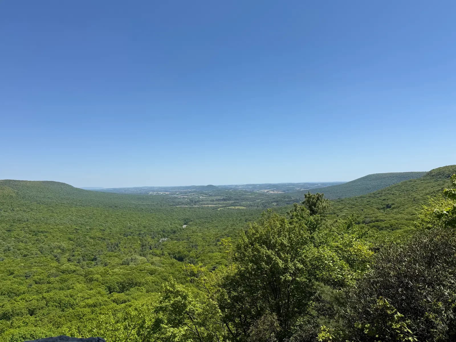
Photo: Dough4872, CC BY-SA 4.0 The reason for the ride. In 1934 the conservationist Rosalie Edge leased this stretch of ridge and hired wardens to stop the shooting of hawks from its rocks, and it has been a sanctuary ever since. Every autumn some 20,000 hawks, eagles and falcons are counted from the lookouts as they ride the ridge's updrafts south. The Visitor Center sits beside the road at the top of the climb; the South Lookout is a short walk from it, and the North Lookout, at about 1,520 feet, looks out over a view of up to 70 miles at the end of a rocky trail of about a mile.
Tip: A trail fee is charged at the Visitor Center. The North Lookout trail is rough and rocky; riding boots manage it, but take your time and carry water.
The roadmiles 50–70
Maiden Creek and the Oley Valley
PA 143PA 662PA 73Two-lane country highwaysPA 143 runs south down the Maiden Creek valley through Lenhartsville, where it crosses Old Route 22 and Interstate 78, then past the Dreibelbis Station covered bridge and through Virginville. It is gentle, open riding past dairy farms and fields, with slow farm machinery the main hazard. At Moselem Springs PA 662 carries you through Fleetwood, over a wooded rise with grades of up to about 8% and down into the Oley Valley to the village of Oley.
- 4mile 55.8
Sight
Dreibelbis Station Bridge
Allow 10 min
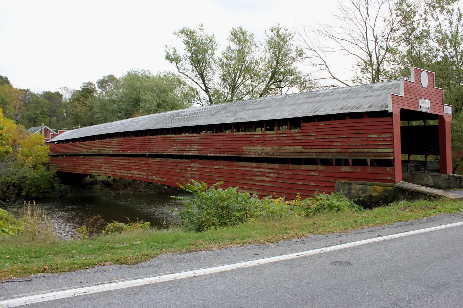
Photo: PattiParker, CC BY-SA 3.0 Just south of Lenhartsville, a red wooden covered bridge crosses Maiden Creek a few yards off PA 143. It was built in 1869 with a Burr arch truss, runs 172 feet from bank to bank, and is listed on the National Register of Historic Places. It still carries traffic, one vehicle at a time.
Tip: Pull onto the side road to look rather than stopping on PA 143. If you ride through, the bridge is one lane with a low clearance and weight limit; give way to anyone already on it.
- 5mile 69.8
Sight
Oley Valley
Allow 15 min
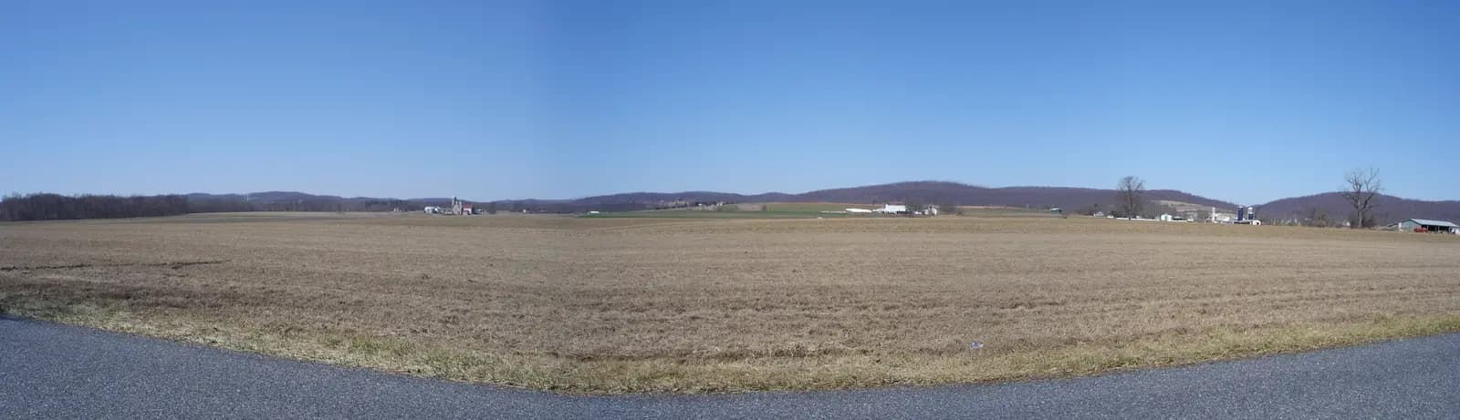
Photo: Skabat169, CC BY-SA 4.0 Past Fleetwood, PA 662 climbs over a wooded rise and drops into the Oley Valley, a broad bowl of farmland ringed by low hills. The whole of Oley Township, more than 15,000 acres of fields, stone farmhouses and big bank barns, is listed on the National Register as a single historic district. The route runs along PA 73 and PA 662 to the edge of the village of Oley before turning west for home.
Tip: This is the last easy fuel and food before Reading, and the farm roads either side of PA 662 are worth an aimless half hour if you have time.
The roadmiles 70–78
Home over Mount Penn
Friedensburg RoadTwo-lane country roads, steep final climbFriedensburg Road heads west for about 6 miles through rolling farms and woods, a quiet, flowing road with farm entrances and the odd tractor. Spook Lane and a short run of back roads then climb the back of Mount Penn, with grades of up to about 11% and some tight, wooded bends, to Duryea Drive and the gate below the Pagoda.
- 6mile 77.5
Finish
The Pagoda
The last miles climb the back of Mount Penn through the woods to the Pagoda, and the city view is there again at the end. Late in the afternoon, with the sun going down over the hills to the west, it is the best moment of the day to be up here.
Before you ride
Licence and insurance
In the US you need a licence with a motorcycle endorsement (class M). Visitors need a home licence that covers motorcycles, usually with an International Driving Permit; rental companies set their own rules on age and experience, so check before you book. Carry proof of insurance.
Rules of the road
Traffic drives on the right. Pennsylvania requires a helmet unless you are 21 or older and have either held a motorcycle licence for two full years or passed a PennDOT-approved motorcycle safety course; a passenger may ride without one only if the rider qualifies and the passenger is also 21 or older. Eye protection is compulsory for all riders. On a rented bike or a visitor's licence, wear a helmet.
Tolls
The loop is toll-free: the West Shore Bypass, PA 183, PA 895 and the country roads charge nothing. You only meet tolls if you arrive on the Pennsylvania Turnpike, which is cashless; without an E-ZPass a bill is mailed to the registered owner, so ask a rental company how they pass it on.
Fuel
Stations are frequent: in Reading's suburbs, around Bernville and Strausstown, on PA 895 near Auburn and PA 61, at the foot of Hawk Mountain Road near Kempton, at Moselem Springs and in Oley. You can fill up yourself in Pennsylvania. Pumps often ask for a US ZIP code, so visitors with foreign cards may need to pay inside first.
When to ride
May, June, September and October are the best months. The hawk migration runs from late August into December, with the biggest flights of broad-winged hawks in September and eagles later in the autumn, and the leaves turn in mid- to late October. Summer brings heat, humidity and afternoon thunderstorms. In winter Hawk Mountain Road can be icy and is best left alone; check PennDOT's 511PA before you go.
Traffic and safety
Autumn weekends at Hawk Mountain bring heavy traffic and full car parks, so arrive early or ride on a weekday. Deer are common along the ridge and in the farm valleys, especially at dawn and dusk. Watch for slow farm machinery and mud on the country roads, and remember the Pagoda gates close at 9 pm.
Ride further
Liked riding this one on your own? Moto Mass lists small, local operators who run guided motorcycle tours in these countries.
Free ride routes