
Highlights
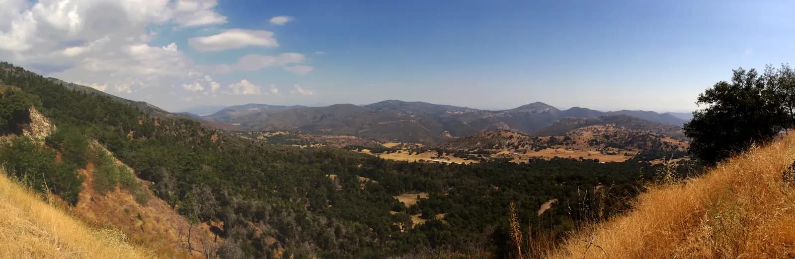
Ask a San Diego rider where to go on a Sunday and the answer is Palomar, usually followed by Julian. This loop strings the two together. It leaves Escondido, the last town before the backcountry and about 30 miles up Interstate 15 from downtown San Diego, follows Valley Center Road out through avocado and citrus country, then climbs South Grade Road, one of the best-known sets of hairpins in Southern California, to the pines at more than 5,000 feet. East Grade, the road built to haul the observatory up the mountain, takes you down to Lake Henshaw, and a string of quiet valleys leads past an old mission chapel at Santa Ysabel to Julian, an 1870s gold-mining town now known across the state for apple pie. Highway 78 brings you home through Ramona and the San Pasqual Valley.
It is about 101 miles with around 8,900 feet of climbing, all of it paved. Most of the loop is fast, open two-lane road that any touring or sport bike will enjoy, but South Grade is something else: about 7 miles of tight, steep hairpins with a long record of motorcycle crashes and some of the heaviest enforcement in the county. Ride it within yourself and stay on your side of the double yellow line. Starting in Escondido rather than the city keeps the freeway out of the loop; add the I-15 there and back if you are riding from San Diego.
Longest stretch without a gas station: about 36 miles, between mile 17 and mile 53.
The ride, stop by stop
- 1mile 0
Start
Grape Day Park
A park in the middle of Escondido, beside City Hall and the California Center for the Arts, with the town's history museum and an old Pullman railway car on the grass. It is an easy place to meet, a few minutes from Interstate 15 and Highway 78, and starting here means the loop begins on Valley Center Road rather than the freeway. If you are coming from San Diego, it is about 30 miles up I-15.
Tip: Fill up in Escondido or Valley Center. After the last stations near Pauma Valley there is no fuel on the mountain.
The roadmiles 0–23
Escondido to Pauma Valley
CR S6CA 76Town streets, then wide two-lane highwayValley Center Road (County Route S6) climbs out of Escondido and runs north for about 18 miles through ranches and groves, wide and quick with gentle grades. At Rincon it joins Highway 76 for about 5 miles east up the Pauma Valley. Traffic is steady, with trucks and casino traffic on 76. The last fuel before the mountain is along this stretch, about 17 miles from the start.
The roadmiles 23–30
South Grade Road
CR S6Two-lane tarmac, tight hairpins, steepThe famous climb: about 7 miles of switchbacks gaining roughly 2,600 feet, from about 2,650 feet at Highway 76 to the crossroads at the top, with gradients up to about 9%. Many corners are blind and the surface carries gravel and leaves. This road has a long history of serious motorcycle crashes, many of them riders running wide into the oncoming lane or off the edge, and it is patrolled heavily, especially at weekends; riders are regularly stopped here. Stay right, look for cars, cyclists and other bikes coming down, and treat the double yellow line as a wall. At the top, County Route S6 goes on to the observatory.
- 2mile 29.6
SightDetour
Palomar Observatory
Allow 45–60 minAbout 5 miles each way
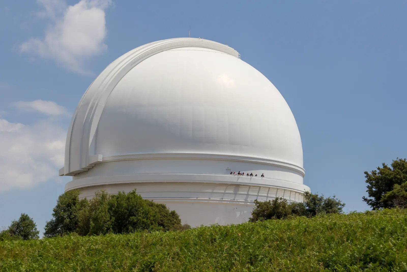
Photo: Mike Peel, CC BY-SA 4.0 At the top of South Grade, County Route S6 carries on north from the crossroads to Caltech's observatory at about 5,600 feet. The great white dome holds the 200-inch Hale Telescope, the largest in the world from 1949 until 1976 and still at work. A visitor centre and a gallery inside the dome let you see the telescope itself, and the ride there through oak and conifer forest is a calm interlude after the climb.
Tip: Check opening days on the observatory's website before you ride up; the road beyond the crossroads leads only to the observatory, so you come back the same way.
The roadmiles 30–41
East Grade Road
CR S7Two-lane tarmac, long sweeping descentCounty Route S7, the 'Highway to the Stars', was built for the construction of the observatory and is everything South Grade is not: about 11 miles of broad, open sweepers and steady gradients up to about 8%, falling from the high point of the day at nearly 5,400 feet to about 2,650 feet at Highway 76. Lower down the views open out over Lake Henshaw and the valleys beyond; the Kica Mik Overlook near the top and Henshaw Scenic Vista lower down are the places to stop and look. It invites speed; watch for deer, gravel on the shoulders and cars pulling out of turnouts.
- 3mile 39.5
Viewpoint
Henshaw Scenic Vista
Allow 10 min
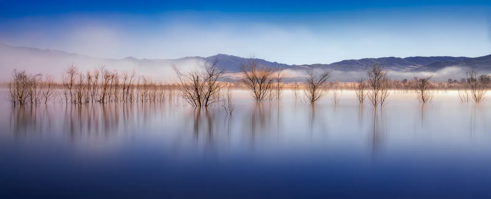
Photo: John D. from Pasadena, USA, CC BY 2.0 A pull-out near the foot of East Grade with the whole of Lake Henshaw spread out below: a wide, shallow lake in an open valley at the foot of the mountain. It is a reservoir on the San Luis Rey River, dammed in 1923 to water the farms downstream, and its level rises and falls a long way with the rains, leaving drowned trees standing in the shallows.
Tip: Slow early for the pull-out, as the descent here is fast; there is another, the Kica Mik Overlook, a mile or so below the top of the grade.
The roadmiles 41–62
Lake Henshaw to Julian
CA 76CA 79CA 78Wynola RoadFarmer RoadTwo-lane highway, then narrow back roadsHighway 76 runs past the lake to join Highway 79, which crosses open ranch country and oak-dotted valleys south to Santa Ysabel, where there is fuel at the junction, about 53 miles from the start. Highways 78 and 79 then climb together towards Julian. At Wynola, leave the highway for Wynola Road and then Farmer Road for a narrower, quieter back way into town through farmland and oaks, reaching Main Street at about 4,200 feet.
- 4mile 51.3
Sight
Mission Santa Ysabel
Allow 20–30 min
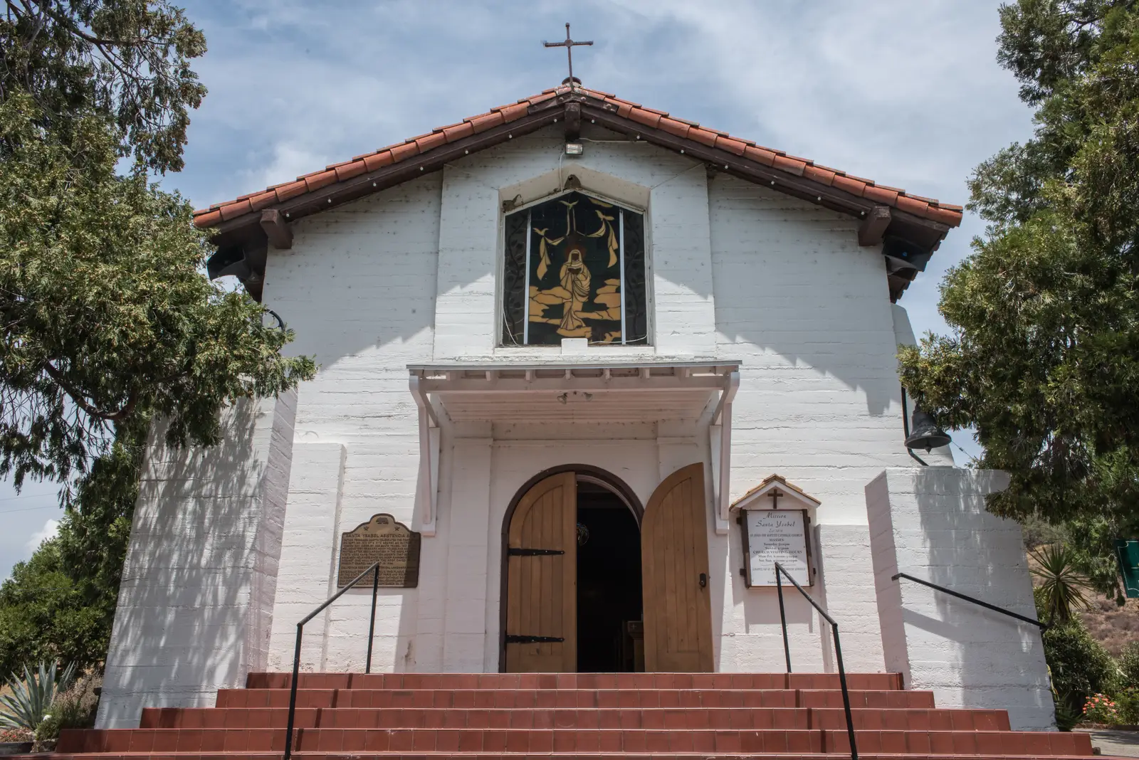
Photo: Tristan Loper, CC BY-SA 4.0 A small white chapel just off Highway 79, on the site of a sub-mission founded in 1818 as an outpost of Mission San Diego. Nothing of the original adobe survives; the present chapel was begun in 1924 on the old site, with the mission cemetery beside it. Its two old bells, among the oldest in California, disappeared one night in 1926 and have never been found.
Tip: This is a working church; keep voices and engines low when you pull in.
- 5mile 53.9
Viewpoint
Inaja Memorial
Allow 15–30 min
A Forest Service picnic site on Highway 78 between Santa Ysabel and Wynola, built in memory of the 11 firefighters who died in the Inaja Fire in November 1956. A short nature trail climbs from the picnic area to a viewpoint over the canyon of the San Diego River. You pass it on the way to Julian and again on the way back; it is shaded and quiet, a good place to stretch your legs on either pass.
Tip: Signal early and check your mirrors as you slow for the turn: traffic behind you on 78 is often close and fast.
- 6mile 61.5
Food
Julian
Allow 1–1½ hours with lunch

Photo: Seauton, CC BY-SA 4.0 Julian grew up as a gold-rush boomtown in the 1870s, and its old wooden storefronts on Main Street, at about 4,200 feet, have changed little since; the town is a California Historical Landmark, with a small pioneer museum and the old Eagle Mine on its edge. It is famous for apple pie, and the bakeries, cafés and simple restaurants along Main Street make it the natural lunch stop. It is also an International Dark Sky Community, so it stays properly dark at night.
Tip: Autumn weekends, when the apple harvest is in, bring heavy traffic and full parking; arrive before late morning or come on a weekday.
The roadmiles 62–83
Julian to Ramona
CA 78Two-lane highway, long descentHighway 78 leaves Julian downhill through Wynola, then for about 3 miles retraces the road you came in on, past the Inaja Memorial to Santa Ysabel. There it parts from Highway 79, swings south-west and descends through chaparral and grassland to Ramona, losing about 2,700 feet over some 21 miles, with gradients up to about 7%. The corners are mostly open and flowing; the hazards are traffic bunching behind slow vehicles and drivers passing where they shouldn't. Ramona, about 83 miles from the start, has plenty of fuel along Main Street.
The roadmiles 83–101
San Pasqual Valley to Escondido
CA 78East Grand AvenueBusy two-lane highway, then city streetsHighway 78 drops through a winding grade into the San Pasqual Valley, the lowest point of the day at about 370 feet, then runs flat through farmland past the battlefield monument and the Safari Park into Escondido. This is the busiest stretch of the loop, with commuter and weekend traffic and few places to pass. Lane splitting is legal in California, but keep it slow and save it for traffic that has stopped or is crawling in town.
- 7mile 101.3
Finish
Grape Day Park
Highway 78 drops out of the hills into the San Pasqual Valley, past the San Diego Zoo Safari Park and San Pasqual Battlefield State Historic Park, where the bloodiest battle in California of the Mexican–American War was fought in 1846. A few miles of city streets bring you back to the park, with Interstate 15 a few blocks away for the ride home to San Diego.
Before you ride
Licence and insurance
You need a motorcycle licence: a US licence with a motorcycle endorsement (class M), or for visitors a home licence that covers motorcycles, usually together with an International Driving Permit. Rental companies set their own rules on licences, age and insurance, so check before you book. California requires a DOT-compliant helmet for every rider and passenger.
South Grade, safely
South Grade is the reason most riders come and the place most of them get into trouble. Ride it uphill, as this loop does, warm your tyres on Valley Center Road first, and take the hairpins slowly with your eyes on the exit. The California Highway Patrol and the Sheriff's Department enforce speed and lane discipline here; expect to be stopped if you cross the centre line. Don't let a sat-nav take you up the Nate Harrison Grade on the west side of the mountain: it is a dirt road.
Fuel
Fill up in Escondido, Valley Center or Pauma Valley. From the last of those stations, about 17 miles from the start, there is nothing until Santa Ysabel, about 53 miles in, and 10 more if you ride to the observatory and back. Ramona has the next stations, about 83 miles in. Pumps often ask for a US ZIP code, so visitors with foreign cards may need to pay inside first. There are no tolls on the loop.
When to ride
Spring and autumn are best: green hills in March and April, clear skies and apple season in October. Summer is hot inland, regularly above 90°F in the Pauma and San Pasqual valleys and around Lake Henshaw, while Palomar stays much cooler. In winter, snow and ice can settle on Palomar Mountain and around Julian; county roads S6 and S7 can be closed or icy in the shade long after a storm. Check the County of San Diego's road closures and Caltrans QuickMap (for Highways 76, 78 and 79) on the morning you ride.
Fire and wind
The backcountry burns. In late summer and autumn, hot Santa Ana winds from the desert raise the fire risk sharply, and roads can close at short notice during a fire. On red flag days expect strong, gusty crosswinds on the exposed stretches of East Grade and Highway 78, and check road status before you leave.
Traffic and signal
Weekends bring large numbers of riders, cyclists and day-trippers to Palomar and Julian. Watch for deer on the mountain roads at dawn and dusk. Mobile signal is patchy on Palomar Mountain and around Lake Henshaw, so download the route before you leave and tell someone your plans.
Ride further
Liked riding this one on your own? Moto Mass lists small, local operators who run guided motorcycle tours in these countries.
Free ride routes