
Highlights
Every San Francisco rider knows the feeling of crossing the Golden Gate northbound on a clear morning, and this is the ride that makes the most of it. Ten miles from the bridge you turn onto Panoramic Highway, which climbs the flank of Mount Tamalpais to Pantoll at nearly 1,500 feet and then drops in a string of switchbacks to the sea at Stinson Beach. Highway 1 takes you north along Bolinas Lagoon and up the Olema Valley, which follows the line of the San Andreas Fault, to lunch in Point Reyes Station. The way home crosses quiet ranch country past Nicasio Reservoir and over the wooded hills of Lucas Valley Road before US 101 brings you back to the bridge.
It is about 72 miles with some 4,600 feet of climbing, paved throughout, and suits any rider comfortable on narrow two-lane roads. The difficult part is the 9 miles of Panoramic Highway: tight, often blind corners, steep drops on the ocean side and cyclists on every climb. After Stinson Beach the riding is easy and scenic rather than technical. Add the side trip to East Peak, the summit of Mount Tam, and the day becomes about 81 miles. Bring a warm layer whatever the city looks like: fog can sit on the coast all day while the valleys inland are hot.
Longest stretch without a gas station: about 28 miles, between mile 7 and mile 35.
The ride, stop by stop
- 1mile 0
Start
Golden Gate Bridge Welcome Center
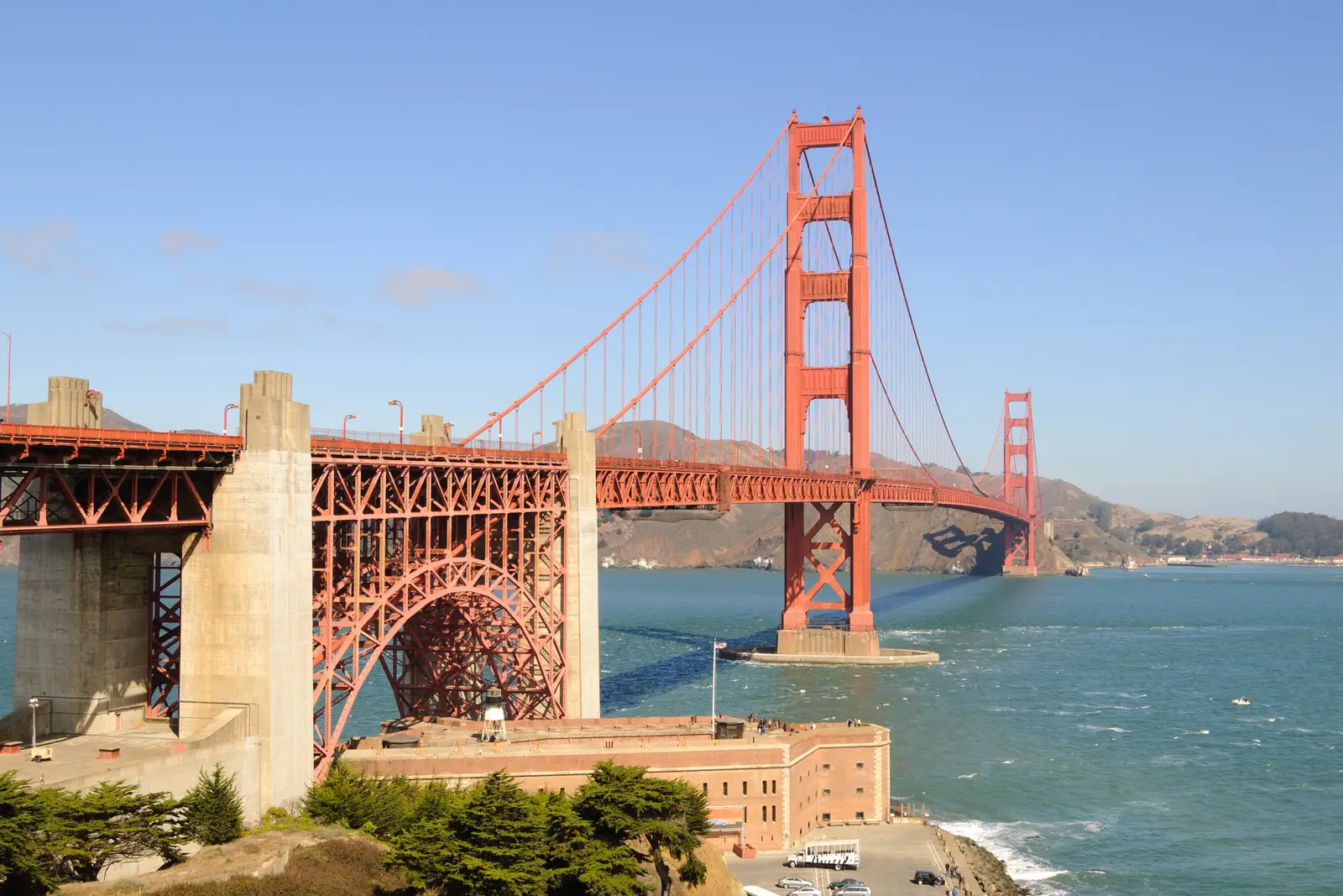
Photo: King of Hearts, CC BY-SA 3.0 The plaza at the south end of the bridge, in the Presidio, with the Welcome Center, the Round House café and a statue of the bridge's chief engineer, Joseph Strauss. It is the obvious place to meet, and the walk to the rail above Fort Point gives you the classic view of the south tower before you ride across it. From the car park you are on US 101 northbound within a few hundred yards.
Tip: Parking here is paid and fills early on fine weekends. There is no toll heading north; it is charged electronically when you come back into the city.
The roadmiles 0–9
Across the Golden Gate
US 101CA 1Freeway, then two-lane highwayUS 101 crosses the bridge, often in a stiff crosswind, then climbs Waldo Grade to about 590 feet and drops through the Robin Williams Tunnel to Richardson Bay. After 6 miles leave for Highway 1, Shoreline Highway, signed for Stinson Beach. It runs through Tam Junction, the last fuel for 28 miles, then climbs about 600 feet in the next 3 miles to the fork where Panoramic Highway turns off to the right.
- 2mile 1.9
Viewpoint
Golden Gate Bridge Vista Point
Allow 15 min
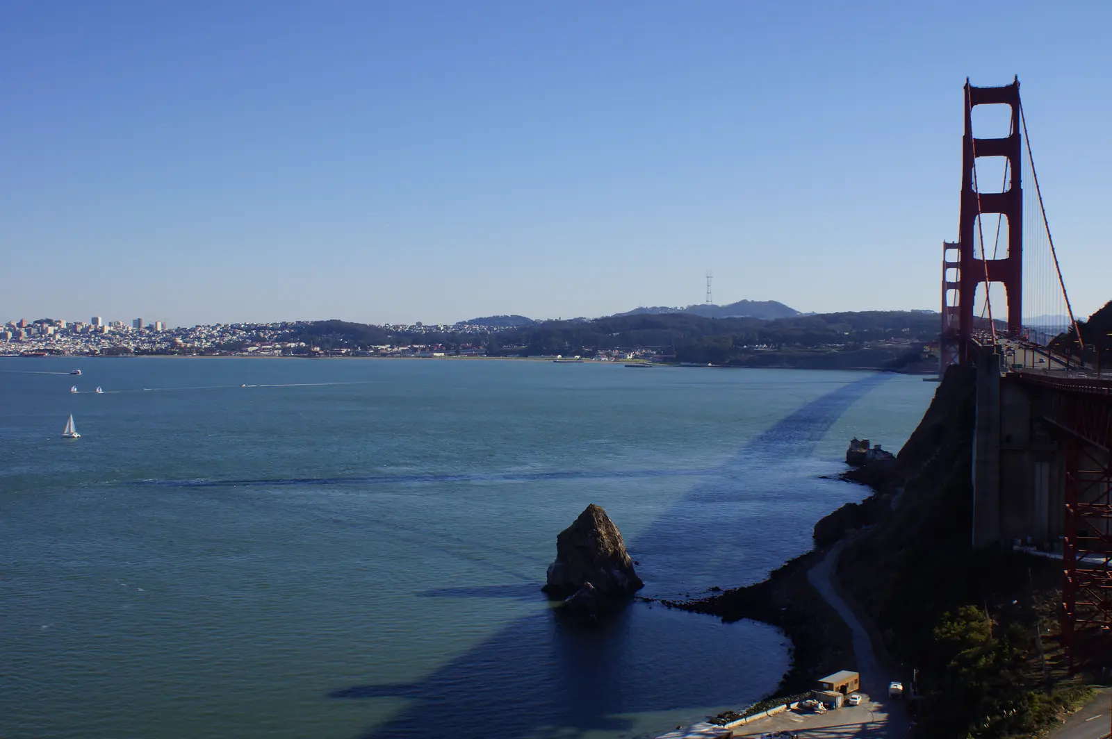
Photo: Chris English, CC BY-SA 3.0 The car park at the north end of the bridge, reached straight off US 101 northbound, looks back past the north tower to the city skyline, Alcatraz and the bay. It is the best place to photograph the bridge you have just crossed, and the Lone Sailor memorial stands at the edge of the lot.
Tip: The exit comes up immediately after the bridge on the right. The lot is busy with tour buses, so ride slowly and park away from the coach bays.
The roadmiles 9–18
Panoramic Highway
Panoramic HighwayNarrow two-lane tarmac, steep and twistyThe heart of the ride. Panoramic climbs through woods past the Muir Woods Road junction to Pantoll, about 870 feet higher in a little over 5 miles. Beyond Pantoll the trees open out and the road drops about 1,350 feet in 3½ miles of switchbacks to Stinson Beach, with the ocean ahead and steep drop-offs on the outside of many bends. Corners are tight and often blind, the lanes are narrow and there is little shoulder. Expect cyclists both ways, cars stopping for trailheads, and fog that leaves the western side wet.
- 3mile 14.7
ViewpointDetour
Pantoll and East Peak
Allow 1 hour with East PeakAbout 4½ miles each way to East Peak, up Pantoll Road
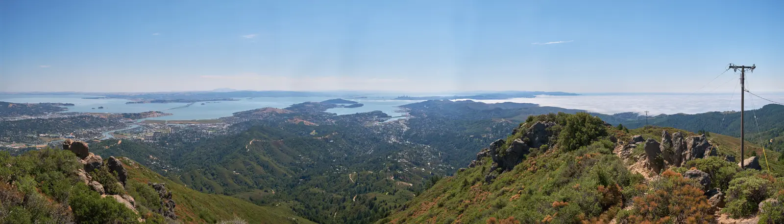
Photo: Chris Rycroft from Madison, Wisconsin, United States, CC BY 2.0 Pantoll, the ranger station at the top of Panoramic Highway, is the crossroads of Mount Tamalpais State Park. From here Pantoll Road climbs to Rock Spring, where East Ridgecrest Boulevard runs on to East Peak, the 2,570-foot summit of Mount Tam. A visitor centre sits by the car park, a short paved path circles the peak and a steep trail climbs to the Gardner fire lookout on top. On a clear day you see the whole bay, San Francisco and the ocean; on many summer mornings you look down on a sea of fog. If you want more, West Ridgecrest Boulevard carries on from Rock Spring along the bare ridge above the ocean.
Tip: The gate at the foot of Pantoll Road closes at sunset, and parking at Pantoll and East Peak is paid. Without the side trip, Pantoll is still worth a stop to look down the coast before the descent.
The roadmiles 18–32
Bolinas Lagoon and the Olema Valley
CA 1Two-lane highway, flat then rollingFourteen miles of Highway 1. North of Stinson Beach the road runs flat for about 4 miles along the edge of Bolinas Lagoon, where harbour seals haul out on the sandbars; the unsigned turn at the far end leads to the village of Bolinas, famous for taking down its own road signs. The highway then climbs gently into the Olema Valley, the trough of the San Andreas Fault, rising to about 470 feet through woods and pasture. The road is narrow, with little shoulder and few places to pull off.
- 4mile 18.9
Sight
Stinson Beach
Allow 30–60 min
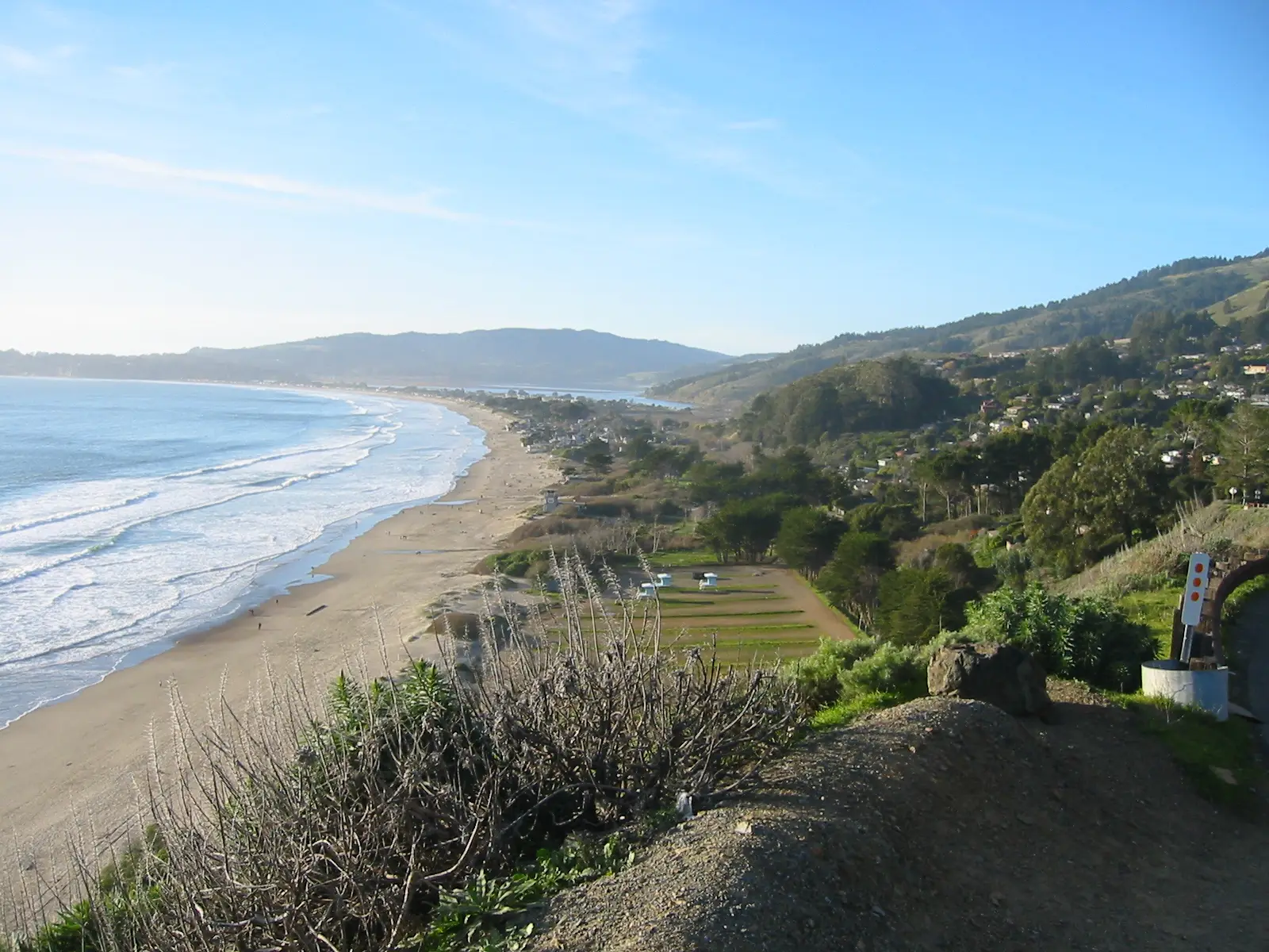
Photo: Kglavin, CC BY-SA 3.0 Panoramic Highway ends on Highway 1 at the village of Stinson Beach, behind a long, wide sweep of sand that is part of the Golden Gate National Recreation Area. It is the one real beach on the ride and the place where the switchbacks give way to sea level, with simple places to eat and a small store along the highway.
Tip: On hot weekends the village jams with beach traffic from mid-morning; arrive early or ride straight through and stop at Point Reyes Station instead.
The roadmiles 32–45
Point Reyes Station and Nicasio
CA 1Point Reyes-Petaluma RoadNicasio Valley RoadTwo-lane country roadsFrom Olema, Highway 1 runs on through Point Reyes Station; just north of town turn right onto Point Reyes–Petaluma Road, which winds east through open ranch land, then right again onto Nicasio Valley Road beside Nicasio Reservoir. These are quiet, gently curving roads with long views, but watch for farm vehicles, cyclists in groups and gravel at field gates.
- 5mile 34.7
Food
Point Reyes Station
Allow 1 hour with lunch
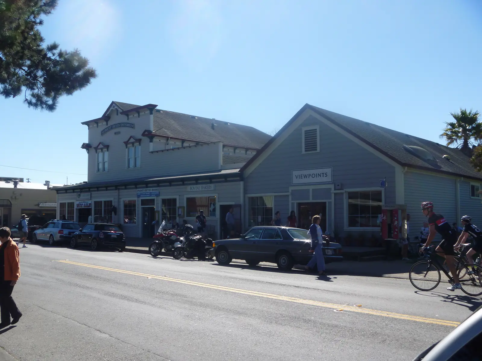
Photo: Edward Betts, CC BY-SA 3.0 A former railway town of timber storefronts at the head of Tomales Bay, and the natural lunch stop. The short main street has bakeries, cafés, a grocery and local cheese, and at weekends it fills with motorcycles and cyclists. Point Reyes National Seashore starts just west of town; its Bear Valley Visitor Center, half a mile off Highway 1 at Olema, has a short Earthquake Trail along the line where the San Andreas Fault moved in 1906.
Tip: Fill up here: the station in town is the only one between Tam Junction and San Rafael. The Point Reyes Lighthouse is a long out-and-back further west and worth a separate day.
- 6mile 44.6
Sight
Nicasio
Allow 15 min
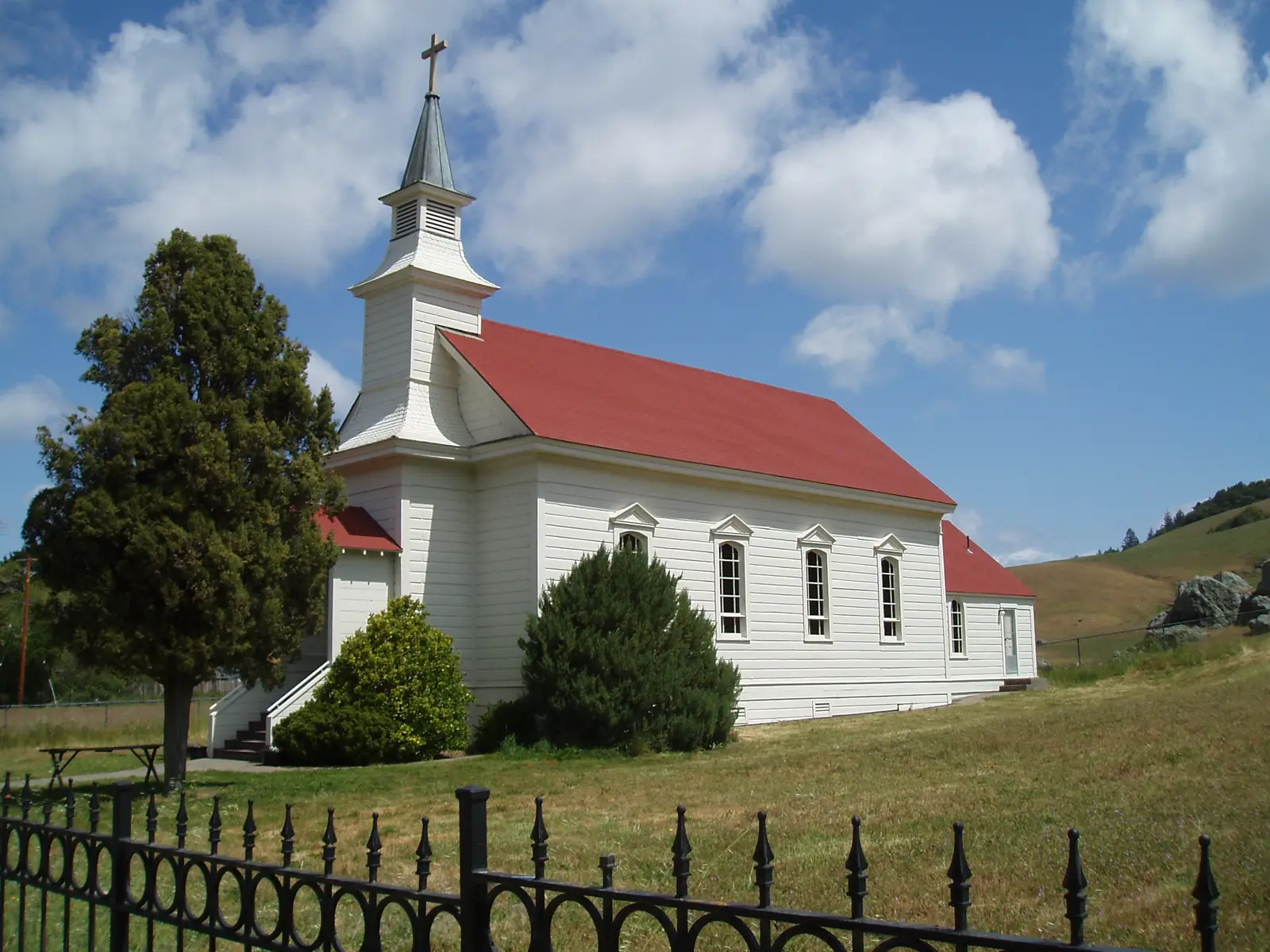
Photo: Tom Hilton, CC BY 2.0 A hamlet in a bowl of grassy hills, with a white wooden church, St. Mary's, an old schoolhouse and a roadhouse around a small square. After the busy coast it feels a long way from the city, and it is a good place to stretch your legs before Lucas Valley Road.
Tip: There is no fuel in Nicasio. If you skipped the station in Point Reyes Station, the next one is on the edge of San Rafael, about 13 miles on.
The roadmiles 45–56
Lucas Valley Road
Lucas Valley RoadTwo-lane tarmac, narrow and wooded, then suburbanTen miles east to the freeway. The road climbs from Nicasio's grassland into oak and redwood, narrows as it twists over the summit at about 630 feet, and passes the discreet gate of George Lucas's Skywalker Ranch; the valley was named long before him. The tight, shaded corners near the top hold damp and leaves well into the day. The last few miles run through the suburb of Lucas Valley, with a lower speed limit, to US 101.
The roadmiles 56–72
US 101 home
US 101Multi-lane freewaySixteen miles south through San Rafael, Corte Madera and Mill Valley, over Waldo Grade and back across the bridge. Traffic is heavy on fine weekend afternoons, when everyone returns from the coast at once; this is where lane splitting earns its keep. On the bridge, watch the overhead lane signs: a movable barrier shifts the lanes through the day.
- 7mile 72.1
Finish
Golden Gate Bridge Welcome Center
US 101 brings you back over Waldo Grade, through the Robin Williams Tunnel with its rainbow-painted arch, and onto the bridge southbound, with the whole city in front of you. Keep right at the south end of the bridge for the car park where you started.
Tip: The toll is taken electronically as you cross southbound: there are no booths and no cash lanes.
Before you ride
Licence and insurance
You need a motorcycle licence: a US licence with a motorcycle (class M1) endorsement, or for visitors a home licence that covers motorcycles, usually with an International Driving Permit. Rental companies set their own rules on licences, age and insurance, so check before you book. Liability insurance is compulsory in California.
Helmets, lane splitting and the toll
California requires a DOT-compliant helmet for every rider and passenger. Lane splitting is legal here and useful on US 101, but keep it slow and only in slow or stopped traffic. The Golden Gate Bridge toll is charged southbound only, into San Francisco, and is all-electronic: pay with FasTrak, set up a licence-plate account or a one-time payment online, or receive a bill by mail. On a rental bike, ask how the company handles the toll before you set off.
Fuel
There are stations on US 101 and at Tam Junction, then none on the route for about 28 miles until Point Reyes Station, and none again for about 23 miles until San Rafael. Fill up at Tam Junction on the way out and at Point Reyes Station at lunch. Many pumps ask for a US ZIP code before they take a card; with a foreign card, pay inside first and give the pump number.
When to ride
The loop is ridable all year. September and October usually bring the warmest, clearest days on the coast; April to June are green, with wildflowers on the hills. In summer a thick marine fog often covers the bridge, Mount Tam's western slopes and Highway 1 while Nicasio bakes in sunshine, so the temperature can swing widely within a few miles. Winter storms bring fallen trees and slides that occasionally close Panoramic Highway or Highway 1; check Caltrans QuickMap and Marin County's road alerts before you ride.
Cyclists, traffic and enforcement
Panoramic Highway, Highway 1 and Lucas Valley Road are some of the busiest cycling roads in the Bay Area. Give riders room on the climbs and never pass on a blind bend. Weekend traffic to Muir Woods, which requires a parking or shuttle reservation, and to Stinson Beach can back up Panoramic and Highway 1 on sunny days. The California Highway Patrol watches these roads at weekends; a weekday or an early start is far quieter.
Wildlife and the unexpected
Deer cross the wooded roads on Mount Tam, in the Olema Valley and on Lucas Valley Road, especially at dawn and dusk. On the ranch roads around Point Reyes and Nicasio expect slow farm vehicles and the odd patch of mud or gravel. Mobile signal is patchy on Panoramic Highway, in the Olema Valley and around Nicasio.
Ride further
Liked riding this one on your own? Moto Mass lists small, local operators who run guided motorcycle tours in these countries.
Free ride routes