
Highlights
Ask a San Francisco rider where to go on a Sunday morning and the answer is nearly always the same: Skyline, Alice's, 84, the coast. This loop strings them together. You leave Ocean Beach, run down the San Andreas rift valley past the Crystal Springs reservoirs, climb onto the spine of the Santa Cruz Mountains and follow Skyline Boulevard through redwood and fir to the crossroads at Sky Londa, where Alice's Restaurant has been the meeting point for Bay Area riders for decades. Route 84 then drops through La Honda to the sea at San Gregorio, and Highway 1 brings you back north along the bluffs, through Half Moon Bay and the tunnels under Devil's Slide.
It is about 87 miles, paved throughout, and suits any rider comfortable on a twisty two-lane road. The hard part is the six miles of Route 84 below Alice's: tight, shaded and often damp. The rest is flowing ridge road and open coast. The two things that catch visitors out are the fog, which can turn a sunny city morning into a cold, wet ridge in a few miles, and the crowd: at weekends you share every mile with cyclists, sports cars and the Highway Patrol.
Longest stretch without a gas station: about 26 miles, between mile 36 and mile 62.
The ride, stop by stop
- 1mile 0
Start
Ocean Beach
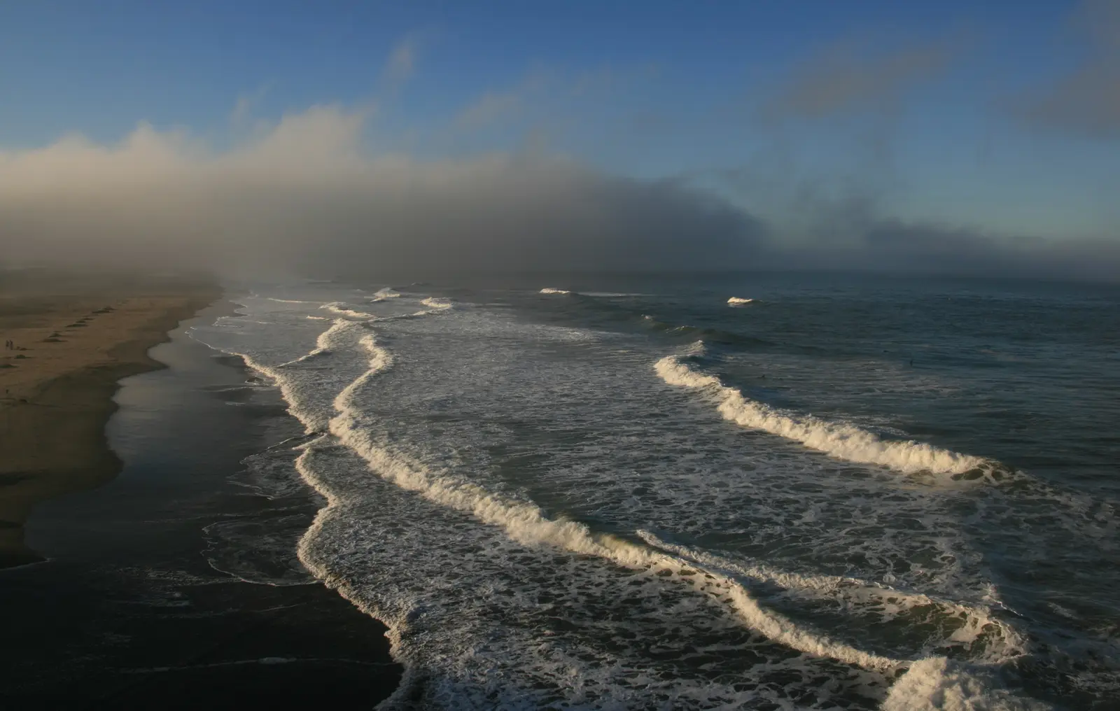
Photo: Brocken Inaglory, CC BY-SA 3.0 The west end of Lincoln Way, where Golden Gate Park runs out at the Pacific beside the Murphy Windmill. The old Upper Great Highway south from here is now Sunset Dunes, a park closed to cars, so the loop heads inland on Sunset Boulevard. It is a quick escape: you are on the freeway within seven miles.
Tip: If the beach is grey and dripping, the fog usually thins once you are inland on I-280; pack a warm layer anyway for the ridge and the coast.
The roadmiles 0–6
Out of the city
Lincoln WaySunset BoulevardLake Merced BoulevardBrotherhood WayCA 1City streets, then freewayLincoln Way and Sunset Boulevard carry you south through the Sunset District, then Lake Merced Boulevard and Brotherhood Way lead to a short stretch of Route 1 and onto Interstate 280. It is the slowest part of the ride: watch for cars pulling out of the cross streets and for pedestrians at the crossings.
The roadmiles 6–24
I-280 and the climb to the ridge
I 280CA 35CA 92Multi-lane freeway, then two-lane highwayFourteen miles of fast, wide freeway down the rift valley of the San Andreas Fault, with the Crystal Springs reservoirs below on your right. Leave for Route 35, which runs briefly beside the reservoir before joining Route 92 west; together they climb about 550 feet in two miles to the ridge, where Skyline turns off south. Route 92 is the main road to the coast and can be slow with beach traffic at weekends.
The roadmiles 24–36
Skyline Boulevard
CA 35Two-lane tarmac, forested ridgeTwelve miles of Route 35 along the crest of the Santa Cruz Mountains, climbing from about 860 feet to just over 2,300 feet near Skeggs Point before dropping to Alice's. The corners are well sighted and flowing, but the road is shaded by redwoods and firs, so fog can leave it wet when the sky above is blue. Expect cyclists on every climb and cars slowing for the trailhead car parks.
- 2mile 32.2
Viewpoint
Skeggs Point
Allow 10–15 min
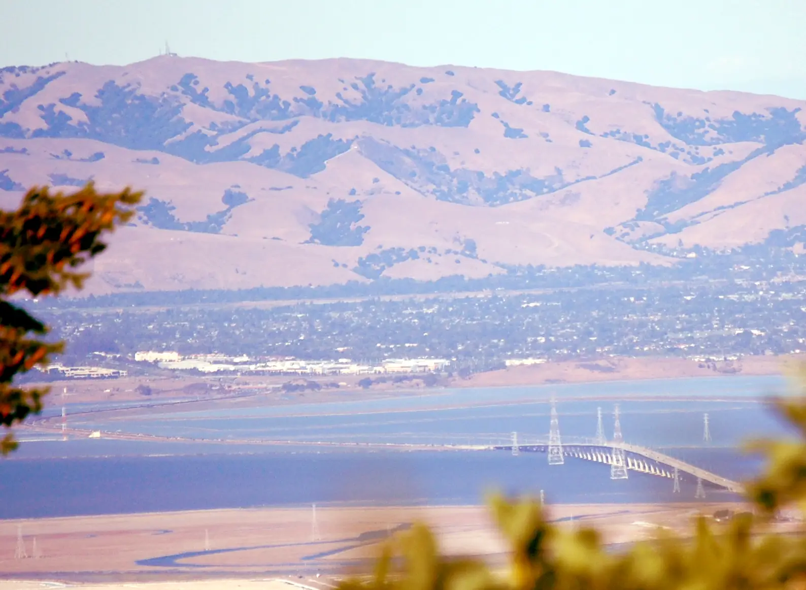
Photo: David Jordan at English Wikipedia, CC BY-SA 3.0 A roadside car park at about 2,300 feet, close to the highest point of the loop. On a clear day the view east takes in the whole southern bay: the salt ponds, the Dumbarton Bridge and the bare East Bay hills beyond. It is also a natural place to pause before the last few miles of Skyline into Alice's.
Tip: Pull in and out slowly: the lot opens straight onto Skyline, and cars and cyclists come round the bends quickly in both directions.
- 3mile 36.1
Food
Alice's Restaurant
Allow 45–60 min
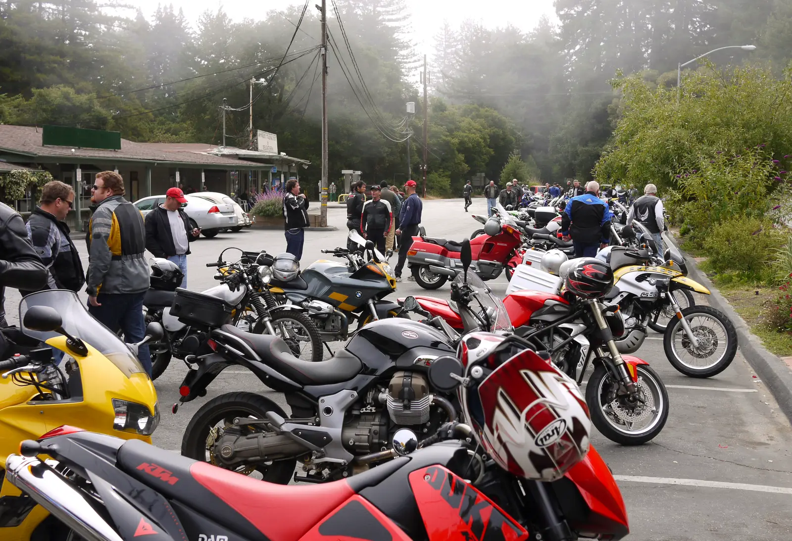
Photo: Craig Howell from San Carlos, CA, USA, CC BY 2.0 The roadhouse at Sky Londa, where Skyline Boulevard crosses Route 84, is the most famous motorcycle stop in the Bay Area. On a weekend morning the car park fills with every kind of bike, from café racers to adventure tourers, and it is as much a place to look and talk as to eat. Breakfast here is the traditional first stop of the loop.
Tip: At weekends arrive before about 10 am for a parking space; leave carefully, as the junction is busy and traffic on Skyline is fast.
The roadmiles 36–51
Route 84 to the sea
La Honda RoadCA 84Two-lane tarmac, steep and twisty, then open valleyThe hardest stretch. From Alice's, Route 84 (La Honda Road) drops about 1,100 feet in six miles through deep redwood forest to La Honda: tight, often blind corners, damp shade, leaves and the odd patch of moss on the surface. Below the village the road opens out along San Gregorio Creek, with faster sweepers through ranch land for the last nine miles to Highway 1. Phone signal is patchy all the way.
- 4mile 51.4
SightDetour
San Gregorio State Beach
Allow 30 minAbout ¼ mile each way
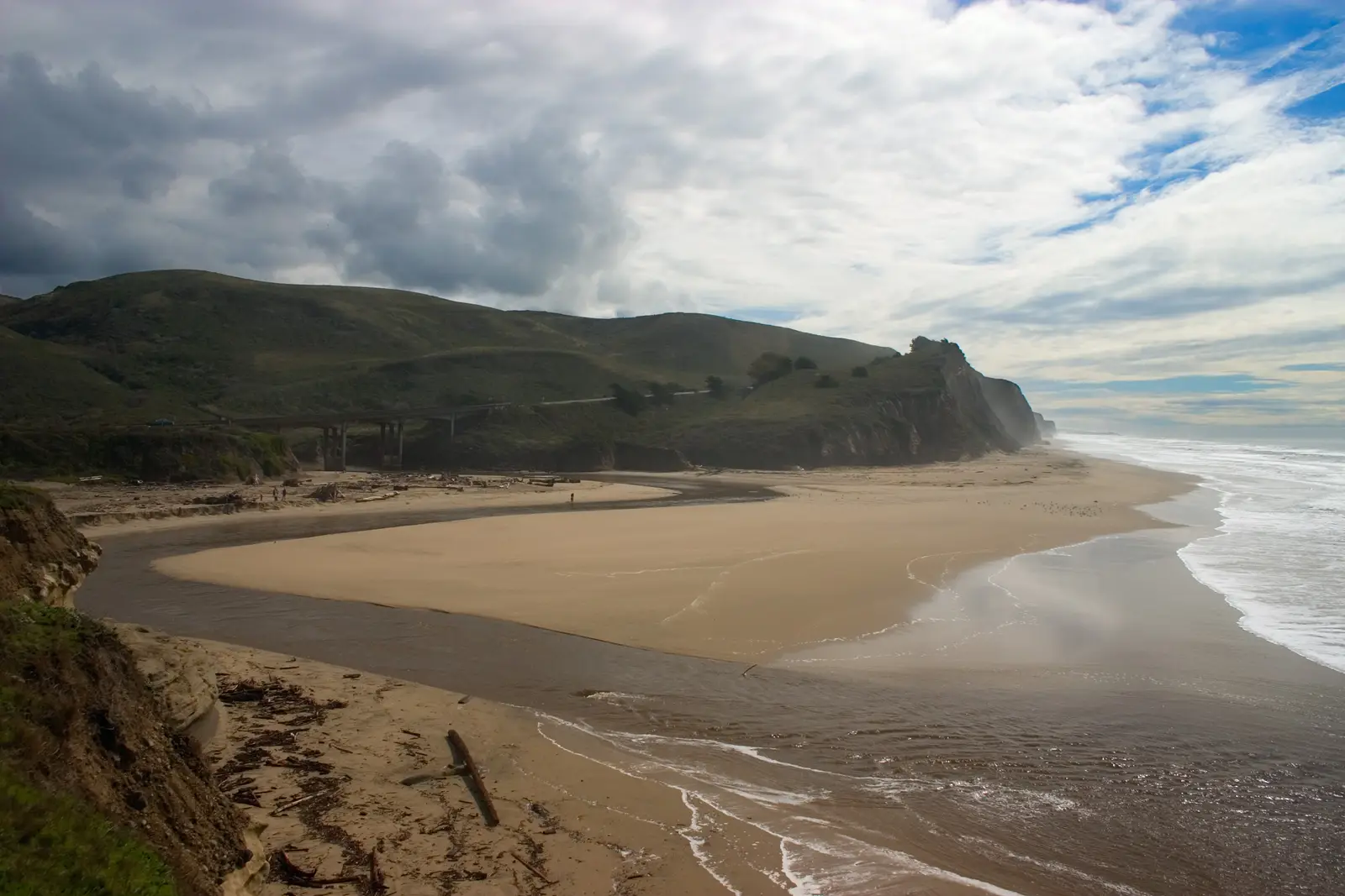
Photo: The original uploader was Seano1 at English Wikipedia., CC BY-SA 3.0 Route 84 meets the Pacific where San Gregorio Creek spreads into a lagoon below sandstone bluffs. A short path from the car park leads down to the sand and the creek mouth, a good place to stretch your legs after the mountains. A mile back up the valley, the old general store at the San Gregorio crossroads is a long-standing stop for riders and cyclists alike.
Tip: The entrance is just south of the Route 84 junction on Highway 1. It is a state beach, and a day-use parking fee is charged.
The roadmiles 51–80
Highway 1 north
CA 1Two-lane highway, then freewayTwenty-eight miles up the coast. The first eleven to Half Moon Bay run over farmland on the bluffs, with the ocean on your left and a crosswind off the sea. Traffic slows through Half Moon Bay and past Pillar Point Harbor, then the road runs along the cliffs past Montara and through the twin bores of the Tom Lantos Tunnels into Pacifica. North of Pacifica it becomes a freeway and climbs to Daly City.
- 5mile 61.9
FoodDetour
Half Moon Bay
Allow 45–60 minAbout ¼ mile each way
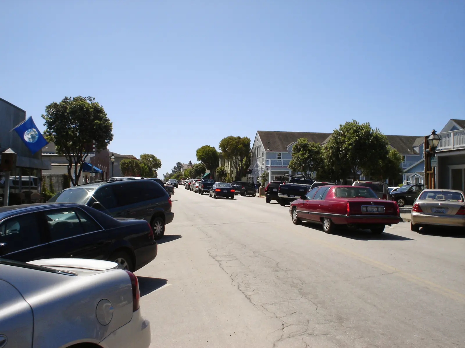
Photo: Sallyrob at English Wikipedia, Public domain The coast's main town sits just inland from Highway 1. Main Street is lined with old timber buildings, bakeries and simple places to eat, and it is the easiest lunch stop on the second half of the ride. Fields of pumpkins and flowers surround the town, and in October the farm stands are piled high.
Tip: Fill up here: it is the first sure fuel since Sky Londa, and the stations along Highway 1 in town are on your route.
- 6mile 72.8
Viewpoint
Devil's Slide
Allow 30–45 min
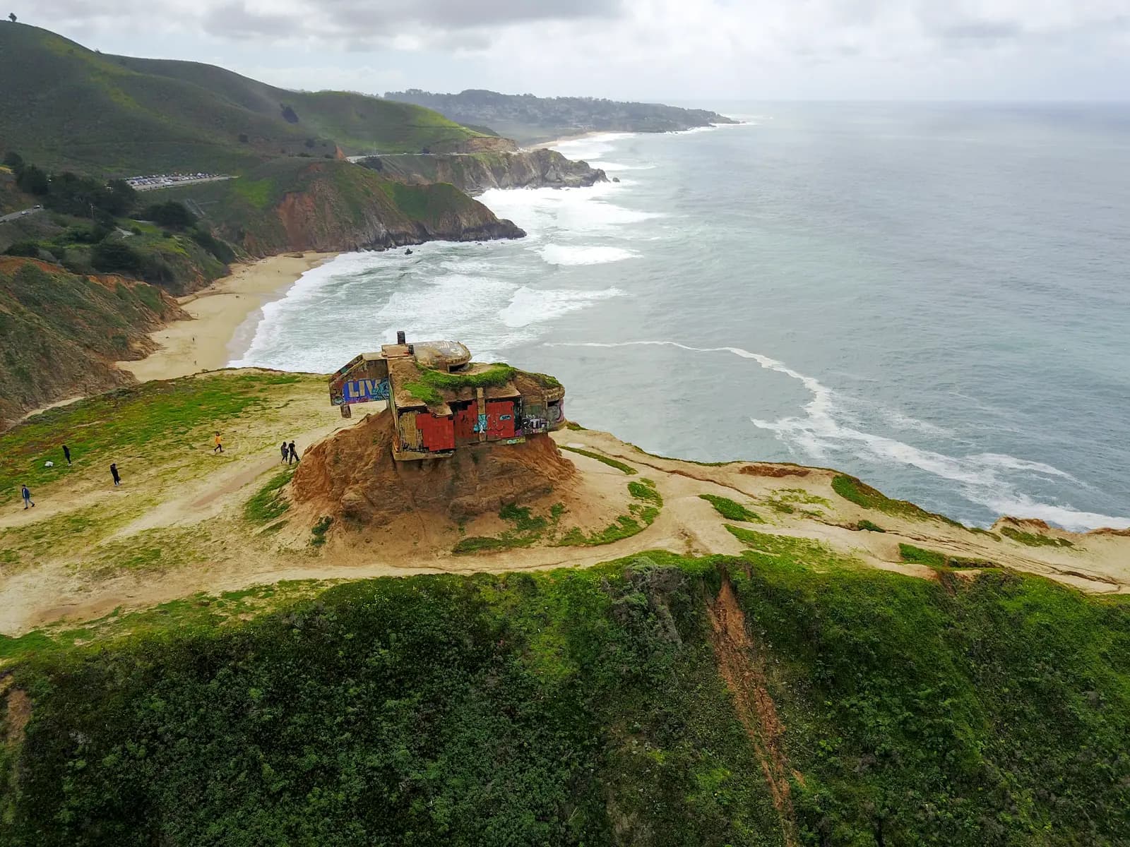
Photo: Christopher Michel from San Francisco, USA, CC BY 2.0 For decades Highway 1 clung to the cliff here and kept sliding into the sea, closing the coast road for months at a time. Since 2013 traffic has run through the Tom Lantos Tunnels instead, and the old road on the cliff face has become the Devil's Slide Trail, open to walkers and cyclists only. A stroll along it gives you the view the road used to have: sheer cliffs, seabirds on the rocks and a wartime concrete lookout bunker on the headland.
Tip: Park at the trailhead car park at either end of the tunnels. The old road is paved and a little over a mile end to end, so riding boots will do.
The roadmiles 80–87
Skyline and home
CA 3548th AvenueDivided suburban highway, then city streetsLeave Highway 1 for Route 35, here a four-lane boulevard, which runs north along the clifftops past Fort Funston and the west shore of Lake Merced. Turn left onto Sloat Boulevard past the zoo, then right onto 48th Avenue, a quiet street behind the dunes, back to Lincoln Way.
- 7mile 87.4
Finish
Ocean Beach
The loop comes home along the cliffs at Fort Funston, round Lake Merced and up 48th Avenue behind the dunes to where it began. In the late afternoon the fog often rolls back in over the beach; Golden Gate Park is right behind you if you want to stretch your legs.
Before you ride
Licence and insurance
California riders need a motorcycle (M1) endorsement. Visitors should carry a home licence that covers motorcycles, usually with an International Driving Permit; rental companies set their own rules on licences and age. Liability insurance is compulsory in California, so check what your rental includes.
Helmets and lane splitting
California requires every rider and passenger to wear a DOT-compliant helmet. Lane splitting is legal here, which helps on I-280 and in city traffic, but do it slowly and only when traffic is slow or stopped. There are no tolls anywhere on this loop.
Fuel
There are plenty of stations in the city and Daly City, then only the small station at Sky Londa before Half Moon Bay, about 26 miles further on. Many pumps ask for a US ZIP code before they accept a card; if yours is foreign, pay inside first and tell the cashier the pump number.
When to ride
The loop is ridable all year. September and October usually bring the clearest, warmest days on the coast, and April to June are green and bright. In summer, fog often blankets the coast and the ridge while the bay side is in sunshine. Winter rain can bring slides that close Route 84, Skyline or Highway 1; check Caltrans QuickMap before you set out. Avoid the October weekend of the Half Moon Bay pumpkin festival, when Highway 1 and Route 92 jam for miles.
Traffic and enforcement
Skyline and Route 84 are among the most popular riding roads in California, and the California Highway Patrol watches them closely at weekends. Keep to the limits, and give cyclists room on the climbs, where many ride two abreast. A weekday or an early weekend start is far quieter.
Wildlife and the unexpected
Deer cross Skyline and Route 84 at dawn and dusk. On the coast, watch for farm vehicles and for cars braking suddenly to pull off at the beaches. The temperature can drop sharply between Half Moon Bay and the tunnels when the fog is in; full gear with a warm layer underneath is the local habit.
Ride further
Liked riding this one on your own? Moto Mass lists small, local operators who run guided motorcycle tours in these countries.
Free ride routes