

A Great Day Out
Pattaya, Thailand
1 day
THB 6,900 / person

Pattaya's best short escape: a fishing village on the coast, the gold Buddha etched into the cliff at Khao Chi Chan, a royal temple in parkland and a lakeside road home. Flat, paved and under 80 km.
Pattaya is not a city of quiet roads, and any honest day ride from it starts with some traffic. This loop keeps that to a minimum. It leaves from the viewpoint on Khao Phra Tamnak, runs the length of Jomtien Beach, takes about 11 km of Sukhumvit Road south to the fishing village of Bang Saray, then turns inland onto rural roads to Khao Chi Chan, where the outline of a seated Buddha is etched in gold into a sheer cliff, and to the parkland temple of Wat Yansangwararam. Back roads through Huai Yai bring you north to Mabprachan Reservoir and a lakeside road into town.
It suits riders who want a half day out of the city on a rented scooter. The highest point of the loop is under 100 metres, the roads are paved throughout and there are no hard corners. The challenge is traffic: Sukhumvit is a busy dual carriageway with trucks and U-turn lanes, and the town streets at either end are crowded with baht buses and scooters. Once you leave Bang Saray, the roads are mostly narrow two-lane country lanes with light traffic.
Longest stretch without a fuel station: about 25 km, between km 25 and km 50.
Start
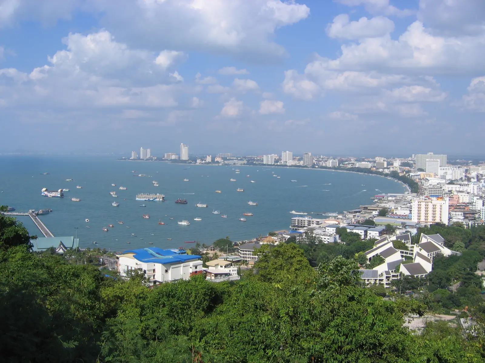
The hill between Pattaya Bay and Jomtien is the easiest landmark in town to meet at, and the viewpoint at the top looks north across the bay, the Bali Hai pier and the whole curve of the beach. The monument to Admiral Prince Abhakara of Chumphon, honoured as the father of the Royal Thai Navy, stands beside it, and a kilometre down the road the Big Buddha of Wat Phra Yai sits on the southern end of the same hill.
Tip: Leave early, before the town traffic builds. The first fuel stations on the loop are on Sukhumvit Road at about km 11.
The roadkm 0–10.2
From the viewpoint you drop past the Big Buddha, take Thappraya Road over the hill and run the length of Jomtien along Jomtien Second Road and Jomtien Beach Road. The beach road is two-way, concrete and slow, with baht buses stopping without warning and cars pulling out of parking spaces. Soi Na Jomtien 6 takes you out to Sukhumvit Road.
The roadkm 10.2–24.6
There is no coast road south of Na Jomtien, so Route 3 carries you for about 11 km. It is fast and busy, with trucks, and traffic crosses from one side to the other at U-turn lanes. Keep to the left lane and watch for vehicles slowing to turn. Fuel is easy here. At km 21.5 you turn off into Bang Saray and loop through the village streets.
Food
Allow 30–60 min
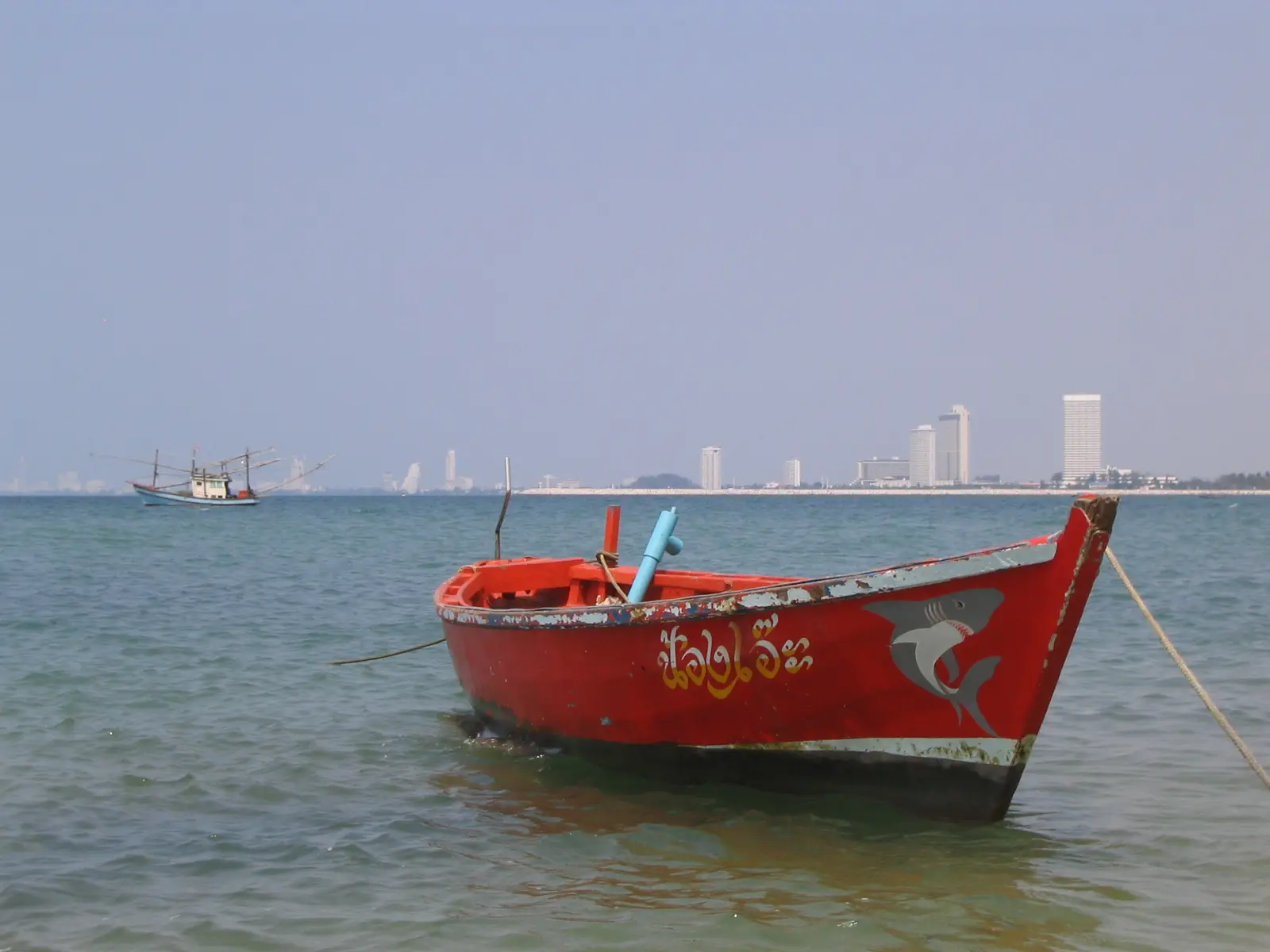
A fishing village on the coast south of Pattaya, with long-tail and fishing boats moored off the beach and a looser, slower feel than Jomtien. Small restaurants and cafés line the streets near the water and along the road in, so this is the natural place for coffee or an early lunch before you turn inland.
Tip: South of Bang Saray much of the coast around Sattahip is Royal Thai Navy land. The loop turns inland here; don't follow side roads south into military areas.
The roadkm 24.6–40.5
Cross Sukhumvit Road with care and head inland on Soi Wanphen, then the Huai Tu Reservoir road and Soi Khao Chi Chan 1/2 to the Buddha cliff. Rural roads 1003, 5010, 3002 and 5001 take you on to Wat Yansangwararam. Traffic is light, but tour vans and coaches use these roads to reach the sights, and farm vehicles turn in and out of side roads.
Sight
Allow 20–30 min
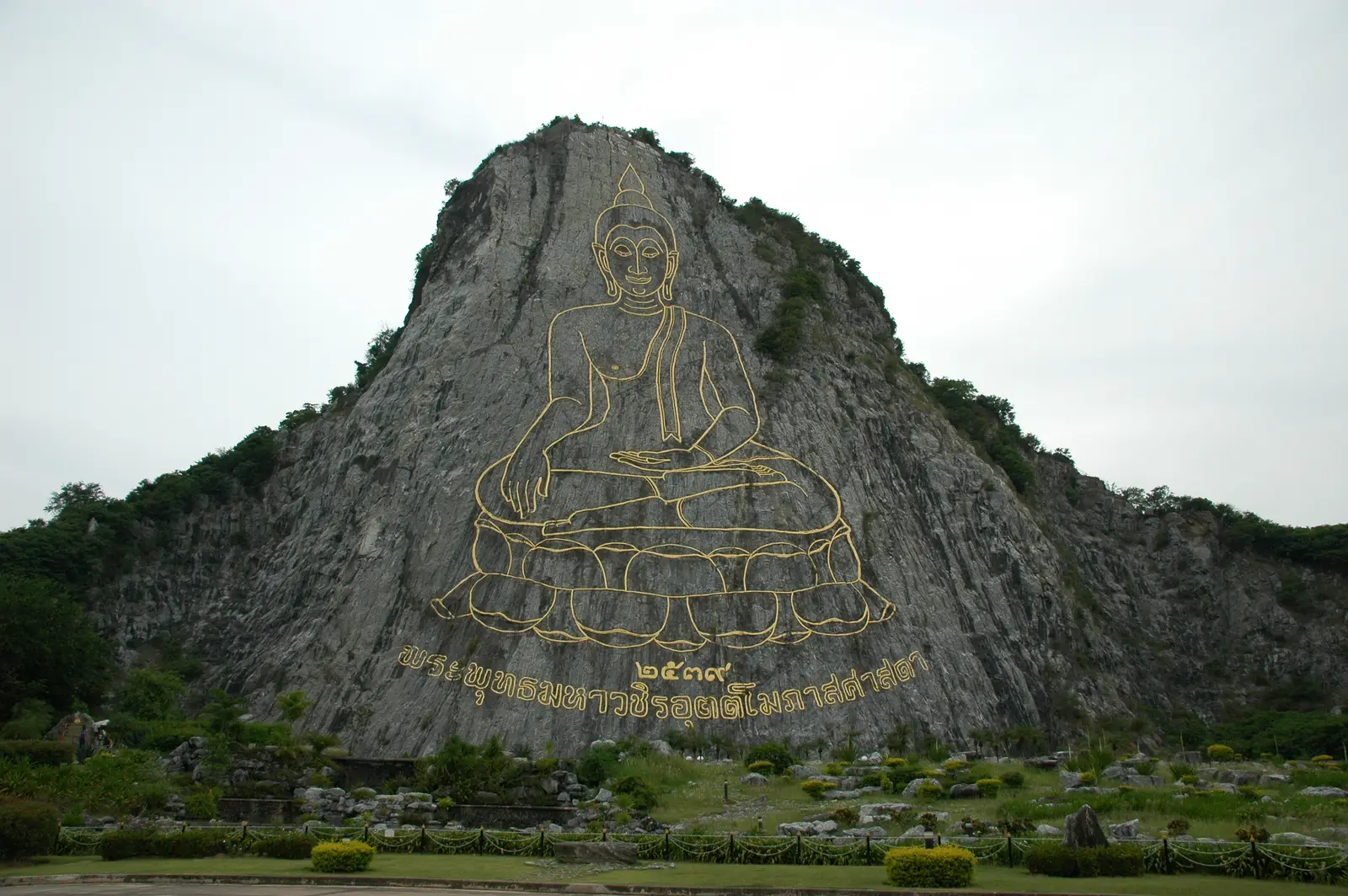
The outline of a seated Buddha, picked out in gold lines on the sheer rock face of Khao Chi Chan, covers most of the cliff. It was made in 1996 to mark King Bhumibol's fiftieth year on the throne. A lawn and gardens in front of the cliff give you the full view, and Wat Khao Chi Chan stands just beside the road.
Tip: The lawn has little shade. In the hot season come in the morning and carry water.
Sight
Allow 45–90 min
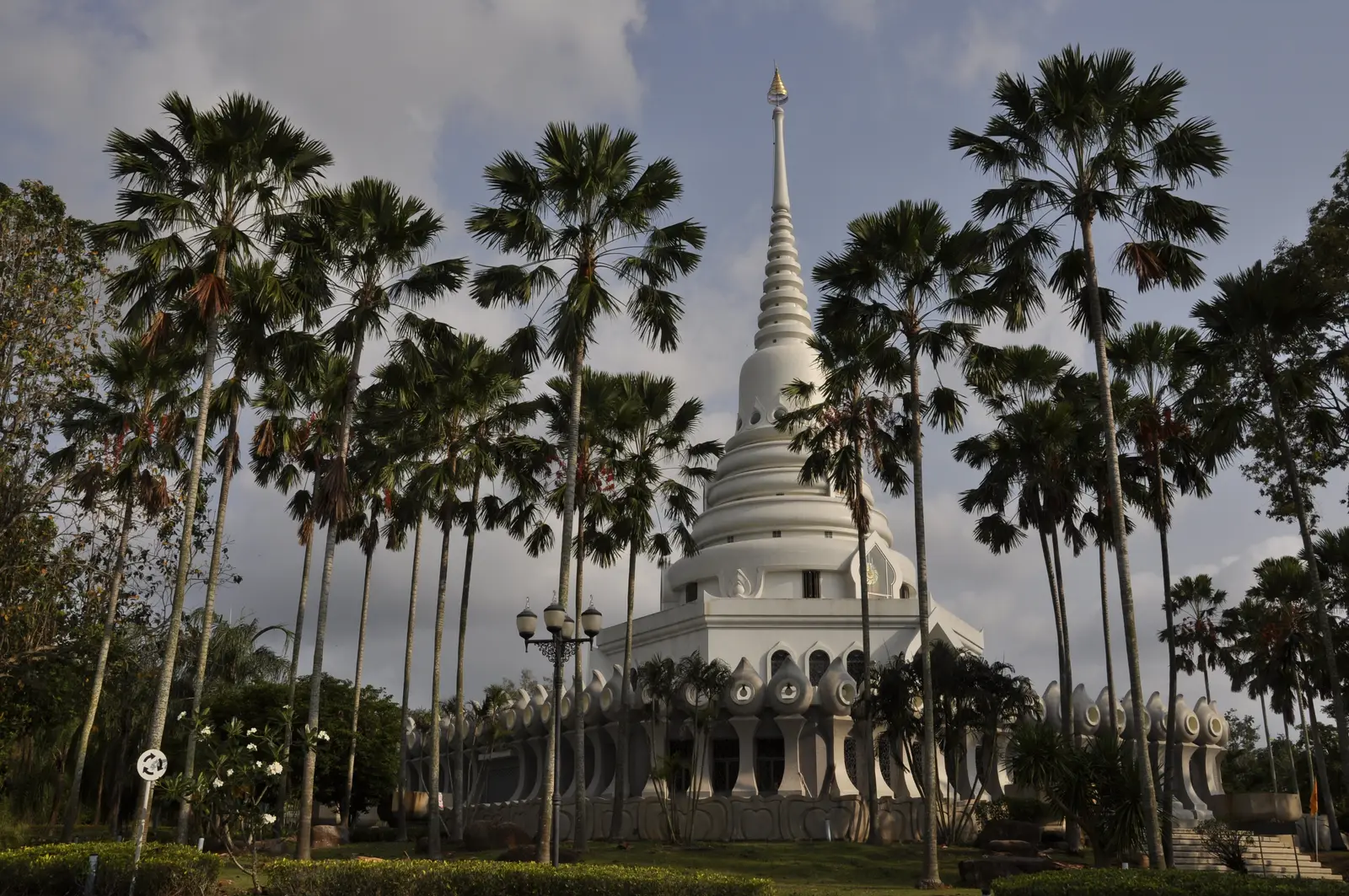
A royal temple founded in the 1970s under King Bhumibol's patronage, set in wide landscaped grounds with lakes. The road passes the Viharn Sien museum and a Chinese-style pavilion on a lake before reaching the main temple, and its halls and chedis come in several styles from across Asia. It is quiet, green and spread out, so the bike is a good way to see it.
Tip: This is a working temple: cover shoulders and knees, and take your shoes off before entering any hall.
The roadkm 40.5–56.2
Rural road 1008, Soi Sak Ngaeo 1, Huai Yai Road and Rural road 2081 carry you north through villages, farmland and new housing. The roads are flat and narrow with gentle bends. You cross Motorway 7, which motorcycles may not use: stay on the local roads and ignore signs for the motorway.
The roadkm 56.2–72.4
Rural road 1095 and Soi Mabprachan Bon 1 swing round the north of the reservoir, then Rural road 1095 follows the western shore and heads west into Pattaya. The lakeside stretch is the most relaxed riding of the day; after it the road gets busier with shops and housing as you approach Sukhumvit Road.
Viewpoint
Allow 15–60 min
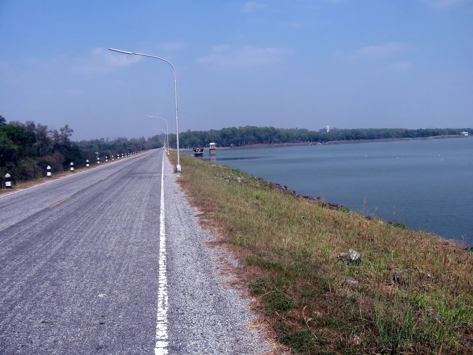
A large reservoir on the eastern edge of Pattaya. After the loop swings round its northern end, the road follows the western shore with open water beside you for a couple of kilometres. Cafés and restaurants are scattered along the road here and just after, which makes it a good place for a late lunch or a cold drink before the last stretch into town.
Tip: The lakeside road is narrow and shared with cyclists and walkers, so keep the speed down.
The roadkm 72.4–78.8
Cross Sukhumvit Road onto Pattaya Klang Road, then turn south along Beach Road, which is one-way, to its end and climb back up Khao Phra Tamnak. Expect heavy traffic, baht buses stopping anywhere and pedestrians stepping out between parked cars, especially in the evening.
Finish
Beach Road and the climb up Khao Phra Tamnak bring you back to where you started. The viewpoint faces west over the bay, so if you time the end of the ride for late afternoon you can watch the sun go down over the water.
Thailand requires a motorcycle licence: either a Thai licence or your home licence with an International Driving Permit that covers motorcycles. Police checkpoints are frequent around Pattaya and do stop foreign riders, and most travel insurance will not pay out if you ride without the right licence.
Any 125 cc scooter will do this loop: it is flat, paved and short. On Sukhumvit Road a 150 cc scooter or a small motorcycle feels more comfortable keeping up with traffic, especially two up.
Fuel is easy to find. There are several stations on Sukhumvit Road and around Bang Saray, more along the way through Huai Yai and on the road back into Pattaya from Mabprachan. Small shops in the villages also sell bottled fuel.
November to February is the most comfortable time, with less humidity and little rain. March to May is the hot season; ride early in the morning. The rainy season runs from May to October, with heavy afternoon storms that leave standing water on low roads; plan to be back before mid-afternoon.
Thailand drives on the left. Helmets are compulsory for rider and passenger, and the police around Pattaya enforce it. Motorway 7 is closed to motorcycles. On Sukhumvit Road, watch for vehicles crossing at U-turn lanes, and in town for baht buses pulling over without signalling.
The coast south of Bang Saray around Sattahip includes Royal Thai Navy land; this loop turns inland before it, and you should not ride into military areas or past guarded gates. At Wat Yansangwararam and Wat Khao Chi Chan, dress modestly, with shoulders and knees covered.
These operators run guided tours from Pattaya, listed alphabetically. Contact any of them through Moto Mass.
Free ride routes