
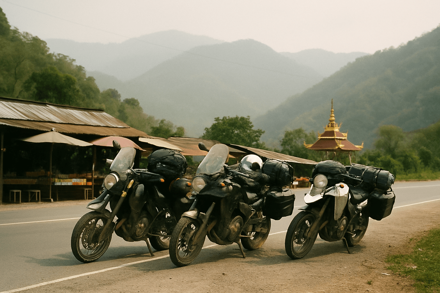
5 Day Spirit of the North Motorcycle Tour
Chiang Mai, Thailand
5 days
THB 42,000 / person

Chiang Rai's big day out: a climb to the tea hills of Mae Salong at over 1,100 metres, a steep descent through hill villages, the walled river town of Chiang Saen and the meeting of three countries on the Mekong.
This loop strings together the two rides that everyone in Chiang Rai talks about. In the morning you climb from the rice plain to Mae Salong, the Yunnanese hill town also called Santikhiri, where tea terraces run along the ridges at over 1,100 metres. After lunch you drop down through the hills, cross the plain to Chiang Saen, a walled town of ancient brick temples on the bank of the Mekong, and take a short detour north to Sop Ruak, where Thailand, Laos and Myanmar meet at the Golden Triangle. A quiet country road brings you back to Chiang Rai.
At about 200 km plus the detour it is a full day, and the mountain half is demanding: the roads into and out of Mae Salong are steep, with tight hairpins and gradients of around 15% on the way down. Everything is paved, so a 125 cc scooter can do it, but a bigger scooter or a small motorcycle makes the climbs far easier and the long flat stretches less tiring. Start early and the plain will still be cool when you reach the hills.
Longest stretch without a fuel station: about 46 km, between km 140 and km 186.
Start
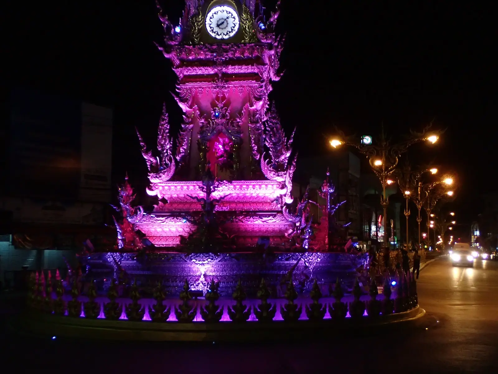
The gilded clock tower in the middle of town was designed by Chalermchai Kositpipat, the artist behind the White Temple, and it is the easiest landmark in Chiang Rai to meet at. Leave by 8 am: the first hour is on the main highway north, and it is far calmer before the morning traffic builds.
Tip: There are plenty of fuel stations on Route 1 in the first 30 km; fill up before you turn off at Mae Chan.
The roadkm 0–28
Route 1 carries you north across the plain to Mae Chan. It is fast and busy with trucks and pickups rather than scenic. Keep left, watch for U-turn gaps and vehicles pulling out of side roads, and fill up here.
The roadkm 28–57
Route 107 heads west through farmland and villages, rising slowly at first and then climbing more steeply after about km 50 to reach roughly 800 metres at the junction with Route 1130. Traffic thins out quickly once you leave Mae Chan.
The roadkm 57–72
Route 1130 turns north and climbs hard to about 1,000 metres within 3 km, dips through a valley and climbs again, with a stretch of around 15% near km 67, before reaching Mae Salong at the top of the ride. The hairpins are tight and often blind: stay well left and sound your horn as local riders do.
Food
Allow 1–1½ hours with lunch
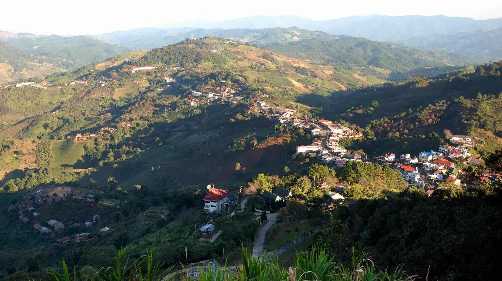
A ridge-top town settled by Kuomintang soldiers and their families who crossed from Yunnan after the Chinese civil war. Chinese signs, tea shops and Yunnanese noodle kitchens line the main road, and the Chinese Martyrs' Memorial Museum tells the story of how they got here. A chedi on the summit above town looks out over the whole range.
Tip: This is the highest part of the ride, a little over 1,100 metres. It is noticeably colder than Chiang Rai on winter mornings, so bring a warm layer.
The roadkm 72–107
Route 1130 continues east along the ridge past tea terraces, then drops steeply, at around 15% and briefly more between about km 74 and km 77. Below that the descent is long and winding, past hill-tribe villages, down to about 430 metres by km 100 and Route 1 just north of Mae Chan. Watch for gravel and wet patches in the shaded corners and for pickups cutting the bends.
Viewpoint
Allow 15–30 min
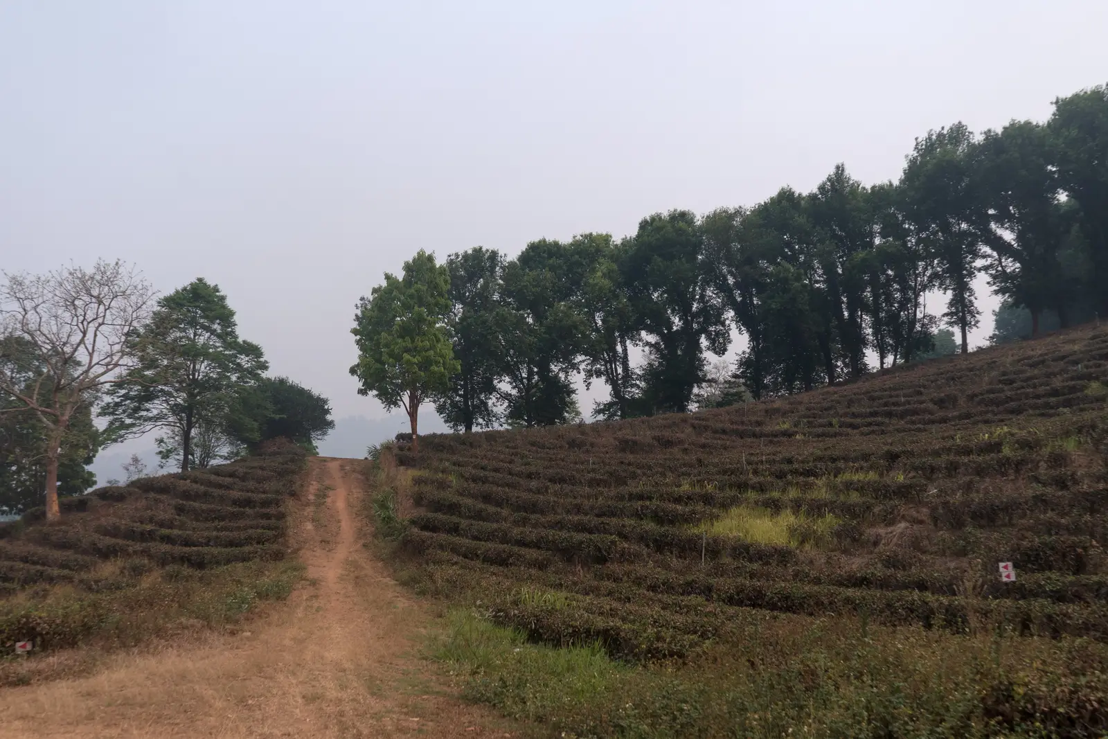
East of town, Route 1130 runs past hillsides combed into rows of tea, the crop that replaced opium in these hills. Several plantations along this stretch have viewing points and sell tea to taste, and the terraces make the best photographs of the day.
Tip: The steepest descent of the ride starts right here, at around 15% for a few kilometres. Take it in a low gear and keep the brakes for the corners.
The roadkm 107–142
A short stretch of Route 1 leads to Route 1016, which runs straight and flat across rice fields and orchards to the walls of Chiang Saen. For the Golden Triangle, follow the Mekong north from town for about 10 km and come back the same way.
ViewpointDetour
Allow 45 minAbout 10 km each way, north along the Mekong
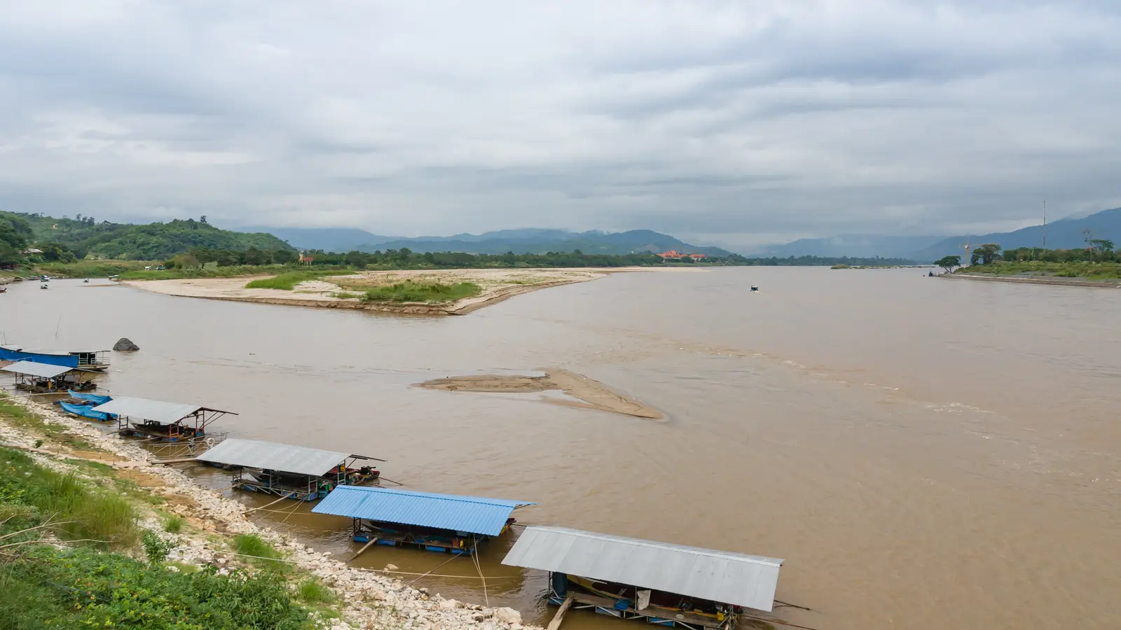
Here the Ruak river flows into the Mekong and three countries face each other: Thailand on your side, Myanmar across the Ruak and Laos across the Mekong. A large golden Buddha sits on the riverbank, and the hilltop temple of Phra That Doi Pu Khao, up a short side road, gives the classic view of the confluence. The Hall of Opium, a large museum about the region's opium history, is just past the village on the same road.
Tip: Keep an eye on the time: from here it is still about 70 km back to Chiang Rai, much of it on unlit country roads.
Sight
Allow 45 min–1 hour
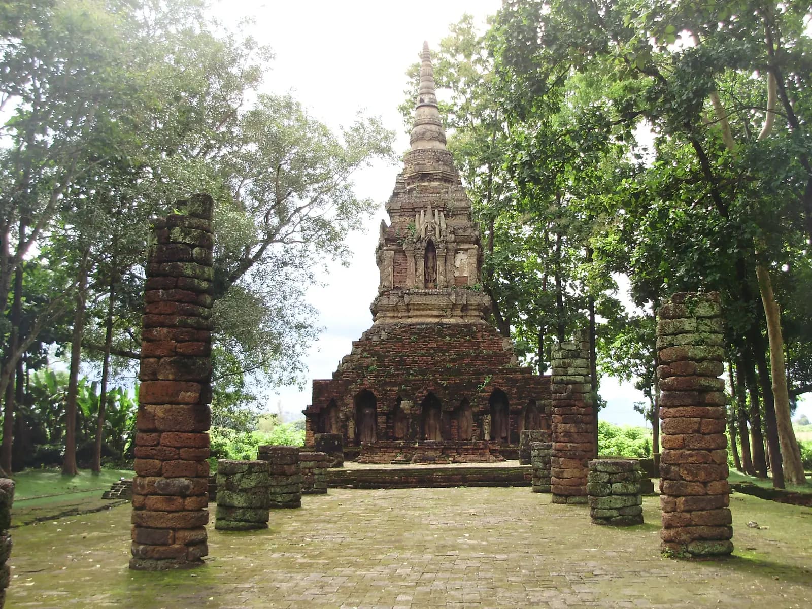
Route 1016 enters Chiang Saen through a gap in its old earth-and-brick ramparts, and inside the walls ruined temples sit among the houses and trees. Wat Pa Sak, just outside the western gate, keeps fine stucco work on its brick chedi; inside, the tall brick chedi of Wat Phra That Chedi Luang and the Chiang Saen National Museum are a few minutes apart. The riverside road along the Mekong has simple restaurants and a view across to Laos.
Tip: Fill up in Chiang Saen. The back road to Chiang Rai has no fuel station for about 45 km.
The roadkm 142–199.8
Rural roads CR 4004 and CR 1063, the old road between Chiang Saen and Chiang Rai, take you south through villages and paddy fields with little traffic. Watch for dogs, farm vehicles and children on bicycles. From km 184 you rejoin Route 1 for the last 14 km into the city, the same road you left on in the morning; traffic builds from late afternoon.
Finish
The loop ends where it began. The clock tower puts on a short light-and-music show in the evening, and the night bazaar a short walk to the south-east is an easy place for dinner after a long day.
Thailand requires a motorcycle licence: either a Thai licence or your home licence with an International Driving Permit that covers motorcycles. Police checkpoints on the main roads around Chiang Rai and near the borders do stop foreign riders, so carry your passport or a copy too. Most travel insurance will not pay out if you ride without the right licence.
A 125 cc scooter will get round solo, but the climbs to Mae Salong are long and steep and the day is 200 km. A 150 cc scooter or a small motorcycle is much more comfortable, especially two up. Check the brakes before you leave: the descent east of Mae Salong is the steepest part of the ride.
Stations are frequent on Route 1, along Route 107 and across the plain to Chiang Saen, and there is a station in Mae Salong and another on the descent east of it. The longest gap on the loop is the back road from Chiang Saen to Route 1, about 45 km without a station, so leave Chiang Saen with a full tank. Village shops sell bottled fuel if you are caught short.
November to February is cool, dry and clear, the best time for views from Mae Salong; mornings in the hills can be cold. From late February to April, farm burning across northern Thailand fills the air with smoke and the hills often disappear in haze. From May to October the rain makes the steep mountain roads slippery; ride in the morning, before the afternoon storms.
Thailand drives on the left. Helmets are compulsory for rider and passenger. The roads around Mae Salong are steep, with tight hairpins and gradients around 15%; ride them in daylight and give yourself time. Allow a full day with stops, and plan to be off the mountain roads well before dark.
This loop runs close to the borders with Myanmar and Laos. Stay on the public roads, expect occasional checkpoints, and do not try to cross into either country by road unless you have the right visa and paperwork for the bike.
These operators run guided tours from Chiang Rai, listed alphabetically. Contact any of them through Moto Mass.
Chiang Mai, Thailand
5 days

Golden Triangle, Thailand
15 days

Chiang Mai, Thailand
13 days
Chiang Mai, Thailand
4 days
Chiang Mai, Thailand
8 days

Northern Thailand, Thailand
8 days
Free ride routes