
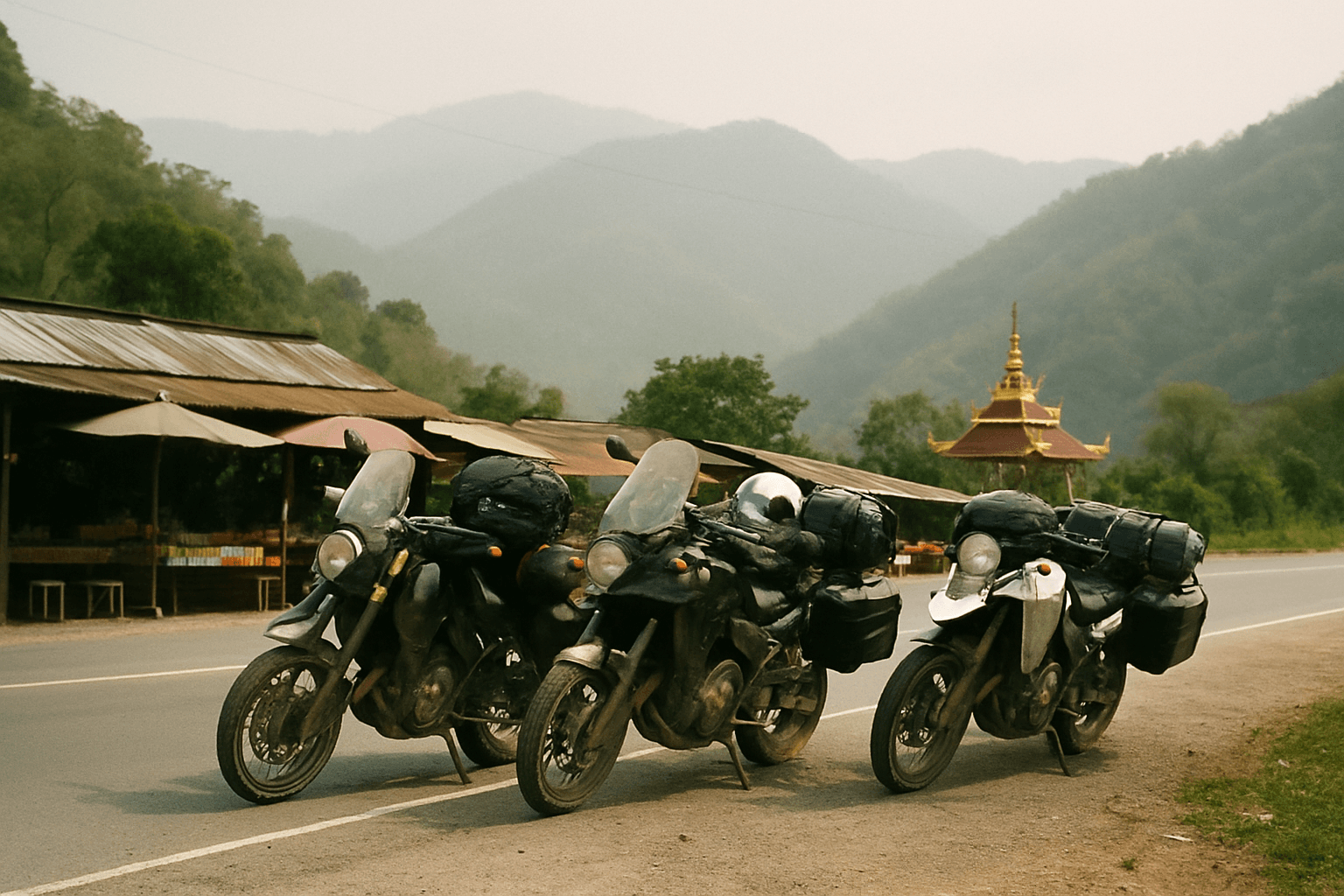
5 Day Spirit of the North Motorcycle Tour
Chiang Mai, Thailand
5 days
THB 42,000 / person

Chiang Mai's classic day ride: a jungle waterfall, a climb to 1,100 metres through pine forest, and a ridge road home. Tarmac all the way.
Ask anyone in Chiang Mai who rides where to go for a day and they will say Samoeng. The loop leaves the old city, follows the Mae Sa valley past waterfalls and orchid farms, then climbs hard through forest to a pass above 1,100 metres before swinging home along Route 1269, one of the best-loved riding roads in northern Thailand.
It is short enough to ride before lunch and good enough to ride twice. The surface is paved the whole way, so a rented 125 cc scooter will do it, but the climbs are steep and the corners are many: this is a day for riders who are comfortable on mountain roads.
Longest stretch without a fuel station: about 33 km, between km 35 and km 67.
Start
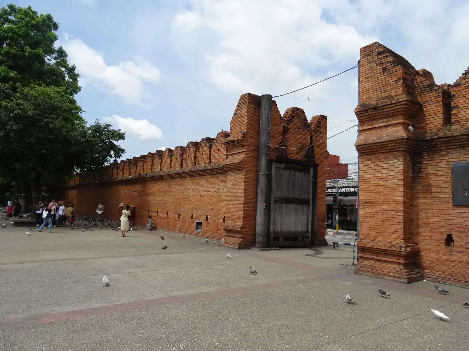
The brick gate on the east side of the old city moat is the easiest place in Chiang Mai to meet, and most rental shops are a few streets away. Leave early: by 8 am the traffic is still light and the mountain air is cool.
Tip: Fill up with fuel before you leave the city, or at the stations along Route 107 in Mae Rim.
The roadkm 0–17
Chang Phueak Road and Route 107 carry you north to Mae Rim. It is busy and fast rather than pretty. Keep left, watch for vehicles pulling out of side roads and U-turn gaps, and fill up here: there is little fuel once you leave the valley.
The roadkm 17–35
Route 1096 turns west and follows the Mae Sa stream past waterfalls, orchid farms and elephant camps. Expect tour vans and slow traffic around the attractions, especially at weekends, and cyclists on the climb.
Sight
Allow 45–90 min
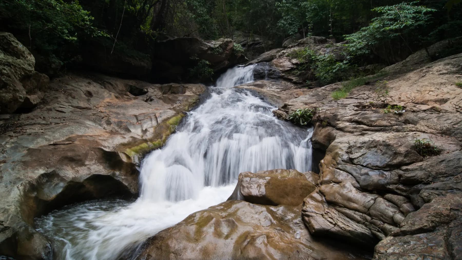
Ten tiers of water stepping down through the jungle, inside Doi Suthep–Pui National Park. A shaded footpath follows the stream from the car park; the lower tiers are a few minutes' walk, and the upper ones reward the climb with fewer people.
Tip: There is a national park entrance fee at the gate, higher for foreign visitors than for Thais. Keep the ticket for the day.
Sight
Allow 1–2 hours
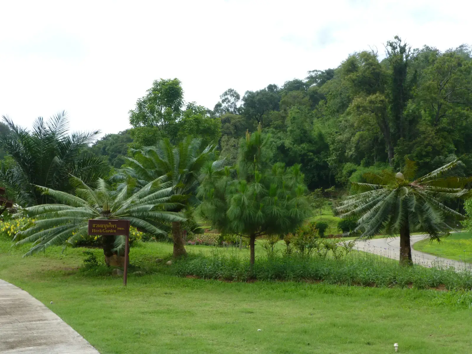
A huge hillside garden with a cluster of glasshouses near the top and a canopy walkway through the treetops. Even if you skip it, the stretch of road past its gates is one of the prettiest in the valley.
Tip: It takes a good chunk of the day. If you only have the morning, save it for another ride and keep climbing.
The roadkm 35–48
The road leaves the valley and climbs hard through forest to the top of the loop at about 1,120 metres. Corners are tight and often blind; stay well left and use the horn on hairpins as local riders do.
Viewpoint
Allow 15 min
The top of the climb and the highest point of the loop, a little over 1,100 metres. A roadside pull-out looks west over ridge after ridge of forest. On a clear winter morning you can see a long way; in the afternoon cloud often rolls in below you.
Tip: It gets cold up here between December and February. Bring a layer even if the city is warm.
FoodDetour
Allow 1 hour with lunchAbout 5 km each way, downhill from the junction
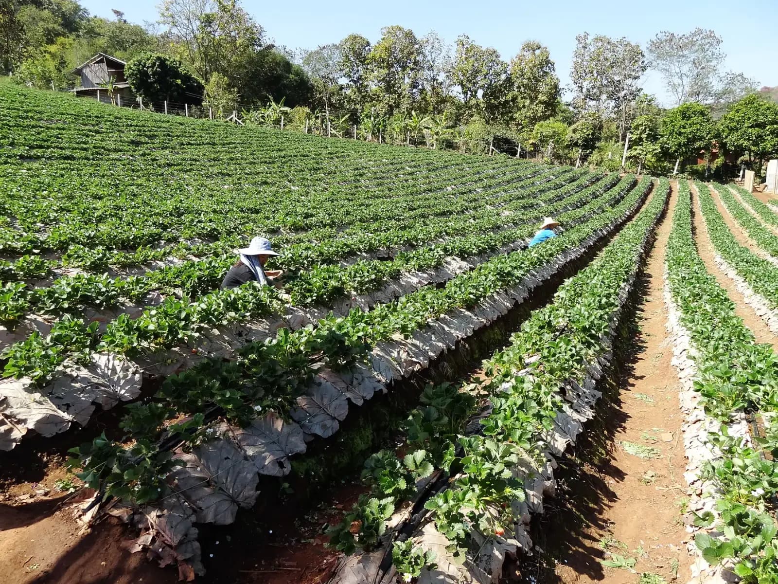
At the junction where Route 1096 meets Route 1269, the main loop turns left. Turn right instead and the road drops into a valley of strawberry farms around Samoeng Tai, with simple restaurants along the road. It is the natural lunch stop, and in season the farms sell fruit straight from the field.
Tip: Strawberry season is roughly December to February. The ride back up to the junction is steep, so take it steady on a small scooter.
The roadkm 48–78
The highlight. A ridge road with views either side, then a long, twisting descent to the Hang Dong valley with gradients up to about 15%. Watch for gravel on the inside of corners after rain and for pickups cutting the bends.
Viewpoint
Allow 10 min
Just after the junction, Route 1269 runs along a ridge with views opening on both sides before it starts its long descent towards Hang Dong. This is the reason riders come back to Samoeng: flowing corners, little traffic and the whole valley below.
Tip: The descent that follows is steep in places, up to about 15%. Use engine braking and a lower gear rather than riding the brakes.
The roadkm 78–90
Route 121 and Route 108 bring you back through the southern suburbs, then Wua Lai Road takes you to the old city. Traffic builds from late afternoon.
Finish
The loop comes back into the old city along Wua Lai Road, the silversmiths' street, and finishes at the south gate. The food stalls around Chiang Mai Gate are a good place to end the day, and on Saturday evenings Wua Lai Road turns into a walking-street market.
Thailand requires a motorcycle licence: either a Thai licence or your home licence with an International Driving Permit that covers motorcycles. Police checkpoints around Chiang Mai do stop foreign riders, and most travel insurance will not pay out if you ride without the right licence.
Any 125 cc scooter will make it round solo. Two up, or if you want to enjoy the climbs, a 150 cc scooter or a small motorcycle is much more comfortable. Check the brakes before you leave: the descent on Route 1269 is long.
There are plenty of stations on Route 107 and in the Mae Sa valley, then none on the main loop for about 30 km between the top of the valley and the Hang Dong side of Route 1269. Small shops sell bottled fuel in villages, but leave the valley with a full tank.
November to February is cool, dry and clear. From late February to April, farm burning across northern Thailand often fills the hills with smoke and the views disappear. From May to October the rain makes the mountain corners slippery; ride in the morning before the afternoon storms.
Thailand drives on the left. Helmets are compulsory for rider and passenger. Weekends bring more traffic and cyclists to Route 1096; a weekday morning is the quietest time to ride. Allow a full day if you want to stop at everything.
These operators run guided tours from Chiang Mai, listed alphabetically. Contact any of them through Moto Mass.
Chiang Mai, Thailand
5 days

Chiang Mai, Thailand
13 days
Chiang Mai, Thailand
4 days
Chiang Mai, Thailand
8 days

Northern Thailand, Thailand
8 days
Free ride routes