
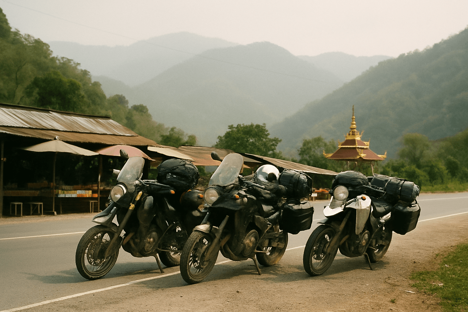
5 Day Spirit of the North Motorcycle Tour
Chiang Mai, Thailand
5 days
THB 42,000 / person

A day's ride from Chiang Mai to the roof of Thailand: south down Route 108, then up Route 1009 past three big waterfalls and the twin royal pagodas to the summit at over 2,500 metres.
Doi Inthanon is Thailand's highest mountain, and riding to the top of it is the other great day out from Chiang Mai. You leave the old city by the south gate, run down the Ping valley on Route 108 to Chom Thong, then turn onto Route 1009, a single paved road that climbs about 2,300 metres in less than 50 km. On the way it passes some of the biggest waterfalls in the north and the two royal pagodas that look out over the ridges towards Myanmar, before ending in moss-hung cloud forest at the summit.
Route 1009 ends at the top, so this is an honest out-and-back: you ride the same road home, and the descent is half the ride. The surface is paved all the way, but it is a long day of about 205 km, and the last stretch below the summit is very steep. It suits riders who are at ease on mountain roads, ideally on something bigger than a basic scooter, who leave Chiang Mai early and pack a warm layer.
Longest stretch without a fuel station: about 57 km, between km 75 and km 132.
Start
The south gate of the old city sits on the moat at the top of Wua Lai Road, which leads straight out to Route 108. Starting here keeps you clear of the old city's one-way system, and the market stalls by the gate are already busy with breakfast early in the morning.
Tip: Leave by 7 am. The summit is a long way off, and the clearest views are usually in the morning before cloud builds on the mountain.
The roadkm 0–2.3
Wua Lai Road takes you south from the gate, past the silversmiths' workshops, to the junction with Route 108. Traffic is light early in the morning; keep left and watch for scooters pulling out of side streets.
The roadkm 2.3–55
A fast, flat highway through Hang Dong and San Pa Tong to Chom Thong. It is busy rather than scenic, with trucks, U-turn gaps and vehicles joining from both sides; stay in the left lane and keep your speed sensible. Fuel stations are frequent. Route 1009 turns right just before Chom Thong town, where Wat Phra That Si Chom Thong, one of the province's best-known temples, lies a little further along Route 108.
The roadkm 55–70
Route 1009 runs up a wooded valley, gaining little height at first. You pass the park checkpoint and Mae Klang Waterfall; tour vans and pickups stop and turn without much warning around the attractions.
Sight
Allow 20–30 min
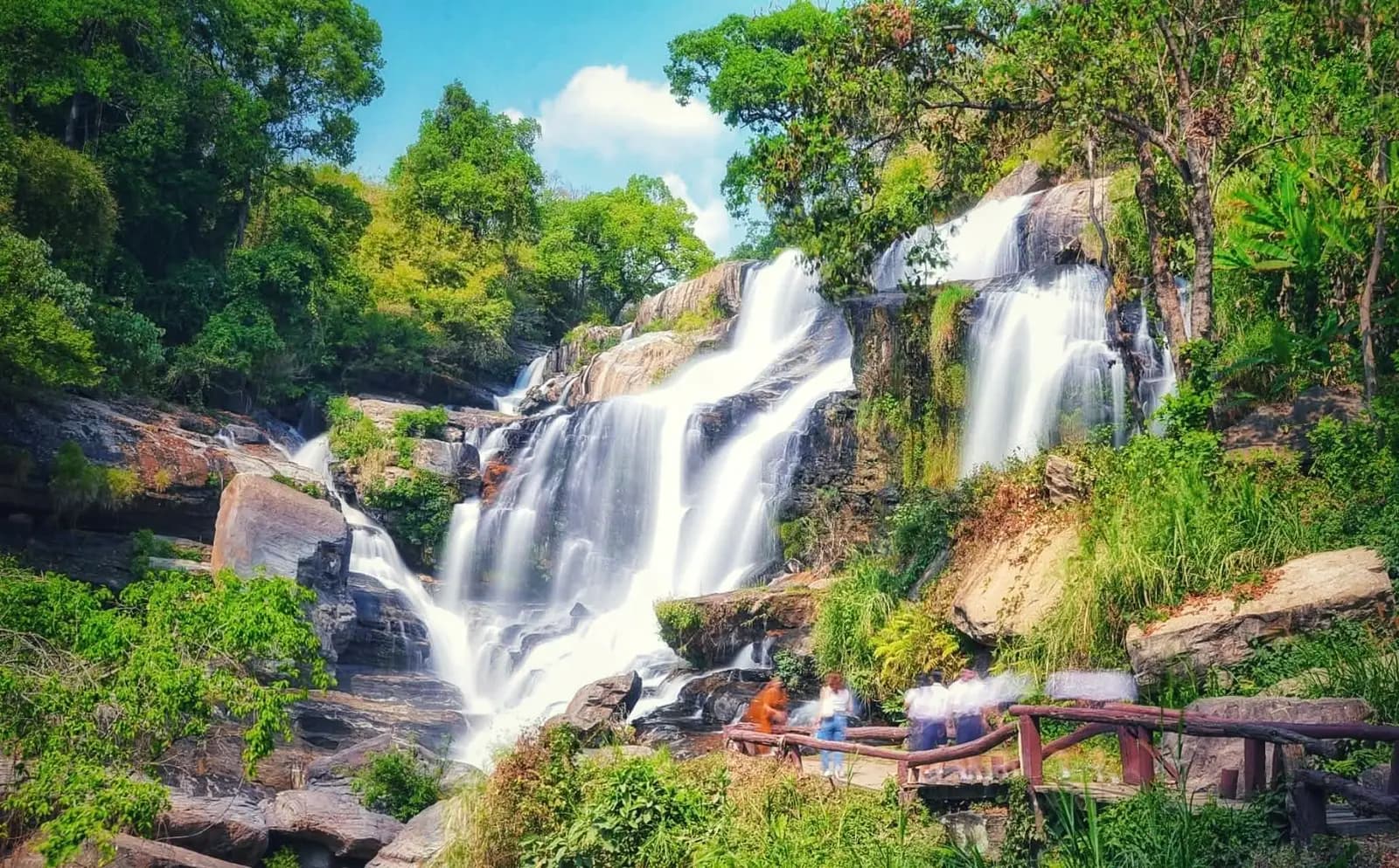
The first waterfall on Route 1009 and the easiest to reach: a broad cascade tumbling over boulders a short walk from the road, with shady banks and simple food stalls around it. It is a favourite picnic spot for Thai families, so weekends are busy.
Tip: The national park entrance fee is collected at the checkpoint on Route 1009, higher for foreign visitors than for Thais, with a further charge for the motorcycle. Keep the ticket: it covers the waterfalls and the summit.
The roadkm 70–87
The road starts to climb in earnest past Wachirathan Waterfall, from about 500 metres to over 1,200 metres at Khun Klang. The bends are well surfaced and mostly open, but slow vans and trucks are common, so overtake only where you can see well ahead.
Sight
Allow 30 min
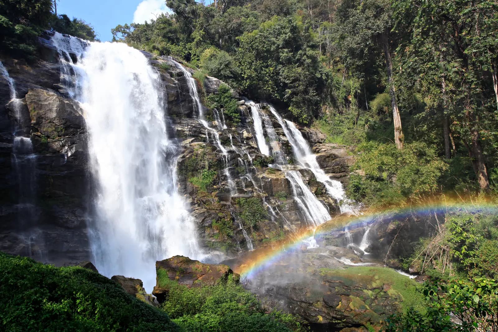
The most powerful of the mountain's falls: a wide curtain of water dropping down a rock face, close enough to the viewing area that the spray often throws a rainbow on a sunny morning. It is a few minutes' walk down from the road, and simple restaurants line the car park.
Tip: The paths and steps by the falls are wet and slippery all year. Wear proper shoes rather than riding boots with smooth soles.
SightDetour
Allow 45 min with lunchAbout 1.5 km each way
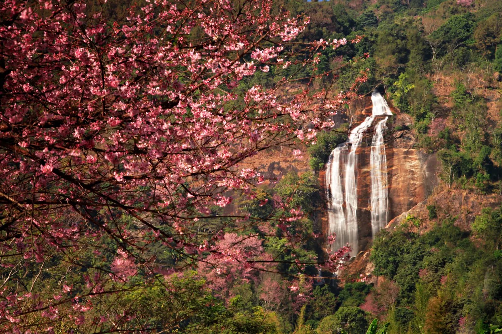
At Khun Klang, the village by the park headquarters, a short side road leads to the royal agricultural station, where Siriphum's twin streams fall side by side down a tall cliff above the gardens. Around the turn-off, Khun Klang has simple restaurants and is the natural place to stop for lunch before the final climb.
Tip: From roughly January to February, wild Himalayan cherry trees flower pink around Khun Klang, and the area gets busy at weekends.
The roadkm 87–102.9
The hardest part of the ride. Above Khun Klang the road climbs past the royal pagodas to the summit at about 2,560 metres, with gradients up to about 17% near the top. Cloud often sits on this stretch, so expect fog, damp tarmac and poor visibility at any time of year, and use your lights.
Viewpoint
Allow 45 min
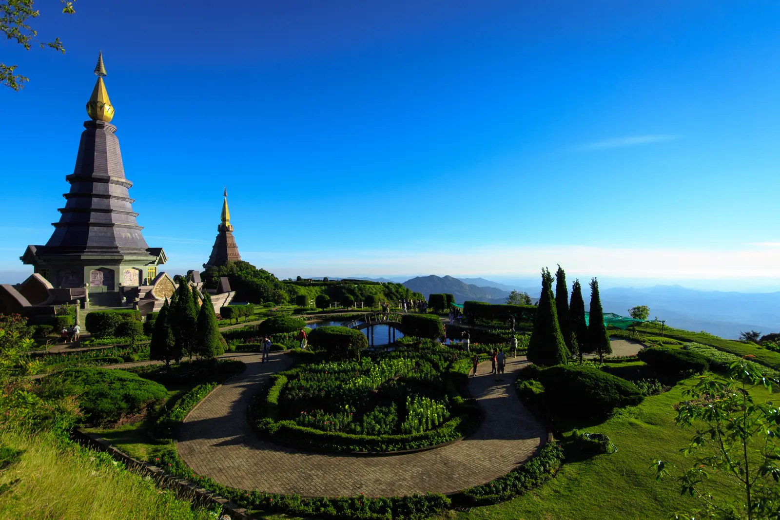
The twin pagodas were built by the Royal Thai Air Force to honour King Bhumibol and Queen Sirikit, and stand in terraced flower gardens on a ridge above 2,000 metres. Walk round the terraces for the view: on a clear day the ridges roll away west towards the Myanmar border.
Tip: The pagodas charge their own admission, separate from the park ticket. Dress respectfully, with shoulders and knees covered, as at any Thai temple.
Viewpoint
Allow 30–45 min
The road ends in a small loop at the top, about 2,560 metres up. The summit itself is wooded, so there is no grand view, but there is the sign marking the highest point in Thailand, the shrine to King Inthanon, the last ruler of Chiang Mai, after whom the mountain is named, and a short boardwalk through cool, moss-covered cloud forest.
Tip: It is cold up here: on winter mornings the temperature is often in single figures. Put your warm layer on before the descent, not after.
The roadkm 102.9–204.8
You ride Route 1009 back down to Route 108 and north to Chiang Mai. The descent from the summit is long and steep: use a low gear and engine braking, and give the brakes a rest at the waterfalls. Traffic on Route 108 and through the southern suburbs builds in the late afternoon.
Finish
The ride ends where it began, back at the south gate after the long run up Route 108. The food stalls around Chiang Mai Gate fill up in the evening, and on Saturday evenings Wua Lai Road becomes a walking-street market.
Thailand requires a motorcycle licence: either a Thai licence or your home licence with an International Driving Permit that covers motorcycles. Police checkpoints around Chiang Mai do stop foreign riders, and most travel insurance will not pay out if you ride without the right licence.
A 125 cc scooter can make it solo, but it will be slow on the steepest climbs and the brakes work hard on the way down. A 150 cc scooter or a small motorcycle of 250 cc or so is far more comfortable, and two up it is close to essential. Check the brakes and tyres before you leave.
Route 108 has stations all the way to Chom Thong. On Route 1009 there is only one station on the map, low down near the 75 km mark, and none from there to the summit and back. Fill up in Chom Thong before you turn off, and top up again on the way home if you need to.
The summit is more than 2,000 metres higher than Chiang Mai and much colder: on winter mornings it is often in single figures, and the wind chill on the descent makes it feel colder still. Bring a warm jacket and gloves even when the city is hot, and rain gear in the wet season.
November to February is cool, dry and clearest, though weekends and Thai holidays bring heavy traffic to the summit road. From late February to April, farm burning fills the hills with haze and the views disappear. From May to October afternoon storms make the mountain road slippery and foggy; ride in the morning.
Thailand drives on the left. Helmets are compulsory for rider and passenger. A national park entrance fee is charged on Route 1009, higher for foreign visitors. Allow a full day with stops, and plan to be off the mountain well before dark: you do not want to ride the descent at night.
These operators run guided tours from Chiang Mai, listed alphabetically. Contact any of them through Moto Mass.
Chiang Mai, Thailand
5 days

Chiang Mai, Thailand
13 days
Chiang Mai, Thailand
4 days
Chiang Mai, Thailand
8 days

Northern Thailand, Thailand
8 days
Free ride routes