
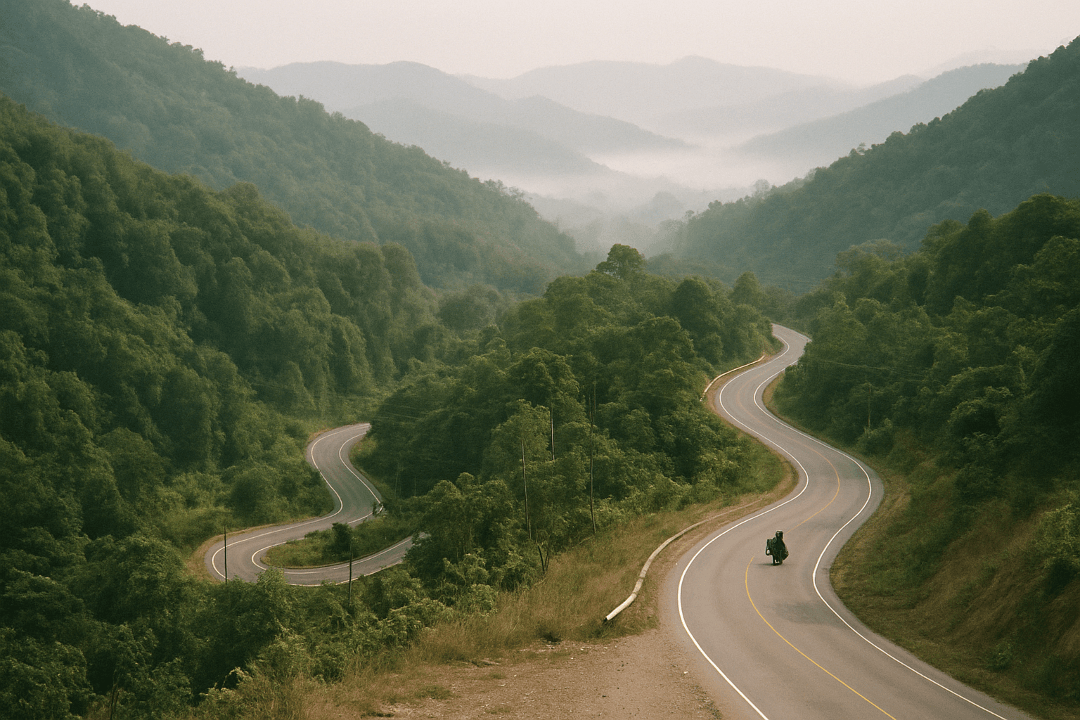
The Golden Triangle Loop: Motorcycle Route Guide
The Golden Triangle loop is the other classic ride out of Chiang Mai. The Mae Hong Son loop heads west into tight corners. This one heads north and east, to the point where Thailand, Laos and Myanmar meet on the Mekong, and comes back along the Lao border on one of the best ridge roads in the country. It is longer, less technical and more varied: tea villages, river roads, border towns and mountain viewpoints, with fewer minibuses on the way.
This guide covers the usual shape of the loop, the roads that matter, when to ride it, the border questions riders ask, and every guided tour on Moto Mass that rides it. For the wider picture, see our Thailand motorcycle tours hub.
Quick facts
| Item | Detail |
|---|---|
| Distance | About 700 to 800 km for the core loop, about 1,000 km if you come back through Nan |
| Start and finish | Chiang Mai |
| Key roads | 107 to Tha Ton, 1130 to Mae Salong, 1290 along the Mekong, 1155 and 1093 along the Lao border |
| Days | 4 at a push, 5 to 7 to enjoy it, 7 to 11 on most guided versions |
| Surface | Sealed almost everywhere, with rough patches on the border ridge |
| Best months | November to February. Avoid March and April smoke |
The shape of the loop
There is no single official route. The version most riders follow, and the one the GT-Rider map of the region suggests, runs Chiang Mai, Fang, Tha Ton, Doi Mae Salong, Doi Tung, Mae Sai, the Golden Triangle, Chiang Saen, Chiang Khong, Chiang Kham, Phayao and back to Chiang Mai (GT-Rider Golden Triangle map). GT-Rider calls it a ride of four to seven days at minimum.
| Stage | Road | Approx. distance | Character |
|---|---|---|---|
| Chiang Mai to Tha Ton | 107 | 180 km | Valley road north through Chiang Dao and Fang |
| Tha Ton to Doi Mae Salong | 107, then 1130 | 45 km | Climb into the hills, tea terraces, little traffic |
| Mae Salong to Mae Sai | 1130, Highway 1 | 65 to 75 km | Down the range, longer via Doi Tung |
| Mae Sai to Chiang Khong | 1290 | About 90 km | The Golden Triangle point, then hilly river road |
| Chiang Khong to Phu Chi Fa | 1020, 1155 | About 70 km | Up onto the Lao border ridge |
| Phu Chi Fa to Chiang Mai | 1093, then via Chiang Kham and Phayao | About 280 km | Ridge road, then a long run home |
Distances are approximate, measured between town centres on OpenStreetMap routing, so allow for detours and fuel stops. Road numbers in this part of Thailand have changed in recent years, and signs, maps and older trip reports do not always agree. The two you will meet most often are below.
Chiang Mai to Tha Ton (Route 107)
The first leg is the least interesting: a valley road north past Chiang Dao to Fang, then on to Tha Ton on the Kok river. It is quick, and that is useful, because the riding gets good once you leave Tha Ton. If you have an extra day, the hills around Chiang Dao make a better first night than pushing straight through.
Tha Ton to Doi Mae Salong (107 and 1130)
Here the loop starts to earn its name. The road climbs into the Doi Mae Salong range, and Route 1130 through Akha and Yao villages is good tarmac with little traffic, according to riders on GT-Rider. Mae Salong itself sits at about 1,134 metres (Wikipedia). It was settled by soldiers of the Kuomintang 93rd Division who fled Yunnan in 1950 and later moved here from Burma. Opium was replaced by oolong tea, which the hillsides are now covered in, and Yunnanese is still widely spoken. It is the obvious overnight stop.
Mae Salong to Mae Sai, with or without Doi Tung
The direct way drops down 1130 to Highway 1 and runs north to Mae Sai, the border town where Highway 1 ends at the bridge to Tachileik in Myanmar. The longer way climbs Doi Tung, a 1,389 metre peak with a temple on the summit and the Doi Tung Royal Villa and Mae Fah Luang Garden below it (Wikipedia). It adds only ten kilometres or so and is the better riding.
Mae Sai to Chiang Khong (Route 1290)
Route 1290 runs from just south of Mae Sai to Sop Ruak, the village at the Golden Triangle itself, where the Ruak river joins the Mekong and the three countries meet (Wikipedia). The Hall of Opium, a museum built by the Mae Fah Luang Foundation, is the stop worth making here. The souvenir stalls by the marker are not.
From Chiang Saen the road follows the Mekong to Chiang Khong. This section is hilly and winding, with the river on one side and Laos on the other, and GT-Rider members call it the Mekong Paradise Road. Fill up in Chiang Saen.
The Lao border ridge (1155 and 1093)
For many riders this is the best day of the loop. From Chiang Khong the road climbs onto the ridge that forms the Thai and Lao border, past Doi Pha Tang to Phu Chi Fa and south towards Chiang Kham. The road was built along the border after the communist insurgency of 1965 to 1983, and the hills here run from about 1,200 to 1,628 metres (Wikipedia). Thai wild cherry blossom lines the road from December to February, and the Thai government lists it among its winter scenic routes (Thailand.go.th).
Sources disagree on where 1155 ends and 1093 begins, so follow the signs for Phu Chi Fa rather than a road number. Riders report rough patches and steep, tight sections, and the viewpoints draw crowds at sunrise in the cool season.
Back to Chiang Mai
From Chiang Kham the direct way home runs through Phayao, with its lake, and back on Highway 1 and Route 118, about 280 kilometres from Phu Chi Fa. Longer guided versions turn south instead to Nan, one of the quietest riding provinces in the country, and return through Phayao or Sukhothai. That turns a five-day loop into a week or more.
How many days
| Days | Shape | Suits |
|---|---|---|
| 4 | Nights in Mae Salong, Chiang Khong and Phu Chi Fa or Chiang Kham | Experienced riders on a tight schedule |
| 5 to 7 | Adds Doi Tung, Chiang Rai and a slower ridge day | Most people riding independently |
| 7 to 11 | Adds Nan, or links to the Mae Hong Son loop | Guided tours and riders who want the whole north |
The distances look modest, but the best sections are slow, and the border towns are worth some time off the bike. Fatigue on a mountain road with unguarded edges is the main risk on any loop in northern Thailand, so plan short days on the ridge.
When to ride it
November to February is the window. Chiang Rai averages highs of about 28°C and lows of about 14°C in December and January, with very little rain (Chiang Rai climate normals). Mae Salong and Phu Chi Fa sit more than a thousand metres higher and are colder, so a warm layer for early starts is worth carrying.
March and April are the burning season. Agricultural and forest fires fill the valleys with smoke, fire detections peak in March, and the haze clears with the rains in May (NASA Earth Observatory). Mae Sai was among the places reporting critical PM2.5 levels in March 2026 (Thairath), and the views that make the ridge road worth riding disappear.
May to October is the wet season, with August the wettest month at around 370 mm in Chiang Rai. The roads stay open and the hills turn green, but the ridge road is slippery in the rain and fog is frequent. Our Thailand riding calendar goes month by month.
Licence, borders and paperwork
UK riders need the 1968 International Driving Permit alongside a full UK motorcycle licence, and the permit can only be bought in the UK before travel (gov.uk Thailand travel advice). Other nationalities should check the equivalent rule for their own licence. Helmets are compulsory. Riding without the right licence can invalidate travel insurance, and the same advice warns that many hire bikes are unregistered and cannot legally be ridden on public roads.
- Myanmar at Mae Sai. The bridge to Tachileik has been reported closed or restricted to foreign passport holders, with dates and details varying between reports (Chiang Rai Times). Do not plan a day trip across without checking that week. The UK government describes the security situation in Myanmar as unpredictable.
- Laos at Chiang Khong. The Fourth Thai and Lao Friendship Bridge connects Chiang Khong with Huay Xai. Riders report taking Thai-registered bikes across with the original registration book (a copy is not accepted), a licence and Lao insurance bought at the border. A rented bike will also need its owner's agreement, so ask before you book. There is no clear published rule and the process has changed over the years, so check with the bike's owner or your tour operator before relying on it.
- Checkpoints. Police and military checkpoints are normal near both borders. Carry your passport, licence and IDP, not copies.
Guided options on Moto Mass
These are all the tours currently listed on Moto Mass that ride part or all of the Golden Triangle loop, in alphabetical order of operator. Prices are the listed starting price per rider. Check the current price and exchange rate with the operator.
| Tour | Operator | Days | Golden Triangle section | Listed from |
|---|---|---|---|---|
| The Four Corners of South East Asia | Bike Tour Asia | 25 | Chiang Rai and Sop Ruak, then into Laos | On request |
| Chiang Mai to the Great Wall of China | Bike Tour Asia | 25 | Chiang Rai to Chiang Khong, then Laos and China | On request |
| Spirit of the North | Let's Ride | 5 | Chiang Rai and back via Phayao | THB 42,000 |
| Northern Thailand Experience | RIDE Adventures | 13 | Nan to Chiang Rai, then Tha Ton | US$5,749 |
| Chasing Dragons: The Golden Triangle Tour | Thai Bespoke Bike Tours | 7 | Nan, Phu Chi Fa, Chiang Khong, Sop Ruak, Chiang Rai, Fang | THB 67,000 |
| The Total North Thailand Tour | Thai Bespoke Bike Tours | 11 | Mae Hong Son loop, then Nan, Phu Chi Fa, Chiang Khong, Chiang Rai | THB 95,000 |
| Golden Triangle Loop | Thai Motorcycle Tours | 8 | Sop Ruak and the Mekong, with a boat trip | THB 64,189 |
One naming note: the Golden Triangle Grand Tour from Motorbike Madness is built around the Mae Hong Son loop and, on its published itinerary, does not visit Chiang Rai or the Golden Triangle point itself. It is a good fit for the western loop rather than this one.
For a full comparison of every Thailand operator, see our Thailand motorcycle tour companies guide, and for what a trip costs beyond the tour price, our Thailand motorcycle tour cost guide.
Other rides from Chiang Mai
If you have a spare day before or after the loop, the Samoeng Loop is a short ride from the city with a free GPX file, and the Mae Hong Son Loop is the natural second trip, tighter and more technical than this one.
Frequently asked questions
How long is the Golden Triangle loop from Chiang Mai?
About 700 to 800 km for the usual loop through Tha Ton, Mae Salong, Mae Sai, Chiang Khong and Phu Chi Fa, and about 1,000 km if you return through Nan.
How many days do I need?
Four days is possible for an experienced rider. Five to seven is more comfortable, and most guided versions take seven to eleven because they add Nan or the Mae Hong Son loop.
Is the Golden Triangle loop harder than the Mae Hong Son loop?
Generally no. It has fewer continuous tight corners and more open road. The exception is the border ridge around Phu Chi Fa, which is steep, narrow in places and has rough patches.
Can I cross into Myanmar or Laos on the loop?
Mae Sai has been reported closed or restricted to foreign visitors, so check before you go. Crossing into Laos at Chiang Khong with a Thai-registered bike is reported to be possible with the original registration book, but the rules are not clearly published and have changed before.
When is the best time to ride it?
November to February, when it is dry and clear. Avoid March and April, when smoke from seasonal burning hides the views and air quality in Chiang Rai province is often poor.