
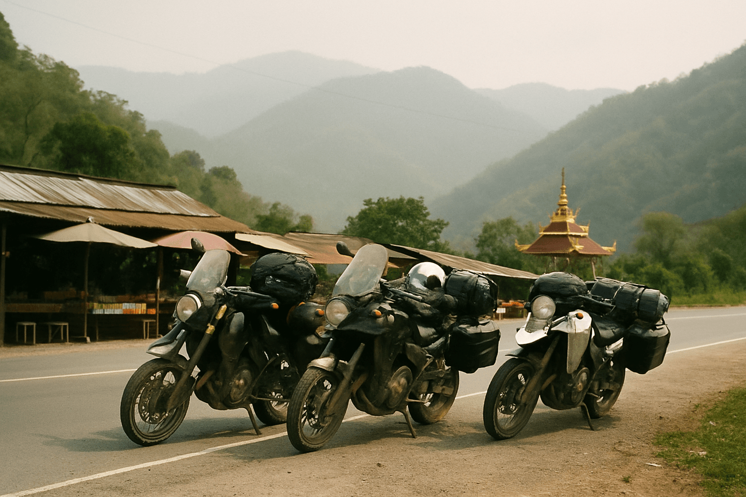
5 Day Spirit of the North Motorcycle Tour
Chiang Mai, Thailand
5 days
THB 42,000 / person

Northern Thailand's classic multi-day ride: the corners of Route 1095 to Pai, over the hills to Mae Hong Son, then south and home on Route 108 through Mae Sariang. About 590 km of tarmac, with a free GPX for the whole loop and for each day.
The Mae Hong Son Loop is the ride riders in Chiang Mai talk about once they have done the day trips. It leaves the city north on Route 107, turns west onto Route 1095, a road famous for its corners, and climbs through forest to Pai. From Pai it crosses the highest ground of the loop to Soppong and Mae Hong Son, a small provincial capital close to the Myanmar border, then follows Route 108 south through Khun Yuam and Mae Sariang and east over the ranges back to Chiang Mai.
It is about 590 km with some 9,000 metres of climbing, usually ridden over four days with nights in Pai, Mae Hong Son and Mae Sariang. The whole loop is paved and a rented 125 to 150 cc scooter can do it, but the first two days are almost all corners, steep in places, so it suits riders who are comfortable on mountain roads. The third and fourth days are faster and more open. Ride it clockwise as described here, or the other way round: both are common.
Longest stretch without a fuel station: about 61 km, between km 244 and km 305.
Also on Moto MassDoi Inthanon: Route 1009 to Thailand's highest mountain turns off Route 108 at Chom Thong, on the last day of this loop. Add it if you have the energy, or ride it another day.
The usual way to split the ride, with the town most riders sleep in each night. Download the whole loop, or one day at a time.
Day 1km 0–130
130 km↑ 2,060 mOvernight: Pai
North on Route 107 to Mae Malai, then Route 1095 and its corners: a climb to over 1,400 metres through forest and a long descent into the Pai valley. Stop at Pai Canyon just before town. It is a short day on the map, but most riders are glad to stop by mid-afternoon.
GPX for day 1Day 2km 130–236.6
107 km↑ 2,340 mOvernight: Mae Hong Son
Up again to Doi Kiew Lom, the highest point of the loop, then along the ridges to Soppong, where a side road leads to Tham Lod cave. The afternoon is a long, winding descent to Mae Hong Son in its valley. Another day of almost constant corners.
GPX for day 2Day 3km 236.6–399.6
163 km↑ 2,290 mOvernight: Mae Sariang
Route 108 heads south through quiet valleys and forest to Khun Yuam, the natural lunch stop, and on to Mae Sariang on the Yuam river. The longest day, but the road is wider and the bends gentler, so it rides faster than days one and two.
GPX for day 3Day 4km 399.6–590
190 km↑ 2,370 mFinish: Chiang Mai
Route 108 climbs east over two ridges above 1,100 metres, passes Ob Luang gorge and drops to the plain at Hot, then runs north through Chom Thong and back into Chiang Mai. With a fifth day, turn off at Chom Thong for Doi Inthanon and come home the next morning.
GPX for day 4Start
The brick gate on the east side of the old city moat is the easiest place in Chiang Mai to meet, and most rental shops are a few streets away. Leave early on day one to get through the city traffic before it builds and onto Route 1095 while it is cool.
Tip: Tell the rental shop you are riding the loop, and check what its insurance covers before you sign.
Day 1: Chiang Mai to Pai
The roadkm 0–34
Chang Phueak Road and Route 107 carry you north to Mae Malai, where the loop turns left onto Route 1095. Busy and fast rather than pretty; watch for vehicles pulling out of side roads and U-turn gaps.
The roadkm 34–130
The road that makes the loop's name, famous on souvenir T-shirts for its 762 curves. It climbs from about 330 metres to over 1,400 metres through forest, with tight, often blind bends and steep gradients, then drops to the Pai valley. Minibuses to and from Pai use the whole road; stay well left and expect them round every corner.
Viewpoint
Allow 30 to 60 min
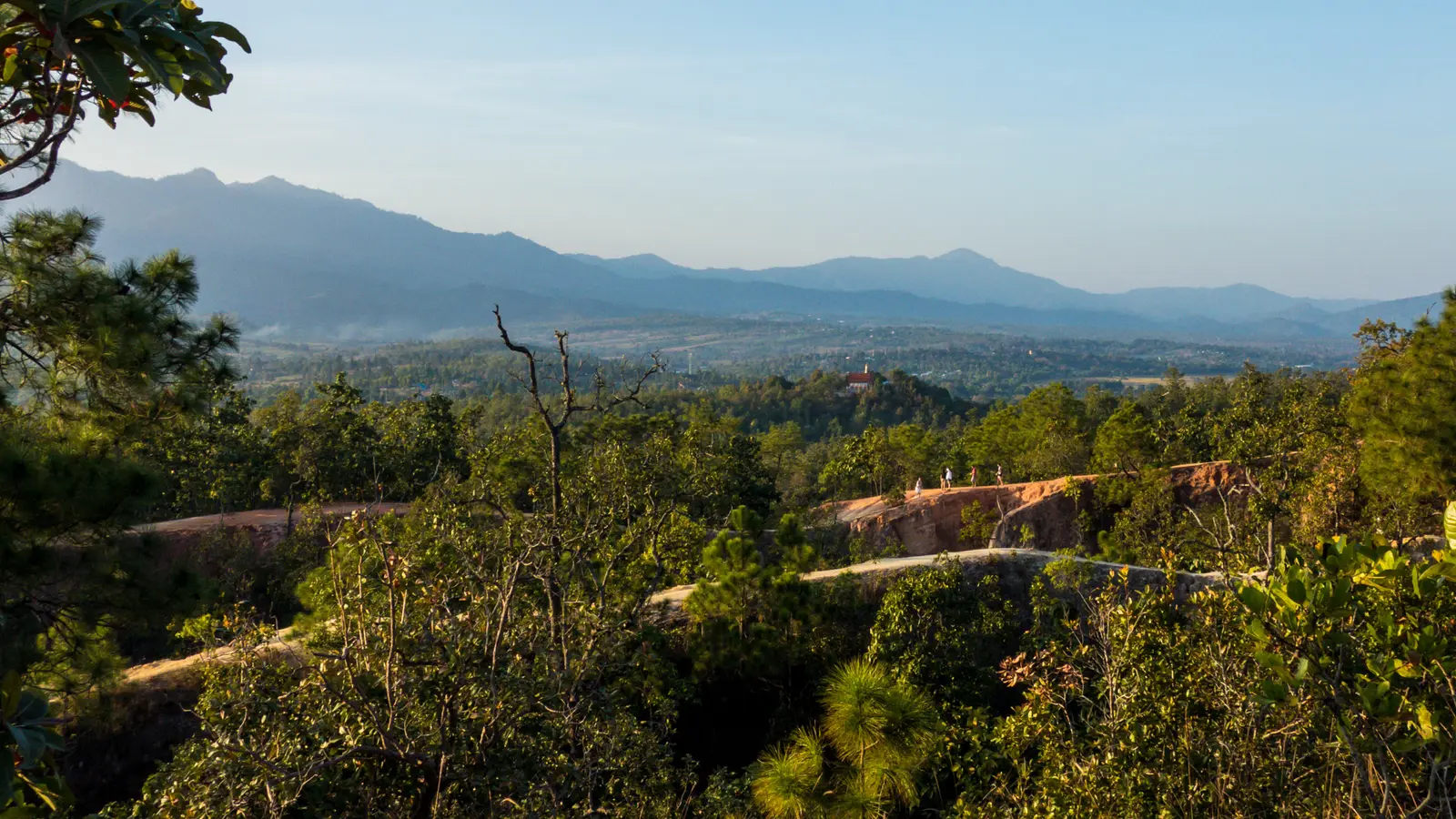
Narrow ridges of eroded sandstone with steep drops either side, a few minutes' walk from a car park just off Route 1095 before Pai. The paths along the ridges look over pine forest to the hills around the Pai valley. It is busiest at sunset.
Tip: The ridges are crumbly with no railings; wear proper shoes and stay off them in the rain.
Food
Allow Overnight
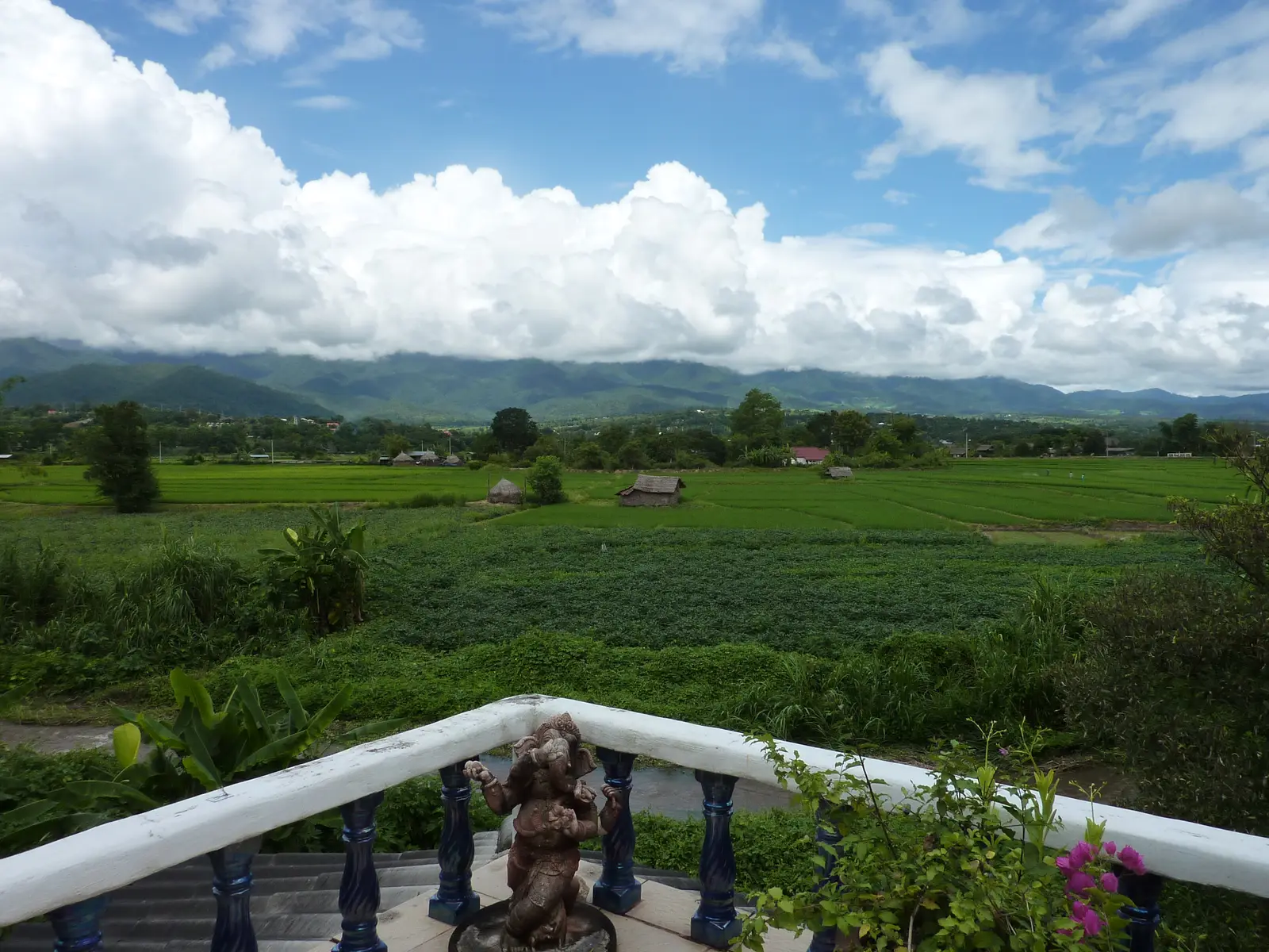
A small town in a wide green valley, long popular with backpackers, with guesthouses, cafés and an evening walking street of food stalls. It is the natural first night: the hardest corners of Route 1095 are behind you, and the valley is good for a slow morning before the climb towards Soppong.
Day 2: Pai to Mae Hong Son
The roadkm 130–236.6
Route 1095 climbs again to the loop's high point at Doi Kiew Lom, about 1,430 metres, then runs along ridges and through Soppong before the long descent towards Mae Hong Son, at about 260 metres. As many corners as the first day, with less traffic.
Viewpoint
Allow 20 min
The highest point of the loop, at about 1,430 metres, on the ridge between Pai and Soppong. A roadside viewpoint looks across ridge after ridge of forest, and on cool-season mornings the valleys below are often full of mist.
Tip: It is noticeably colder up here than in Pai; keep a layer handy between November and February.
SightDetour
Allow 1 to 2 hoursAbout 9 km each way from Soppong
A large cave with the Lang river running right through it, north of Soppong. Local guides with lanterns lead visitors through the chambers, partly by bamboo raft, and at dusk huge numbers of swifts fly in to roost.
Tip: Visits are with a guide only, paid at the entrance; allow time for the detour and still reach Mae Hong Son before dark.
Food
Allow Overnight
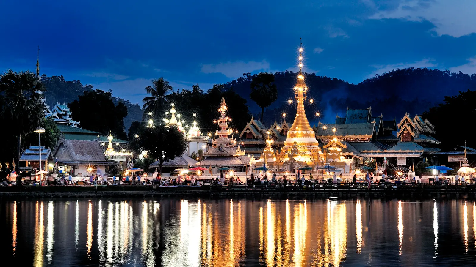
A quiet provincial capital in a valley close to the Myanmar border. Its best-known sight is the pair of Burmese-style temples, Wat Chong Kham and Wat Chong Klang, beside the small lake in the centre of town. Wat Phra That Doi Kong Mu, on the hill above, looks over the whole valley and is a short ride up.
Tip: There are several fuel stations in and just outside town; fill up before you leave in the morning, as the next on the map is at Khun Yuam.
Day 3: Mae Hong Son to Mae Sariang
The roadkm 236.6–399.6
Route 108 follows valleys south through Khun Yuam to Mae Sariang, staying between about 210 and 650 metres. The longest day on the map but the easiest riding of the loop: wider bends, quiet villages and long stretches of forest.
Sight
Allow 30 to 60 min
A small town on Route 108 and a good place to break the ride south. Its Thai-Japan Friendship Memorial Hall is a museum about the Second World War, when Japanese troops retreating from Burma passed through the town.
Tip: The town has fuel stations and simple restaurants; it is a natural lunch stop on day three.
Food
Allow Overnight
A low, quiet town on the Yuam river, at about 210 metres the lowest point of the loop. Guesthouses and riverside restaurants make it an easy third night, and it is far less visited than Pai or Mae Hong Son.
Tip: Fill up before you leave: Route 108 east climbs into the hills with few stations for the first stretch.
Day 4: Mae Sariang to Chiang Mai
The roadkm 399.6–503.4
East of Mae Sariang, Route 108 climbs twice to over 1,100 metres across the ranges, with views over terraced fields, then descends past Ob Luang gorge to the plain at Hot. Watch for trucks on the climbs and for gravel on the corners after rain.
Sight
Allow 30 min
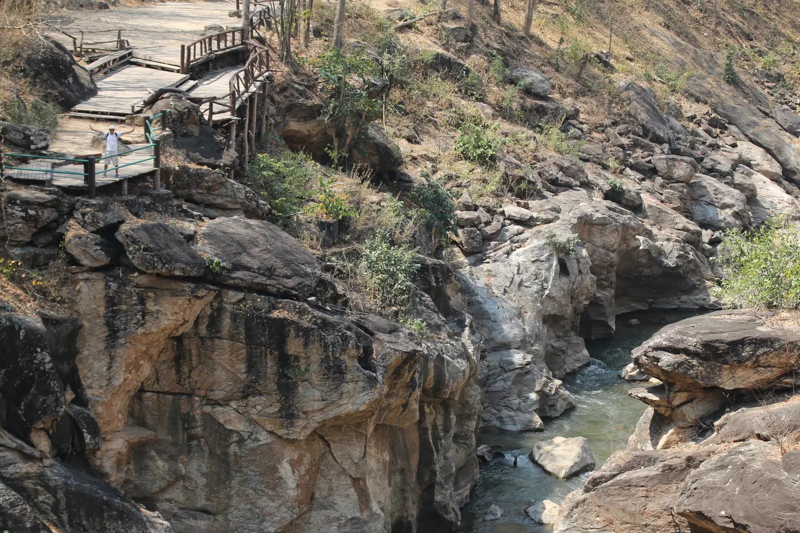
Inside Ob Luang National Park, right beside Route 108, the Mae Chaem river squeezes through a narrow rock gorge. A short walkway and a bridge cross the gorge, and it is the last natural stop before the road drops to the plain at Hot.
Tip: There is a national park entrance fee, higher for foreign visitors than for Thais.
The roadkm 503.4–590
Route 108 turns north through Chom Thong and runs flat and straight back to Chiang Mai. Heavy traffic builds towards the city, especially late in the afternoon; stay in the left lane and watch for vehicles turning across you.
Finish
The loop comes back into the old city along Wua Lai Road and finishes at the south gate. The food stalls around Chiang Mai Gate are a good place to end four days on the road.
Thailand requires a motorcycle licence: a Thai licence, or your home licence with an International Driving Permit that covers motorcycles. Police checkpoints around Chiang Mai stop foreign riders, and most travel insurance will not pay out if you ride without the right licence.
Check what you need in Thailand →A 125 cc scooter will make it round solo, but the climbs on Route 1095 are long and steep, so a 150 cc scooter or a small motorcycle is more comfortable, and much better two up. Check the brakes and tyres before you go: you will use them hard.
November to January is cool, dry and clear, with cold mornings and valley mist in the mountains. From about February to April, farm and forest burning fills northern Thailand with smoke, the views disappear and air quality can be poor. From May to October the rain makes the corners slippery and can bring landslides; ride in the morning before the afternoon storms.
Stations are easy to find around Chiang Mai, Pai, Mae Hong Son, Mae Sariang and Hot, but sparse in between. On the map the longest gaps are about 60 km between Mae Hong Son and Khun Yuam, and over 50 km between Soppong and Mae Hong Son and south of Khun Yuam. Village pumps and shops selling bottled fuel fill some of the gaps, but fill up in every town you pass.
Thailand drives on the left, and helmets are compulsory for rider and passenger. Route 1095 needs the most care: take the corners slowly, stay left on blind bends, and expect minibuses, pickups and other riders cutting the corner towards you. Don't ride the mountain roads after dark.
Chiang Mai city and the Samoeng Loop hills.
Average high/low in °C and monthly rain. How we rate months
| Month | Riding | High | Low | Rain | Rain days | PM2.5 | Why |
|---|---|---|---|---|---|---|---|
| January | Good | 26 °C 78 °F | 15 °C 58 °F | 21 mm | 3 | 26 | |
| February | Mixed | 29 °C 84 °F | 16 °C 61 °F | 7 mm | 1 | 28 | see note |
| March | Mixed | 33 °C 91 °F | 19 °C 67 °F | 12 mm | 2 | 38 | hazy |
| April | Mixed | 34 °C 92 °F | 22 °C 71 °F | 47 mm | 7 | 31 | see note |
| May | Mixed | 32 °C 90 °F | 23 °C 73 °F | 134 mm | 16 | 19 | wet |
| June | Mixed | 29 °C 85 °F | 23 °C 73 °F | 192 mm | 21 | 13 | wet |
| July | Poor | 29 °C 83 °F | 22 °C 72 °F | 261 mm | 24 | 12 | very wet |
| August | Poor | 28 °C 82 °F | 22 °C 71 °F | 320 mm | 27 | 13 | very wet |
| September | Poor | 28 °C 82 °F | 22 °C 71 °F | 256 mm | 24 | 15 | very wet |
| October | Mixed | 27 °C 81 °F | 20 °C 69 °F | 164 mm | 18 | 20 | wet |
| November | Good | 27 °C 80 °F | 18 °C 64 °F | 30 mm | 7 | 24 | |
| December | Good | 25 °C 78 °F | 15 °C 60 °F | 16 mm | 2 | 25 |
Rain days: days with at least 1 mm. Averages of daily values, 2015 to 2024, for Chiang Mai and Samoeng road, corrected to riding elevation. Reanalysis smooths mountains and local showers, so read these as a regional picture rather than a forecast. PM2.5 in µg/m³ from the CAMS global model, 2022 to 2025; it tends to read lower than ground monitors during smoke episodes.
Climate data: Open-Meteo / ERA5, 2015 to 2024 (CC BY 4.0). More on Chiang Mai weather
These operators run guided tours from Chiang Mai, listed alphabetically. Contact any of them through Moto Mass.
Chiang Mai, Thailand
5 days

Chiang Mai, Thailand
13 days
Chiang Mai, Thailand
4 days
Chiang Mai, Thailand
8 days
Chiang Mai, Thailand
12 days

Northern Thailand, Thailand
8 days
Free ride routes
Get an email when we add a new free ride in Thailand. Nothing else.
One email per new route. Unsubscribe with one click.